| Home | City Bus | Maps | Villages | Cities | Rail | Tourist Places | School | College | Pin Codes | Corona Cases Count |
| Distance Calculator Bus Services IFSC Codes Trace Mobile Number Weather Search Place Trace IP Available Cash ATM/Banks Locate Polling Booth Report an Error contact People |
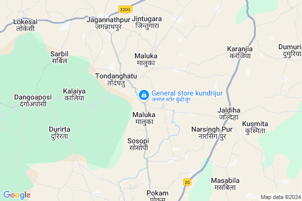
Patahatu
Patahatu Map
EDIT Map
Add Your House
 ..
..
Current Corona Virus Infected Patients Count in West Singhbhum District
| City Name | District Name | Total Covid cases |
|---|
Locality Name :
Patahatu
( पातहतु )
Block Name : Jagannathpur
District : West Singhbhum
State : Jharkhand
Language : Hindi and Santali
Current Time 02:10 AM
Date: Saturday , Apr 26,2025 (IST)
Time zone: IST (UTC+5:30)
Elevation / Altitude: 438 meters. Above Seal level
Telephone Code / Std Code: 06588
Assembly constituency : Jaganathpur assembly constituency
Assembly MLA : SONA RAM SINKU
Lok Sabha constituency : Singhbhum parliamentary constituency
Parliament MP : GEETA KORA
Serpanch Name :
Main Village Name : Patahatu
Commodities Prices : Karanjia Market / Mandi
Dauberra Live Weather
Temperature: 27.9 °C
clear sky
Humidity: 36%
Wind : 2.9 mt/sec towards S
StationName : "JagannÄ\u0081thpur"
observed on 1 Hours Back
Temperature: 27.9 °C
clear sky
Humidity: 36%
Wind : 2.9 mt/sec towards S
StationName : "JagannÄ\u0081thpur"
observed on 1 Hours Back
Dauberra Weather Forecast for Next 5 days
26-04-2025
26.5°C to 28.2°C
clear sky
26.5°C to 28.2°C
clear sky
27-04-2025
25.0°C to 41.8°C
clear sky, few clouds, scattered clouds, broken clouds
25.0°C to 41.8°C
clear sky, few clouds, scattered clouds, broken clouds
28-04-2025
27.4°C to 37.9°C
broken clouds, overcast clouds, scattered clouds
27.4°C to 37.9°C
broken clouds, overcast clouds, scattered clouds
29-04-2025
25.0°C to 37.9°C
broken clouds, scattered clouds, few clouds
25.0°C to 37.9°C
broken clouds, scattered clouds, few clouds
30-04-2025
21.5°C to 35.9°C
few clouds, scattered clouds, light rain, moderate rain, overcast clouds, broken clouds
21.5°C to 35.9°C
few clouds, scattered clouds, light rain, moderate rain, overcast clouds, broken clouds
National Highways Reachable To Patahatu
Nationa High Way :NH320G
Nationa High Way :NH320G
Rivers Near Patahatu
Kalia
Meghahatu Nallah
Kalia
Meghahatu Nallah
About Patahatu
Correct below Info and add more info about PatahatuPatahatu is a small Village/hamlet in Jagannathpur Block in West Singhbhum District of Jharkhand State, India. It comes under Patahatu Panchayath. It is located 52 KM towards South from District head quarters Chaibasa. 158 KM from State capital Ranchi
Patahatu is surrounded by Noamundi Block towards west , Kumardungi Block towards East , Champua Block towards South , Manjhgaon Block towards East .
Barbil , Joda , Chaibasa , Rairangpur are the near by Cities to Patahatu.
This Place is in the border of the West Singhbhum District and Kendujhar District. Kendujhar District Champua is South towards this place . It is near to the Odisha State Border.
Patahatu 2011 Census Details
Patahatu Local Language is Hindi. Patahatu Village Total population is 870 and number of houses are 174. Female Population is 54.8%. Village literacy rate is 44.5% and the Female Literacy rate is 17.6%.
Population
| Census Parameter | Census Data |
| Total Population | 870 |
| Total No of Houses | 174 |
| Female Population % | 54.8 % ( 477) |
| Total Literacy rate % | 44.5 % ( 387) |
| Female Literacy rate | 17.6 % ( 153) |
| Scheduled Tribes Population % | 72.8 % ( 633) |
| Scheduled Caste Population % | 0.0 % ( 0) |
| Working Population % | 37.8 % |
| Child(0 -6) Population by 2011 | 176 |
| Girl Child(0 -6) Population % by 2011 | 59.7 % ( 105) |
Patahatu Census More Deatils.
Politics in Patahatu
Indian National Congress , JBSP , BJP , INC are the major political parties in this area.Polling Stations /Booths near Patahatu
1)Primary School Baljori2)Middle School Karampada (east Part)
3)Upgrade Middle School Mugadigiya
4)Gandhi Memoriyal Bhawan Gua
5)Upgrade Middle School Diriburu (south Part)
HOW TO REACH Patahatu
By Rail
Maluka Rail Way Station , Dangoaposi Rail Way Station are the very nearby railway stations to Patahatu.Pincodes near Patahatu
833203 ( Jagannathpur ) , 833212 ( Danguaposi ) , 833217 ( Noamundi )Colleges near Patahatu
Degree College Jagannathpur
Address : College Name Degree College Jagannathpur: degree College Jagannathpur
college Alternate Name : degree College Jagannathpur
city/village :jagannathpur jharkhand, West Singhbhum , Jagannathpur , Jagannathpur
public/private : public
college Type art
Jagannathpur Inter College
Address :
Schools near Patahatu
St. Paul's Middle School Maluka
Address :
U H S Siyaljora
Address : u h s siyaljora
Govt Health Centers near Patahatu
1) HSC DEVGAON , DEOGAON , DEOGAON , DEOGAON2) HSC KASIRA , Kasira , Kasira , Kasira
3) HSC KENDUA , KENDUA , KENDUA , KENDUA
Sub Villages in Patahatu
Petrol Bunks in Patahatu,Jagannathpur
HP PETROL PUMP - RASHMI AUTO SERVICE
HP Retail Outlet Village Jagannathpur AT & PO Jaganathpur; Ranchi; Jharkhand 833203; India
7.8 KM distance Detail
Bharat Petroleum: Kolhan Fuel Station.
Jharkhand State Highway 4; Jagannathpur; Jharkhand 833203; India
7.8 KM distance Detail
more ..
Schools in Patahatu,Jagannathpur
उत्क्रमित प्राथमिक विद्यालय चुरलासाई ; कासिरा
रोड; Kasira; Jharkhand 833203; India
3.8 KM distance Detail
Electronic Shops in Patahatu,Jagannathpur
Electronics Point; Jagannathpur; 833203
Jagannathpur; Jharkhand 833203; India
7.3 KM distance Detail
Police Stations near Patahatu,Jagannathpur
Hat Gamhariya Police Station.
National Highway 75; Haat Gamhariya; Jharkhand 833214; India
16.1 KM distance Detail
Governement Offices near Patahatu,Jagannathpur
Block Development Office Noamundi
Kolebira - Hat Gamharia Rd; Noamundi; Jharkhand 833217; India
19.7 KM distance Detail
About Patahatu &
History
How to reach Patahatu
Tourist Places Near By Patahatu
Schools in Patahatu
Colleges in Patahatu
Temperature & weather of Patahatu
places in Patahatu
Patahatu photos
More Information
How to reach Patahatu
Tourist Places Near By Patahatu
Schools in Patahatu
Colleges in Patahatu
Temperature & weather of Patahatu
places in Patahatu
Patahatu photos
More Information
Village Talk
Post News or Events about this Village
Near Cities
Barbil 31 KM near
Joda 33 KM near
Chaibasa 49 KM near
Rairangpur 60 KM near
Barbil 31 KM near
Joda 33 KM near
Chaibasa 49 KM near
Rairangpur 60 KM near
Near By Taluks
Jagannathpur 0 KM near
Noamundi 21 KM near
Kumardungi 23 KM near
Champua 25 KM near
Jagannathpur 0 KM near
Noamundi 21 KM near
Kumardungi 23 KM near
Champua 25 KM near
Near By Air Ports
Ranchi Airport 148 KM near
Bhubaneswar Airport 239 KM near
Netaji Subhas Chandra Bose Airport 324 KM near
Gaya Airport 331 KM near
Ranchi Airport 148 KM near
Bhubaneswar Airport 239 KM near
Netaji Subhas Chandra Bose Airport 324 KM near
Gaya Airport 331 KM near
Near By Tourist Places
Seraikela 72 KM near
Rourkela 91 KM near
Barehipani & Joranda Barehipani & Joranda Falls 92 KM near
Jamshedpur 100 KM near
Baripada 126 KM near
Seraikela 72 KM near
Rourkela 91 KM near
Barehipani & Joranda Barehipani & Joranda Falls 92 KM near
Jamshedpur 100 KM near
Baripada 126 KM near
Near By Districts
West Singhbhum 49 KM near
Kendujhar 64 KM near
Saraikela Kharsawan 72 KM near
East Singhbum 97 KM near
West Singhbhum 49 KM near
Kendujhar 64 KM near
Saraikela Kharsawan 72 KM near
East Singhbum 97 KM near
Near By RailWay Station
Maluka Rail Way Station 4.3 KM near
Dangoaposi Rail Way Station 9 KM near
Goilkera Rail Way Station 53 KM near
Maluka Rail Way Station 4.3 KM near
Dangoaposi Rail Way Station 9 KM near
Goilkera Rail Way Station 53 KM near