| Home | City Bus | Maps | Villages | Cities | Rail | Tourist Places | School | College | Pin Codes | Corona Cases Count |
| Distance Calculator Bus Services IFSC Codes Trace Mobile Number Weather Search Place Trace IP Available Cash ATM/Banks Locate Polling Booth Report an Error contact People |
Banla
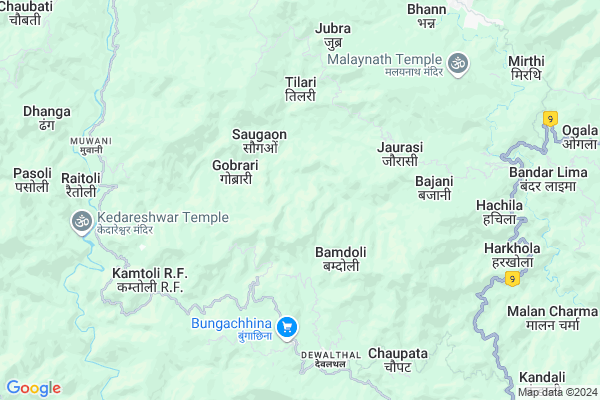
Banla Map
EDIT Map
Add Your House
 ..
..
Current Corona Virus Infected Patients Count in Pithoragarh District
| City Name | District Name | Total Covid cases |
|---|
Locality Name :
Banla
( बनला )
Block Name : Didihat
District : Pithoragarh
State : Uttarakhand
Language : Hindi and Urdu, Kumauni
Current Time 02:38 PM
Date: Thursday , Apr 24,2025 (IST)
Time zone: IST (UTC+5:30)
Elevation / Altitude: 258 meters. Above Seal level
Telephone Code / Std Code: 05964
Assembly constituency : Didihat assembly constituency
Assembly MLA : Vishan Singh
Lok Sabha constituency : Almora parliamentary constituency
Parliament MP : Ajay Tamta
Serpanch Name :
Pin Code : 262551
Post Office Name : Didihat
Main Village Name : Banla
Commodities Prices : Haldwani Market / Mandi
National Highways Reachable To Banla
Nationa High Way :NH309A
Nationa High Way :NH309A
Rivers Near Banla
:काली गाड Sharda :Mahakali River :शारदा नदी :महाकाली नदी
:काली गाड Sharda :Mahakali River :शारदा नदी :महाकाली नदी
:काली गाड Sharda :Mahakali River :शारदा नदी :महाकाली नदी
:काली गाड Sharda :Mahakali River :शारदा नदी :महाकाली नदी
About Banla
Correct below Info and add more info about BanlaBanla is a small Village/hamlet in Didihat Block in Pithoragarh District of Uttarakhand State, India. It comes under Banla Panchayath. It is located 19 KM towards North from District head quarters Pithoragarh. 8 KM from Didihat. 256 KM from State capital Dehradun
Banla Pin code is 262551 and postal head office is Didihat .
Lakhati Gaon ( 2 KM ) , Sil ( 3 KM ) , Bhandari Gaon Rajwar ( 3 KM ) , Gobrari ( 3 KM ) , Saugaon ( 3 KM ) are the nearby Villages to Banla. Banla is surrounded by Kanalichina Block towards East , Berinag Block towards west , Pithoragarh Block towards South , Munakot Block towards South .
Pithoragarh , Champawat , Almora , Nainital are the near by Cities to Banla.
Demographics of Banla
Hindi is the Local Language here.Politics in Banla
BJP , UKKD , BJP , INC are the major political parties in this area.Polling Stations /Booths near Banla
1)Borabunga (hararkatiya)2)Khawantari
3)Ghasar
4)Adichaura
5)Vishkholi
HOW TO REACH Banla
By Rail
There is no railway station near to Banla in less than 10 km.Colleges near Banla
G I C Gandginager
Address :
Rajendra Singh Pawar
Address : Smkot Teela
Schools near Banla
Kendriy School Merthi
Address : merthi talla , didihat , pithoragarh , Uttarakhand . PIN- 262550 , Post - Merthi
G.i.c. Choobati
Address : tilari , didihat , pithoragarh , Uttarakhand . PIN- 262551 , Post - Didihat
Ggic Didihat
Address : hath tharp , didihat , pithoragarh , Uttarakhand . PIN- 262551 , Post - Didihat
G.i.c. Jorasi
Address : durlekh , didihat , pithoragarh , Uttarakhand . PIN- 262551 , Post - Didihat
Govt Health Centers near Banla
1) Gangolihat Main Center , Gangolihat Main Center , Gangolihat Main Center , Gangolihat Main Center2) CHC Gangolihat , CHC Gangolihat , CHC Gangolihat , CHC Gangolihat
3) Sainrathi , Sainranthi , Sainrathi ,
Sub Villages in Banla
Hospitals in Banla,Didihat
Mehara Health Clinic Didihat Thal Road
Roadways Station; Didihat; Uttarakhand 262551; India
9.8 KM distance Detail
more ..
Petrol Bunks in Banla,Didihat
HP PETROL PUMP - BAJRANG FILLING STATION
Thal Road; Berinag Dist-pithoragrh Uttaranchal; Dehradun; UL 262531; India
18.8 KM distance Detail
HARBANS MOTOR WORKS A/C PITHORAGARH
KUMOD;PITHORAGARH; Pithoragarh; Uttarakhand 262501; India
19.8 KM distance Detail
more ..
Colleges in Banla,Didihat
Government Girls Inter College
Didihat Rd; Didihat; Uttarakhand 262544; India
9.7 KM distance Detail
Government Inter College
GIC Rd; G.I.C. Ward; Didihat; Uttarakhand 262544; India
10.0 KM distance Detail
Government Inter College
Berinag - Muwani Rd; Mantoli; Berinag; Uttarakhand 262531; India
16.8 KM distance Detail
more ..
Local Parks in Banla,Didihat
Govind Ballabh Pant Park
Mahatma Gandhi Marg; Pithoragarh; Uttarakhand 262501; India
19.8 KM distance Detail
Sampoornanand Park Ghantakaran
Ghantakaran; Pithoragarh; Uttarakhand 262501; India
19.8 KM distance Detail
Police Stations near Banla,Didihat
Didihat Thanna
262541; GIC Rd; G.I.C. Ward; Didihat; Uttarakhand 262544; India
9.9 KM distance Detail
Governement Offices near Banla,Didihat
उपजिलाधिकारी/तहसील कार्यालय बेरीनाग
Mantoli; Berinag; Uttarakhand 262531; India
16.5 KM distance Detail
SDM /Tahseeldar Office Berinag
Berinag Rd; Mantoli; Khitauli; Uttarakhand 262531; India
16.5 KM distance Detail
About Banla &
History
How to reach Banla
Tourist Places Near By Banla
Schools in Banla
Colleges in Banla
Temperature & weather of Banla
places in Banla
Banla photos
More Information
How to reach Banla
Tourist Places Near By Banla
Schools in Banla
Colleges in Banla
Temperature & weather of Banla
places in Banla
Banla photos
More Information
Village Talk
Post News or Events about this Village
Near Cities
Pithoragarh 19 KM near
Champawat 50 KM near
Almora 61 KM near
Nainital 91 KM near
Pithoragarh 19 KM near
Champawat 50 KM near
Almora 61 KM near
Nainital 91 KM near
Near By Taluks
Didihat 7 KM near
Kanalichina 12 KM near
Berinag 13 KM near
Pithoragarh 19 KM near
Didihat 7 KM near
Kanalichina 12 KM near
Berinag 13 KM near
Pithoragarh 19 KM near
Near By Air Ports
Pantnagar Airport 118 KM near
Dehra Dun Airport 244 KM near
Muzaffarnagar Airport 276 KM near
Indira Gandhi International Airport 367 KM near
Pantnagar Airport 118 KM near
Dehra Dun Airport 244 KM near
Muzaffarnagar Airport 276 KM near
Indira Gandhi International Airport 367 KM near
Near By Tourist Places
Pithoragarh 19 KM near
Chaukori 21 KM near
Abbott Mount 40 KM near
Bageshwar 47 KM near
Champawat 51 KM near
Pithoragarh 19 KM near
Chaukori 21 KM near
Abbott Mount 40 KM near
Bageshwar 47 KM near
Champawat 51 KM near
Near By Districts
Pithoragarh 19 KM near
Bageshwar 47 KM near
Champawat 51 KM near
Almora 61 KM near
Pithoragarh 19 KM near
Bageshwar 47 KM near
Champawat 51 KM near
Almora 61 KM near
Near By RailWay Station
Kathgodam Rail Way Station 92 KM near
Haldwani Rail Way Station 97 KM near
Kathgodam Rail Way Station 92 KM near
Haldwani Rail Way Station 97 KM near