| Home | City Bus | Maps | Villages | Cities | Rail | Tourist Places | School | College | Pin Codes | Corona Cases Count |
| Distance Calculator Bus Services IFSC Codes Trace Mobile Number Weather Search Place Trace IP Available Cash ATM/Banks Locate Polling Booth Report an Error contact People |
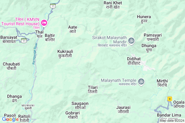
Atalgaon
Atalgaon Map
EDIT Map
Add Your House
 ..
..
Current Corona Virus Infected Patients Count in Pithoragarh District
| City Name | District Name | Total Covid cases |
|---|
Locality Name :
Atalgaon
( अतलगाओं )
Block Name : Didihat
District : Pithoragarh
State : Uttarakhand
Language : Hindi and Urdu, Kumauni
Current Time 02:58 PM
Date: Thursday , Apr 24,2025 (IST)
Time zone: IST (UTC+5:30)
Elevation / Altitude: 258 meters. Above Seal level
Telephone Code / Std Code: 05964
Assembly constituency : Didihat assembly constituency
Assembly MLA : Vishan Singh
Lok Sabha constituency : Almora parliamentary constituency
Parliament MP : Ajay Tamta
Serpanch Name :
Pin Code : 262551
Post Office Name : Didihat
Main Village Name : Atalgaon
Commodities Prices : Haldwani Market / Mandi
Atalgaon Live Weather
Temperature: 29.2 °C
clear sky
Humidity: 5%
Wind : 2.91 mt/sec towards W
StationName : "PithorÄ\u0081garh"
observed on 26 Mins Back
Temperature: 29.2 °C
clear sky
Humidity: 5%
Wind : 2.91 mt/sec towards W
StationName : "PithorÄ\u0081garh"
observed on 26 Mins Back
Atalgaon Weather Forecast for Next 5 days
25-04-2025
12.1°C to 27.9°C
clear sky, broken clouds, scattered clouds
12.1°C to 27.9°C
clear sky, broken clouds, scattered clouds
26-04-2025
10.9°C to 29.2°C
clear sky, broken clouds, scattered clouds
10.9°C to 29.2°C
clear sky, broken clouds, scattered clouds
27-04-2025
12.6°C to 29.4°C
broken clouds, overcast clouds
12.6°C to 29.4°C
broken clouds, overcast clouds
28-04-2025
13.0°C to 27.7°C
overcast clouds, broken clouds
13.0°C to 27.7°C
overcast clouds, broken clouds
29-04-2025
12.8°C to 26.4°C
overcast clouds, broken clouds
12.8°C to 26.4°C
overcast clouds, broken clouds
National Highways Reachable To Atalgaon
Nationa High Way :NH309A
Nationa High Way :NH309A
Rivers Near Atalgaon
:काली गाड Sharda :Mahakali River :शारदा नदी :महाकाली नदी
:काली गाड Sharda :Mahakali River :शारदा नदी :महाकाली नदी
:काली गाड Sharda :Mahakali River :शारदा नदी :महाकाली नदी
:काली गाड Sharda :Mahakali River :शारदा नदी :महाकाली नदी
About Atalgaon
Correct below Info and add more info about AtalgaonAtalgaon is a small Village/hamlet in Didihat Block in Pithoragarh District of Uttarakhand State, India. It comes under Atalgaon Panchayath. It is located 27 KM towards North from District head quarters Pithoragarh. 0 KM from Didihat. 253 KM from State capital Dehradun
Atalgaon Pin code is 262551 and postal head office is Didihat .
Borabunga ( 3 KM ) , Kukrauli ( 3 KM ) , Baram Bachkudi ( 3 KM ) , Sata ( 3 KM ) , Masmoli ( 4 KM ) are the nearby Villages to Atalgaon. Atalgaon is surrounded by Berinag Block towards west , Kanalichina Block towards East , Gangolihat Block towards west , Pithoragarh Block towards South .
Pithoragarh , Champawat , Almora , Nainital are the near by Cities to Atalgaon.
Demographics of Atalgaon
Hindi is the Local Language here.Politics in Atalgaon
BJP , UKKD , BJP , INC are the major political parties in this area.Polling Stations /Booths near Atalgaon
1)Borabunga (hararkatiya)2)Khawantari
3)Ghasar
4)Adichaura
5)Vishkholi
HOW TO REACH Atalgaon
By Rail
There is no railway station near to Atalgaon in less than 10 km.Colleges near Atalgaon
G I C Gandginager
Address :
Rajendra Singh Pawar
Address : Smkot Teela
Schools near Atalgaon
Kendriy School Merthi
Address : merthi talla , didihat , pithoragarh , Uttarakhand . PIN- 262550 , Post - Merthi
G.i.c. Choobati
Address : tilari , didihat , pithoragarh , Uttarakhand . PIN- 262551 , Post - Didihat
Ggic Didihat
Address : hath tharp , didihat , pithoragarh , Uttarakhand . PIN- 262551 , Post - Didihat
G.i.c. Jorasi
Address : durlekh , didihat , pithoragarh , Uttarakhand . PIN- 262551 , Post - Didihat
Govt Health Centers near Atalgaon
1) Kamedidevi SC , Kamedidevi , Bageshwar Didihat Road , Near Tiraha2) Bhandari gaon SC , Bhandari Gaon ANM center , Kanda Rawatsera Bans Patan Road , Near Aanganwadi Kendra
3) Rawatsera SC , Rawatsera ANM Center , Kanda Rawatsera Bans Patan Road , Near Primary School
Sub Villages in Atalgaon
Hospitals in Atalgaon,Didihat
Mehara Health Clinic Didihat Thal Road
Roadways Station; Didihat; Uttarakhand 262551; India
5.6 KM distance Detail
more ..
Petrol Bunks in Atalgaon,Didihat
HP PETROL PUMP - BAJRANG FILLING STATION
Thal Road; Berinag Dist-pithoragrh Uttaranchal; Dehradun; UL 262531; India
18.2 KM distance Detail
more ..
Colleges in Atalgaon,Didihat
Government Inter College
GIC Rd; G.I.C. Ward; Didihat; Uttarakhand 262544; India
6.4 KM distance Detail
Government Girls Inter College
Didihat Rd; Didihat; Uttarakhand 262544; India
6.5 KM distance Detail
more ..
Police Stations near Atalgaon,Didihat
Didihat Thanna
262541; GIC Rd; G.I.C. Ward; Didihat; Uttarakhand 262544; India
6.1 KM distance Detail
Police Station Nachani
Near SBI ATM Didihat Rd; Chilkiya; Uttarakhand 262553; India
14.1 KM distance Detail
Governement Offices near Atalgaon,Didihat
उपजिलाधिकारी/तहसील कार्यालय बेरीनाग
Mantoli; Berinag; Uttarakhand 262531; India
16.2 KM distance Detail
SDM /Tahseeldar Office Berinag
Berinag Rd; Mantoli; Khitauli; Uttarakhand 262531; India
16.2 KM distance Detail
About Atalgaon &
History
How to reach Atalgaon
Tourist Places Near By Atalgaon
Schools in Atalgaon
Colleges in Atalgaon
Temperature & weather of Atalgaon
places in Atalgaon
Atalgaon photos
More Information
How to reach Atalgaon
Tourist Places Near By Atalgaon
Schools in Atalgaon
Colleges in Atalgaon
Temperature & weather of Atalgaon
places in Atalgaon
Atalgaon photos
More Information
Village Talk
Post News or Events about this Village
Near Cities
Pithoragarh 26 KM near
Champawat 58 KM near
Almora 63 KM near
Nainital 94 KM near
Pithoragarh 26 KM near
Champawat 58 KM near
Almora 63 KM near
Nainital 94 KM near
Near By Taluks
Didihat 0 KM near
Berinag 12 KM near
Kanalichina 16 KM near
Gangolihat 24 KM near
Didihat 0 KM near
Berinag 12 KM near
Kanalichina 16 KM near
Gangolihat 24 KM near
Near By Air Ports
Pantnagar Airport 123 KM near
Dehra Dun Airport 242 KM near
Muzaffarnagar Airport 278 KM near
Simla Airport 366 KM near
Pantnagar Airport 123 KM near
Dehra Dun Airport 242 KM near
Muzaffarnagar Airport 278 KM near
Simla Airport 366 KM near
Near By Tourist Places
Chaukori 18 KM near
Pithoragarh 27 KM near
Bageshwar 46 KM near
Abbott Mount 47 KM near
Binsar 53 KM near
Chaukori 18 KM near
Pithoragarh 27 KM near
Bageshwar 46 KM near
Abbott Mount 47 KM near
Binsar 53 KM near
Near By Districts
Pithoragarh 26 KM near
Bageshwar 46 KM near
Champawat 59 KM near
Almora 63 KM near
Pithoragarh 26 KM near
Bageshwar 46 KM near
Champawat 59 KM near
Almora 63 KM near
Near By RailWay Station
Kathgodam Rail Way Station 97 KM near
Haldwani Rail Way Station 102 KM near
Kathgodam Rail Way Station 97 KM near
Haldwani Rail Way Station 102 KM near