| Home | City Bus | Maps | Villages | Cities | Rail | Tourist Places | School | College | Pin Codes | Corona Cases Count |
| Distance Calculator Bus Services IFSC Codes Trace Mobile Number Weather Search Place Trace IP Available Cash ATM/Banks Locate Polling Booth Report an Error contact People |
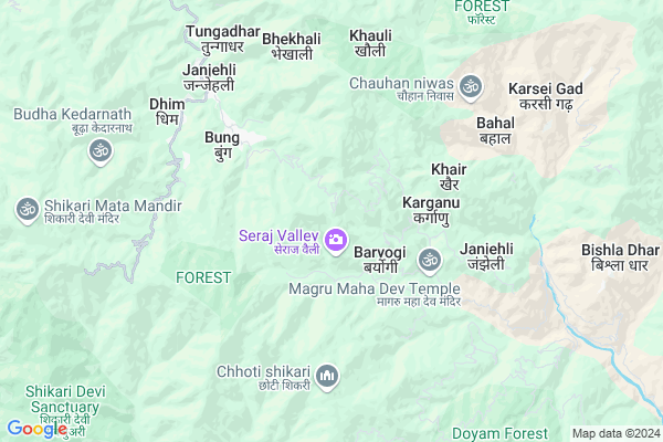
Chhota Liyur
Chhota Liyur Map
EDIT Map
Add Your House
 ..
..
Current Corona Virus Infected Patients Count in Mandi District
| City Name | District Name | Total Covid cases |
|---|
Locality Name :
Chhota Liyur
( छोटा लियर )
Tehsil Name : Seraj
District : Mandi
State : Himachal Pradesh
Language : Hindi and English, Pahari And Mandyali
Current Time 04:29 PM
Date: Tuesday , Apr 29,2025 (IST)
Time zone: IST (UTC+5:30)
Telephone Code / Std Code: 01903
Assembly constituency : Seraj assembly constituency
Assembly MLA : Jai Ram Thakur
Lok Sabha constituency : Mandi parliamentary constituency
Parliament MP : RAM SWAROOP SHARMA
Serpanch Name :
Pin Code : 175047
Post Office Name : Janjehli
Main Village Name : Chhota Liyur
Commodities Prices : Chail Chowk Market / Mandi
Chhota Liyur Live Weather
Temperature: 15.7 °C
few clouds
Humidity: 29%
Wind : 3.39 mt/sec towards N
StationName : "BanjÄ\u0081r"
observed on 20 Mins Back
Temperature: 15.7 °C
few clouds
Humidity: 29%
Wind : 3.39 mt/sec towards N
StationName : "BanjÄ\u0081r"
observed on 20 Mins Back
Chhota Liyur Weather Forecast for Next 5 days
30-04-2025
12.8°C to 20.5°C
few clouds, broken clouds
12.8°C to 20.5°C
few clouds, broken clouds
01-05-2025
11.9°C to 26.7°C
broken clouds, scattered clouds, few clouds, clear sky, overcast clouds
11.9°C to 26.7°C
broken clouds, scattered clouds, few clouds, clear sky, overcast clouds
02-05-2025
9.8°C to 25.5°C
overcast clouds, broken clouds, moderate rain, light rain
9.8°C to 25.5°C
overcast clouds, broken clouds, moderate rain, light rain
03-05-2025
10.8°C to 25.1°C
light rain, broken clouds, overcast clouds, heavy intensity rain, moderate rain
10.8°C to 25.1°C
light rain, broken clouds, overcast clouds, heavy intensity rain, moderate rain
04-05-2025
12.4°C to 22.2°C
light rain, overcast clouds
12.4°C to 22.2°C
light rain, overcast clouds
National Highways Reachable To Chhota Liyur
Nationa High Way :NH5
Nationa High Way :NH5
Rivers Near Chhota Liyur
Pandoa
Beas River
Pandoa
Beas River
About Chhota Liyur
Correct below Info and add more info about Chhota LiyurChhota Liyur is a small Village/hamlet in Seraj Tehsil in Mandi District of Himachal Pradesh State, India. It comes under Chhota Liyur Panchayath. It is located 46 KM towards East from District head quarters Mandi. 12 KM from Seraj. 50 KM from State capital Shimla
Chhota Liyur Pin code is 175047 and postal head office is Janjehli .
Janjehli (srj) ( 6 KM ) , Thakur Thana ( 11 KM ) , Sanarli ( 11 KM ) , Masogal ( 12 KM ) , Seraj ( 12 KM ) are the nearby Villages to Chhota Liyur. Chhota Liyur is surrounded by Karsog Tehsil towards South , Anni Tehsil towards East , Banjar Tehsil towards North , Gohar Tehsil towards west .
Sundarnagar , Mandi , Shimla , Solan are the near by Cities to Chhota Liyur.
Chhota Liyur 2011 Census Details
Chhota Liyur Local Language is Hindi. Chhota Liyur Village Total population is 2 and number of houses are 1. Female Population is 50.0%. Village literacy rate is 100.0% and the Female Literacy rate is 50.0%.
Population
| Census Parameter | Census Data |
| Total Population | 2 |
| Total No of Houses | 1 |
| Female Population % | 50.0 % ( 1) |
| Total Literacy rate % | 100.0 % ( 2) |
| Female Literacy rate | 50.0 % ( 1) |
| Scheduled Tribes Population % | 0.0 % ( 0) |
| Scheduled Caste Population % | 0.0 % ( 0) |
| Working Population % | 100.0 % |
| Child(0 -6) Population by 2011 | 0 |
| Girl Child(0 -6) Population % by 2011 | -1.0 % ( 0) |
Chhota Liyur Census More Deatils.
Politics in Chhota Liyur
BJP , INC are the major political parties in this area.Polling Stations /Booths near Chhota Liyur
1)Gps Anah2)Gps Dheem Kataru
3)Gsss Bara
4)Gms Kelti
5)Gps Dhensar (ghartehad)
HOW TO REACH Chhota Liyur
By Rail
There is no railway station near to Chhota Liyur in less than 10 km.Colleges near Chhota Liyur
Govt. Degree College Ladbharol
Address :
Mlsm College
Address :
Govt. Degree College
Address :
Karsog
Address : Gdc Karsog Near Govt.school Karsog
Abhilashi College Of Education
Address : Village & Post Office Nerchowk, Mandi, Himachal Pr
Schools near Chhota Liyur
Gsss Som Nachan
Address : somgad , seraj-2 , mandi , Himachal Pradesh . PIN- 175121 , Post - Aut
Gsss Khani
Address : khani , seraj-2 , mandi , Himachal Pradesh . PIN- 175106 , Post - Balichowki
Gsss Kholanal
Address : kholanal , seraj-2 , mandi , Himachal Pradesh . PIN- 175124 , Post - Pandoh
Gsss Khuhan
Address : khuhan , seraj-2 , mandi , Himachal Pradesh . PIN- 175106 , Post - Balichowki
Govt Health Centers near Chhota Liyur
1) Battal PHC , NA , NA , Near GDC2) Sharda PHC , Sharda , Sharda , Sharda
3) Deen Dayal Upadhyaya Zonal Hospital , Ram Bazaar, Shimla , Shimla ,
Sub Villages in Chhota Liyur
Hospitals in Chhota Liyur,Seraj
Ayush Clinic & Health Care
sector 17 sub tehsil Chhatri; Seraj; Himachal Pradesh; India
13.0 KM distance Detail
more ..
Petrol Bunks in Chhota Liyur,Seraj
Bharat Petroleum Petrol Pump
Karsog - Sundernagar - Mandi Road; Sanarli; Himachal Pradesh 175011; India
11.7 KM distance Detail
Indian Oil Petrol Pump
Karsog - Sundernagar - Mandi Road; Chambi; Himachal Pradesh 175011; India
12.4 KM distance Detail
Tilak Filling Station
Karsog - Mnadi - Rampur - Kinnour; Himachal Pradesh 175011; India
12.6 KM distance Detail
more ..
Colleges in Chhota Liyur,Seraj
Shastri College
Karsog - Mnadi - Rampur - Kinnour; Karsog; Himachal Pradesh 175011; India
12.3 KM distance Detail
more ..
Schools in Chhota Liyur,Seraj
Government Middle School
Shikari Temple Rd; Sagalwara; Himachal Pradesh 175047; India
5.4 KM distance Detail
MOTHER CHOICE PUBLIC HIGH SCHOOL
Janjhli Road; Janjehli; Himachal Pradesh 175047; India
6.2 KM distance Detail
Government Senior Secondary School
Janjhli Road; Janjehli; Himachal Pradesh 175047; India
6.4 KM distance Detail
Electronic Shops in Chhota Liyur,Seraj
Aditya Communication
Shikari Temple Rd; Janjehli; Himachal Pradesh 175047; India
6.2 KM distance Detail
Kumar Digital Studio Showad
post office showad teh; Anni; Himachal Pradesh; India
11.0 KM distance Detail
Super Markets in Chhota Liyur,Seraj
CSC Center
Nerchowk-Chailchowk-Janjehli Rd; Janjehli; Himachal Pradesh 175047; India
6.9 KM distance Detail
Governement Offices near Chhota Liyur,Seraj
Himachal Pradesh Public Works Department
Karsog; Himachal Pradesh 175011; India
14.0 KM distance Detail
About Chhota Liyur &
History
How to reach Chhota Liyur
Tourist Places Near By Chhota Liyur
Schools in Chhota Liyur
Colleges in Chhota Liyur
Temperature & weather of Chhota Liyur
places in Chhota Liyur
Chhota Liyur photos
More Information
How to reach Chhota Liyur
Tourist Places Near By Chhota Liyur
Schools in Chhota Liyur
Colleges in Chhota Liyur
Temperature & weather of Chhota Liyur
places in Chhota Liyur
Chhota Liyur photos
More Information
Village Talk
Post News or Events about this Village
Near Cities
Sundarnagar 39 KM near
Mandi 44 KM near
Shimla 48 KM near
Solan 72 KM near
Sundarnagar 39 KM near
Mandi 44 KM near
Shimla 48 KM near
Solan 72 KM near
Near By Taluks
Seraj 12 KM near
Karsog 17 KM near
Anni 18 KM near
Banjar 23 KM near
Seraj 12 KM near
Karsog 17 KM near
Anni 18 KM near
Banjar 23 KM near
Near By Air Ports
Simla Airport 46 KM near
Bhuntar Airport 64 KM near
Chandigarh Airport 111 KM near
Gaggal Airport 146 KM near
Simla Airport 46 KM near
Bhuntar Airport 64 KM near
Chandigarh Airport 111 KM near
Gaggal Airport 146 KM near
Near By Tourist Places
Chindi 15 KM near
Narkanda 34 KM near
Naldehra 38 KM near
Rampur 39 KM near
Mashobra 44 KM near
Chindi 15 KM near
Narkanda 34 KM near
Naldehra 38 KM near
Rampur 39 KM near
Mashobra 44 KM near
Near By Districts
Mandi 45 KM near
Shimla 48 KM near
Bilaspur District 55 KM near
Kullu 62 KM near
Mandi 45 KM near
Shimla 48 KM near
Bilaspur District 55 KM near
Kullu 62 KM near
Near By RailWay Station
Anandpur Sahib Rail Way Station 86 KM near
Kalka Rail Way Station 87 KM near
Anandpur Sahib Rail Way Station 86 KM near
Kalka Rail Way Station 87 KM near