| Home | City Bus | Maps | Villages | Cities | Rail | Tourist Places | School | College | Pin Codes | Corona Cases Count |
| Distance Calculator Bus Services IFSC Codes Trace Mobile Number Weather Search Place Trace IP Available Cash ATM/Banks Locate Polling Booth Report an Error contact People |
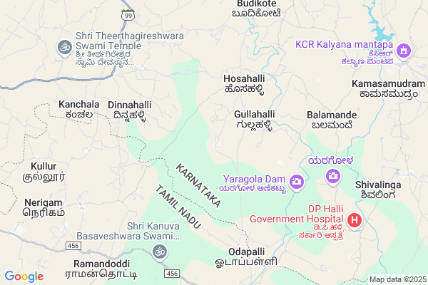
Pataramagulla
Pataramagulla Map
EDIT Map
Add Your House
 ..
..
Current Corona Virus Infected Patients Count in Kolar District
| City Name | District Name | Total Covid cases |
|---|
Locality Name :
Pataramagulla
( ಪಟರಮಗುಳ್ಳ )
Taluk Name : Bangarapet
District : Kolar
State : Karnataka
Division : Bangalore
Language : Kannada and Urdu, Telugu, Tamil
Current Time 08:02 PM
Date: Friday , Apr 25,2025 (IST)
Time zone: IST (UTC+5:30)
Elevation / Altitude: 815 meters. Above Seal level
Telephone Code / Std Code: 08152
Assembly constituency : Bangarapet assembly constituency
Assembly MLA : S.N. Narayanaswamy. K.M
Lok Sabha constituency : Kolar parliamentary constituency
Parliament MP : S. MUNISWAMY
Serpanch Name :
Pin Code : 563129
Post Office Name : Kamasamudra
Main Village Name : Pataramagulla
Commodities Prices : Bangarpet Market / Mandi
Pataramagulla Live Weather
Temperature: 31.5 °C
few clouds
Humidity: 28%
Wind : 4.32 mt/sec towards E
StationName : "Bangarapet"
observed on 20 Mins Back
Temperature: 31.5 °C
few clouds
Humidity: 28%
Wind : 4.32 mt/sec towards E
StationName : "Bangarapet"
observed on 20 Mins Back
Pataramagulla Weather Forecast for Next 5 days
26-04-2025
24.4°C to 29.8°C
scattered clouds, broken clouds
24.4°C to 29.8°C
scattered clouds, broken clouds
27-04-2025
22.4°C to 35.9°C
overcast clouds
22.4°C to 35.9°C
overcast clouds
28-04-2025
21.9°C to 35.9°C
broken clouds, overcast clouds, light rain
21.9°C to 35.9°C
broken clouds, overcast clouds, light rain
29-04-2025
22.7°C to 36.2°C
broken clouds, overcast clouds, scattered clouds, light rain
22.7°C to 36.2°C
broken clouds, overcast clouds, scattered clouds, light rain
30-04-2025
23.8°C to 35.2°C
scattered clouds, clear sky, broken clouds, overcast clouds, light rain
23.8°C to 35.2°C
scattered clouds, clear sky, broken clouds, overcast clouds, light rain
National Highways Reachable To Pataramagulla
Nationa High Way :NH75
Nationa High Way :NH648
Nationa High Way :NH75
Nationa High Way :NH648
About Pataramagulla
Correct below Info and add more info about PataramagullaPataramagulla is a small Village/hamlet in Bangarapet Taluk in Kolar District of Karnataka State, India. It comes under Pataramagulla Panchayath. It belongs to Bangalore Division . It is located 38 KM towards South from District head quarters Kolar. 20 KM from Bangarapet. 67 KM from State capital Bangalore
Pataramagulla Pin code is 563129 and postal head office is Kamasamudra .
Dinnahalli ( 7 KM ) , Budikote ( 8 KM ) , Yelesandra ( 9 KM ) , Nutuve ( 10 KM ) , Kamasamudra ( 10 KM ) are the nearby Villages to Pataramagulla. Pataramagulla is surrounded by Bangarapet Taluk towards North , Veppanapalli Taluk towards South , Gudupalle Taluk towards East , Shoolagiri Taluk towards South .
Robertson Pet , Malur , Kolar , Mulbagal are the near by Cities to Pataramagulla.
Pataramagulla 2011 Census Details
Pataramagulla Local Language is Kannada. Pataramagulla Village Total population is 331 and number of houses are 76. Female Population is 47.4%. Village literacy rate is 67.1% and the Female Literacy rate is 26.6%.
Population
| Census Parameter | Census Data |
| Total Population | 331 |
| Total No of Houses | 76 |
| Female Population % | 47.4 % ( 157) |
| Total Literacy rate % | 67.1 % ( 222) |
| Female Literacy rate | 26.6 % ( 88) |
| Scheduled Tribes Population % | 0.0 % ( 0) |
| Scheduled Caste Population % | 21.5 % ( 71) |
| Working Population % | 33.5 % |
| Child(0 -6) Population by 2011 | 24 |
| Girl Child(0 -6) Population % by 2011 | 33.3 % ( 8) |
Pataramagulla Census More Deatils.
Politics in Pataramagulla
Bharatiya Janata Party , JD(S) , BJP , Indian National Congress (INC) , INC are the major political parties in this area.Polling Stations /Booths near Pataramagulla
1)Government Higher Primary School Mugalabele.2)Government Higher Primary School East Peddapalli-1.
3)Government Lower Primary School Girnahalli.
4)Government Higher Primary School Manchahalli.
5)Government Lower Primary School Chikkapura.
HOW TO REACH Pataramagulla
By Rail
Kamasamudram Rail Way Station is the very nearby railway stations to Pataramagulla. Varadapura Rail Way Station (near to Bangarapet) , Champion Rail Way Station (near to Robertson Pet) , Oorgaum Rail Way Station (near to Robertson Pet) , Kolar Rail Way Station (near to Kolar) , Bangarapet Junction Rail Way Station (near to Bangarapet) are the Rail way stations reachable from near by towns.By Road
Bangarapet , Robertson Pet , Kolar , Mulbagal , V.Kote (Andhra Pradesh) are the nearby by towns to Pataramagulla having road connectivity to PataramagullaColleges near Pataramagulla
Fgc
Address :
Sri Bhagawan Mahaveer Jain College
Address :
A.r Correspondance Collage
Address :
Schools in Pataramagulla
Glps Pataramagulla
Address : pataramagulla , bangarapete , kolar , Karnataka . PIN- 563129 , Post - Kamasamudra
Govt Health Centers near Pataramagulla
1) Bangarpet-A , Bangarpet-A , Bangarpet-A , Bangarpet-A anganwadi center2) Bangarpet-A , Bovi nagar , Seat Compound , Anganwadi center
3) Bangarpet-B , Sate compound , opposite police station bangarpet , near vertnory hospital
Sub Villages in Pataramagulla
Petrol Bunks in Pataramagulla,Bangarapet
Sri Sai Vinayaka Filling Station BPCL
; Karimanahalli; Karnataka 563114; India
9.9 KM distance Detail
Bharath Petroleum Petrol Bunk
Bangarpete Main Road; Budikote; Karnataka; India
9.9 KM distance Detail
more ..
Colleges in Pataramagulla,Bangarapet
Indira B.Ed. College
Budikote; Bangarpet Taluk; Kolar; Karnataka 563114; India
9.0 KM distance Detail
more ..
Schools in Pataramagulla,Bangarapet
Govt Primaty School Bhattegowdanur
Berigai - KGF Rd; Kotaramagulla; Karnataka 563129; India
6.5 KM distance Detail
Govt. High School Budikote
Markandaya Nagar; Budikote; Karnataka 563114; India
9.1 KM distance Detail
Super Markets in Pataramagulla,Bangarapet
jai bhuvaneshwari yuvakara kannada sanga
Hunasanahalli; Karnataka 563114; India
20.3 KM distance Detail
MVL Complex
Ellemallapa Rd; Vivekanand Nagar; Bangarapet; Karnataka 563114; India
21.1 KM distance Detail
Karthik Enterepses
Ellemallapa Rd; Vivekanand Nagar; Bangarapet; Karnataka 563114; India
21.1 KM distance Detail
Governement Offices near Pataramagulla,Bangarapet
Huladenahalli Grama Panchaythi VenuTNPVA
; Huladenahalli; Karnataka 563137; India
17.1 KM distance Detail
About Pataramagulla &
History
How to reach Pataramagulla
Tourist Places Near By Pataramagulla
Schools in Pataramagulla
Colleges in Pataramagulla
Temperature & weather of Pataramagulla
places in Pataramagulla
Pataramagulla photos
More Information
How to reach Pataramagulla
Tourist Places Near By Pataramagulla
Schools in Pataramagulla
Colleges in Pataramagulla
Temperature & weather of Pataramagulla
places in Pataramagulla
Pataramagulla photos
More Information
Village Talk
Post News or Events about this Village
Near Cities
Robertson Pet 24 KM near
Malur 28 KM near
Kolar 36 KM near
Mulbagal 53 KM near
Robertson Pet 24 KM near
Malur 28 KM near
Kolar 36 KM near
Mulbagal 53 KM near
Near By Taluks
Malur 18 KM near
Bangarapet 20 KM near
Veppanapalli 21 KM near
Gudupalle 22 KM near
Malur 18 KM near
Bangarapet 20 KM near
Veppanapalli 21 KM near
Gudupalle 22 KM near
Near By Air Ports
Bengaluru International Airport 66 KM near
Salem Airport 148 KM near
Mysore Airport 189 KM near
Tirupati Airport 199 KM near
Bengaluru International Airport 66 KM near
Salem Airport 148 KM near
Mysore Airport 189 KM near
Tirupati Airport 199 KM near
Near By Tourist Places
Bangalore 64 KM near
Yelagiri 72 KM near
Nandi Hills 84 KM near
Hogenakkal 97 KM near
Savandurga 98 KM near
Bangalore 64 KM near
Yelagiri 72 KM near
Nandi Hills 84 KM near
Hogenakkal 97 KM near
Savandurga 98 KM near
Near By Districts
Kolar 36 KM near
Krishnagiri 40 KM near
Bangalore 63 KM near
Bangalore Rural 70 KM near
Kolar 36 KM near
Krishnagiri 40 KM near
Bangalore 63 KM near
Bangalore Rural 70 KM near
Near By RailWay Station
Bangarapet Junction Rail Way Station 19 KM near
Malur Rail Way Station 27 KM near
Bangarapet Junction Rail Way Station 19 KM near
Malur Rail Way Station 27 KM near