| Home | City Bus | Maps | Villages | Cities | Rail | Tourist Places | School | College | Pin Codes | Corona Cases Count |
| Distance Calculator Bus Services IFSC Codes Trace Mobile Number Weather Search Place Trace IP Available Cash ATM/Banks Locate Polling Booth Report an Error contact People |
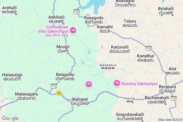
Belame Map
EDIT Map
Add Your House
 ..
..
Current Corona Virus Infected Patients Count in Hassan District
| City Name | District Name | Total Covid cases |
|---|
Locality Name :
Belame
( ಬೇಲಮ್ )
Taluk Name : Alur
District : Hassan
State : Karnataka
Division : Mysore
Language : Kannada and Sanskrit, Tamil, Marathi, Marwari And Mahajani
Current Time 02:56 AM
Date: Saturday , Apr 26,2025 (IST)
Time zone: IST (UTC+5:30)
Elevation / Altitude: 953 meters. Above Seal level
Telephone Code / Std Code: 08170
Assembly constituency : Sakleshpur assembly constituency
Assembly MLA : Cement Manju
Lok Sabha constituency : Hassan parliamentary constituency
Parliament MP : PRAJWAL REVANNA
Serpanch Name :
Pin Code : 573214
Post Office Name : Ballupet
Main Village Name : Belame
Commodities Prices : Arakalgud Market / Mandi
Belame Live Weather
Temperature: 21.5 °C
overcast clouds
Humidity: 93%
Wind : 2.33 mt/sec towards W
StationName : "Alūr"
observed on 10 Mins Back
Temperature: 21.5 °C
overcast clouds
Humidity: 93%
Wind : 2.33 mt/sec towards W
StationName : "Alūr"
observed on 10 Mins Back
Belame Weather Forecast for Next 5 days
27-04-2025
21.0°C to 35.5°C
overcast clouds, light rain
21.0°C to 35.5°C
overcast clouds, light rain
28-04-2025
19.8°C to 31.6°C
light rain, overcast clouds, broken clouds
19.8°C to 31.6°C
light rain, overcast clouds, broken clouds
29-04-2025
19.4°C to 32.7°C
scattered clouds, few clouds, broken clouds, light rain
19.4°C to 32.7°C
scattered clouds, few clouds, broken clouds, light rain
30-04-2025
20.0°C to 32.0°C
broken clouds, scattered clouds, light rain, overcast clouds
20.0°C to 32.0°C
broken clouds, scattered clouds, light rain, overcast clouds
Edit below overview about Belame
Edit below overview about Belame
OverView of Belame
Local language is Kannada. No other languages are spoken in this Village. When it comes to administration, Belame village is administrated by a sarpanch who is elected representative of the village by the local elections. As per 2019 stats, Belame village comes under Sakleshpur assembly constituencyEdit below overview about Belame
National Highways Reachable To Belame
Nationa High Way :NH75
Nationa High Way :NH373
Nationa High Way :NH75
Nationa High Way :NH373
Rivers Near Belame
Yettinahole :ಎತ್ತಿನಹೊಳೆ :Ettinahoḷe
Shisla Hole :ಸಿಶ್ಲಾ
Yettinahole :ಎತ್ತಿನಹೊಳೆ :Ettinahoḷe
Shisla Hole :ಸಿಶ್ಲಾ
About Belame
Belame is a small Village/hamlet in Alur Taluk in Hassan District of Karnataka State, India. It comes under Belame Panchayath. It belongs to Mysore Division . It is located 26 KM towards west from District head quarters Hassan. 11 KM from Alur. 215 KM from State capital Bangalore
Belame Pin code is 573214 and postal head office is Ballupet .
Ballu ( 6 KM ) , Kesagodu ( 6 KM ) , Palya ( 7 KM ) , Kanathur ( 8 KM ) , Bage ( 8 KM ) are the nearby Villages to Belame. Belame is surrounded by Sakaleshpur Taluk towards west , Belur Taluk towards North , Hassan Taluk towards East , Mudigere Taluk towards west .
Sakleshpur , Hassan , Chikmagalur , Arasikere are the near by Cities to Belame.
Belame 2011 Census Details
Belame Local Language is Kannada. Belame Village Total population is 474 and number of houses are 115. Female Population is 54.9%. Village literacy rate is 64.8% and the Female Literacy rate is 32.5%.
Population
| Census Parameter | Census Data |
| Total Population | 474 |
| Total No of Houses | 115 |
| Female Population % | 54.9 % ( 260) |
| Total Literacy rate % | 64.8 % ( 307) |
| Female Literacy rate | 32.5 % ( 154) |
| Scheduled Tribes Population % | 0.8 % ( 4) |
| Scheduled Caste Population % | 39.2 % ( 186) |
| Working Population % | 55.5 % |
| Child(0 -6) Population by 2011 | 37 |
| Girl Child(0 -6) Population % by 2011 | 48.6 % ( 18) |
Belame Census More Deatils.
Politics in Belame
Janata Dal (Secular) , JD(S) , BJP , Bharatiya Janata Party (BJP) , INC are the major political parties in this area.Polling Stations /Booths near Belame
1)Govt. Lower Primary School (east Division) Uppalli2)Govt. Higher Primary School Muraduru
3)Govt. Higher Primary School Achangi
4)Govt. Higher Primary School Belagodu (east Wing)
5)Govt. Higher Primary School Kollahalli
HOW TO REACH Belame
By Rail
There is no railway station near to Belame in less than 10 km.Colleges near Belame
Mangala College Of Nursing
Address :
Governament Pu College
Address :
Vidyaranya Pre University College
Address :
Govt.pre University College Thatanahally
Address :
Ck College Of Tears
Address :
Schools in Belame
Glps Belame
Address : belame , alur , hassan , Karnataka . PIN- 573218 , Post - Palya
Govt Health Centers near Belame
1) Arehalli CHC , Community Health Center Arehalli , Sakleshpur Belur Main Road , Near Arehalli Police Station2) DODDAKANAGAL , SC Doddakanagalu , Main road , Next to Ayurvedic Hospital
3) THENKAULIPADY , building no 43 , mogaru grama , malali school
Sub Villages in Belame
Hospitals in Belame,Alur
Primary Health Center
Byrapura; Belagodu; Hassan; NH-48; Mangalore Bangalore Highway; Alur; Alur; Karnataka 573218; India
3.2 KM distance Detail
jumma masjid tippu circle
Bengaluru - Mangaluru Highway; Ballupet; Karnataka 573214; India
6.2 KM distance Detail
Government Hospital Ballupete
; Vaibhav Layout; Ballupet; Karnataka 573214; India
6.9 KM distance Detail
more ..
Petrol Bunks in Belame,Alur
SSM Petrol Bunk
Singapura; Kanadahalli; Hassan; NH-48; Mangalore Bangalore Highway; Alur; Alur; Karnataka 573218; India
8.7 KM distance Detail
more ..
Colleges in Belame,Alur
Government Pre University College
Palya; Hassan; NH-48; Mangalore Bangalore Highway; Alur; Alur; Karnataka 573218; India
7.5 KM distance Detail
more ..
Schools in Belame,Alur
Government High School Belagodu
Kudanahalli(V); Belagodu(P); Sakleshpur(Tq); Hassan(D; 573214; India
2.6 KM distance Detail
Government Urdu Higher Primary School
Kakona Hally Belagodu; Belagodu; Hassan; NH-48; Mangalore Bangalore Highway; Sakalespura; Sakalespura; Karnataka 573218; India
3.8 KM distance Detail
Electronic Shops in Belame,Alur
Neha Photo Studio Belagodu
Belur - Somvarpet Rd; Kudanahalli; Karnataka 573214; India
3.1 KM distance Detail
Police Stations near Belame,Alur
Arehalli Police Station
Saklespura- Arehally- Talallu -Belur Rd; Arehally; Karnataka 573101; India
14.4 KM distance Detail
Governement Offices near Belame,Alur
Sarakari Nyayabele Angadi; Bage; Prop: B S Ramakrishna
NH 75; Bhage; Karnataka 573127; India
7.3 KM distance Detail
MANAPPURAM FINANCE LIMITED
HARSHITH COMPLEX; BM Rd; Alur; Karnataka 573213; India
11.4 KM distance Detail
About Belame &
History
How to reach Belame
Tourist Places Near By Belame
Schools in Belame
Colleges in Belame
Temperature & weather of Belame
places in Belame
Belame photos
More Information
How to reach Belame
Tourist Places Near By Belame
Schools in Belame
Colleges in Belame
Temperature & weather of Belame
places in Belame
Belame photos
More Information
Village Talk
Post News or Events about this Village
Near Cities
Sakleshpur 15 KM near
Hassan 19 KM near
Chikmagalur 44 KM near
Arasikere 58 KM near
Sakleshpur 15 KM near
Hassan 19 KM near
Chikmagalur 44 KM near
Arasikere 58 KM near
Near By Taluks
Alur 10 KM near
Sakaleshpur 17 KM near
Belur 19 KM near
Hassan 26 KM near
Alur 10 KM near
Sakaleshpur 17 KM near
Belur 19 KM near
Hassan 26 KM near
Near By Air Ports
Bajpe Airport 122 KM near
Mysore Airport 125 KM near
Bengaluru International Airport 220 KM near
Calicut Airport 230 KM near
Bajpe Airport 122 KM near
Mysore Airport 125 KM near
Bengaluru International Airport 220 KM near
Calicut Airport 230 KM near
Near By Tourist Places
Sakleshpur 15 KM near
Belur 21 KM near
Hassan 24 KM near
Halebid 30 KM near
Chikmagalur 43 KM near
Sakleshpur 15 KM near
Belur 21 KM near
Hassan 24 KM near
Halebid 30 KM near
Chikmagalur 43 KM near
Near By Districts
Hassan 24 KM near
Chikmagalur 44 KM near
Kodagu 73 KM near
Mysore 124 KM near
Hassan 24 KM near
Chikmagalur 44 KM near
Kodagu 73 KM near
Mysore 124 KM near
Near By RailWay Station
Sakleshpur Rail Way Station 15 KM near
Hassan Junction Rail Way Station 26 KM near
Sakleshpur Rail Way Station 15 KM near
Hassan Junction Rail Way Station 26 KM near