| Home | City Bus | Maps | Villages | Cities | Rail | Tourist Places | School | College | Pin Codes | Corona Cases Count |
| Distance Calculator Bus Services IFSC Codes Trace Mobile Number Weather Search Place Trace IP Available Cash ATM/Banks Locate Polling Booth Report an Error contact People |
Jamb
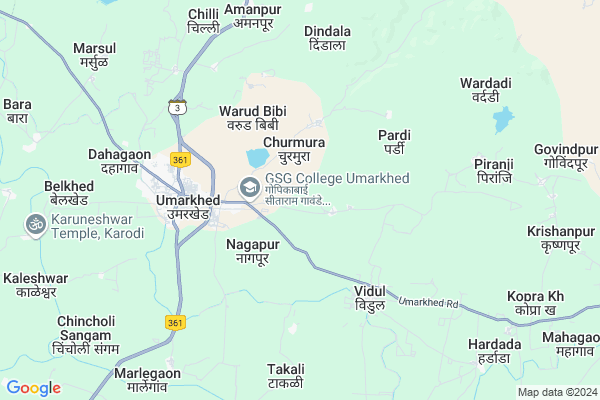
Jamb Map
EDIT Map
Add Your House
 ..
..
Current Corona Virus Infected Patients Count in Yavatmal District
| City Name | District Name | Total Covid cases |
|---|---|---|
| Yavatmal District | Yavatmal | 18 |
| Yavatmal | Yavatmal | 4 |
Locality Name :
Jamb
( जांब )
Taluka Name : Umarkhed
District : Yavatmal
State : Maharashtra
Region : Vidarbha
Division : Amravati
Language : Marathi and Gormati Or Banjari, Gondi, Hindi, Sindhi And Marwari.
Current Time 01:30 PM
Date: Monday , Apr 28,2025 (IST)
Time zone: IST (UTC+5:30)
Elevation / Altitude: 398 meters. Above Seal level
Telephone Code / Std Code: 07231
Assembly constituency : Umarkhed assembly constituency
Assembly MLA : Namdev Jayram Sasane
Lok Sabha constituency : Hingoli parliamentary constituency
Parliament MP : Hemant Patil
Serpanch Name :
Main Village Name : Jamb
Commodities Prices : Umarked(Danki) Market / Mandi
Jamb Live Weather
Temperature: 38.8 °C
clear sky
Humidity: 15%
Wind : 1.42 mt/sec towards W
StationName : "Umarkhed"
observed on 2 Hours Back
Temperature: 38.8 °C
clear sky
Humidity: 15%
Wind : 1.42 mt/sec towards W
StationName : "Umarkhed"
observed on 2 Hours Back
Jamb Weather Forecast for Next 5 days
29-04-2025
31.2°C to 40.3°C
clear sky, few clouds, scattered clouds
31.2°C to 40.3°C
clear sky, few clouds, scattered clouds
30-04-2025
29.6°C to 41.8°C
scattered clouds, clear sky, few clouds
29.6°C to 41.8°C
scattered clouds, clear sky, few clouds
01-05-2025
31.1°C to 42.6°C
scattered clouds, few clouds, clear sky
31.1°C to 42.6°C
scattered clouds, few clouds, clear sky
02-05-2025
30.1°C to 43.4°C
clear sky, broken clouds, scattered clouds
30.1°C to 43.4°C
clear sky, broken clouds, scattered clouds
03-05-2025
30.8°C to 42.9°C
broken clouds, scattered clouds, few clouds
30.8°C to 42.9°C
broken clouds, scattered clouds, few clouds
Rivers Near Jamb
Kothari
Kayadhu
Kothari
Kayadhu
About Jamb
Correct below Info and add more info about JambJamb is a small Village/hamlet in Umarkhed Taluka in Yavatmal District of Maharashtra State, India. It comes under Jamb Panchayath. It belongs to Vidarbha region . It belongs to Amravati Division . It is located 114 KM towards South from District head quarters Yavatmal. 603 KM from State capital Mumbai
Jamb is surrounded by Hadgaon Taluka towards west , Himayatnagar Taluka towards South , Mahagaon Taluka towards North , Mahur Taluka towards North .
Umarkhed , Pusad , Bhainsa , Nanded-Waghala are the near by Cities to Jamb.
This Place is in the border of the Yavatmal District and Nanded District. Nanded District Hadgaon is west towards this place .
Jamb 2011 Census Details
Jamb Local Language is Marathi. Jamb Village Total population is 74 and number of houses are 16. Female Population is 45.9%. Village literacy rate is 58.1% and the Female Literacy rate is 27.0%.
Population
| Census Parameter | Census Data |
| Total Population | 74 |
| Total No of Houses | 16 |
| Female Population % | 45.9 % ( 34) |
| Total Literacy rate % | 58.1 % ( 43) |
| Female Literacy rate | 27.0 % ( 20) |
| Scheduled Tribes Population % | 50.0 % ( 37) |
| Scheduled Caste Population % | 0.0 % ( 0) |
| Working Population % | 59.5 % |
| Child(0 -6) Population by 2011 | 11 |
| Girl Child(0 -6) Population % by 2011 | 27.3 % ( 3) |
Jamb Census More Deatils.
Politics in Jamb
BJP , NCP , Shivsena , INC , SHS are the major political parties in this area.Polling Stations /Booths near Jamb
1)Anantvadi2)Baladi
3)Chincholi (sangam)
4)Churmura
5)Murali
HOW TO REACH Jamb
By Rail
There is no railway station near to Jamb in less than 10 km. Kinwat Rail Way Station (near to Kinwat) , Ambari Rail Way Station (near to Kinwat) are the Rail way stations reachable from near by towns.By Road
Umarkhed , Pusad , Kinwat are the nearby by towns to Jamb having road connectivity to JambPincodes near Jamb
445206 ( Umarkhed ) , 445230 ( Fulsavangi ) , 431712 ( Hadgaon )Colleges near Jamb
Shivaji College
Address :
Shri Tejmal Gandhi Krushi Vidyalay Brahamangaon
Address :
Panchakrushna Arts & Science Junior College
Address :
Shri Tejmal Gandhi Jr. College
Address :
Schools near Jamb
Khajgi Madyamik Vidyalaya
Address : kupti , umarkhed , yavatmal , Maharashtra . PIN- 445211 , Post - Mulawa
S. D. Highschool
Address : mulawa , umarkhed , yavatmal , Maharashtra . PIN- 445211 , Post - Mulawa
Gadgebaba Vjnt Ashram School
Address : dhanki , umarkhed , yavatmal , Maharashtra . PIN- 445207 , Post - Dhanki (Yavatmal)
Suddhamm Highschool
Address : mulawa , umarkhed , yavatmal , Maharashtra . PIN- 445211 , Post - Mulawa
Govt Health Centers near Jamb
1) Devsari , sc Devsari , sc Devsari , sc Devsari2) Baladi , 192/13 , iti collage road baladi , near itit colage umarkhed
3) Vidul , 74 in phc bulding , umarkhed to dhanki road on tuch , umarkhed to dhanki road on tuch
Sub Villages in Jamb
Electronic Shops in Jamb,Umarkhed
Super Markets in Jamb,Umarkhed
Local Parks in Jamb,Umarkhed
Police Stations near Jamb,Umarkhed
Governement Offices near Jamb,Umarkhed
About Jamb &
History
How to reach Jamb
Tourist Places Near By Jamb
Schools in Jamb
Colleges in Jamb
Temperature & weather of Jamb
places in Jamb
Jamb photos
More Information
How to reach Jamb
Tourist Places Near By Jamb
Schools in Jamb
Colleges in Jamb
Temperature & weather of Jamb
places in Jamb
Jamb photos
More Information
Village Talk
Post News or Events about this Village
Near Cities
Umarkhed 3 KM near
Pusad 42 KM near
Bhainsa 66 KM near
Nanded-Waghala 83 KM near
Umarkhed 3 KM near
Pusad 42 KM near
Bhainsa 66 KM near
Nanded-Waghala 83 KM near
Near By Taluks
Umarkhed 0 KM near
Hadgaon 25 KM near
Himayatnagar 29 KM near
Mahagaon 30 KM near
Umarkhed 0 KM near
Hadgaon 25 KM near
Himayatnagar 29 KM near
Mahagaon 30 KM near
Near By Air Ports
Nanded Airport 71 KM near
Latur Airport 210 KM near
Sonegaon Airport 241 KM near
Chikkalthana Airport 275 KM near
Nanded Airport 71 KM near
Latur Airport 210 KM near
Sonegaon Airport 241 KM near
Chikkalthana Airport 275 KM near
Near By Tourist Places
Hingoli 69 KM near
Washim 93 KM near
Amravati 165 KM near
Sevagram 173 KM near
Chandrapur 189 KM near
Hingoli 69 KM near
Washim 93 KM near
Amravati 165 KM near
Sevagram 173 KM near
Chandrapur 189 KM near
Near By Districts
Hingoli 69 KM near
Nanded 73 KM near
Washim 93 KM near
Adilabad 95 KM near
Hingoli 69 KM near
Nanded 73 KM near
Washim 93 KM near
Adilabad 95 KM near
Near By RailWay Station
Himayatnagar Rail Way Station 27 KM near
Kinwat Rail Way Station 55 KM near
Himayatnagar Rail Way Station 27 KM near
Kinwat Rail Way Station 55 KM near