| Home | City Bus | Maps | Villages | Cities | Rail | Tourist Places | School | College | Pin Codes | Corona Cases Count |
| Distance Calculator Bus Services IFSC Codes Trace Mobile Number Weather Search Place Trace IP Available Cash ATM/Banks Locate Polling Booth Report an Error contact People |
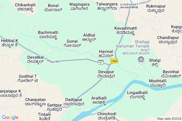
Nagaral Map
EDIT Map
Add Your House
 ..
..
Current Corona Virus Infected Patients Count in Yadgir District
| City Name | District Name | Total Covid cases |
|---|
Locality Name :
Nagaral
( ನಾಗರಾಳ್ )
Taluk Name : Shorapur
District : Yadgir
State : Karnataka
Division : Gulbarga
Language : Kannada
Current Time 03:08 PM
Date: Tuesday , Apr 29,2025 (IST)
Time zone: IST (UTC+5:30)
Elevation / Altitude: 383 meters. Above Seal level
Telephone Code / Std Code: 08443
Assembly constituency : Shorapur assembly constituency
Assembly MLA : Raja Venkatappa Naik
Lok Sabha constituency : Raichur parliamentary constituency
Parliament MP : RAJA AMARESHWARA NAIK
Serpanch Name :
Pin Code : 585290
Post Office Name : Kumbarpeth
Main Village Name : Nagaral
Alternate Village Name : Nagral
Commodities Prices : Devadurga Market / Mandi
Nagaral Live Weather
Temperature: 40.4 °C
clear sky
Humidity: 15%
Wind : 3.99 mt/sec towards E
StationName : "ShorÄ\u0081pur"
observed on 58 Mins Back
Temperature: 40.4 °C
clear sky
Humidity: 15%
Wind : 3.99 mt/sec towards E
StationName : "ShorÄ\u0081pur"
observed on 58 Mins Back
Nagaral Weather Forecast for Next 5 days
30-04-2025
34.0°C to 40.4°C
clear sky, scattered clouds, broken clouds
34.0°C to 40.4°C
clear sky, scattered clouds, broken clouds
01-05-2025
30.4°C to 41.7°C
broken clouds, scattered clouds, few clouds
30.4°C to 41.7°C
broken clouds, scattered clouds, few clouds
02-05-2025
28.3°C to 42.4°C
scattered clouds, clear sky, few clouds, overcast clouds, broken clouds
28.3°C to 42.4°C
scattered clouds, clear sky, few clouds, overcast clouds, broken clouds
03-05-2025
29.6°C to 42.2°C
broken clouds, clear sky, overcast clouds, scattered clouds
29.6°C to 42.2°C
broken clouds, clear sky, overcast clouds, scattered clouds
04-05-2025
30.3°C to 42.6°C
few clouds, clear sky, scattered clouds
30.3°C to 42.6°C
few clouds, clear sky, scattered clouds
National Highways Reachable To Nagaral
Nationa High Way :NH150
Nationa High Way :NH150A
Nationa High Way :NH150
Nationa High Way :NH150A
Rivers Near Nagaral
Bhima :ಭೀಮಾ :भीमा :కృష్ణా
Bhima :ಭೀಮಾ :भीमा :కృష్ణా
Bhima :ಭೀಮಾ :भीमा :కృష్ణా
Bhima :ಭೀಮಾ :भीमा :కృష్ణా
About Nagaral
Correct below Info and add more info about NagaralNagaral is a small Village/hamlet in Shorapur Taluk in Yadgir District of Karnataka State, India. It comes under Nagaral Panchayath. It belongs to Gulbarga Division . It is located 66 KM towards west from District head quarters Yadgir. 9 KM from Shorapur. 466 KM from State capital Bangalore
Nagaral Pin code is 585290 and postal head office is Kumbarpeth .
Kumbarpet ( 9 KM ) , Shorapur ( 11 KM ) , Peth Ammapur ( 11 KM ) , Venkatapur ( 11 KM ) , Tinthani ( 12 KM ) are the nearby Villages to Nagaral. Nagaral is surrounded by Devadurga Taluk towards East , Shahapur Taluk towards North , Lingsugur Taluk towards South , Jevargi Taluk towards North .
Shorapur , Shahpur , Talikota , Lingsugur are the near by Cities to Nagaral.
Nagaral 2011 Census Details
Nagaral Local Language is Kannada. Nagaral Village Total population is 1551 and number of houses are 244. Female Population is 48.4%. Village literacy rate is 34.9% and the Female Literacy rate is 9.9%.
Population
| Census Parameter | Census Data |
| Total Population | 1551 |
| Total No of Houses | 244 |
| Female Population % | 48.4 % ( 751) |
| Total Literacy rate % | 34.9 % ( 542) |
| Female Literacy rate | 9.9 % ( 153) |
| Scheduled Tribes Population % | 0.6 % ( 9) |
| Scheduled Caste Population % | 24.3 % ( 377) |
| Working Population % | 58.3 % |
| Child(0 -6) Population by 2011 | 300 |
| Girl Child(0 -6) Population % by 2011 | 52.3 % ( 157) |
Nagaral Census More Deatils.
Politics in Nagaral
JD(U) , Bharatiya Janata Party , JD(S) , BJP , Bharatiya Janata Party (BJP) , INC are the major political parties in this area.Polling Stations /Booths near Nagaral
1)Govt.higher Primary School Shamshirapur Shorapur2)Govt.lower Primary School (right Wing) Hasanapur
3)Govt.lower Primary School Chandalapur
4)Govt Higher Primary School Marnala Dodda Tanda
5)Govt Lower Primary School Benchigaddi
HOW TO REACH Nagaral
By Road
Shorapur is the Nearest Town to Nagaral. Shorapur is 13 km from Nagaral. Road connectivity is there from Shorapur to Nagaral.By Rail
There is no railway station near to Nagaral in less than 10 km.Colleges near Nagaral
Govt Pu College Kembhavi
Address :
Govt Pu College
Address :
Govt Degree Collage Kembhavi
Address :
Hunasagi Govt Puc Science College U.k.p
Address :
Sk
Address :
Schools in Nagaral
Govt Lps Nagaral
Address : nagaral , shorapur , yadagiri , Karnataka . PIN- 558290
Govt Health Centers near Nagaral
1) JUMALPUR , JUMALPUR , Rajankollur ,2) Shorapur , shorapur , Shorapur ,
3) MANGALURA , MANGALURA , Petammapur ,
Sub Villages in Nagaral
Police Stations near Nagaral,Shorapur
Police Station Shahapur
Police Station; Kondhwa Rd; Kondhwa; Pune; Maharashtra 411048; India
11.6 KM distance Detail
About Nagaral &
History
How to reach Nagaral
Tourist Places Near By Nagaral
Schools in Nagaral
Colleges in Nagaral
Temperature & weather of Nagaral
places in Nagaral
Nagaral photos
More Information
How to reach Nagaral
Tourist Places Near By Nagaral
Schools in Nagaral
Colleges in Nagaral
Temperature & weather of Nagaral
places in Nagaral
Nagaral photos
More Information
Village Talk
Post News or Events about this Village
Near Cities
Shorapur 10 KM near
Shahpur 34 KM near
Talikota 46 KM near
Lingsugur 47 KM near
Shorapur 10 KM near
Shahpur 34 KM near
Talikota 46 KM near
Lingsugur 47 KM near
Near By Taluks
Shorapur 9 KM near
Devadurga 32 KM near
Shahapur 36 KM near
Lingsugur 47 KM near
Shorapur 9 KM near
Devadurga 32 KM near
Shahapur 36 KM near
Lingsugur 47 KM near
Near By Air Ports
Sholapur Airport 173 KM near
Rajiv Gandhi International Airport 227 KM near
Hubli Airport 237 KM near
Latur Airport 245 KM near
Sholapur Airport 173 KM near
Rajiv Gandhi International Airport 227 KM near
Hubli Airport 237 KM near
Latur Airport 245 KM near
Near By Tourist Places
Mantralayam 106 KM near
Gulbarga 110 KM near
Aihole 112 KM near
Pattadakkal 123 KM near
Bijapur 127 KM near
Mantralayam 106 KM near
Gulbarga 110 KM near
Aihole 112 KM near
Pattadakkal 123 KM near
Bijapur 127 KM near
Near By Districts
Yadgir 63 KM near
Raichur 82 KM near
Gulbarga 111 KM near
Bijapur District 126 KM near
Yadgir 63 KM near
Raichur 82 KM near
Gulbarga 111 KM near
Bijapur District 126 KM near
Near By RailWay Station
Yadgir Rail Way Station 62 KM near
Nalwar Rail Way Station 70 KM near
Yadgir Rail Way Station 62 KM near
Nalwar Rail Way Station 70 KM near