| Home | City Bus | Maps | Villages | Cities | Rail | Tourist Places | School | College | Pin Codes | Corona Cases Count |
| Distance Calculator Bus Services IFSC Codes Trace Mobile Number Weather Search Place Trace IP Available Cash ATM/Banks Locate Polling Booth Report an Error contact People |
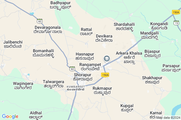
Hasnapur Map
EDIT Map
Add Your House
 ..
..
Current Corona Virus Infected Patients Count in Yadgir District
| City Name | District Name | Total Covid cases |
|---|
Locality Name :
Hasnapur
( ಹಸನಪುರ್ )
Taluk Name : Shorapur
District : Yadgir
State : Karnataka
Division : Gulbarga
Language : Kannada
Current Time 11:25 AM
Date: Tuesday , Apr 29,2025 (IST)
Time zone: IST (UTC+5:30)
Elevation / Altitude: 383 meters. Above Seal level
Telephone Code / Std Code: 08443
Assembly constituency : Shorapur assembly constituency
Assembly MLA : Raja Venkatappa Naik
Lok Sabha constituency : Raichur parliamentary constituency
Parliament MP : RAJA AMARESHWARA NAIK
Serpanch Name :
Pin Code : 585224
Post Office Name : Shorapur Town
Main Village Name : Hasnapur
Commodities Prices : Shahapur Market / Mandi
National Highways Reachable To Hasnapur
Nationa High Way :NH150
Nationa High Way :NH150A
Nationa High Way :NH150
Nationa High Way :NH150A
Rivers Near Hasnapur
Bhima :ಭೀಮಾ :भीमा :కృష్ణా
Bhima :ಭೀಮಾ :भीमा :కృష్ణా
Bhima :ಭೀಮಾ :भीमा :కృష్ణా
Bhima :ಭೀಮಾ :भीमा :కృష్ణా
About Hasnapur
Correct below Info and add more info about HasnapurHasnapur is a small Village/hamlet in Shorapur Taluk in Yadgir District of Karnataka State, India. It comes under Hasnapur Panchayath. It belongs to Gulbarga Division . It is located 54 KM towards west from District head quarters Yadgir. 15 KM from Shorapur. 476 KM from State capital Bangalore
Hasnapur Pin code is 585224 and postal head office is Shorapur Town .
Venkatapur ( 4 KM ) , Kumbarpet ( 4 KM ) , Sagar ( 11 KM ) , Peth Ammapur ( 11 KM ) , Devapur ( 14 KM ) are the nearby Villages to Hasnapur. Hasnapur is surrounded by Shahapur Taluk towards North , Devadurga Taluk towards East , Jevargi Taluk towards North , Lingsugur Taluk towards South .
Shorapur , Shahpur , Yadgir , Talikota are the near by Cities to Hasnapur.
Hasnapur 2011 Census Details
Hasnapur Local Language is Kannada. Hasnapur Village Total population is and number of houses are . Female Population is -1.0%. Village literacy rate is -1.0% and the Female Literacy rate is -1.0%.
Population
| Census Parameter | Census Data |
| Total Population | |
| Total No of Houses | |
| Female Population % | -1.0 % ( ) |
| Total Literacy rate % | -1.0 % ( ) |
| Female Literacy rate | -1.0 % ( ) |
| Scheduled Tribes Population % | -1.0 % ( ) |
| Scheduled Caste Population % | -1.0 % ( ) |
| Working Population % | -1.0 % |
| Child(0 -6) Population by 2011 | |
| Girl Child(0 -6) Population % by 2011 | -1.0 % ( ) |
Hasnapur Census More Deatils.
Politics in Hasnapur
JD(U) , Bharatiya Janata Party , JD(S) , BJP , Bharatiya Janata Party (BJP) , INC are the major political parties in this area.Polling Stations /Booths near Hasnapur
1)Govt.higher Primary School (left Wing) Kolihal2)Govt.higher Primary School Isamapur
3)Govt.model Girls Primary School (darbar) Shorapur
4)Govt Composite Higher Primary School ( Left Wing West Direction) Balashettihal
5)Govt. Higher Primary School (south Wing) Kumbarpet
HOW TO REACH Hasnapur
By Rail
There is no railway station near to Hasnapur in less than 10 km. are the Rail way stations reachable from near by towns.By Road
Shorapur , Talikota , Muddebihal are the nearby by towns to Hasnapur having road connectivity to HasnapurColleges near Hasnapur
Govt Pu College Kembhavi
Address :
Govt Pu College
Address :
Govt Degree Collage Kembhavi
Address :
Hunasagi Govt Puc Science College U.k.p
Address :
Sk
Address :
Schools near Hasnapur
Govt Hps Waganagera
Address : waganagera , shorapur , yadagiri , Karnataka . PIN- 585290 , Post - Kumbarpeth
Morarji Desai Hunasagi
Address : hunasagi , shorapur , yadagiri , Karnataka . PIN- 585230
Morarji Desai Kodakal
Address : kodekal , shorapur , yadagiri , Karnataka . PIN- 585237 , Post - Kodekal
Residential School(moorarjee)
Address : kembhavi , shorapur , yadagiri , Karnataka . PIN- 585216 , Post - Kembhavi
Govt Health Centers near Hasnapur
1) MANGALURA , MANGALURA , Petammapur ,2) Devapura , devapura sub centre , Pethammapura phc ,
3) Hunasangi , Hunasangi subcentre , phc srinivaspur ,
Sub Villages in Hasnapur
Schools in Hasnapur,Shorapur
Gurukul school and college of arts;commerce and science rangampet
Rangampet; Karnataka 585224; India
1.4 KM distance Detail
Priyadarshini First Grade Arts and Science College Rangampet
Shorapur; Karnataka 585224; India
1.7 KM distance Detail
Christ The King School
rangampet- main road shorapur; Shorapur; Karnataka; India
1.9 KM distance Detail
Police Stations near Hasnapur,Shorapur
Police Station Shahapur
Police Station; Kondhwa Rd; Kondhwa; Pune; Maharashtra 411048; India
2.3 KM distance Detail
About Hasnapur &
History
How to reach Hasnapur
Tourist Places Near By Hasnapur
Schools in Hasnapur
Colleges in Hasnapur
Temperature & weather of Hasnapur
places in Hasnapur
Hasnapur photos
More Information
How to reach Hasnapur
Tourist Places Near By Hasnapur
Schools in Hasnapur
Colleges in Hasnapur
Temperature & weather of Hasnapur
places in Hasnapur
Hasnapur photos
More Information
Village Talk
Post News or Events about this Village
Near Cities
Shorapur 2 KM near
Shahpur 21 KM near
Yadgir 51 KM near
Talikota 54 KM near
Shorapur 2 KM near
Shahpur 21 KM near
Yadgir 51 KM near
Talikota 54 KM near
Near By Taluks
Shorapur 15 KM near
Shahapur 22 KM near
Devadurga 32 KM near
Jevargi 50 KM near
Shorapur 15 KM near
Shahapur 22 KM near
Devadurga 32 KM near
Jevargi 50 KM near
Near By Air Ports
Sholapur Airport 168 KM near
Rajiv Gandhi International Airport 215 KM near
Latur Airport 235 KM near
Hubli Airport 249 KM near
Sholapur Airport 168 KM near
Rajiv Gandhi International Airport 215 KM near
Latur Airport 235 KM near
Hubli Airport 249 KM near
Near By Tourist Places
Gulbarga 99 KM near
Mantralayam 108 KM near
Aihole 124 KM near
Bijapur 130 KM near
Pattadakkal 135 KM near
Gulbarga 99 KM near
Mantralayam 108 KM near
Aihole 124 KM near
Bijapur 130 KM near
Pattadakkal 135 KM near
Near By Districts
Yadgir 51 KM near
Raichur 81 KM near
Gulbarga 99 KM near
Bijapur District 129 KM near
Yadgir 51 KM near
Raichur 81 KM near
Gulbarga 99 KM near
Bijapur District 129 KM near
Near By RailWay Station
Yadgir Rail Way Station 49 KM near
Nalwar Rail Way Station 57 KM near
Yadgir Rail Way Station 49 KM near
Nalwar Rail Way Station 57 KM near