| Home | City Bus | Maps | Villages | Cities | Rail | Tourist Places | School | College | Pin Codes | Corona Cases Count |
| Distance Calculator Bus Services IFSC Codes Trace Mobile Number Weather Search Place Trace IP Available Cash ATM/Banks Locate Polling Booth Report an Error contact People |
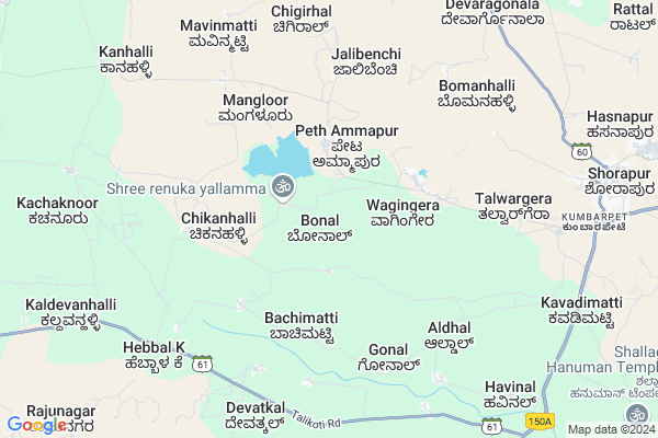
Bonal Map
EDIT Map
Add Your House
 ..
..
Current Corona Virus Infected Patients Count in Yadgir District
| City Name | District Name | Total Covid cases |
|---|
Locality Name :
Bonal
( ಬೋನಲ್ )
Taluk Name : Shorapur
District : Yadgir
State : Karnataka
Division : Gulbarga
Language : Kannada
Current Time 03:13 PM
Date: Tuesday , Apr 29,2025 (IST)
Time zone: IST (UTC+5:30)
Elevation / Altitude: 383 meters. Above Seal level
Telephone Code / Std Code: 08443
Assembly constituency : Shorapur assembly constituency
Assembly MLA : Raja Venkatappa Naik
Lok Sabha constituency : Raichur parliamentary constituency
Parliament MP : RAJA AMARESHWARA NAIK
Serpanch Name :
Pin Code : 585290
Post Office Name : Kumbarpeth
Main Village Name : Bonal
Commodities Prices : Shahapur Market / Mandi
Bonal Live Weather
Temperature: 40.4 °C
clear sky
Humidity: 15%
Wind : 3.99 mt/sec towards E
StationName : "ShorÄ\u0081pur"
observed on 1 Hours Back
Temperature: 40.4 °C
clear sky
Humidity: 15%
Wind : 3.99 mt/sec towards E
StationName : "ShorÄ\u0081pur"
observed on 1 Hours Back
Bonal Weather Forecast for Next 5 days
30-04-2025
34.0°C to 40.4°C
clear sky, scattered clouds, broken clouds
34.0°C to 40.4°C
clear sky, scattered clouds, broken clouds
01-05-2025
30.4°C to 41.7°C
broken clouds, scattered clouds, few clouds
30.4°C to 41.7°C
broken clouds, scattered clouds, few clouds
02-05-2025
28.3°C to 42.4°C
scattered clouds, clear sky, few clouds, overcast clouds, broken clouds
28.3°C to 42.4°C
scattered clouds, clear sky, few clouds, overcast clouds, broken clouds
03-05-2025
29.6°C to 42.2°C
broken clouds, clear sky, overcast clouds, scattered clouds
29.6°C to 42.2°C
broken clouds, clear sky, overcast clouds, scattered clouds
04-05-2025
30.3°C to 42.6°C
few clouds, clear sky, scattered clouds
30.3°C to 42.6°C
few clouds, clear sky, scattered clouds
National Highways Reachable To Bonal
Nationa High Way :NH150
Nationa High Way :NH150A
Nationa High Way :NH150
Nationa High Way :NH150A
Rivers Near Bonal
Bhima :ಭೀಮಾ :भीमा :కృష్ణా
Bhima :ಭೀಮಾ :भीमा :కృష్ణా
Bhima :ಭೀಮಾ :भीमा :కృష్ణా
Bhima :ಭೀಮಾ :भीमा :కృష్ణా
About Bonal
Correct below Info and add more info about BonalBonal is a small Village/hamlet in Shorapur Taluk in Yadgir District of Karnataka State, India. It comes under Bonal Panchayath. It belongs to Gulbarga Division . It is located 67 KM towards west from District head quarters Yadgir. 2 KM from Shorapur. 474 KM from State capital Bangalore
Bonal Pin code is 585290 and postal head office is Kumbarpeth .
Kumbarpet ( 10 KM ) , Shorapur ( 11 KM ) , Devapur ( 11 KM ) , Venkatapur ( 13 KM ) , Devikera ( 16 KM ) are the nearby Villages to Bonal. Bonal is surrounded by Shahapur Taluk towards East , Devadurga Taluk towards East , Lingsugur Taluk towards South , Jevargi Taluk towards North .
Shorapur , Shahpur , Talikota , Lingsugur are the near by Cities to Bonal.
Bonal 2011 Census Details
Bonal Local Language is Kannada. Bonal Village Total population is 2235 and number of houses are 373. Female Population is 49.3%. Village literacy rate is 35.3% and the Female Literacy rate is 12.8%.
Population
| Census Parameter | Census Data |
| Total Population | 2235 |
| Total No of Houses | 373 |
| Female Population % | 49.3 % ( 1102) |
| Total Literacy rate % | 35.3 % ( 789) |
| Female Literacy rate | 12.8 % ( 287) |
| Scheduled Tribes Population % | 0.0 % ( 1) |
| Scheduled Caste Population % | 43.6 % ( 974) |
| Working Population % | 51.7 % |
| Child(0 -6) Population by 2011 | 368 |
| Girl Child(0 -6) Population % by 2011 | 47.3 % ( 174) |
Bonal Census More Deatils.
Politics in Bonal
JD(U) , Bharatiya Janata Party , JD(S) , BJP , Bharatiya Janata Party (BJP) , INC are the major political parties in this area.Polling Stations /Booths near Bonal
1)Govt. Higher Primary School (left Wing) Jalibhenchi J2)Govt.higher Primary School Aldal
3)Govt.higher Primary School Halagera
4)Govt. Higher Primary School Building Yadiyapur
5)Govt Higher Primary School 4th Std Room Kakkera
HOW TO REACH Bonal
By Rail
There is no railway station near to Bonal in less than 10 km.Colleges near Bonal
Govt Pu College Kembhavi
Address :
Govt Pu College
Address :
Govt Degree Collage Kembhavi
Address :
Hunasagi Govt Puc Science College U.k.p
Address :
Sk
Address :
Schools in Bonal
Govt Hps Bonal
Address : bonal , shorapur , yadagiri , Karnataka . PIN- 585290 , Post - Kumbarpeth
Govt Health Centers near Bonal
1) JUMALPUR , JUMALPUR , Rajankollur ,2) Shorapur , shorapur , Shorapur ,
3) HEBBAL. (B) , HEBBAL. (B) , Kalladevan Halli ,
Sub Villages in Bonal
Electronic Shops in Bonal,Shorapur
SR Digital photo studio
Surapur; Gandhi Chowk Rd; Shahapur; Karnataka 585223; India
10.9 KM distance Detail
Police Stations near Bonal,Shorapur
Police Station Shahapur
Police Station; Kondhwa Rd; Kondhwa; Pune; Maharashtra 411048; India
11.3 KM distance Detail
About Bonal &
History
How to reach Bonal
Tourist Places Near By Bonal
Schools in Bonal
Colleges in Bonal
Temperature & weather of Bonal
places in Bonal
Bonal photos
More Information
How to reach Bonal
Tourist Places Near By Bonal
Schools in Bonal
Colleges in Bonal
Temperature & weather of Bonal
places in Bonal
Bonal photos
More Information
Village Talk
Post News or Events about this Village
Near Cities
Shorapur 10 KM near
Shahpur 30 KM near
Talikota 41 KM near
Lingsugur 50 KM near
Shorapur 10 KM near
Shahpur 30 KM near
Talikota 41 KM near
Lingsugur 50 KM near
Near By Taluks
Shorapur 3 KM near
Shahapur 33 KM near
Devadurga 39 KM near
Lingsugur 52 KM near
Shorapur 3 KM near
Shahapur 33 KM near
Devadurga 39 KM near
Lingsugur 52 KM near
Near By Air Ports
Sholapur Airport 165 KM near
Rajiv Gandhi International Airport 228 KM near
Hubli Airport 237 KM near
Latur Airport 237 KM near
Sholapur Airport 165 KM near
Rajiv Gandhi International Airport 228 KM near
Hubli Airport 237 KM near
Latur Airport 237 KM near
Near By Tourist Places
Gulbarga 104 KM near
Aihole 112 KM near
Mantralayam 114 KM near
Bijapur 120 KM near
Pattadakkal 123 KM near
Gulbarga 104 KM near
Aihole 112 KM near
Mantralayam 114 KM near
Bijapur 120 KM near
Pattadakkal 123 KM near
Near By Districts
Yadgir 63 KM near
Raichur 89 KM near
Gulbarga 104 KM near
Bijapur District 119 KM near
Yadgir 63 KM near
Raichur 89 KM near
Gulbarga 104 KM near
Bijapur District 119 KM near
Near By RailWay Station
Yadgir Rail Way Station 62 KM near
Nalwar Rail Way Station 67 KM near
Yadgir Rail Way Station 62 KM near
Nalwar Rail Way Station 67 KM near