| Home | City Bus | Maps | Villages | Cities | Rail | Tourist Places | School | College | Pin Codes | Corona Cases Count |
| Distance Calculator Bus Services IFSC Codes Trace Mobile Number Weather Search Place Trace IP Available Cash ATM/Banks Locate Polling Booth Report an Error contact People |
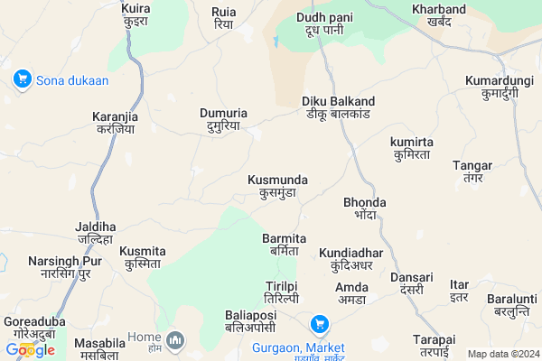
Kusmunda
Kusmunda Map
EDIT Map
Add Your House
 ..
..
Current Corona Virus Infected Patients Count in West Singhbhum District
| City Name | District Name | Total Covid cases |
|---|
Locality Name :
Kusmunda
( कुसमुंडा )
Block Name : Kumardungi
District : West Singhbhum
State : Jharkhand
Language : Hindi and Santali
Current Time 11:17 AM
Date: Wednesday , Feb 05,2025 (IST)
Time zone: IST (UTC+5:30)
Elevation / Altitude: 428 meters. Above Seal level
Telephone Code / Std Code: 06589
Assembly constituency : Majhgaon assembly constituency
Assembly MLA : NIRAL PURTY
Lok Sabha constituency : Singhbhum parliamentary constituency
Parliament MP : GEETA KORA
Serpanch Name :
Pin Code : 833214
Post Office Name : Hatgamaria
Main Village Name : Kusmunda
Commodities Prices : Karanjia Market / Mandi
National Highways Reachable To Kusmunda
Nationa High Way :NH320G
Nationa High Way :NH320G
Rivers Near Kusmunda
ଦକ୍ଷିଣ କାରୋ ନଦୀ :South Karo :ଦକ୍ଷିଣ କାରୋ ନଦୀ
ଦକ୍ଷିଣ କାରୋ ନଦୀ :South Karo :ଦକ୍ଷିଣ କାରୋ ନଦୀ
ଦକ୍ଷିଣ କାରୋ ନଦୀ :South Karo :ଦକ୍ଷିଣ କାରୋ ନଦୀ
ଦକ୍ଷିଣ କାରୋ ନଦୀ :South Karo :ଦକ୍ଷିଣ କାରୋ ନଦୀ
About Kusmunda
Correct below Info and add more info about KusmundaKusmunda is a small Village/hamlet in Kumardungi Block in West Singhbhum District of Jharkhand State, India. It comes under Kusmunda Panchayath. It is located 48 KM towards South from District head quarters Chaibasa. 10 KM from Kumardungi. 162 KM from State capital Ranchi
Kusmunda Pin code is 833214 and postal head office is Hatgamaria .
Kumirta ( 6 KM ) , Karanjia ( 7 KM ) , Asanpat ( 8 KM ) , Tangar Pokhria ( 9 KM ) , Chhota Mahuldiha ( 10 KM ) are the nearby Villages to Kusmunda. Kusmunda is surrounded by Jagannathpur Block towards west , Manjhgaon Block towards South , Manjhari Block towards North , Raruan Block towards South .
Barbil , Chaibasa , Joda , Rairangpur are the near by Cities to Kusmunda.
Demographics of Kusmunda
Hindi is the Local Language here.Politics in Kusmunda
Indian National Congress , JBSP , BJP , JMM , are the major political parties in this area.Polling Stations /Booths near Kusmunda
1)Primary School Baratorlo2)Primary School
3)Middle School
4)Primary School Chotatorlo
5)M/s Kharpos (n. Part )
HOW TO REACH Kusmunda
By Rail
There is no railway station near to Kusmunda in less than 10 km.Colleges near Kusmunda
Degree College Jagannathpur
Address : College Name Degree College Jagannathpur: degree College Jagannathpur
college Alternate Name : degree College Jagannathpur
city/village :jagannathpur jharkhand, West Singhbhum , Jagannathpur , Jagannathpur
public/private : public
college Type art
St. Augustine College, Manoharpur
Address : Same As College.
Jagannathpur Inter College
Address :
Inter College Manjhgaon
Address :
Kolhan University Chaibasa
Address :
Schools near Kusmunda
Kasturba Gandhi Balika Vidyalay
Address : Kgbv,vill-serbinza,block+ps+p.o.-kumardungi,dist.-west singhbhum,jharkhand,833214
Project High School Andhri
Address : At+po Andhari, west singhbhum
Project High School Andhari
Address : At+po Andhari, west singhbhum
Govt Health Centers near Kusmunda
1) HSC BARMITA , , ,2) HSC DUMARIA , , ,
3) HSC KOCHRA , , ,
Sub Villages in Kusmunda
Petrol Bunks in Kusmunda,Kumardungi
Bharat Petroleum Fuel Station; Kumardungi.
Hatgamhariya Kumardungi Road; Sarbil; Jharkhand 833201; India
11.7 KM distance Detail
Bharat Petroleum Fuel Station; Hat Gamariya.
National Highway 75; Hat Gamhariya; Jharkhand 833214; India
13.2 KM distance Detail
Bharat Petroleum: Kolhan Fuel Station.
Jharkhand State Highway 4; Jagannathpur; Jharkhand 833203; India
17.5 KM distance Detail
more ..
Electronic Shops in Kusmunda,Kumardungi
Infotech Solution Mobile Shop
Hat Gamhariya - Ruiya Rd; Haat Gamhariya; Jharkhand 833214; India
13.3 KM distance Detail
Super Markets in Kusmunda,Kumardungi
Prusty Shope
Hat Gamhariya - Ruiya Rd; Haat Gamhariya; Jharkhand 833214; India
13.3 KM distance Detail
Local Parks in Kusmunda,Kumardungi
Police Stations near Kusmunda,Kumardungi
Kumardungi Police Station.
Hatgamhariya Kumardungi Road; Kumardungi; Jharkhand 833201; India
11.7 KM distance Detail
Hat Gamhariya Police Station.
National Highway 75; Haat Gamhariya; Jharkhand 833214; India
13.9 KM distance Detail
About Kusmunda &
History
How to reach Kusmunda
Tourist Places Near By Kusmunda
Schools in Kusmunda
Colleges in Kusmunda
Temperature & weather of Kusmunda
places in Kusmunda
Kusmunda photos
More Information
How to reach Kusmunda
Tourist Places Near By Kusmunda
Schools in Kusmunda
Colleges in Kusmunda
Temperature & weather of Kusmunda
places in Kusmunda
Kusmunda photos
More Information
Village Talk
Post News or Events about this Village
Near Cities
Barbil 45 KM near
Chaibasa 45 KM near
Joda 46 KM near
Rairangpur 46 KM near
Barbil 45 KM near
Chaibasa 45 KM near
Joda 46 KM near
Rairangpur 46 KM near
Near By Taluks
Kumardungi 9 KM near
Jagannathpur 14 KM near
Manjhgaon 17 KM near
Manjhari 24 KM near
Kumardungi 9 KM near
Jagannathpur 14 KM near
Manjhgaon 17 KM near
Manjhari 24 KM near
Near By Air Ports
Ranchi Airport 151 KM near
Bhubaneswar Airport 240 KM near
Netaji Subhas Chandra Bose Airport 310 KM near
Gaya Airport 333 KM near
Ranchi Airport 151 KM near
Bhubaneswar Airport 240 KM near
Netaji Subhas Chandra Bose Airport 310 KM near
Gaya Airport 333 KM near
Near By Tourist Places
Seraikela 66 KM near
Barehipani & Joranda Barehipani & Joranda Falls 82 KM near
Jamshedpur 91 KM near
Rourkela 104 KM near
Baripada 113 KM near
Seraikela 66 KM near
Barehipani & Joranda Barehipani & Joranda Falls 82 KM near
Jamshedpur 91 KM near
Rourkela 104 KM near
Baripada 113 KM near
Near By Districts
West Singhbhum 46 KM near
Saraikela Kharsawan 66 KM near
Kendujhar 68 KM near
East Singhbum 89 KM near
West Singhbhum 46 KM near
Saraikela Kharsawan 66 KM near
Kendujhar 68 KM near
East Singhbum 89 KM near
Near By RailWay Station
Dangoaposi Rail Way Station 22 KM near
Goilkera Rail Way Station 62 KM near
Dangoaposi Rail Way Station 22 KM near
Goilkera Rail Way Station 62 KM near