| Home | City Bus | Maps | Villages | Cities | Rail | Tourist Places | School | College | Pin Codes | Corona Cases Count |
| Distance Calculator Bus Services IFSC Codes Trace Mobile Number Weather Search Place Trace IP Available Cash ATM/Banks Locate Polling Booth Report an Error contact People |
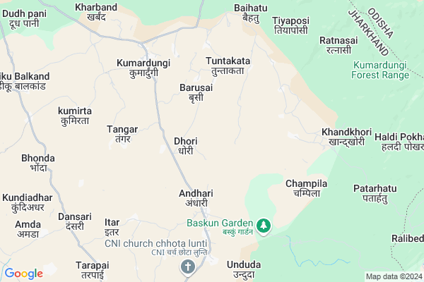
Kunkalpi
Kunkalpi Map
EDIT Map
Add Your House
 ..
..
Current Corona Virus Infected Patients Count in West Singhbhum District
| City Name | District Name | Total Covid cases |
|---|
Locality Name :
Kunkalpi
( कुंकल्पी )
Block Name : Kumardungi
District : West Singhbhum
State : Jharkhand
Language : Hindi and Santali
Current Time 11:30 AM
Date: Wednesday , Feb 05,2025 (IST)
Time zone: IST (UTC+5:30)
Elevation / Altitude: 428 meters. Above Seal level
Telephone Code / Std Code: 06589
Assembly constituency : Majhgaon assembly constituency
Assembly MLA : NIRAL PURTY
Lok Sabha constituency : Singhbhum parliamentary constituency
Parliament MP : GEETA KORA
Serpanch Name :
Pin Code : 833214
Post Office Name : Hatgamaria
Main Village Name : Kunkalpi
Commodities Prices : Karanjia Market / Mandi
Kunkalpi Live Weather
Temperature: 30.1 °C
scattered clouds
Humidity: 25%
Wind : 2.18 mt/sec towards NW
StationName : "JagannÄ\u0081thpur"
observed on 7 Mins Back
Temperature: 30.1 °C
scattered clouds
Humidity: 25%
Wind : 2.18 mt/sec towards NW
StationName : "JagannÄ\u0081thpur"
observed on 7 Mins Back
Kunkalpi Weather Forecast for Next 5 days
06-02-2025
19.8°C to 32.5°C
scattered clouds, broken clouds, clear sky
19.8°C to 32.5°C
scattered clouds, broken clouds, clear sky
07-02-2025
18.8°C to 30.8°C
few clouds, clear sky
18.8°C to 30.8°C
few clouds, clear sky
08-02-2025
16.1°C to 30.7°C
clear sky
16.1°C to 30.7°C
clear sky
09-02-2025
14.5°C to 30.6°C
clear sky
14.5°C to 30.6°C
clear sky
10-02-2025
14.4°C to 30.7°C
clear sky
14.4°C to 30.7°C
clear sky
National Highways Reachable To Kunkalpi
Nationa High Way :NH320G
Nationa High Way :NH320G
Rivers Near Kunkalpi
ଦକ୍ଷିଣ କାରୋ ନଦୀ :South Karo :ଦକ୍ଷିଣ କାରୋ ନଦୀ
ଦକ୍ଷିଣ କାରୋ ନଦୀ :South Karo :ଦକ୍ଷିଣ କାରୋ ନଦୀ
ଦକ୍ଷିଣ କାରୋ ନଦୀ :South Karo :ଦକ୍ଷିଣ କାରୋ ନଦୀ
ଦକ୍ଷିଣ କାରୋ ନଦୀ :South Karo :ଦକ୍ଷିଣ କାରୋ ନଦୀ
About Kunkalpi
Correct below Info and add more info about KunkalpiKunkalpi is a small Village/hamlet in Kumardungi Block in West Singhbhum District of Jharkhand State, India. It comes under Kunkalpi Panchayath. It is located 49 KM towards South from District head quarters Chaibasa. 4 KM from Kumardungi. 167 KM from State capital Ranchi
Kunkalpi Pin code is 833214 and postal head office is Hatgamaria .
Angardiha ( 4 KM ) , Tangar Pokhria ( 5 KM ) , Kumardungi ( 5 KM ) , Baihatu ( 6 KM ) , Khandkhori ( 7 KM ) are the nearby Villages to Kunkalpi. Kunkalpi is surrounded by Manjhgaon Block towards South , Jamda Block towards East , Manjhari Block towards North , Raruan Block towards South .
Rairangpur , Chaibasa , Karanjia , Joda are the near by Cities to Kunkalpi.
Kunkalpi 2011 Census Details
Kunkalpi Local Language is Hindi. Kunkalpi Village Total population is 963 and number of houses are 176. Female Population is 49.0%. Village literacy rate is 46.0% and the Female Literacy rate is 19.5%.
Population
| Census Parameter | Census Data |
| Total Population | 963 |
| Total No of Houses | 176 |
| Female Population % | 49.0 % ( 472) |
| Total Literacy rate % | 46.0 % ( 443) |
| Female Literacy rate | 19.5 % ( 188) |
| Scheduled Tribes Population % | 84.9 % ( 818) |
| Scheduled Caste Population % | 5.6 % ( 54) |
| Working Population % | 44.5 % |
| Child(0 -6) Population by 2011 | 218 |
| Girl Child(0 -6) Population % by 2011 | 45.4 % ( 99) |
Kunkalpi Census More Deatils.
Politics in Kunkalpi
Indian National Congress , JBSP , BJP , JMM , are the major political parties in this area.Polling Stations /Booths near Kunkalpi
1)Primary School Kantbila2)Primary School Khandkhori (north Part)
3)Middle School Barhamita (s. Part )
4)Primary School Tangrai
5)Primary School Dhobadhobin
HOW TO REACH Kunkalpi
By Rail
There is no railway station near to Kunkalpi in less than 10 km.Colleges near Kunkalpi
Degree College Jagannathpur
Address : College Name Degree College Jagannathpur: degree College Jagannathpur
college Alternate Name : degree College Jagannathpur
city/village :jagannathpur jharkhand, West Singhbhum , Jagannathpur , Jagannathpur
public/private : public
college Type art
St. Augustine College, Manoharpur
Address : Same As College.
Jagannathpur Inter College
Address :
Inter College Manjhgaon
Address :
Kolhan University Chaibasa
Address :
Schools near Kunkalpi
Kasturba Gandhi Balika Vidyalay
Address : Kgbv,vill-serbinza,block+ps+p.o.-kumardungi,dist.-west singhbhum,jharkhand,833214
Project High School Andhri
Address : At+po Andhari, west singhbhum
Project High School Andhari
Address : At+po Andhari, west singhbhum
Govt Health Centers near Kunkalpi
1) HSC ULIHATU , , ,2) HSC ANDHARI , , ,
3) HSC BERAMUNDUI , , ,
Sub Villages in Kunkalpi
Petrol Bunks in Kunkalpi,Kumardungi
Bharat Petroleum Fuel Station; Kumardungi.
Hatgamhariya Kumardungi Road; Sarbil; Jharkhand 833201; India
7.2 KM distance Detail
indian oil petrol pump
Chaibasa-Bharbharia-Kumardungi Rd; Barbil; Jharkhand 833201; India
17.4 KM distance Detail
more ..
Schools in Kunkalpi,Kumardungi
Kumardungi Govt Higher Secondary School / Rajkiyakrit +2 high school; Kumardungi
Hatgamhariya Kumardungi Road; Kharband; Jharkhand 833201; India
7.9 KM distance Detail
Super Markets in Kunkalpi,Kumardungi
Local Parks in Kunkalpi,Kumardungi
Police Stations near Kunkalpi,Kumardungi
Kumardungi Police Station.
Hatgamhariya Kumardungi Road; Kumardungi; Jharkhand 833201; India
7.1 KM distance Detail
Manjhari Police Station
Chaibasa-Bharbharia-Kumardungi Rd; Roladih; Jharkhand 833201; India
20.5 KM distance Detail
About Kunkalpi &
History
How to reach Kunkalpi
Tourist Places Near By Kunkalpi
Schools in Kunkalpi
Colleges in Kunkalpi
Temperature & weather of Kunkalpi
places in Kunkalpi
Kunkalpi photos
More Information
How to reach Kunkalpi
Tourist Places Near By Kunkalpi
Schools in Kunkalpi
Colleges in Kunkalpi
Temperature & weather of Kunkalpi
places in Kunkalpi
Kunkalpi photos
More Information
Village Talk
Post News or Events about this Village
Near Cities
Rairangpur 33 KM near
Chaibasa 47 KM near
Karanjia 51 KM near
Joda 58 KM near
Rairangpur 33 KM near
Chaibasa 47 KM near
Karanjia 51 KM near
Joda 58 KM near
Near By Taluks
Kumardungi 3 KM near
Manjhgaon 15 KM near
Jamda 18 KM near
Manjhari 18 KM near
Kumardungi 3 KM near
Manjhgaon 15 KM near
Jamda 18 KM near
Manjhari 18 KM near
Near By Air Ports
Ranchi Airport 156 KM near
Bhubaneswar Airport 240 KM near
Netaji Subhas Chandra Bose Airport 296 KM near
Gaya Airport 338 KM near
Ranchi Airport 156 KM near
Bhubaneswar Airport 240 KM near
Netaji Subhas Chandra Bose Airport 296 KM near
Gaya Airport 338 KM near
Near By Tourist Places
Seraikela 65 KM near
Barehipani & Joranda Barehipani & Joranda Falls 72 KM near
Jamshedpur 84 KM near
Baripada 99 KM near
Rourkela 118 KM near
Seraikela 65 KM near
Barehipani & Joranda Barehipani & Joranda Falls 72 KM near
Jamshedpur 84 KM near
Baripada 99 KM near
Rourkela 118 KM near
Near By Districts
West Singhbhum 47 KM near
Saraikela Kharsawan 64 KM near
Kendujhar 74 KM near
East Singhbum 83 KM near
West Singhbhum 47 KM near
Saraikela Kharsawan 64 KM near
Kendujhar 74 KM near
East Singhbum 83 KM near
Near By RailWay Station
Dangoaposi Rail Way Station 36 KM near
Rajkharsawan Junction Rail Way Station 69 KM near
Dangoaposi Rail Way Station 36 KM near
Rajkharsawan Junction Rail Way Station 69 KM near