| Home | City Bus | Maps | Villages | Cities | Rail | Tourist Places | School | College | Pin Codes | Corona Cases Count |
| Distance Calculator Bus Services IFSC Codes Trace Mobile Number Weather Search Place Trace IP Available Cash ATM/Banks Locate Polling Booth Report an Error contact People |
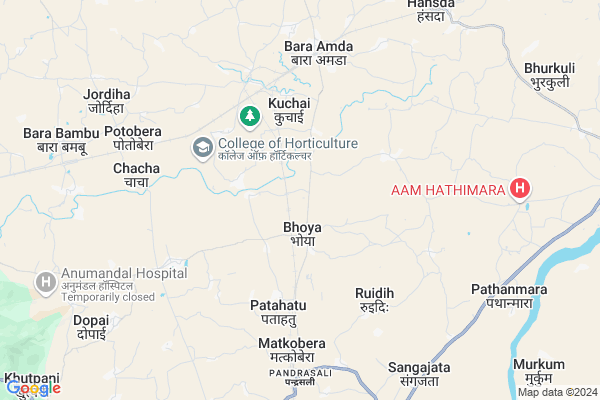
Gotai
Gotai Map
EDIT Map
Add Your House
 ..
..
Current Corona Virus Infected Patients Count in West Singhbhum District
| City Name | District Name | Total Covid cases |
|---|
Locality Name :
Gotai
( गोते )
Block Name : Khuntpani
District : West Singhbhum
State : Jharkhand
Language : Hindi and Santali
Current Time 12:04 PM
Date: Sunday , Apr 27,2025 (IST)
Time zone: IST (UTC+5:30)
Elevation / Altitude: 227 meters. Above Seal level
Telephone Code / Std Code: 06582
Assembly constituency : Kharsawan assembly constituency
Assembly MLA :
Lok Sabha constituency : Khunti parliamentary constituency
Parliament MP :
Serpanch Name :
Pin Code : 833101
Post Office Name : Amda
Main Village Name : Gotai
Commodities Prices : Balarampur Market / Mandi
Gotai Live Weather
Temperature: 35.6 °C
overcast clouds
Humidity: 21%
Wind : 5.77 mt/sec towards W
StationName : "KharsÄ\u0081wÄ\u0081n"
observed on 2 Hours Back
Temperature: 35.6 °C
overcast clouds
Humidity: 21%
Wind : 5.77 mt/sec towards W
StationName : "KharsÄ\u0081wÄ\u0081n"
observed on 2 Hours Back
Gotai Weather Forecast for Next 5 days
28-04-2025
26.3°C to 37.2°C
overcast clouds, broken clouds, light rain
26.3°C to 37.2°C
overcast clouds, broken clouds, light rain
29-04-2025
25.4°C to 37.5°C
overcast clouds, broken clouds, light rain, scattered clouds
25.4°C to 37.5°C
overcast clouds, broken clouds, light rain, scattered clouds
30-04-2025
23.9°C to 36.7°C
overcast clouds, scattered clouds, light rain, broken clouds, clear sky, few clouds
23.9°C to 36.7°C
overcast clouds, scattered clouds, light rain, broken clouds, clear sky, few clouds
01-05-2025
23.4°C to 38.3°C
overcast clouds, clear sky, light rain
23.4°C to 38.3°C
overcast clouds, clear sky, light rain
02-05-2025
24.0°C to 36.5°C
broken clouds, clear sky, light rain, moderate rain, overcast clouds
24.0°C to 36.5°C
broken clouds, clear sky, light rain, moderate rain, overcast clouds
National Highways Reachable To Gotai
Nationa High Way :NH320D
Nationa High Way :NH20
Nationa High Way :NH320D
Nationa High Way :NH20
Rivers Near Gotai
Karo River
Koel River :Koel River
Karo River
Koel River :Koel River
About Gotai
Correct below Info and add more info about GotaiGotai is a small Village/hamlet in Khuntpani Block in West Singhbhum District of Jharkhand State, India. It comes under Gotai Panchayath. It is located 18 KM towards North from District head quarters Chaibasa. 9 KM from Khuntpani. 103 KM from State capital Ranchi
Gotai Pin code is 833101 and postal head office is Amda .
Ruidih ( 5 KM ) , Purnia ( 6 KM ) , Matkobera ( 6 KM ) , Ulirajabasa ( 8 KM ) , Padampur ( 8 KM ) are the nearby Villages to Gotai. Gotai is surrounded by Khuntpani Block towards South , Saraikela Block towards East , Seraikella Block towards East , West Singhbhum Block towards South .
Chaibasa , Chakradharpur , Barughutu , Chandil are the near by Cities to Gotai.
This Place is in the border of the West Singhbhum District and Saraikela Kharsawan District. Saraikela Kharsawan District Kharsawan is North towards this place .
Gotai 2011 Census Details
Gotai Local Language is Hindi. Gotai Village Total population is 745 and number of houses are 137. Female Population is 48.7%. Village literacy rate is 57.2% and the Female Literacy rate is 23.6%.
Population
| Census Parameter | Census Data |
| Total Population | 745 |
| Total No of Houses | 137 |
| Female Population % | 48.7 % ( 363) |
| Total Literacy rate % | 57.2 % ( 426) |
| Female Literacy rate | 23.6 % ( 176) |
| Scheduled Tribes Population % | 72.6 % ( 541) |
| Scheduled Caste Population % | 0.0 % ( 0) |
| Working Population % | 46.2 % |
| Child(0 -6) Population by 2011 | 120 |
| Girl Child(0 -6) Population % by 2011 | 41.7 % ( 50) |
Gotai Census More Deatils.
Politics in Gotai
J V (P) , Bharatiya Janata Party , BJP , JMM , JKP , INC are the major political parties in this area.Polling Stations /Booths near Gotai
1)Upgrated Middle School Bhawan Hathitar2)Primary School Bhawan Thakura Hutu Right Side
3)Upgrated High School Bhawan Nengtasai
4)Primary School Bhawan Baruhatu
5)Upgrated Middle School Bhawan Kamalpur
HOW TO REACH Gotai
By Rail
Rajkharsawan Junction Rail Way Station , Pandrasali Rail Way Station are the very nearby railway stations to Gotai.Colleges near Gotai
Degree College Jagannathpur
Address : College Name Degree College Jagannathpur: degree College Jagannathpur
college Alternate Name : degree College Jagannathpur
city/village :jagannathpur jharkhand, West Singhbhum , Jagannathpur , Jagannathpur
public/private : public
college Type art
St. Augustine College, Manoharpur
Address : Same As College.
Jagannathpur Inter College
Address :
Inter College Manjhgaon
Address :
Kolhan University Chaibasa
Address :
Schools near Gotai
Govt Health Centers near Gotai
1) HSC BINZ , , ,2) HSC KRISHANPUR , , KRISHANPUR ,
3) HSC PURNIYA , , ,
Sub Villages in Gotai
Hospitals in Gotai,Khuntpani
Spriha Malti Helth Service
Adityapur - Chaibasa Rd; Saraikela; Jharkhand 833219; India
13.8 KM distance Detail
more ..
Petrol Bunks in Gotai,Khuntpani
OM SHANTI FILLING STATION
SARAIKELA; SERAIKALA KARSAWAN; Jharkhand 833219; India
12.0 KM distance Detail
HP PETROL PUMP - M P SAHU
HP Retail Outlet AT Seraikela Seraikela; Saraikela; Jharkhand 833220; India
15.4 KM distance Detail
more ..
Colleges in Gotai,Khuntpani
Mahila College;Chaibasa
Pashchimi Singhbhum; Chaibasa; Jharkhand 833201; India
18.6 KM distance Detail
Kolhan University
Jamshedpur - Keonjhar Hwy; Sadar Bazaar; Chaibasa; Jharkhand 833201; India
18.7 KM distance Detail
more ..
Schools in Gotai,Khuntpani
St. Xavier's Hindi Med. High School
Kharswan Road; Basahatu; Jharkhand 833101; India
2.8 KM distance Detail
Electronic Shops in Gotai,Khuntpani
Shyam Electronics
Kuchai;Seraikela; Jamshedpur H O; Jamshedpur - 831001; Saraikela; Jharkhand 831001; India
14.3 KM distance Detail
Local Parks in Gotai,Khuntpani
Veer Shahid Shiddhu Kanhu Park
Jharkhand State Highway 5; Jaganathpur; Jharkhand 833219; India
16.6 KM distance Detail
Governement Offices near Gotai,Khuntpani
Khuntpani Block Office
Chaibasa-Chakradharpur Highway; Kharswan Road; Jharkhand; India
6.3 KM distance Detail
About Gotai &
History
How to reach Gotai
Tourist Places Near By Gotai
Schools in Gotai
Colleges in Gotai
Temperature & weather of Gotai
places in Gotai
Gotai photos
More Information
How to reach Gotai
Tourist Places Near By Gotai
Schools in Gotai
Colleges in Gotai
Temperature & weather of Gotai
places in Gotai
Gotai photos
More Information
Village Talk
Post News or Events about this Village
Near Cities
Chaibasa 17 KM near
Chakradharpur 21 KM near
Barughutu 29 KM near
Chandil 43 KM near
Chaibasa 17 KM near
Chakradharpur 21 KM near
Barughutu 29 KM near
Chandil 43 KM near
Near By Taluks
Kharsawan 7 KM near
Khuntpani 9 KM near
Saraikela 13 KM near
Seraikella 16 KM near
Kharsawan 7 KM near
Khuntpani 9 KM near
Saraikela 13 KM near
Seraikella 16 KM near
Near By Air Ports
Ranchi Airport 96 KM near
Gaya Airport 274 KM near
Netaji Subhas Chandra Bose Airport 302 KM near
Bhubaneswar Airport 303 KM near
Ranchi Airport 96 KM near
Gaya Airport 274 KM near
Netaji Subhas Chandra Bose Airport 302 KM near
Bhubaneswar Airport 303 KM near
Near By Tourist Places
Seraikela 13 KM near
Jamshedpur 47 KM near
Dassam Falls 71 KM near
Purulia 78 KM near
Ranchi 99 KM near
Seraikela 13 KM near
Jamshedpur 47 KM near
Dassam Falls 71 KM near
Purulia 78 KM near
Ranchi 99 KM near
Near By Districts
Saraikela Kharsawan 13 KM near
West Singhbhum 17 KM near
East Singhbum 44 KM near
Khunti 77 KM near
Saraikela Kharsawan 13 KM near
West Singhbhum 17 KM near
East Singhbum 44 KM near
Khunti 77 KM near
Near By RailWay Station
Rajkharsawan Junction Rail Way Station 5.7 KM near
Pandrasali Rail Way Station 7.3 KM near
Sini Junction Rail Way Station 19 KM near
Rajkharsawan Junction Rail Way Station 5.7 KM near
Pandrasali Rail Way Station 7.3 KM near
Sini Junction Rail Way Station 19 KM near