| Home | City Bus | Maps | Villages | Cities | Rail | Tourist Places | School | College | Pin Codes | Corona Cases Count |
| Distance Calculator Bus Services IFSC Codes Trace Mobile Number Weather Search Place Trace IP Available Cash ATM/Banks Locate Polling Booth Report an Error contact People |
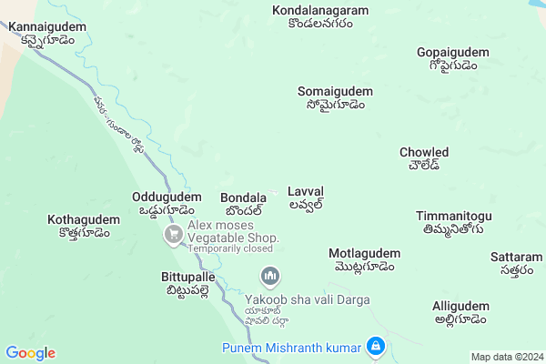
Bandala Map
EDIT Map
Add Your House
 ..
..
Current Corona Virus Infected Patients Count in Warangal District
| City Name | District Name | Total Covid cases |
|---|---|---|
| Warangal Urban District | Warangal Urban | 23 |
| Mulugu District | Mulugu | 2 |
| Mahabubabad District | Mahabubabad | 1 |
Locality Name :
Bandala
( బండ్ల )
Mandal Name : Tadvai
District : Warangal
State : Telangana
Region : Telangana
Language : Telugu and Urdu
Current Time 09:19 AM
Date: Friday , Apr 25,2025 (IST)
Time zone: IST (UTC+5:30)
Elevation / Altitude: 92 meters. Above Seal level
Telephone Code / Std Code: 08717
Assembly constituency : Mulug assembly constituency
Assembly MLA : Danasari Anasuya Seethakka
Lok Sabha constituency : Mahabubabad parliamentary constituency
Parliament MP : Kavitha Malothu
Serpanch Name :
Pin Code : 506347
Post Office Name : Pasra
Main Village Name : Bandala
Alternate Village Name : Bandal
Commodities Prices : Narsampet Market / Mandi
National Highways Reachable To Bandala
Nationa High Way :NH163
Nationa High Way :NH163
Rivers Near Bandala
Are Vagu
Godavari :गोदावरी :ಗೋದಾವರಿ :गोदावरी :கோதாவரி :గోదావరి
Are Vagu
Godavari :गोदावरी :ಗೋದಾವರಿ :गोदावरी :கோதாவரி :గోదావరి
About Bandala
Correct below Info and add more info about BandalaBandala is a small Village/hamlet in Tadvai Mandal in Warangal District of Telangana State, India. It comes under Bandala Panchayath. It belongs to Telangana region . As part Telangana Districts re-organisation , Bandala Village Tadvai Mandal re organised from Warangal District to Jaya Shankar district. It is located 87 KM towards East from District head quarters Warangal. 10 KM from Tadvai.
Bandala Pin code is 506347 and postal head office is Pasra .
Ailapur ( 16 KM ) , Katapuram ( 17 KM ) are the nearby Villages to Bandala. Bandala is surrounded by Govindaraopet Mandal towards west , Kothagudem Mandal towards South , Gundala Mandal towards South , Mangapet Mandal towards East .
Yellandu , Manuguru , Warangal , Kothagudem are the near by Cities to Bandala.
Bondal 2011 Census Details
Bandala Local Language is Telugu. Bondal Village Total population is 401 and number of houses are 92. Female Population is 50.4%. Village literacy rate is 32.9% and the Female Literacy rate is 11.0%.
Population
| Census Parameter | Census Data |
| Total Population | 401 |
| Total No of Houses | 92 |
| Female Population % | 50.4 % ( 202) |
| Total Literacy rate % | 32.9 % ( 132) |
| Female Literacy rate | 11.0 % ( 44) |
| Scheduled Tribes Population % | 100.0 % ( 401) |
| Scheduled Caste Population % | 0.0 % ( 0) |
| Working Population % | 92.5 % |
| Child(0 -6) Population by 2011 | 38 |
| Girl Child(0 -6) Population % by 2011 | 57.9 % ( 22) |
Bondal Census More Deatils.
Politics in Bandala
TDP , TRS , INC are the major political parties in this area.Polling Stations /Booths near Bandala
1)Balanna Gudem2)Bhoopalnagar
3)Bittupalli
4)Narayanagiripally
5)Narsapur
HOW TO REACH Bandala
By Road
Warangal is the Nearest Town to Bandala. Warangal is 90 km from Bandala. Road connectivity is there from Warangal to Bandala.By Rail
There is no railway station near to Bandala in less than 10 km. How ever there are railway Stations from Near By town Warangal. are the railway Stations near to Warangal. You can reach from Warangal to Bandala by road after .Colleges near Bandala
Vmr Polytechnic College
Address :
Maharshi Degree$ P.g College Mulugu Code 280
Address : Main Road Mulugu Pincode 506343
Sri Vikas Junioer And Degree Collage
Address :
Nalanda Junior College
Address :
Sri Vivekandha Degree College
Address :
Schools in Bandala
Tw Ps Bandala
Address : bandal , thadvai , warangal , Andhra Pradesh . PIN- 506347 , Post - Pasra
Govt Health Centers near Bandala
1) SubCentre, Kodishala , 29-Aug , kodishala , kodishala2) Primary Health Centre, Kodishala , , kodishala ,
3) SubCentre, Miryalapenta , 9--81 , main road , Miriyalapenta
Sub Villages in Bandala
Colleges in Bandala,Tadvai
Government Junior College
National Highway 202; Tadvai; Telangana 506344; India
17.0 KM distance Detail
more ..
Electronic Shops in Bandala,Tadvai
Eshwar Electricals Iron; Hardware And Automobiles
Main road katapur; Telangana 506344; India
16.6 KM distance Detail
Super Markets in Bandala,Tadvai
Police Stations near Bandala,Tadvai
Police Station
Pasra; National Highway 163; Kannaigudem; Telangana 506347; India
13.5 KM distance Detail
Governement Offices near Bandala,Tadvai
MeeSeva Center
H.No.3-74/1; Near Bus stop; Opposite Tribal Welfare girls Asrama High school; NH163; Tadvai; Telangana 506344; India
16.9 KM distance Detail
About Bandala &
History
How to reach Bandala
Tourist Places Near By Bandala
Schools in Bandala
Colleges in Bandala
Temperature & weather of Bandala
places in Bandala
Bandala photos
More Information
How to reach Bandala
Tourist Places Near By Bandala
Schools in Bandala
Colleges in Bandala
Temperature & weather of Bandala
places in Bandala
Bandala photos
More Information
Village Talk
Post News or Events about this Village
Near Cities
Yellandu 64 KM near
Manuguru 68 KM near
Warangal 81 KM near
Kothagudem 81 KM near
Yellandu 64 KM near
Manuguru 68 KM near
Warangal 81 KM near
Kothagudem 81 KM near
Near By Taluks
Tadvai 9 KM near
Govindaraopet 17 KM near
Kothagudem 29 KM near
Gundala 32 KM near
Tadvai 9 KM near
Govindaraopet 17 KM near
Kothagudem 29 KM near
Gundala 32 KM near
Near By Air Ports
Vijayawada Airport 206 KM near
Rajahmundry Airport 222 KM near
Rajiv Gandhi International Airport 243 KM near
Vishakhapatnam Airport 353 KM near
Vijayawada Airport 206 KM near
Rajahmundry Airport 222 KM near
Rajiv Gandhi International Airport 243 KM near
Vishakhapatnam Airport 353 KM near
Near By Tourist Places
Medaram 26 KM near
Warangal 79 KM near
Bhadrachalam 92 KM near
Khammam 107 KM near
Dantewada 160 KM near
Medaram 26 KM near
Warangal 79 KM near
Bhadrachalam 92 KM near
Khammam 107 KM near
Dantewada 160 KM near
Near By Districts
Warangal 83 KM near
Bijapur 107 KM near
Khammam 107 KM near
Karimnagar 140 KM near
Warangal 83 KM near
Bijapur 107 KM near
Khammam 107 KM near
Karimnagar 140 KM near
Near By RailWay Station
Nekonda Rail Way Station 67 KM near
Kesamudram Rail Way Station 68 KM near
Nekonda Rail Way Station 67 KM near
Kesamudram Rail Way Station 68 KM near