| Home | City Bus | Maps | Villages | Cities | Rail | Tourist Places | School | College | Pin Codes | Corona Cases Count |
| Distance Calculator Bus Services IFSC Codes Trace Mobile Number Weather Search Place Trace IP Available Cash ATM/Banks Locate Polling Booth Report an Error contact People |
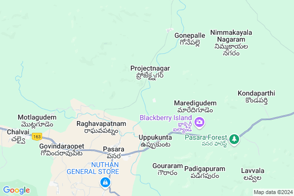
Muthapur
Muthapur Map
EDIT Map
Add Your House
 ..
..
Current Corona Virus Infected Patients Count in Warangal District
| City Name | District Name | Total Covid cases |
|---|---|---|
| Warangal Urban District | Warangal Urban | 23 |
| Mulugu District | Mulugu | 2 |
| Mahabubabad District | Mahabubabad | 1 |
Locality Name :
Muthapur
( మూఠాపూర్ )
Mandal Name : Govindaraopet
District : Warangal
State : Telangana
Region : Telangana
Language : Telugu and Urdu
Current Time 09:15 AM
Date: Saturday , Apr 26,2025 (IST)
Time zone: IST (UTC+5:30)
Elevation / Altitude: 249 meters. Above Seal level
Telephone Code / Std Code: 08715
Assembly constituency : Mulug assembly constituency
Assembly MLA : Danasari Anasuya Seethakka
Lok Sabha constituency : Mahabubabad parliamentary constituency
Parliament MP : Kavitha Malothu
Serpanch Name :
Pin Code : 506344
Post Office Name : Govindaraopet
Main Village Name : Muthapur
Commodities Prices : Ghanpur Market / Mandi
National Highways Reachable To Muthapur
Nationa High Way :NH365BB
Nationa High Way :NH16
Nationa High Way :NH365BB
Nationa High Way :NH16
Rivers Near Muthapur
Gadhavi
Pranhita
Gadhavi
Pranhita
About Muthapur
Correct below Info and add more info about MuthapurMuthapur is a small Village/hamlet in Govindaraopet Mandal in Warangal District of Telangana State, India. It comes under Muthapur Panchayath. It belongs to Telangana region . As part Telangana Districts re-organisation , Muthapur Village Govindaraopet Mandal re organised from Warangal District to Jaya Shankar district. It is located 82 KM towards East from District head quarters Warangal. 7 KM from Govindaraopeta.
Muthapur Pin code is 506344 and postal head office is Govindaraopet .
Tadvai ( 9 KM ) , Motlagudem ( 10 KM ) , Narlapur ( 10 KM ) , Karlapalle ( 11 KM ) , Chalvai ( 12 KM ) are the nearby Villages to Muthapur. Muthapur is surrounded by Tadvai Mandal towards East , Eturnagaram Mandal towards East , Mulug Mandal towards west , Venkatapur Mandal towards west .
Warangal , Yellandu , Manuguru , Kothagudem are the near by Cities to Muthapur.
Muthapur 2011 Census Details
Muthapur Local Language is Telugu. Muthapur Village Total population is 340 and number of houses are 98. Female Population is 52.1%. Village literacy rate is 43.8% and the Female Literacy rate is 18.5%.
Population
| Census Parameter | Census Data |
| Total Population | 340 |
| Total No of Houses | 98 |
| Female Population % | 52.1 % ( 177) |
| Total Literacy rate % | 43.8 % ( 149) |
| Female Literacy rate | 18.5 % ( 63) |
| Scheduled Tribes Population % | 91.2 % ( 310) |
| Scheduled Caste Population % | 4.1 % ( 14) |
| Working Population % | 60.6 % |
| Child(0 -6) Population by 2011 | 34 |
| Girl Child(0 -6) Population % by 2011 | 58.8 % ( 20) |
Muthapur Census More Deatils.
Politics in Muthapur
TDP , TRS , INC are the major political parties in this area.Polling Stations /Booths near Muthapur
1)Musmi ( Ladaigadda Thanda)2)Potlapur
3)Raayinigudem
4)Pandikunta
5)Pasaranagaram
HOW TO REACH Muthapur
By Road
Warangal is the Nearest Town to Muthapur. Warangal is 78 km from Muthapur. Road connectivity is there from Warangal to Muthapur.By Rail
There is no railway station near to Muthapur in less than 10 km. How ever there are railway Stations from Near By town Warangal. are the railway Stations near to Warangal. You can reach from Warangal to Muthapur by road after .Colleges near Muthapur
Nalanda Junior College
Address :
Govt Jr College
Address :
Schools in Muthapur
Twps Muthapur
Address : muthapur , govindaraopet , warangal , Andhra Pradesh . PIN- 506347 , Post - Pasra
Govt Health Centers near Muthapur
1) SubCentre Projectnagar , 22-91 , mainroad , Ashrama highschool2) SubCentre Pasra , 1-163 , pathur , Bodrai
3) Primary Health Centre Pasra , , Main road ,
Sub Villages in Muthapur
Colleges in Muthapur,Govindaraopet
Government Junior College
National Highway 202; Tadvai; Telangana 506344; India
15.5 KM distance Detail
more ..
Super Markets in Muthapur,Govindaraopet
Police Stations near Muthapur,Govindaraopet
Police Station
Pasra; National Highway 163; Kannaigudem; Telangana 506347; India
8.8 KM distance Detail
About Muthapur &
History
How to reach Muthapur
Tourist Places Near By Muthapur
Schools in Muthapur
Colleges in Muthapur
Temperature & weather of Muthapur
places in Muthapur
Muthapur photos
More Information
How to reach Muthapur
Tourist Places Near By Muthapur
Schools in Muthapur
Colleges in Muthapur
Temperature & weather of Muthapur
places in Muthapur
Muthapur photos
More Information
Village Talk
Post News or Events about this Village
Near Cities
Warangal 75 KM near
Yellandu 80 KM near
Manuguru 82 KM near
Kothagudem 99 KM near
Warangal 75 KM near
Yellandu 80 KM near
Manuguru 82 KM near
Kothagudem 99 KM near
Near By Taluks
Govindaraopet 7 KM near
Tadvai 8 KM near
Eturnagaram 29 KM near
Mulug 30 KM near
Govindaraopet 7 KM near
Tadvai 8 KM near
Eturnagaram 29 KM near
Mulug 30 KM near
Near By Air Ports
Vijayawada Airport 223 KM near
Rajahmundry Airport 238 KM near
Rajiv Gandhi International Airport 242 KM near
Nanded Airport 359 KM near
Vijayawada Airport 223 KM near
Rajahmundry Airport 238 KM near
Rajiv Gandhi International Airport 242 KM near
Nanded Airport 359 KM near
Near By Tourist Places
Medaram 12 KM near
Warangal 74 KM near
Bhadrachalam 108 KM near
Khammam 121 KM near
Bhamragarh Wildlife Sanctuary 154 KM near
Medaram 12 KM near
Warangal 74 KM near
Bhadrachalam 108 KM near
Khammam 121 KM near
Bhamragarh Wildlife Sanctuary 154 KM near
Near By Districts
Warangal 78 KM near
Bijapur 102 KM near
Khammam 121 KM near
Karimnagar 127 KM near
Warangal 78 KM near
Bijapur 102 KM near
Khammam 121 KM near
Karimnagar 127 KM near
Near By RailWay Station
Nekonda Rail Way Station 70 KM near
Kesamudram Rail Way Station 76 KM near
Nekonda Rail Way Station 70 KM near
Kesamudram Rail Way Station 76 KM near