| Home | City Bus | Maps | Villages | Cities | Rail | Tourist Places | School | College | Pin Codes | Corona Cases Count |
| Distance Calculator Bus Services IFSC Codes Trace Mobile Number Weather Search Place Trace IP Available Cash ATM/Banks Locate Polling Booth Report an Error contact People |
Chintamala
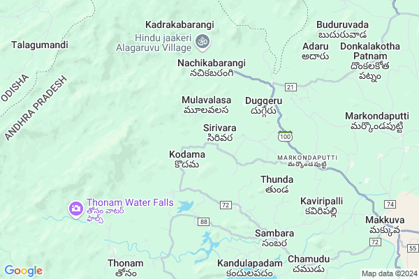
Chintamala Map
EDIT Map
Add Your House
 ..
..
Current Corona Virus Infected Patients Count in Vizianagaram District
| City Name | District Name | Total Covid cases |
|---|
Locality Name :
Chintamala
( చింతమల )
Mandal Name : Salur
District : Vizianagaram
State : Andhra Pradesh
Region : Andhra
Language : Telugu
Current Time 05:20 PM
Date: Friday , Apr 25,2025 (IST)
Time zone: IST (UTC+5:30)
Elevation / Altitude: 158 meters. Above Seal level
Telephone Code / Std Code: 08964
Assembly constituency : Proddatur assembly constituency
Assembly MLA : Rachamallu Siva Prasad Reddy
Lok Sabha constituency : Kurnool parliamentary constituency
Parliament MP : AYUSHMAN DOCTOR SANJEEV KUMAR
Serpanch Name :
Pin Code : 535547
Post Office Name : Makkuva
Main Village Name : Chintamala
Commodities Prices : Koraput(Semilguda) Market / Mandi
Chintamala Live Weather
Temperature: 37.9 °C
broken clouds
Humidity: 29%
Wind : 6.16 mt/sec towards SE
StationName : "SÄ\u0081lÅ«r"
observed on 1 Hours Back
Temperature: 37.9 °C
broken clouds
Humidity: 29%
Wind : 6.16 mt/sec towards SE
StationName : "SÄ\u0081lÅ«r"
observed on 1 Hours Back
Chintamala Weather Forecast for Next 5 days
26-04-2025
28.2°C to 37.3°C
broken clouds, scattered clouds
28.2°C to 37.3°C
broken clouds, scattered clouds
27-04-2025
27.7°C to 39.0°C
broken clouds, scattered clouds, few clouds, light rain, overcast clouds
27.7°C to 39.0°C
broken clouds, scattered clouds, few clouds, light rain, overcast clouds
28-04-2025
27.6°C to 39.6°C
overcast clouds, broken clouds, light rain, moderate rain
27.6°C to 39.6°C
overcast clouds, broken clouds, light rain, moderate rain
29-04-2025
26.8°C to 37.8°C
overcast clouds, broken clouds, scattered clouds, light rain
26.8°C to 37.8°C
overcast clouds, broken clouds, scattered clouds, light rain
30-04-2025
25.3°C to 37.2°C
scattered clouds, clear sky, light rain, broken clouds
25.3°C to 37.2°C
scattered clouds, clear sky, light rain, broken clouds
National Highways Reachable To Chintamala
Nationa High Way :NH16
Nationa High Way :NH16
Rivers Near Chintamala
Nagavali
Pedda Eru
Nagavali
Pedda Eru
About Chintamala
Correct below Info and add more info about ChintamalaChintamala is a small Village/hamlet in Salur Mandal in Vizianagaram District of Andhra Pradesh State, India. It comes under Chintamala Panchayath. It belongs to Andhra region . It is located 80 KM towards North from District head quarters Vizianagaram. 11 KM from Salur. 605 KM from State capital Hyderabad
Chintamala Pin code is 535547 and postal head office is Makkuva .
Mavudi ( 6 KM ) , Sambaraa ( 7 KM ) , Kottuparuvu ( 7 KM ) , Kandulapadam ( 7 KM ) , Kaviripalli ( 7 KM ) are the nearby Villages to Chintamala. Chintamala is surrounded by Makkuva Mandal towards East , Narayan Patana Mandal towards North , Seethanagaram Mandal towards East , Parvathipuram Mandal towards East .
Salur , Bobbili , Parvathipuram , Sunabeda are the near by Cities to Chintamala.
Chintamala 2011 Census Details
Chintamala Local Language is Telugu. Chintamala Village Total population is 482 and number of houses are 132. Female Population is 53.7%. Village literacy rate is 17.4% and the Female Literacy rate is 9.3%.
Population
| Census Parameter | Census Data |
| Total Population | 482 |
| Total No of Houses | 132 |
| Female Population % | 53.7 % ( 259) |
| Total Literacy rate % | 17.4 % ( 84) |
| Female Literacy rate | 9.3 % ( 45) |
| Scheduled Tribes Population % | 99.8 % ( 481) |
| Scheduled Caste Population % | 0.0 % ( 0) |
| Working Population % | 73.7 % |
| Child(0 -6) Population by 2011 | 67 |
| Girl Child(0 -6) Population % by 2011 | 47.8 % ( 32) |
Chintamala Census More Deatils.
Politics in Chintamala
TDP , YSRC , Yuvajana Sramika Rythu Congress Party , YSRCP , INC are the major political parties in this area.Polling Stations /Booths near Chintamala
1)Kottala H/o Tanguturu2). Chowduru
3). Proddutur
4)Kothapeta H/o Peddasettypalle
5)Parlapadu
HOW TO REACH Chintamala
By Road
Salur is the Nearest Town to Chintamala. Salur is 32 km from Chintamala. Road connectivity is there from Salur to Chintamala.By Rail
There is no railway station near to Chintamala in less than 10 km. How ever there are railway Stations from Near By town Salur. are the railway Stations near to Salur. You can reach from Salur to Chintamala by road after .By Bus
Salur APSRTC Bus Station , Bobbili APSRTC Bus Station , Ramabadrapuram APSRTC Bus Station are the nearby by Bus Stations to Chintamala .APSRTC runs Number of busses from major cities to here.Colleges near Chintamala
Nekkanti Agricultural Polytechnic College
Address :
Sri Satya Sai Jr College Salur
Address : Sri Satya Sai Jr College Salur
Sri Vasavi Jr College? Salur
Address : Sri Vasavi Jr College? Salur
Govt Junior College Salur
Address : Govt Junior College Salur
St Agnes Jr College, Kothavalasa
Address : Kothavalasa
Schools in Chintamala
Mpps Chinatamala
Address : chintamala , saluru , vizianagaram , Andhra Pradesh . PIN- 535547 , Post - Makkuva
Govtps Tw Lodda
Address : chintamala , saluru , vizianagaram , Andhra Pradesh . PIN- 535547 , Post - Makkuva
Govt Health Centers near Chintamala
1) Kodama , , MAIN ROAD , MAINROAD2) Duggeru , Jan-39 , MAIN ROAD , SANDIPOINT
3) P Gaiseela , , MAIN ROAD , MAINROAD
Sub Villages in Chintamala
Petrol Bunks in Chintamala,Salur
Joy Filling Station
Makkuava main road; Makkuva; Andhra Pradesh 535547; India
12.9 KM distance Detail
HP PETROL PUMP - SRI RAMA TRANSPORTS CHERUKUPALLY
Cherukupalli Village P. Konavalasa Panchayat Pachipenta Mandalam; Visakhapatnam; Andhra Pradesh 535592; India
22.3 KM distance Detail
HP PETROL PUMP - KARUNAMAYA PETRO STATION P.KONAVA
S.NO:12/3; Plot NO 86; NH-43 Gavirammapeta Pachipenta Mandalam; Visakhapatnam; Andhra Pradesh 535592; India
23.3 KM distance Detail
more ..
Colleges in Chintamala,Salur
Sri Chaitanya Polytechnic College
Pachipenta; Vizianagaram; NH-26; Saluru Road; Saluru; Salur; Andhra Pradesh 535591; India
22.7 KM distance Detail
more ..
Local Parks in Chintamala,Salur
Apex Salur Railway Station Property
Vizianagaram; Andhra Pradesh 535591; India
22.5 KM distance Detail
Police Stations near Chintamala,Salur
Makkuva Police Station
Sambara-Kaviripalli Road; Makkuva; Andhra Pradesh 535547; India
11.8 KM distance Detail
About Chintamala &
History
How to reach Chintamala
Tourist Places Near By Chintamala
Schools in Chintamala
Colleges in Chintamala
Temperature & weather of Chintamala
places in Chintamala
Chintamala photos
More Information
How to reach Chintamala
Tourist Places Near By Chintamala
Schools in Chintamala
Colleges in Chintamala
Temperature & weather of Chintamala
places in Chintamala
Chintamala photos
More Information
Village Talk
Post News or Events about this Village
Near Cities
Salur 23 KM near
Bobbili 24 KM near
Parvathipuram 31 KM near
Sunabeda 41 KM near
Salur 23 KM near
Bobbili 24 KM near
Parvathipuram 31 KM near
Sunabeda 41 KM near
Near By Taluks
Salur 10 KM near
Makkuva 10 KM near
Narayan Patana 17 KM near
Parvathipuram 24 KM near
Salur 10 KM near
Makkuva 10 KM near
Narayan Patana 17 KM near
Parvathipuram 24 KM near
Near By Air Ports
Vishakhapatnam Airport 121 KM near
Rajahmundry Airport 255 KM near
Raipur Airport 352 KM near
Bhubaneswar Airport 365 KM near
Vishakhapatnam Airport 121 KM near
Rajahmundry Airport 255 KM near
Raipur Airport 352 KM near
Bhubaneswar Airport 365 KM near
Near By Tourist Places
Araku Valley 58 KM near
Ananthagiri 59 KM near
Jeypore 75 KM near
Vizayanagaram 78 KM near
Simhachalam 118 KM near
Araku Valley 58 KM near
Ananthagiri 59 KM near
Jeypore 75 KM near
Vizayanagaram 78 KM near
Simhachalam 118 KM near
Near By Districts
Koraput 56 KM near
Rayagada 64 KM near
Vizianagaram 77 KM near
Nabarangpur 98 KM near
Koraput 56 KM near
Rayagada 64 KM near
Vizianagaram 77 KM near
Nabarangpur 98 KM near
Near By RailWay Station
Bobbili Junction Rail Way Station 24 KM near
Parvatipuram Rail Way Station 30 KM near
Bobbili Junction Rail Way Station 24 KM near
Parvatipuram Rail Way Station 30 KM near