| Home | City Bus | Maps | Villages | Cities | Rail | Tourist Places | School | College | Pin Codes | Corona Cases Count |
| Distance Calculator Bus Services IFSC Codes Trace Mobile Number Weather Search Place Trace IP Available Cash ATM/Banks Locate Polling Booth Report an Error contact People |
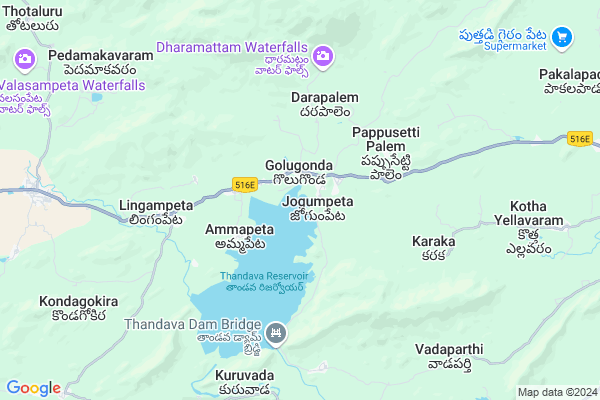
Kumarapuram
Kumarapuram Map
EDIT Map
Add Your House
 ..
..
Current Corona Virus Infected Patients Count in Visakhapatanam District
| City Name | District Name | Total Covid cases |
|---|---|---|
| Visakhapatnam District | Visakhapatnam | 14 |
| Akkayyapelem | Visakhapatnam | 2 |
| Narsipatnam | Visakhapatnam | 2 |
| Visakhapatnam | Visakhapatnam | 2 |
| Gajuwaka | Visakhapatnam | 1 |
| Visakapatnam | Visakhapatnam | 1 |
Locality Name :
Kumarapuram
( కుమారపురం )
Mandal Name : Golugonda
District : Visakhapatanam
State : Andhra Pradesh
Region : Andhra
Language : Telugu
Current Time 02:13 PM
Date: Wednesday , Feb 05,2025 (IST)
Time zone: IST (UTC+5:30)
Elevation / Altitude: 30 meters. Above Seal level
Telephone Code / Std Code: 08932
Assembly constituency : Anantapur Urban assembly constituency
Assembly MLA : UMA SANKARA GANESH PETLA
Lok Sabha constituency : Nellore parliamentary constituency
Parliament MP : Adala Prabhakara Reddy
Serpanch Name :
Pin Code : 531084
Post Office Name : Kd Peta
Main Village Name : Kumarapuram
Commodities Prices : Anakapally Market / Mandi
Kumarapuram Live Weather
Temperature: 30.9 °C
overcast clouds
Humidity: 27%
Wind : 3.43 mt/sec towards SE
StationName : "Narsīpatnam"
observed on 15 Mins Back
Temperature: 30.9 °C
overcast clouds
Humidity: 27%
Wind : 3.43 mt/sec towards SE
StationName : "Narsīpatnam"
observed on 15 Mins Back
Kumarapuram Weather Forecast for Next 5 days
06-02-2025
20.2°C to 33.9°C
broken clouds, scattered clouds
20.2°C to 33.9°C
broken clouds, scattered clouds
07-02-2025
19.9°C to 35.2°C
scattered clouds, broken clouds, clear sky
19.9°C to 35.2°C
scattered clouds, broken clouds, clear sky
08-02-2025
20.1°C to 34.4°C
clear sky, few clouds
20.1°C to 34.4°C
clear sky, few clouds
09-02-2025
19.6°C to 35.0°C
clear sky
19.6°C to 35.0°C
clear sky
10-02-2025
19.2°C to 34.3°C
clear sky
19.2°C to 34.3°C
clear sky
National Highways Reachable To Kumarapuram
Nationa High Way :NH16
Nationa High Way :NH16
Rivers Near Kumarapuram
Kanneru River :Kanneru River
Pedda Eru
Kanneru River :Kanneru River
Pedda Eru
About Kumarapuram
Correct below Info and add more info about KumarapuramKumarapuram is a small Village/hamlet in Golugonda Mandal in Visakhapatanam District of Andhra Pradesh State, India. It comes under Kumarapuram Panchayath. It belongs to Andhra region . It is located 95 KM towards west from District head quarters Vishakhapatnam. 495 KM from State capital Hyderabad
Kumarapuram Pin code is 531084 and postal head office is Kd Peta .
Kumarapuram is surrounded by Nathavaram Mandal towards South , Narsipatnam Mandal towards East , Rolugunta Mandal towards East , Kotauratla Mandal towards East .
Narsipatnam , Tuni , Anakapalle , Pithapuram are the near by Cities to Kumarapuram.
Kumarapuram 2011 Census Details
Kumarapuram Local Language is Telugu. Kumarapuram Village Total population is 179 and number of houses are 44. Female Population is 50.3%. Village literacy rate is 47.5% and the Female Literacy rate is 26.8%.
Population
| Census Parameter | Census Data |
| Total Population | 179 |
| Total No of Houses | 44 |
| Female Population % | 50.3 % ( 90) |
| Total Literacy rate % | 47.5 % ( 85) |
| Female Literacy rate | 26.8 % ( 48) |
| Scheduled Tribes Population % | 13.4 % ( 24) |
| Scheduled Caste Population % | 86.6 % ( 155) |
| Working Population % | 50.3 % |
| Child(0 -6) Population by 2011 | 23 |
| Girl Child(0 -6) Population % by 2011 | 39.1 % ( 9) |
Kumarapuram Census More Deatils.
Politics in Kumarapuram
TDP , YSRC , Yuvajana Sramika Rythu Congress Party , YSRCP , INC are the major political parties in this area.Polling Stations /Booths near Kumarapuram
1)Anantapur Municipal Corporation2)Anantapur Municipal Corporation
3)Anantapur Municipal Corporation
4)Anantapur Municipal Corporation
5)Anantapur Municipal Corporation
HOW TO REACH Kumarapuram
By Road
Visakhapatnam is the Nearest Town to Kumarapuram. Visakhapatnam is 102 km from Kumarapuram. Road connectivity is there from Visakhapatnam to Kumarapuram.By Rail
There is no railway station near to Kumarapuram in less than 10 km. How ever there are railway Stations from Near By town Visakhapatnam. are the railway Stations near to Visakhapatnam. You can reach from Visakhapatnam to Kumarapuram by road after .By Bus
Narsipatnam APSRTC Bus Station , Kotananduru APSRTC Bus Station , Chintapally APSRTC Bus Station are the nearby by Bus Stations to Kumarapuram .APSRTC runs Number of busses from major cities to here.Colleges near Kumarapuram
A P S W Resi Jr College Golugonda, Vizag
Address : Vizag
Sri Sai R S N Jr Coll Cheedikada, Vizag
Address : Vizag
Schools in Kumarapuram
Mpps Kumarapuram
Address : kumarapuram , golugonda , visakhapatnam , Andhra Pradesh . PIN- 531084 , Post - Kd Peta
Govt Health Centers near Kumarapuram
1) Golugonda , , , Near State Bank of Hyd2) GOLUGONDA , , , Near PHC
3) JOGAMPETA , 21-171 , Main road , Near hanuman temple
Sub Villages in Kumarapuram
Petrol Bunks in Kumarapuram,Golugonda
Srinivasa Traders Bharat Petroleum
Krishnadevipet; Visakhapatnam; SH-38; KD Peta Road; Golugonda; Golugonda; Andhra Pradesh 531084; India
11.7 KM distance Detail
Syamala Filling Station
531116; Unnamed; Chikili; Andhra Pradesh 761106; India
16.4 KM distance Detail
HP PETROL PUMP - SREE VENKATA SIVASAI FILLING STA
S NO. 384/2 Bhalighttam Y Junction Narsipatnam; Visakhapatnam; Andhra Pradesh 531116; India
16.9 KM distance Detail
more ..
Colleges in Kumarapuram,Golugonda
Government Polytechnic College
Visakhapatnam; SH-38; KD Peta Road; Narsipatnam; Narsipatnam; Andhra Pradesh 531116; India
15.3 KM distance Detail
DMK Junior College
Visakhapatnam; SH-38; KD Peta Road; Narsipatnam; Narsipatnam; Andhra Pradesh 531116; India
16.0 KM distance Detail
Sri Shiridi Sai Junior College
Sivapuram; Visakhapatnam; SH-38; KD Peta Road; Narsipatnam; Narsipatnam; Andhra Pradesh 531116; India
16.4 KM distance Detail
more ..
Schools in Kumarapuram,Golugonda
APSWREIS SCHOOL Jr. College(Boys); Golugonda
1-150; SH 38; Jogumpeta; Andhra Pradesh 531084; India
1.2 KM distance Detail
Electronic Shops in Kumarapuram,Golugonda
Cell Den Services&Accessories
; Krishnadevipeta; Andhra Pradesh 531084; India
11.2 KM distance Detail
Super Markets in Kumarapuram,Golugonda
Sri Shiridi Sai General Stores
Krishnadevipeta; Andhra Pradesh 531084; India
11.2 KM distance Detail
Chinthamani Stores చింతామణి ట్రడర్స్
Narsipatnam; Andhra Pradesh 531116; India
17.4 KM distance Detail
Governement Offices near Kumarapuram,Golugonda
MEO Office
Ligampet; Visakhapatnam; SH-38; KD Peta Road; Golugonda; Golugonda; Andhra Pradesh 531084; India
1.3 KM distance Detail
MeeSeva Center
Agency laxmi puram(L);Golugonda(M); Krishnadevipeta; Andhra Pradesh 531084; India
11.1 KM distance Detail
About Kumarapuram &
History
How to reach Kumarapuram
Tourist Places Near By Kumarapuram
Schools in Kumarapuram
Colleges in Kumarapuram
Temperature & weather of Kumarapuram
places in Kumarapuram
Kumarapuram photos
More Information
How to reach Kumarapuram
Tourist Places Near By Kumarapuram
Schools in Kumarapuram
Colleges in Kumarapuram
Temperature & weather of Kumarapuram
places in Kumarapuram
Kumarapuram photos
More Information
Village Talk
Post News or Events about this Village
Near Cities
Narsipatnam 18 KM near
Tuni 40 KM near
Anakapalle 66 KM near
Pithapuram 72 KM near
Narsipatnam 18 KM near
Tuni 40 KM near
Anakapalle 66 KM near
Pithapuram 72 KM near
Near By Taluks
Golugonda 0 KM near
Nathavaram 16 KM near
Narsipatnam 16 KM near
Rolugunta 22 KM near
Golugonda 0 KM near
Nathavaram 16 KM near
Narsipatnam 16 KM near
Rolugunta 22 KM near
Near By Air Ports
Vishakhapatnam Airport 90 KM near
Rajahmundry Airport 104 KM near
Vijayawada Airport 244 KM near
Raipur Airport 445 KM near
Vishakhapatnam Airport 90 KM near
Rajahmundry Airport 104 KM near
Vijayawada Airport 244 KM near
Raipur Airport 445 KM near
Near By Tourist Places
Visakhapatnam 88 KM near
Simhachalam 91 KM near
Kakinada 94 KM near
Ananthagiri 94 KM near
Araku Valley 95 KM near
Visakhapatnam 88 KM near
Simhachalam 91 KM near
Kakinada 94 KM near
Ananthagiri 94 KM near
Araku Valley 95 KM near
Near By Districts
Visakhapatanam 90 KM near
East Godavari 93 KM near
Malkangiri 108 KM near
Vizianagaram 124 KM near
Visakhapatanam 90 KM near
East Godavari 93 KM near
Malkangiri 108 KM near
Vizianagaram 124 KM near
Near By RailWay Station
Tuni Rail Way Station 39 KM near
Narsipatnam Road Rail Way Station 40 KM near
Tuni Rail Way Station 39 KM near
Narsipatnam Road Rail Way Station 40 KM near