| Home | City Bus | Maps | Villages | Cities | Rail | Tourist Places | School | College | Pin Codes | Corona Cases Count |
| Distance Calculator Bus Services IFSC Codes Trace Mobile Number Weather Search Place Trace IP Available Cash ATM/Banks Locate Polling Booth Report an Error contact People |
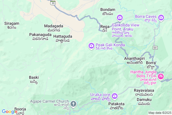
Somelapadu
Somelapadu Map
EDIT Map
Add Your House
 ..
..
Current Corona Virus Infected Patients Count in Visakhapatanam District
| City Name | District Name | Total Covid cases |
|---|---|---|
| Visakhapatnam District | Visakhapatnam | 14 |
| Narsipatnam | Visakhapatnam | 2 |
| Visakhapatnam | Visakhapatnam | 2 |
| Akkayyapelem | Visakhapatnam | 2 |
| Visakapatnam | Visakhapatnam | 1 |
| Gajuwaka | Visakhapatnam | 1 |
Locality Name :
Somelapadu
( సోమేపడు )
Mandal Name : Araku Valley
District : Visakhapatanam
State : Andhra Pradesh
Region : Andhra
Language : Telugu
Current Time 06:25 PM
Date: Monday , Apr 28,2025 (IST)
Time zone: IST (UTC+5:30)
Elevation / Altitude: 925 meters. Above Seal level
Telephone Code / Std Code: 08936
Assembly constituency : Alur assembly constituency
Assembly MLA : P Jayaram
Lok Sabha constituency : Kurnool parliamentary constituency
Parliament MP : AYUSHMAN DOCTOR SANJEEV KUMAR
Serpanch Name :
Pin Code : 531149
Post Office Name : Araku Colony
Main Village Name : Somelapadu
Commodities Prices : Koraput(Semilguda) Market / Mandi
Somelapadu Live Weather
Temperature: 23.1 °C
scattered clouds
Humidity: 71%
Wind : 2.18 mt/sec towards S
StationName : "MÄ\u0081dugula"
observed on 0 Mins Back
Temperature: 23.1 °C
scattered clouds
Humidity: 71%
Wind : 2.18 mt/sec towards S
StationName : "MÄ\u0081dugula"
observed on 0 Mins Back
Somelapadu Weather Forecast for Next 5 days
29-04-2025
20.8°C to 24.2°C
light rain, broken clouds, scattered clouds
20.8°C to 24.2°C
light rain, broken clouds, scattered clouds
30-04-2025
20.1°C to 31.7°C
few clouds, clear sky, overcast clouds, light rain, broken clouds, scattered clouds
20.1°C to 31.7°C
few clouds, clear sky, overcast clouds, light rain, broken clouds, scattered clouds
01-05-2025
19.6°C to 31.9°C
broken clouds, scattered clouds, moderate rain, light rain, clear sky
19.6°C to 31.9°C
broken clouds, scattered clouds, moderate rain, light rain, clear sky
02-05-2025
18.9°C to 31.2°C
clear sky, light rain, moderate rain
18.9°C to 31.2°C
clear sky, light rain, moderate rain
03-05-2025
18.7°C to 30.1°C
clear sky, light rain, moderate rain
18.7°C to 30.1°C
clear sky, light rain, moderate rain
Rivers Near Somelapadu
Champavati
Potula Gedda
Champavati
Potula Gedda
About Somelapadu
Correct below Info and add more info about SomelapaduSomelapadu is a small Village/hamlet in Araku Valley Mandal in Visakhapatanam District of Andhra Pradesh State, India. It comes under Somelapadu Panchayath. It belongs to Andhra region . It is located 77 KM towards North from District head quarters Vishakhapatnam. 9 KM from Araku Valley. 564 KM from State capital Hyderabad
Somelapadu Pin code is 531149 and postal head office is Araku Colony .
Kunapuram ( 7 KM ) , Ananthagiri ( 8 KM ) , Baski ( 8 KM ) , Tokuru ( 9 KM ) , Kondiba ( 10 KM ) are the nearby Villages to Somelapadu. Somelapadu is surrounded by Ananthagiri Mandal towards South , Dumbriguda Mandal towards west , Hukumpeta Mandal towards west , Srungavarapukota Mandal towards East .
Salur , Vizianagaram , Sunabeda , Bobbili are the near by Cities to Somelapadu.
This Place is in the border of the Visakhapatanam District and Koraput District. Koraput District Semiliguda is North towards this place . It is near to the Odisha State Border.
Somelapadu 2011 Census Details
Somelapadu Local Language is Telugu. Somelapadu Village Total population is and number of houses are . Female Population is -1.0%. Village literacy rate is -1.0% and the Female Literacy rate is -1.0%.
Population
| Census Parameter | Census Data |
| Total Population | |
| Total No of Houses | |
| Female Population % | -1.0 % ( ) |
| Total Literacy rate % | -1.0 % ( ) |
| Female Literacy rate | -1.0 % ( ) |
| Scheduled Tribes Population % | -1.0 % ( ) |
| Scheduled Caste Population % | -1.0 % ( ) |
| Working Population % | -1.0 % |
| Child(0 -6) Population by 2011 | |
| Girl Child(0 -6) Population % by 2011 | -1.0 % ( ) |
Somelapadu Census More Deatils.
Politics in Somelapadu
TDP , YSRC , Yuvajana Sramika Rythu Congress Party , PRAP , YSRCP , INC are the major political parties in this area.Polling Stations /Booths near Somelapadu
1)M.kottala2)Nitravatti
3)P.kotakonda
4)P.kotakonda-
5)P.kotakonda-
HOW TO REACH Somelapadu
By Rail
Karakavalasa Rail Way Station , Shimiliguda Rail Way Station are the very nearby railway stations to Somelapadu. Kottapalem Rail Way Station (near to Visakhapatnam) , Marripalem Rail Way Station (near to Visakhapatnam) are the Rail way stations reachable from near by towns.By Road
Visakhapatnam are the nearby by towns to Somelapadu having road connectivity to SomelapaduBy Bus
Borra Caves APSRTC Bus Station , Arakuvalley APSRTC Bus Station , Araku APSRTC Bus Station are the nearby by Bus Stations to Somelapadu .APSRTC runs Number of busses from major cities to here.Colleges near Somelapadu
Dadi Satyanarayana College Of Eduation, (b.ed.,) , Anakapalle
Address :
Sabbavarapu Pandu Ranga Kumar Degree Collage
Address :
Govt College
Address :
Sri Gnaneswari Engineering College For Women
Address :
Sri Sai Rsn Jr College
Address :
Schools near Somelapadu
Kgbv Yendapalli Valasa
Address : arakuvally , arakuvalley , visakhapatnam , Andhra Pradesh . PIN- 531149 , Post - Araku Colony
Aptwrs Jr. Col(g) Y Valas
Address : yandapalli valasa , arakuvalley , visakhapatnam , Andhra Pradesh . PIN- 531151 , Post - Araku Rs
Vijnana Bharathi Ups Arak
Address : arakuvally , arakuvalley , visakhapatnam , Andhra Pradesh . PIN- 531149 , Post - Araku Colony
Twhs Arakuvally
Address : arakuvally , arakuvalley , visakhapatnam , Andhra Pradesh . PIN- 531149 , Post - Araku Colony
Govt Health Centers near Somelapadu
1) Madagada-II , Govt Sub Centre , Janamguda ,2) Sunkarametta , Govt Sub Centre , araku road , Near PHC Sunkarametta
3) Sunkarametta , Govt Hospital , araku road , neat old panchyath bulding
Sub Villages in Somelapadu
Schools in Somelapadu,Araku Valley
M.P. Elementary School; Gattaraguda
Visakapatnam; Gattaraguda; Andhra Pradesh 531149; India
5.1 KM distance Detail
Model School Building Dekkapuram
Visakhapatnam; Andhra Pradesh 531149; India
10.7 KM distance Detail
GOVT TW Ashram School(B); TOKURU
Visakhapatnam; Andhra Pradesh 531149; India
11.2 KM distance Detail
GTWAH SCHOOL BOYS SIVALINGAPURAM
Visakhapatnam; Andhra Pradesh 531149; India
15.0 KM distance Detail
Super Markets in Somelapadu,Araku Valley
Police Stations near Somelapadu,Araku Valley
Police Station
Araku - Visakhapatnam Rd; Araku; Andhra Pradesh 531149; India
13.4 KM distance Detail
Governement Offices near Somelapadu,Araku Valley
MeeSeva Center
Near RTC Complex; Araku - Visakhapatnam Rd; Araku; Andhra Pradesh 531149; India
13.9 KM distance Detail
About Somelapadu &
History
How to reach Somelapadu
Tourist Places Near By Somelapadu
Schools in Somelapadu
Colleges in Somelapadu
Temperature & weather of Somelapadu
places in Somelapadu
Somelapadu photos
More Information
How to reach Somelapadu
Tourist Places Near By Somelapadu
Schools in Somelapadu
Colleges in Somelapadu
Temperature & weather of Somelapadu
places in Somelapadu
Somelapadu photos
More Information
Village Talk
Post News or Events about this Village
Near Cities
Salur 46 KM near
Vizianagaram 58 KM near
Sunabeda 62 KM near
Bobbili 63 KM near
Salur 46 KM near
Vizianagaram 58 KM near
Sunabeda 62 KM near
Bobbili 63 KM near
Near By Taluks
Araku Valley 9 KM near
Ananthagiri 10 KM near
Dumbriguda 18 KM near
Hukumpeta 25 KM near
Araku Valley 9 KM near
Ananthagiri 10 KM near
Dumbriguda 18 KM near
Hukumpeta 25 KM near
Near By Air Ports
Vishakhapatnam Airport 71 KM near
Rajahmundry Airport 194 KM near
Vijayawada Airport 332 KM near
Raipur Airport 393 KM near
Vishakhapatnam Airport 71 KM near
Rajahmundry Airport 194 KM near
Vijayawada Airport 332 KM near
Raipur Airport 393 KM near
Near By Tourist Places
Ananthagiri 14 KM near
Araku Valley 15 KM near
Vizayanagaram 55 KM near
Simhachalam 69 KM near
Visakhapatnam 75 KM near
Ananthagiri 14 KM near
Araku Valley 15 KM near
Vizayanagaram 55 KM near
Simhachalam 69 KM near
Visakhapatnam 75 KM near
Near By Districts
Vizianagaram 56 KM near
Visakhapatanam 74 KM near
Koraput 76 KM near
Srikakulam 112 KM near
Vizianagaram 56 KM near
Visakhapatanam 74 KM near
Koraput 76 KM near
Srikakulam 112 KM near
Near By RailWay Station
Shimiliguda Rail Way Station 8.3 KM near
Karakavalasa Rail Way Station 8.4 KM near
Kottavalasa Junction Rail Way Station 51 KM near
Vizianagaram Junction Rail Way Station 55 KM near
Shimiliguda Rail Way Station 8.3 KM near
Karakavalasa Rail Way Station 8.4 KM near
Kottavalasa Junction Rail Way Station 51 KM near
Vizianagaram Junction Rail Way Station 55 KM near