| Home | City Bus | Maps | Villages | Cities | Rail | Tourist Places | School | College | Pin Codes | Corona Cases Count |
| Distance Calculator Bus Services IFSC Codes Trace Mobile Number Weather Search Place Trace IP Available Cash ATM/Banks Locate Polling Booth Report an Error contact People |
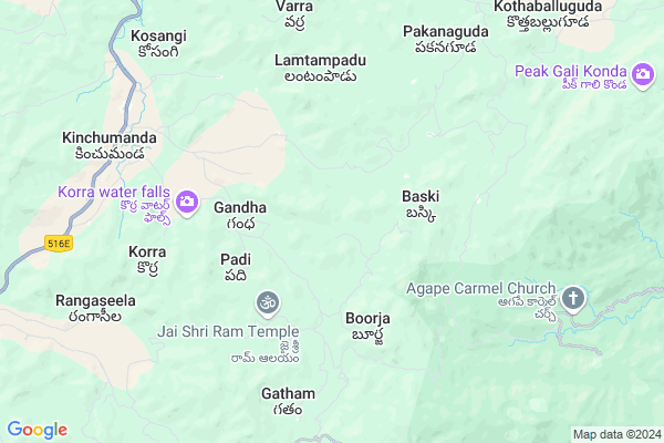
Girliguda
Girliguda Map
EDIT Map
Add Your House
 ..
..
Current Corona Virus Infected Patients Count in Visakhapatanam District
| City Name | District Name | Total Covid cases |
|---|---|---|
| Visakhapatnam District | Visakhapatnam | 14 |
| Narsipatnam | Visakhapatnam | 2 |
| Visakhapatnam | Visakhapatnam | 2 |
| Akkayyapelem | Visakhapatnam | 2 |
| Visakapatnam | Visakhapatnam | 1 |
| Gajuwaka | Visakhapatnam | 1 |
Locality Name :
Girliguda
( గిర్లిగూడ )
Mandal Name : Araku Valley
District : Visakhapatanam
State : Andhra Pradesh
Region : Andhra
Language : Telugu
Current Time 06:37 PM
Date: Monday , Apr 28,2025 (IST)
Time zone: IST (UTC+5:30)
Elevation / Altitude: 925 meters. Above Seal level
Telephone Code / Std Code: 08936
Assembly constituency : Alur assembly constituency
Assembly MLA : P Jayaram
Lok Sabha constituency : Kurnool parliamentary constituency
Parliament MP : AYUSHMAN DOCTOR SANJEEV KUMAR
Serpanch Name :
Pin Code : 531149
Post Office Name : Araku Colony
Main Village Name : Girliguda
Commodities Prices : Koraput(Semilguda) Market / Mandi
Rivers Near Girliguda
Champavati
Potula Gedda
Champavati
Potula Gedda
About Girliguda
Correct below Info and add more info about GirligudaGirliguda is a small Village/hamlet in Araku Valley Mandal in Visakhapatanam District of Andhra Pradesh State, India. It comes under Girliguda Panchayath. It belongs to Andhra region . It is located 79 KM towards North from District head quarters Vishakhapatnam. 17 KM from Araku Valley. 552 KM from State capital Hyderabad
Girliguda Pin code is 531149 and postal head office is Araku Colony .
Pynampadu ( 4 KM ) , Korra ( 7 KM ) , Kithalangi ( 8 KM ) , Pattam ( 8 KM ) , Siragam ( 9 KM ) are the nearby Villages to Girliguda. Girliguda is surrounded by Hukumpeta Mandal towards west , Araku Valley Mandal towards North , Ananthagiri Mandal towards East , Paderu Mandal towards South .
Salur , Sunabeda , Vizianagaram , Anakapalle are the near by Cities to Girliguda.
This Place is in the border of the Visakhapatanam District and Koraput District. Koraput District Semiliguda is North towards this place . It is near to the Odisha State Border.
Girliguda 2011 Census Details
Girliguda Local Language is Telugu. Girliguda Village Total population is 445 and number of houses are 102. Female Population is 55.3%. Village literacy rate is 27.6% and the Female Literacy rate is 11.9%.
Population
| Census Parameter | Census Data |
| Total Population | 445 |
| Total No of Houses | 102 |
| Female Population % | 55.3 % ( 246) |
| Total Literacy rate % | 27.6 % ( 123) |
| Female Literacy rate | 11.9 % ( 53) |
| Scheduled Tribes Population % | 99.8 % ( 444) |
| Scheduled Caste Population % | 0.0 % ( 0) |
| Working Population % | 61.8 % |
| Child(0 -6) Population by 2011 | 72 |
| Girl Child(0 -6) Population % by 2011 | 50.0 % ( 36) |
Girliguda Census More Deatils.
Politics in Girliguda
TDP , YSRC , Yuvajana Sramika Rythu Congress Party , PRAP , YSRCP , INC are the major political parties in this area.Polling Stations /Booths near Girliguda
1)M.kottala2)Nitravatti
3)P.kotakonda
4)P.kotakonda-
5)P.kotakonda-
HOW TO REACH Girliguda
By Road
Visakhapatnam is the Nearest Town to Girliguda. Visakhapatnam is 130 km from Girliguda. Road connectivity is there from Visakhapatnam to Girliguda.By Rail
There is no railway station near to Girliguda in less than 10 km. How ever there are railway Stations from Near By town Visakhapatnam. are the railway Stations near to Visakhapatnam. You can reach from Visakhapatnam to Girliguda by road after .By Bus
Arakuvalley APSRTC Bus Station , Araku APSRTC Bus Station , Borra Caves APSRTC Bus Station are the nearby by Bus Stations to Girliguda .APSRTC runs Number of busses from major cities to here.Colleges near Girliguda
Dadi Satyanarayana College Of Eduation, (b.ed.,) , Anakapalle
Address :
Sabbavarapu Pandu Ranga Kumar Degree Collage
Address :
Govt College
Address :
Sri Gnaneswari Engineering College For Women
Address :
Sri Sai Rsn Jr College
Address :
Schools in Girliguda
Mpps Girliguda
Address : girliguda , arakuvalley , visakhapatnam , Andhra Pradesh . PIN- 531149 , Post - Araku Colony
Govt Health Centers near Girliguda
1) Devarapalli , Govt Sub Centre , Devarapalli , Near A.W.Centre2) Baasiki , , Baski , Near Govt School
3) BOORJA , , Kotta Veedi , Opp.Bathel Church
Sub Villages in Girliguda
Schools in Girliguda,Araku Valley
M.P. Elementary School; Gattaraguda
Visakapatnam; Gattaraguda; Andhra Pradesh 531149; India
14.1 KM distance Detail
Model School Building Dekkapuram
Visakhapatnam; Andhra Pradesh 531149; India
22.4 KM distance Detail
GOVT TW Ashram School(B); TOKURU
Visakhapatnam; Andhra Pradesh 531149; India
23.0 KM distance Detail
Super Markets in Girliguda,Araku Valley
Local Parks in Girliguda,Araku Valley
Padmapuram Garden
Padmapuram village; Arakuvalley; ITDA Paderu; Araku; Andhra Pradesh 531151; India
16.7 KM distance Detail
Police Stations near Girliguda,Araku Valley
Police Station
Araku - Visakhapatnam Rd; Araku; Andhra Pradesh 531149; India
14.7 KM distance Detail
Governement Offices near Girliguda,Araku Valley
MeeSeva Center
Near RTC Complex; Araku - Visakhapatnam Rd; Araku; Andhra Pradesh 531149; India
14.9 KM distance Detail
About Girliguda &
History
How to reach Girliguda
Tourist Places Near By Girliguda
Schools in Girliguda
Colleges in Girliguda
Temperature & weather of Girliguda
places in Girliguda
Girliguda photos
More Information
How to reach Girliguda
Tourist Places Near By Girliguda
Schools in Girliguda
Colleges in Girliguda
Temperature & weather of Girliguda
places in Girliguda
Girliguda photos
More Information
Village Talk
Post News or Events about this Village
Near Cities
Salur 56 KM near
Sunabeda 64 KM near
Vizianagaram 68 KM near
Anakapalle 68 KM near
Salur 56 KM near
Sunabeda 64 KM near
Vizianagaram 68 KM near
Anakapalle 68 KM near
Near By Taluks
Dumbriguda 12 KM near
Hukumpeta 14 KM near
Araku Valley 17 KM near
Ananthagiri 18 KM near
Dumbriguda 12 KM near
Hukumpeta 14 KM near
Araku Valley 17 KM near
Ananthagiri 18 KM near
Near By Air Ports
Vishakhapatnam Airport 74 KM near
Rajahmundry Airport 184 KM near
Vijayawada Airport 322 KM near
Raipur Airport 393 KM near
Vishakhapatnam Airport 74 KM near
Rajahmundry Airport 184 KM near
Vijayawada Airport 322 KM near
Raipur Airport 393 KM near
Near By Tourist Places
Ananthagiri 15 KM near
Araku Valley 15 KM near
Vizayanagaram 64 KM near
Simhachalam 72 KM near
Visakhapatnam 77 KM near
Ananthagiri 15 KM near
Araku Valley 15 KM near
Vizayanagaram 64 KM near
Simhachalam 72 KM near
Visakhapatnam 77 KM near
Near By Districts
Vizianagaram 66 KM near
Visakhapatanam 76 KM near
Koraput 76 KM near
Malkangiri 115 KM near
Vizianagaram 66 KM near
Visakhapatanam 76 KM near
Koraput 76 KM near
Malkangiri 115 KM near
Near By RailWay Station
Kottavalasa Junction Rail Way Station 55 KM near
Vizianagaram Junction Rail Way Station 64 KM near
Kottavalasa Junction Rail Way Station 55 KM near
Vizianagaram Junction Rail Way Station 64 KM near