| Home | City Bus | Maps | Villages | Cities | Rail | Tourist Places | School | College | Pin Codes | Corona Cases Count |
| Distance Calculator Bus Services IFSC Codes Trace Mobile Number Weather Search Place Trace IP Available Cash ATM/Banks Locate Polling Booth Report an Error contact People |
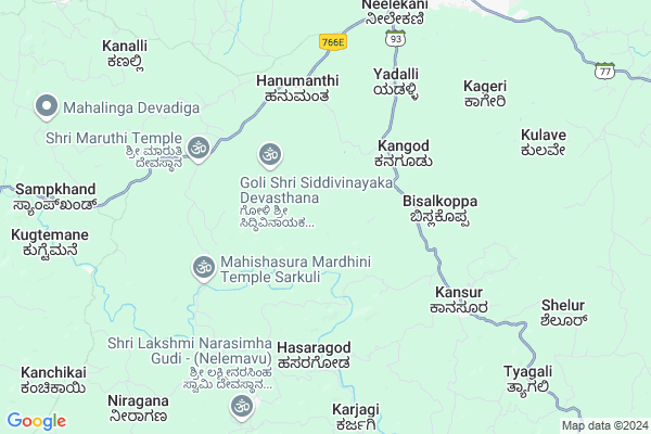
Tataguni
Tataguni Map
EDIT Map
Add Your House
 ..
..
Current Corona Virus Infected Patients Count in Uttar Kannad District
| City Name | District Name | Total Covid cases |
|---|---|---|
| Bhatkal | Uttara Kannada | 7 |
| Uttara Kannada District | Uttara Kannada | 4 |
Locality Name :
Tataguni
( ತಾತಗುಣಿ )
Taluk Name : Sirsi
District : Uttar Kannad
State : Karnataka
Division : Belgaum
Language : Kannada and Konkani, Marathi
Current Time 09:57 AM
Date: Tuesday , Apr 29,2025 (IST)
Time zone: IST (UTC+5:30)
Elevation / Altitude: 576 meters. Above Seal level
Telephone Code / Std Code: 08384
Assembly constituency : Sirsi assembly constituency
Assembly MLA : Bhimanna T. Naik
Lok Sabha constituency : Uttara Kannada parliamentary constituency
Parliament MP : ANANTKUMAR HEGDE
Serpanch Name :
Pin Code : 581450
Post Office Name : Neggu
Main Village Name : Tataguni
Alternate Village Name : Tatguni
Commodities Prices : Sirsi Market / Mandi
Tataguni Live Weather
Temperature: 28.3 °C
few clouds
Humidity: 52%
Wind : 0.57 mt/sec towards SW
StationName : "Sirsi"
observed on 58 Mins Back
Temperature: 28.3 °C
few clouds
Humidity: 52%
Wind : 0.57 mt/sec towards SW
StationName : "Sirsi"
observed on 58 Mins Back
Tataguni Weather Forecast for Next 5 days
30-04-2025
21.8°C to 38.5°C
few clouds, scattered clouds, broken clouds
21.8°C to 38.5°C
few clouds, scattered clouds, broken clouds
01-05-2025
22.0°C to 36.1°C
broken clouds, scattered clouds, clear sky, few clouds, overcast clouds
22.0°C to 36.1°C
broken clouds, scattered clouds, clear sky, few clouds, overcast clouds
02-05-2025
21.0°C to 36.2°C
broken clouds, scattered clouds, clear sky, few clouds
21.0°C to 36.2°C
broken clouds, scattered clouds, clear sky, few clouds
03-05-2025
23.2°C to 35.9°C
broken clouds, clear sky, scattered clouds
23.2°C to 35.9°C
broken clouds, clear sky, scattered clouds
04-05-2025
22.2°C to 35.2°C
broken clouds, few clouds, clear sky, scattered clouds
22.2°C to 35.2°C
broken clouds, few clouds, clear sky, scattered clouds
National Highways Reachable To Tataguni
Nationa High Way :NH766E
Nationa High Way :NH66
Nationa High Way :NH766E
Nationa High Way :NH66
Rivers Near Tataguni
Varada :ವರದಾ
Goli Hole :ಗೋಳಿ ಹೊಳೆ
Varada :ವರದಾ
Goli Hole :ಗೋಳಿ ಹೊಳೆ
About Tataguni
Correct below Info and add more info about TataguniTataguni is a small Village/hamlet in Sirsi Taluk in Uttar Kannad District of Karnataka State, India. It comes under Tataguni Panchayath. It belongs to Belgaum Division . It is located 90 KM towards East from District head quarters Karwar. 10 KM from Sirsi. 408 KM from State capital Bangalore
Tataguni Pin code is 581450 and postal head office is Neggu .
Yadalli ( 7 KM ) , Tarehalli - Kansur ( 7 KM ) , Analebail ( 8 KM ) , Rayerpeth ( 9 KM ) , Marikamba Nagar ( 10 KM ) are the nearby Villages to Tataguni. Tataguni is surrounded by Siddapur Taluk towards South , Sorab Taluk towards East , Kumta Taluk towards west , Mundgod Taluk towards North .
Sirsi , Sagar , Shikapur , Shiggaon are the near by Cities to Tataguni.
Tataguni 2011 Census Details
Tataguni Local Language is Kannada. Tataguni Village Total population is 279 and number of houses are 60. Female Population is 47.0%. Village literacy rate is 88.5% and the Female Literacy rate is 41.2%.
Population
| Census Parameter | Census Data |
| Total Population | 279 |
| Total No of Houses | 60 |
| Female Population % | 47.0 % ( 131) |
| Total Literacy rate % | 88.5 % ( 247) |
| Female Literacy rate | 41.2 % ( 115) |
| Scheduled Tribes Population % | 0.0 % ( 0) |
| Scheduled Caste Population % | 0.0 % ( 0) |
| Working Population % | 73.8 % |
| Child(0 -6) Population by 2011 | 17 |
| Girl Child(0 -6) Population % by 2011 | 41.2 % ( 7) |
Tataguni Census More Deatils.
Politics in Tataguni
Bharatiya Janata Party , BJP , Bharatiya Janata Party (BJP) , INC are the major political parties in this area.Polling Stations /Booths near Tataguni
1)Govt.high School Siddapur (kondli)2)Govt. Lower Primary School Badagi
3)Sri Gajanan High School Sampakanda.
4)Govt. Higher Primary School Kangod (east Wing)
5)Govt. Higher Primary School Bandal
HOW TO REACH Tataguni
By Rail
There is no railway station near to Tataguni in less than 10 km. are the Rail way stations reachable from near by towns.By Road
Sirsi , Hangal , Sorab are the nearby by towns to Tataguni having road connectivity to TataguniColleges near Tataguni
Gajanana Secondery School Vanalli
Address :
Schools near Tataguni
Govt Health Centers near Tataguni
1) Mallapura , Health Sub Center , ,2) G.Basavanakoppa , panchayathi Building , Near Anganwadi ,
3) Devikoppa-A , Devikopa S/C , yellapur Road ,
Sub Villages in Tataguni
Petrol Bunks in Tataguni,Sirsi
HP PETROL PUMP S S DHUNDSHI AND COMPANY
5 Road Circle; Dist. Uttar Kanada; Sirsi; Karnataka 581401; India
10.5 KM distance Detail
UMASHANKAR AUTO FUELS
SIRSI (HUBLI ROAD); NORTH KANARA; Karnataka 581402; India
10.6 KM distance Detail
more ..
Colleges in Tataguni,Sirsi
College of Horticulture; Sirsi. University of Horticultural Sciences; Bagalkot
Sirsi; Karnataka 581402; India
10.2 KM distance Detail
more ..
Electronic Shops in Tataguni,Sirsi
Shri Mahaganapathi Electronics
Five Road cross; CP Bazar; Sirsi; Karnataka 581402; India
10.6 KM distance Detail
Shree Sai Electronics
Shree Chatrapati Shivaji Maharaj Cir; Shreeji Society; Pratham Avenue; Muj Mahuda; Vadodara; Gujarat 390020; India
10.6 KM distance Detail
Local Parks in Tataguni,Sirsi
Musukina Honda ಮುಸುಕಿನ ಹೂಂಡ
Sirsi;; Devikere; Sirsi; Karnataka 581401; India
10.8 KM distance Detail
Police Stations near Tataguni,Sirsi
Rural Police Station Sirsi
Sirsi - Yellapur Rd; Sirsi; Karnataka 581401; India
12.1 KM distance Detail
Governement Offices near Tataguni,Sirsi
Assistant Commissioner Office
Opp Town; Police Station; Sirsi; Karnataka 581401; India
11.1 KM distance Detail
About Tataguni &
History
How to reach Tataguni
Tourist Places Near By Tataguni
Schools in Tataguni
Colleges in Tataguni
Temperature & weather of Tataguni
places in Tataguni
Tataguni photos
More Information
How to reach Tataguni
Tourist Places Near By Tataguni
Schools in Tataguni
Colleges in Tataguni
Temperature & weather of Tataguni
places in Tataguni
Tataguni photos
More Information
Village Talk
Post News or Events about this Village
Near Cities
Sirsi 11 KM near
Sagar 53 KM near
Shikapur 74 KM near
Shiggaon 75 KM near
Sirsi 11 KM near
Sagar 53 KM near
Shikapur 74 KM near
Shiggaon 75 KM near
Near By Taluks
Sirsi 10 KM near
Siddapur 19 KM near
Sorab 38 KM near
Kumta 46 KM near
Sirsi 10 KM near
Siddapur 19 KM near
Sorab 38 KM near
Kumta 46 KM near
Near By Air Ports
Hubli Airport 107 KM near
Dabolim Airport 156 KM near
Sambre Airport 165 KM near
Bajpe Airport 196 KM near
Hubli Airport 107 KM near
Dabolim Airport 156 KM near
Sambre Airport 165 KM near
Bajpe Airport 196 KM near
Near By Tourist Places
Uttara Kannada 14 KM near
Siddapur 26 KM near
Yana 28 KM near
Jog Falls 42 KM near
Gokarna 58 KM near
Uttara Kannada 14 KM near
Siddapur 26 KM near
Yana 28 KM near
Jog Falls 42 KM near
Gokarna 58 KM near
Near By Districts
Haveri 79 KM near
Uttar Kannad 87 KM near
Dharwad 116 KM near
Shimoga 119 KM near
Haveri 79 KM near
Uttar Kannad 87 KM near
Dharwad 116 KM near
Shimoga 119 KM near
Near By RailWay Station
Kumta Rail Way Station 47 KM near
Gokarna Road Rail Way Station 52 KM near
Kumta Rail Way Station 47 KM near
Gokarna Road Rail Way Station 52 KM near