| Home | City Bus | Maps | Villages | Cities | Rail | Tourist Places | School | College | Pin Codes | Corona Cases Count |
| Distance Calculator Bus Services IFSC Codes Trace Mobile Number Weather Search Place Trace IP Available Cash ATM/Banks Locate Polling Booth Report an Error contact People |
Koligar
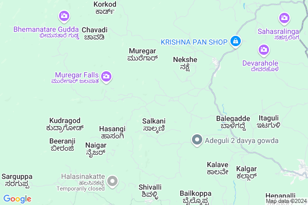
Koligar Map
EDIT Map
Add Your House
 ..
..
Current Corona Virus Infected Patients Count in Uttar Kannad District
| City Name | District Name | Total Covid cases |
|---|---|---|
| Bhatkal | Uttara Kannada | 7 |
| Uttara Kannada District | Uttara Kannada | 4 |
Locality Name :
Koligar
( ಕೋಲೈಗರ್ )
Taluk Name : Sirsi
District : Uttar Kannad
State : Karnataka
Division : Belgaum
Language : Kannada and Konkani, Marathi
Current Time 07:09 PM
Date: Tuesday , Apr 29,2025 (IST)
Time zone: IST (UTC+5:30)
Elevation / Altitude: 576 meters. Above Seal level
Telephone Code / Std Code: 08384
Assembly constituency : Sirsi assembly constituency
Assembly MLA : Bhimanna T. Naik
Lok Sabha constituency : Uttara Kannada parliamentary constituency
Parliament MP : ANANTKUMAR HEGDE
Serpanch Name :
Pin Code : 581336
Post Office Name : Hulekal
Main Village Name : Koligar
Commodities Prices : Sirsi Market / Mandi
Koligar Live Weather
Temperature: 25.4 °C
scattered clouds
Humidity: 77%
Wind : 1.97 mt/sec towards SW
StationName : "Sirsi"
observed on 2 Mins Back
Temperature: 25.4 °C
scattered clouds
Humidity: 77%
Wind : 1.97 mt/sec towards SW
StationName : "Sirsi"
observed on 2 Mins Back
Koligar Weather Forecast for Next 5 days
30-04-2025
22.7°C to 24.1°C
few clouds, scattered clouds, broken clouds
22.7°C to 24.1°C
few clouds, scattered clouds, broken clouds
01-05-2025
21.5°C to 36.9°C
broken clouds, scattered clouds, few clouds
21.5°C to 36.9°C
broken clouds, scattered clouds, few clouds
02-05-2025
21.0°C to 38.5°C
broken clouds, scattered clouds, few clouds, clear sky
21.0°C to 38.5°C
broken clouds, scattered clouds, few clouds, clear sky
03-05-2025
21.8°C to 38.4°C
scattered clouds, few clouds, clear sky
21.8°C to 38.4°C
scattered clouds, few clouds, clear sky
04-05-2025
21.1°C to 36.9°C
scattered clouds, clear sky, broken clouds
21.1°C to 36.9°C
scattered clouds, clear sky, broken clouds
National Highways Reachable To Koligar
Nationa High Way :NH766E
Nationa High Way :NH66
Nationa High Way :NH766E
Nationa High Way :NH66
Rivers Near Koligar
Varada :ವರದಾ
Goli Hole :ಗೋಳಿ ಹೊಳೆ
Varada :ವರದಾ
Goli Hole :ಗೋಳಿ ಹೊಳೆ
About Koligar
Correct below Info and add more info about KoligarKoligar is a small Village/hamlet in Sirsi Taluk in Uttar Kannad District of Karnataka State, India. It comes under Koligar Panchayath. It belongs to Belgaum Division . It is located 76 KM towards East from District head quarters Karwar. 14 KM from Sirsi. 425 KM from State capital Bangalore
Koligar Pin code is 581336 and postal head office is Hulekal .
Shivalli ( 7 KM ) , Vanalli ( 8 KM ) , Devanalli ( 10 KM ) , Kodnagadde ( 13 KM ) , Bhairumbe ( 13 KM ) are the nearby Villages to Koligar. Koligar is surrounded by Yellapur Taluk towards North , Siddapur Taluk towards South , Mundgod Taluk towards East , Kumta Taluk towards west .
Sirsi , Shiggaon , Karwar , Sagar are the near by Cities to Koligar.
Koligar 2011 Census Details
Koligar Local Language is Kannada. Koligar Village Total population is 733 and number of houses are 148. Female Population is 48.2%. Village literacy rate is 83.5% and the Female Literacy rate is 38.7%.
Population
| Census Parameter | Census Data |
| Total Population | 733 |
| Total No of Houses | 148 |
| Female Population % | 48.2 % ( 353) |
| Total Literacy rate % | 83.5 % ( 612) |
| Female Literacy rate | 38.7 % ( 284) |
| Scheduled Tribes Population % | 0.0 % ( 0) |
| Scheduled Caste Population % | 8.0 % ( 59) |
| Working Population % | 46.2 % |
| Child(0 -6) Population by 2011 | 49 |
| Girl Child(0 -6) Population % by 2011 | 49.0 % ( 24) |
Koligar Census More Deatils.
Politics in Koligar
Bharatiya Janata Party , BJP , Bharatiya Janata Party (BJP) , INC are the major political parties in this area.Polling Stations /Booths near Koligar
1)Govt Higher Primary School Khurse2)Shasakar Madari School No 2 Devikere (east Side)
3)Govt Higher Primary School Muski
4)Govt Higher Primary School Mattigar
5)Govt Higher Primary School Kadakod
HOW TO REACH Koligar
By Rail
There is no railway station near to Koligar in less than 10 km. are the Rail way stations reachable from near by towns.By Road
Sirsi , Hangal , Sorab are the nearby by towns to Koligar having road connectivity to KoligarColleges near Koligar
Gajanana Secondery School Vanalli
Address :
Schools near Koligar
Govt Health Centers near Koligar
1) G.Basavanakoppa , panchayathi Building , Near Anganwadi ,2) Mallapura , Health Sub Center , ,
3) Tambur , panchayathi Building , bommigatti Road ,
Sub Villages in Koligar
Petrol Bunks in Koligar,Sirsi
V.M.MIRJANKAR (SIRSI)
SIRSI NR BUS STAND; NORTH KANARA; Karnataka 581401; India
14.3 KM distance Detail
more ..
Colleges in Koligar,Sirsi
Government First Grade College; Sirsi
Near Five Road; Yellapur Rd; Sirsi; 581401; India
15.6 KM distance Detail
more ..
Schools in Koligar,Sirsi
Narasimha Temple Bennegadde
bennegadde;bakkal; Sirsi; Karnataka 581336; India
3.9 KM distance Detail
Electronic Shops in Koligar,Sirsi
Meghana Electricals
hegdekatta; Panchalinga Rd; Sirsi; Karnataka 581403; India
8.4 KM distance Detail
Super Markets in Koligar,Sirsi
More Super Market
trinethra super Retail pvt lmt; shreyas Arcade beside; m/s sushma traders; devikere; sirsi; Sirsi; Karnataka 581410; India
15.6 KM distance Detail
Janatha Complex
Beside Hotel Samrat; Vinayak Colony; Sirsi; Karnataka 581402; India
16.0 KM distance Detail
About Koligar &
History
How to reach Koligar
Tourist Places Near By Koligar
Schools in Koligar
Colleges in Koligar
Temperature & weather of Koligar
places in Koligar
Koligar photos
More Information
How to reach Koligar
Tourist Places Near By Koligar
Schools in Koligar
Colleges in Koligar
Temperature & weather of Koligar
places in Koligar
Koligar photos
More Information
Village Talk
Post News or Events about this Village
Near Cities
Sirsi 15 KM near
Shiggaon 71 KM near
Karwar 72 KM near
Sagar 72 KM near
Sirsi 15 KM near
Shiggaon 71 KM near
Karwar 72 KM near
Sagar 72 KM near
Near By Taluks
Sirsi 13 KM near
Yellapur 36 KM near
Siddapur 37 KM near
Mundgod 42 KM near
Sirsi 13 KM near
Yellapur 36 KM near
Siddapur 37 KM near
Mundgod 42 KM near
Near By Air Ports
Hubli Airport 96 KM near
Dabolim Airport 138 KM near
Sambre Airport 148 KM near
Bajpe Airport 213 KM near
Hubli Airport 96 KM near
Dabolim Airport 138 KM near
Sambre Airport 148 KM near
Bajpe Airport 213 KM near
Near By Tourist Places
Uttara Kannada 9 KM near
Yana 20 KM near
Siddapur 45 KM near
Gokarna 51 KM near
Jog Falls 59 KM near
Uttara Kannada 9 KM near
Yana 20 KM near
Siddapur 45 KM near
Gokarna 51 KM near
Jog Falls 59 KM near
Near By Districts
Uttar Kannad 72 KM near
Haveri 83 KM near
Dharwad 103 KM near
South Goa 118 KM near
Uttar Kannad 72 KM near
Haveri 83 KM near
Dharwad 103 KM near
South Goa 118 KM near
Near By RailWay Station
Gokarna Road Rail Way Station 43 KM near
Kumta Rail Way Station 46 KM near
Gokarna Road Rail Way Station 43 KM near
Kumta Rail Way Station 46 KM near