| Home | City Bus | Maps | Villages | Cities | Rail | Tourist Places | School | College | Pin Codes | Corona Cases Count |
| Distance Calculator Bus Services IFSC Codes Trace Mobile Number Weather Search Place Trace IP Available Cash ATM/Banks Locate Polling Booth Report an Error contact People |
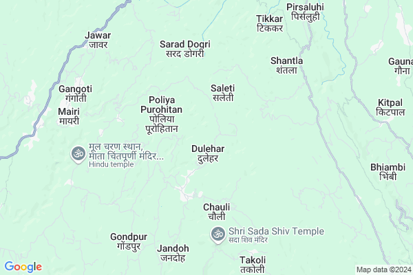
Sanoh
Sanoh Map
EDIT Map
Add Your House
 ..
..
Current Corona Virus Infected Patients Count in Una District
| City Name | District Name | Total Covid cases |
|---|---|---|
| Una District | Una | 15 |
Locality Name :
Sanoh
( सनेह )
Tehsil Name : Amb
District : Una
State : Himachal Pradesh
Language : Devanagiri and Punjabi, Paharihindi
Current Time 12:02 PM
Date: Sunday , Apr 27,2025 (IST)
Time zone: IST (UTC+5:30)
Elevation / Altitude: 478 meters. Above Seal level
Telephone Code / Std Code: 01976
Assembly constituency : Chintpurni assembly constituency
Assembly MLA : Sudarshan Singh Babloo
Lok Sabha constituency : Hamirpur parliamentary constituency
Parliament MP : ANURAG SINGH THAKUR
Serpanch Name :
Pin Code : 177211
Post Office Name : Thathal
Main Village Name : Sanoh
Commodities Prices : Hamirpur(Nadaun) Market / Mandi
National Highways Reachable To Sanoh
Nationa High Way :NH503A
Nationa High Way :NH3
Nationa High Way :NH503A
Nationa High Way :NH3
Rivers Near Sanoh
Kanjali River
Beas
Kanjali River
Beas
About Sanoh
Correct below Info and add more info about SanohSanoh is a small Village/hamlet in Amb Tehsil in Una District of Himachal Pradesh State, India. It comes under Sanoh Panchayath. It is located 31 KM towards North from District head quarters Una. 8 KM from Amb. 129 KM from State capital Shimla
Sanoh Pin code is 177211 and postal head office is Thathal .
Chauli ( 4 KM ) , Mairi Khas ( 5 KM ) , Jawar ( 7 KM ) , Takoli ( 8 KM ) , Sapouri ( 8 KM ) are the nearby Villages to Sanoh. Sanoh is surrounded by Pragpur Tehsil towards North , Bangana Tehsil towards South , Nadaun Tehsil towards East , Gagret Tehsil towards west .
Hamirpur , Hoshiarpur , Nangal , Dasua are the near by Cities to Sanoh.
This Place is in the border of the Una District and Kangra District. Kangra District Pragpur is North towards this place .
Sanoh 2011 Census Details
Sanoh Local Language is Devanagiri. Sanoh Village Total population is 146 and number of houses are 38. Female Population is 50.7%. Village literacy rate is 80.1% and the Female Literacy rate is 38.4%.
Population
| Census Parameter | Census Data |
| Total Population | 146 |
| Total No of Houses | 38 |
| Female Population % | 50.7 % ( 74) |
| Total Literacy rate % | 80.1 % ( 117) |
| Female Literacy rate | 38.4 % ( 56) |
| Scheduled Tribes Population % | 0.0 % ( 0) |
| Scheduled Caste Population % | 0.0 % ( 0) |
| Working Population % | 60.3 % |
| Child(0 -6) Population by 2011 | 5 |
| Girl Child(0 -6) Population % by 2011 | 40.0 % ( 2) |
Sanoh Census More Deatils.
Politics in Sanoh
Bharatiya Janata Party , BJP , INC are the major political parties in this area.Polling Stations /Booths near Sanoh
1)G.p.s. Behar Jaswan2)G.s.s.s. Suri
3)G.s.s.s. Takoli (east Part)
4)G.m.s. Nari
5)G.p.s. Sidh-chalehar
HOW TO REACH Sanoh
By Rail
There is no railway station near to Sanoh in less than 10 km.Colleges near Sanoh
Govt Degree College Bangana
Address :
S.v. S. D College Bhatoli
Address :
Dev Bhumy Group Of Institutes
Address :
Kc Group Of Institute Pandoga Una H.p
Address :
Ayurvedic Hospital In Mehatpur
Address : Una-nangal Highway, Opposite Police Station Mehatpur, Distt. Una, H.p. (india)
Schools in Sanoh
Gps Sanoh
Address : sanoh , amb , una , Himachal Pradesh . PIN- 177210 , Post - Nehri Nauranga
Govt Health Centers near Sanoh
1) Phahal SC , V.P.O. Phahal Tehsil Nadaun Distt. Hamirpur H.P. , Phahal ,2) Dhaned Seribaloni PHC , VPO Dhaned Tehsil &Distt. Hamirpur H.P. , Dhaned ,
3) Chauri PHC , VPO Chauri Tehsil Sujanpur Distt. Hamirpur H.P. , Chauri ,
Sub Villages in Sanoh
Petrol Bunks in Sanoh,Amb
3rd Filling Station
National Highway 70; Kaloha Uparla; Himachal Pradesh 177043; India
10.3 KM distance Detail
Petrl Pump
Kaloha - Saleti Rd; Sarad Bami Doam; Himachal Pradesh 177043; India
10.3 KM distance Detail
more ..
Colleges in Sanoh,Amb
Industrial Training Institutes
MDR46; Reserve Jangal Kaloha; Himachal Pradesh 177043; India
11.2 KM distance Detail
more ..
Schools in Sanoh,Amb
Government Senior Secondary School
Gugga Temple Rd; Himachal Pradesh 177211; India
5.1 KM distance Detail
Electronic Shops in Sanoh,Amb
Computers & Securities Services
NH3; Brahm Nagar; Himachal Pradesh 177043; India
10.6 KM distance Detail
Police Stations near Sanoh,Amb
Police Station Nadaun
National Highway 88; Hamirpur; Himachal Pradesh 177033; India
15.2 KM distance Detail
Police Station Gagret
Gagret Police Station; POlice Station Road; Gagret Khas; Himachal Pradesh 177201; India
20.5 KM distance Detail
Governement Offices near Sanoh,Amb
Tahsildar Office
Hamirpur; NH-88; Shimla Kangra Road; Nadaun; Nadaun; Himachal Pradesh 177043; India
14.6 KM distance Detail
About Sanoh &
History
How to reach Sanoh
Tourist Places Near By Sanoh
Schools in Sanoh
Colleges in Sanoh
Temperature & weather of Sanoh
places in Sanoh
Sanoh photos
More Information
How to reach Sanoh
Tourist Places Near By Sanoh
Schools in Sanoh
Colleges in Sanoh
Temperature & weather of Sanoh
places in Sanoh
Sanoh photos
More Information
Village Talk
Post News or Events about this Village
Near Cities
Hamirpur 28 KM near
Hoshiarpur 41 KM near
Nangal 43 KM near
Dasua 64 KM near
Hamirpur 28 KM near
Hoshiarpur 41 KM near
Nangal 43 KM near
Dasua 64 KM near
Near By Taluks
Amb 8 KM near
Pragpur 16 KM near
Bangana 18 KM near
Nadaun 18 KM near
Amb 8 KM near
Pragpur 16 KM near
Bangana 18 KM near
Nadaun 18 KM near
Near By Air Ports
Gaggal Airport 74 KM near
Pathankot Airport 91 KM near
Bhuntar Airport 96 KM near
Ludhiana Airport 108 KM near
Gaggal Airport 74 KM near
Pathankot Airport 91 KM near
Bhuntar Airport 96 KM near
Ludhiana Airport 108 KM near
Near By Tourist Places
Jawalaji 23 KM near
Una 29 KM near
Hoshiarpur 40 KM near
Palampur 59 KM near
Rewalsar 62 KM near
Jawalaji 23 KM near
Una 29 KM near
Hoshiarpur 40 KM near
Palampur 59 KM near
Rewalsar 62 KM near
Near By Districts
Hamirpur 28 KM near
Una 29 KM near
Hoshiarpur 41 KM near
Kangra 63 KM near
Hamirpur 28 KM near
Una 29 KM near
Hoshiarpur 41 KM near
Kangra 63 KM near
Near By RailWay Station
Nangal Dam Rail Way Station 43 KM near
Dasuya Rail Way Station 64 KM near
Nangal Dam Rail Way Station 43 KM near
Dasuya Rail Way Station 64 KM near