| Home | City Bus | Maps | Villages | Cities | Rail | Tourist Places | School | College | Pin Codes | Corona Cases Count |
| Distance Calculator Bus Services IFSC Codes Trace Mobile Number Weather Search Place Trace IP Available Cash ATM/Banks Locate Polling Booth Report an Error contact People |
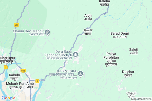
Gangoti
Gangoti Map
EDIT Map
Add Your House
 ..
..
Current Corona Virus Infected Patients Count in Una District
| City Name | District Name | Total Covid cases |
|---|---|---|
| Una District | Una | 15 |
Locality Name :
Gangoti
( गंगोटी )
Tehsil Name : Amb
District : Una
State : Himachal Pradesh
Language : Devanagiri and Punjabi, Paharihindi
Current Time 02:37 AM
Date: Friday , Mar 14,2025 (IST)
Time zone: IST (UTC+5:30)
Elevation / Altitude: 478 meters. Above Seal level
Telephone Code / Std Code: 01976
Assembly constituency : Chintpurni assembly constituency
Assembly MLA : Sudarshan Singh Babloo
Lok Sabha constituency : Hamirpur parliamentary constituency
Parliament MP : ANURAG SINGH THAKUR
Serpanch Name :
Pin Code : 177211
Post Office Name : Thathal
Main Village Name : Gangoti
Commodities Prices : Hamirpur(Nadaun) Market / Mandi
Gangoti Live Weather
Temperature: 14.4 °C
few clouds
Humidity: 63%
Wind : 2.72 mt/sec towards NE
StationName : "Gagret"
observed on 1 Hours Back
Temperature: 14.4 °C
few clouds
Humidity: 63%
Wind : 2.72 mt/sec towards NE
StationName : "Gagret"
observed on 1 Hours Back
Gangoti Weather Forecast for Next 5 days
14-03-2025
14.6°C to 14.6°C
scattered clouds
14.6°C to 14.6°C
scattered clouds
15-03-2025
13.9°C to 27.6°C
scattered clouds, few clouds, broken clouds, light rain
13.9°C to 27.6°C
scattered clouds, few clouds, broken clouds, light rain
16-03-2025
14.4°C to 25.0°C
broken clouds, light rain, overcast clouds
14.4°C to 25.0°C
broken clouds, light rain, overcast clouds
17-03-2025
13.6°C to 27.9°C
broken clouds, overcast clouds, light rain, clear sky
13.6°C to 27.9°C
broken clouds, overcast clouds, light rain, clear sky
18-03-2025
13.2°C to 27.0°C
clear sky, broken clouds
13.2°C to 27.0°C
clear sky, broken clouds
National Highways Reachable To Gangoti
Nationa High Way :NH503A
Nationa High Way :NH3
Nationa High Way :NH503A
Nationa High Way :NH3
Rivers Near Gangoti
Kanjali River
Beas
Kanjali River
Beas
About Gangoti
Correct below Info and add more info about GangotiGangoti is a small Village/hamlet in Amb Tehsil in Una District of Himachal Pradesh State, India. It comes under Gangoti Panchayath. It is located 34 KM towards North from District head quarters Una. 4 KM from Amb. 135 KM from State capital Shimla
Gangoti Pin code is 177211 and postal head office is Thathal .
Bhagrah ( 3 KM ) , Sapouri ( 3 KM ) , Mairi Khas ( 3 KM ) , Chowar ( 5 KM ) , Rajpur Jaswan ( 6 KM ) are the nearby Villages to Gangoti. Gangoti is surrounded by Pragpur Tehsil towards North , Gagret Tehsil towards west , Bangana Tehsil towards East , Nadaun Tehsil towards East .
Hamirpur , Hoshiarpur , Nangal , Dasua are the near by Cities to Gangoti.
This Place is in the border of the Una District and Kangra District. Kangra District Pragpur is North towards this place .
Gangoti 2011 Census Details
Gangoti Local Language is Devanagiri. Gangoti Village Total population is 403 and number of houses are 77. Female Population is 50.9%. Village literacy rate is 78.7% and the Female Literacy rate is 37.2%.
Population
| Census Parameter | Census Data |
| Total Population | 403 |
| Total No of Houses | 77 |
| Female Population % | 50.9 % ( 205) |
| Total Literacy rate % | 78.7 % ( 317) |
| Female Literacy rate | 37.2 % ( 150) |
| Scheduled Tribes Population % | 35.2 % ( 142) |
| Scheduled Caste Population % | 11.2 % ( 45) |
| Working Population % | 83.4 % |
| Child(0 -6) Population by 2011 | 45 |
| Girl Child(0 -6) Population % by 2011 | 55.6 % ( 25) |
Gangoti Census More Deatils.
Politics in Gangoti
Bharatiya Janata Party , BJP , INC are the major political parties in this area.Polling Stations /Booths near Gangoti
1)G.s.s.s. Ripoh Misran2)G.h.s. Kuthera Khairla (lower) (east Part)
3)G.h.s. Mairi (east Part)
4)G.p.s. Pallian
5)G.p.s. Duhal Bangwalan
HOW TO REACH Gangoti
By Rail
Amb Andaura Rail Way Station is the very nearby railway stations to Gangoti.Colleges near Gangoti
Govt Degree College Bangana
Address :
S.v. S. D College Bhatoli
Address :
Dev Bhumy Group Of Institutes
Address :
Kc Group Of Institute Pandoga Una H.p
Address :
Ayurvedic Hospital In Mehatpur
Address : Una-nangal Highway, Opposite Police Station Mehatpur, Distt. Una, H.p. (india)
Schools in Gangoti
Gps Gangoti
Address : gangoti , amb , una , Himachal Pradesh . PIN- 177210 , Post - Nehri Nauranga
Govt Health Centers near Gangoti
1) Phahal SC , V.P.O. Phahal Tehsil Nadaun Distt. Hamirpur H.P. , Phahal ,2) Chauri PHC , VPO Chauri Tehsil Sujanpur Distt. Hamirpur H.P. , Chauri ,
3) Dhaned Seribaloni PHC , VPO Dhaned Tehsil &Distt. Hamirpur H.P. , Dhaned ,
Sub Villages in Gangoti
Hospitals in Gangoti,Amb
Gautam Clinic
Nehrian; Una; NH-70; Nadaun Road; Mairi; Mairi; Himachal Pradesh 177210; India
2.6 KM distance Detail
Sanjeev Clinic
Nehrian; Una; NH-70; Nadaun Road; Mairi; Mairi; Himachal Pradesh 177210; India
3.1 KM distance Detail
more ..
Petrol Bunks in Gangoti,Amb
GURUNANAK FILLING STATION
VILLAGE DILWAL;DIARA; UNA; Himachal Pradesh 174316; India
8.0 KM distance Detail
KARGIL SHAHID MANOHAR RANA FILLING
SHYAM NAGAR;TEHSIL AMB; UN; UNA; Himachal Pradesh 177203; India
8.0 KM distance Detail
Petrl Pump
Kaloha - Saleti Rd; Sarad Bami Doam; Himachal Pradesh 177043; India
8.5 KM distance Detail
3rd Filling Station
National Highway 70; Kaloha Uparla; Himachal Pradesh 177043; India
8.5 KM distance Detail
more ..
Colleges in Gangoti,Amb
Shanti College of Education
Kailash Nagar; Nakroh; Amb; Himachal Pradesh 177203; India
8.7 KM distance Detail
more ..
Schools in Gangoti,Amb
Government Hogh School
Dera Baba Wadbhag Singh Rd - Marri; Mairi; Himachal Pradesh 177211; India
0.9 KM distance Detail
Government Primary School
Patter; Una; NH-70; Nadaun Road; Mairi; Mairi; Himachal Pradesh 177210; India
1.2 KM distance Detail
P.S. International SR.Sec.School Mairi
Modren pvt I.T.I; Mairi; Himachal Pradesh 177211; India
1.4 KM distance Detail
Super Markets in Gangoti,Amb
Kuldeep Karyana Store
Near kangra bank; Mubarikpur; Himachal Pradesh 177202; India
10.1 KM distance Detail
Police Stations near Gangoti,Amb
Police Station Gagret
Gagret Police Station; POlice Station Road; Gagret Khas; Himachal Pradesh 177201; India
14.7 KM distance Detail
Governement Offices near Gangoti,Amb
Food Inspector Office
Near SDM office amb Block Complex Shop no 5; Amb; Himachal Pradesh 177203; India
8.2 KM distance Detail
About Gangoti &
History
How to reach Gangoti
Tourist Places Near By Gangoti
Schools in Gangoti
Colleges in Gangoti
Temperature & weather of Gangoti
places in Gangoti
Gangoti photos
More Information
How to reach Gangoti
Tourist Places Near By Gangoti
Schools in Gangoti
Colleges in Gangoti
Temperature & weather of Gangoti
places in Gangoti
Gangoti photos
More Information
Village Talk
Post News or Events about this Village
Near Cities
Hamirpur 36 KM near
Hoshiarpur 37 KM near
Nangal 48 KM near
Dasua 56 KM near
Hamirpur 36 KM near
Hoshiarpur 37 KM near
Nangal 48 KM near
Dasua 56 KM near
Near By Taluks
Amb 4 KM near
Pragpur 13 KM near
Gagret 13 KM near
Bangana 25 KM near
Amb 4 KM near
Pragpur 13 KM near
Gagret 13 KM near
Bangana 25 KM near
Near By Air Ports
Gaggal Airport 72 KM near
Pathankot Airport 84 KM near
Bhuntar Airport 102 KM near
Ludhiana Airport 107 KM near
Gaggal Airport 72 KM near
Pathankot Airport 84 KM near
Bhuntar Airport 102 KM near
Ludhiana Airport 107 KM near
Near By Tourist Places
Jawalaji 24 KM near
Una 33 KM near
Hoshiarpur 36 KM near
Palampur 61 KM near
Mcleodganj 66 KM near
Jawalaji 24 KM near
Una 33 KM near
Hoshiarpur 36 KM near
Palampur 61 KM near
Mcleodganj 66 KM near
Near By Districts
Una 33 KM near
Hamirpur 36 KM near
Hoshiarpur 37 KM near
Kangra 62 KM near
Una 33 KM near
Hamirpur 36 KM near
Hoshiarpur 37 KM near
Kangra 62 KM near
Near By RailWay Station
Amb Andaura Rail Way Station 8.2 KM near
Nangal Dam Rail Way Station 48 KM near
Dasuya Rail Way Station 56 KM near
Amb Andaura Rail Way Station 8.2 KM near
Nangal Dam Rail Way Station 48 KM near
Dasuya Rail Way Station 56 KM near