| Home | City Bus | Maps | Villages | Cities | Rail | Tourist Places | School | College | Pin Codes | Corona Cases Count |
| Distance Calculator Bus Services IFSC Codes Trace Mobile Number Weather Search Place Trace IP Available Cash ATM/Banks Locate Polling Booth Report an Error contact People |
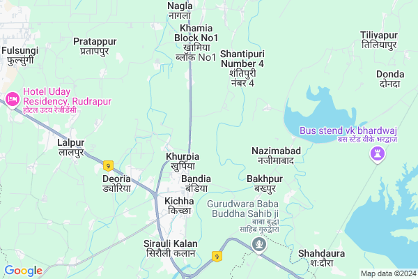
Pantpura
Pantpura Map
EDIT Map
Add Your House
 ..
..
Current Corona Virus Infected Patients Count in Udam Singh Nagar District
| City Name | District Name | Total Covid cases |
|---|---|---|
| Udham Singh Nagar District | Udham Singh Nagar | 4 |
Locality Name :
Pantpura
( पंतपुरा )
Block Name : Rudrapur
District : Udam Singh Nagar
State : Uttarakhand
Language : Hindi and Urdu
Current Time 12:58 PM
Date: Tuesday , Apr 29,2025 (IST)
Time zone: IST (UTC+5:30)
Elevation / Altitude: 208 meters. Above Seal level
Telephone Code / Std Code: 05944
Assembly constituency : Kichha assembly constituency
Assembly MLA : Tilak Raj Behar
Lok Sabha constituency : Nainital-Udhamsingh Nagar parliamentary constituency
Parliament MP : Ajay Bhatt
Serpanch Name :
Pin Code : 263148
Post Office Name : Kichha
Main Village Name : Pantpura
Commodities Prices : Kicchha Market / Mandi
National Highways Reachable To Pantpura
Nationa High Way :NH9
Nationa High Way :NH734
Nationa High Way :NH9
Nationa High Way :NH734
Rivers Near Pantpura
Baur
Bhargot Gad
Baur
Bhargot Gad
About Pantpura
Correct below Info and add more info about PantpuraPantpura is a small Village/hamlet in Rudrapur Block in Udam Singh Nagar District of Uttarakhand State, India. It comes under Pantpura Panchayath. It is located 15 KM towards East from District head quarters Rudrapur. 8 KM from Rudrapur. 246 KM from State capital Dehradun
Pantpura Pin code is 263148 and postal head office is Kichha .
Anandpur ( 6 KM ) , Bhanga ( 7 KM ) , Lalpur ( 7 KM ) , Bhawa Nagla ( 8 KM ) , Kuraiya ( 10 KM ) are the nearby Villages to Pantpura. Pantpura is surrounded by Baheri Block towards South , Sitarganj Block towards East , Bilaspur Block towards west , Haldwani Block towards North .
kichha , Nagla , Rudrapur , Sitarganj are the near by Cities to Pantpura.
This Place is in the border of the Udam Singh Nagar District and Rampur District. Rampur District Bilaspur is west towards this place . It is near to the Uttar Pradesh State Border.
Pantpura 2011 Census Details
Pantpura Local Language is Hindi. Pantpura Village Total population is 32 and number of houses are 6. Female Population is 34.4%. Village literacy rate is 43.8% and the Female Literacy rate is 12.5%.
Population
| Census Parameter | Census Data |
| Total Population | 32 |
| Total No of Houses | 6 |
| Female Population % | 34.4 % ( 11) |
| Total Literacy rate % | 43.8 % ( 14) |
| Female Literacy rate | 12.5 % ( 4) |
| Scheduled Tribes Population % | 0.0 % ( 0) |
| Scheduled Caste Population % | 21.9 % ( 7) |
| Working Population % | 53.1 % |
| Child(0 -6) Population by 2011 | 6 |
| Girl Child(0 -6) Population % by 2011 | 0.0 % ( 0) |
Pantpura Census More Deatils.
Politics in Pantpura
BJP , INC are the major political parties in this area.Polling Stations /Booths near Pantpura
1)Khamia No.2 R.no 22)Siraulikalan R.no. 4
3)Sisai Bandia R.no. 1
4)Banidya R.no. 3
5)Banidya R.no. 2
HOW TO REACH Pantpura
By Rail
Kichha Rail Way Station , Pantnagar Rail Way Station are the very nearby railway stations to Pantpura.Colleges near Pantpura
Gp Shaktifarm U S Nagar Uttrakhand
Address :
Aadi Guru Shankracharya Bhoor Khatima
Address :
Schools in Pantpura
Jhs K Pantpura
Address : pantpura , rudrapur , udham singh nagar , Uttarakhand . PIN- 263148 , Post - Kichha
Govt Health Centers near Pantpura
1) Gokulnagar-Prayagfarm SC , VILLAGE -GOKUALNAGAR , NEAR GOVT MEDIAL SCHOOL , HALDAWANI ROAD2) Suryanagar SC , VILLAGE-SURYANAGAR , SURYANAGAR , DAM ROAD
3) Narayanpur SC , NARAYANPUR , NEAR PHC NARAYANPUR , RUDRAPUR ROAD
Sub Villages in Pantpura
Hospitals in Pantpura,Rudrapur
Janta physiotherapy center
Uttaranchal Colony; Kichha; Uttarakhand 263148; India
4.0 KM distance Detail
vijay homeopathic clinic and store
Kichha Bus Stand; Bareilly Road; Kichha; Uttarakhand; India; Bandia; Uttarakhand 263148; India
4.1 KM distance Detail
more ..
Petrol Bunks in Pantpura,Rudrapur
GURUNANAK HIGHWAY FUELS
UTTAM NAGAR;DIST UDHAM SIN; UDHAM SINGH NAGAR; Uttarakhand 263148; India
6.2 KM distance Detail
more ..
Colleges in Pantpura,Rudrapur
Government Inter College; Chukati
Kishanpur -Chukati Road; Deoria; Uttarakhand 263148; India
5.9 KM distance Detail
Surajmal College of Engineering & Management
Bareilly Rd; Sirolly; Kichha; Uttarakhand 263148; India
7.6 KM distance Detail
more ..
Schools in Pantpura,Rudrapur
Govt. High Secondory School Bakhpur राजकीय उच्चतर मधमिक विद्यालय बखपुर
Nazimabad; Uttarakhand 263148; India
4.4 KM distance Detail
Nalanda Residential School
NH 74; Rudrapur Rd; Kishanpur; Kichha; Uttarakhand 263148; India
4.8 KM distance Detail
Super Markets in Pantpura,Rudrapur
Malik Furniture House
सोसायटी मार्केट हल्द्वावानी रोड बण्डिया 263148; Kichha; Uttarakhand 263148; India
2.8 KM distance Detail
Pradhan Market
Rudrapur Rd; Uttaranchal Colony; Kichha; Uttarakhand 263148; India
4.0 KM distance Detail
Local Parks in Pantpura,Rudrapur
Lord Buddha Park
Avas Vikas Barabanki; Aawas Vikas; Kichha; Uttar Pradesh 263148; India
4.7 KM distance Detail
Police Stations near Pantpura,Rudrapur
Police Station
262402; shortcut to nagla Rd; Pantnagar; Uttarakhand 263145; India
11.6 KM distance Detail
Governement Offices near Pantpura,Rudrapur
dev bhumi jan seva kendra
Ward No-15; Haldwani Road; Bandia;Kichha U.S.Nagar; Uttarakhand 263148; India
3.3 KM distance Detail
About Pantpura &
History
How to reach Pantpura
Tourist Places Near By Pantpura
Schools in Pantpura
Colleges in Pantpura
Temperature & weather of Pantpura
places in Pantpura
Pantpura photos
More Information
How to reach Pantpura
Tourist Places Near By Pantpura
Schools in Pantpura
Colleges in Pantpura
Temperature & weather of Pantpura
places in Pantpura
Pantpura photos
More Information
Village Talk
Post News or Events about this Village
Near Cities
kichha 4 KM near
Nagla 8 KM near
Rudrapur 15 KM near
Sitarganj 19 KM near
kichha 4 KM near
Nagla 8 KM near
Rudrapur 15 KM near
Sitarganj 19 KM near
Near By Taluks
Rudrapur 7 KM near
Baheri 20 KM near
Sitarganj 21 KM near
Bilaspur 28 KM near
Rudrapur 7 KM near
Baheri 20 KM near
Sitarganj 21 KM near
Bilaspur 28 KM near
Near By Air Ports
Pantnagar Airport 12 KM near
Muzaffarnagar Airport 211 KM near
Dehra Dun Airport 235 KM near
Indira Gandhi International Airport 269 KM near
Pantnagar Airport 12 KM near
Muzaffarnagar Airport 211 KM near
Dehra Dun Airport 235 KM near
Indira Gandhi International Airport 269 KM near
Near By Tourist Places
Kathgodam 41 KM near
Khatima 48 KM near
Bhimtal 50 KM near
Sattal 51 KM near
Bhowali 54 KM near
Kathgodam 41 KM near
Khatima 48 KM near
Bhimtal 50 KM near
Sattal 51 KM near
Bhowali 54 KM near
Near By Districts
Udam Singh Nagar 14 KM near
Pilibhit 47 KM near
Nainital 55 KM near
Rampur 57 KM near
Udam Singh Nagar 14 KM near
Pilibhit 47 KM near
Nainital 55 KM near
Rampur 57 KM near
Near By RailWay Station
Kichha Rail Way Station 3.9 KM near
Lal Kuan Junction Rail Way Station 16 KM near
Kichha Rail Way Station 3.9 KM near
Lal Kuan Junction Rail Way Station 16 KM near