| Home | City Bus | Maps | Villages | Cities | Rail | Tourist Places | School | College | Pin Codes | Corona Cases Count |
| Distance Calculator Bus Services IFSC Codes Trace Mobile Number Weather Search Place Trace IP Available Cash ATM/Banks Locate Polling Booth Report an Error contact People |
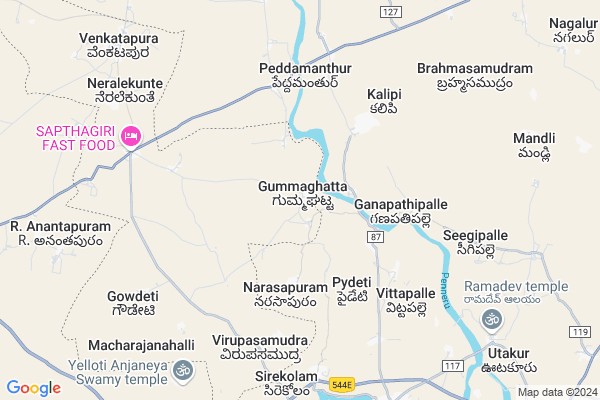
Gummagatta Map
EDIT Map
Add Your House
 ..
..
Current Corona Virus Infected Patients Count in Tumkur District
| City Name | District Name | Total Covid cases |
|---|---|---|
| Tumakuru District | Tumakuru | 1 |
| Tumkur | Tumakuru | 1 |
| Jamalpur | Tumakuru | 1 |
Locality Name :
Gummagatta
( ಗುಮ್ಮಘಟ್ಟ )
Taluk Name : Pavagada
District : Tumkur
State : Karnataka
Division : Bangalore
Language : Kannada
Current Time 12:19 PM
Date: Monday , Apr 28,2025 (IST)
Time zone: IST (UTC+5:30)
Elevation / Altitude: 678 meters. Above Seal level
Telephone Code / Std Code: 08136
Assembly constituency : Pavagada assembly constituency
Assembly MLA : H.V.Venkatesh
Lok Sabha constituency : Chitradurga parliamentary constituency
Parliament MP : A NARAYANASWAMY
Serpanch Name :
Pin Code : 572202
Post Office Name : K R Extn Tiptur
Main Village Name : Gummagatta
Alternate Village Name : Gummaghatta
Commodities Prices : Gowribidanoor Market / Mandi
Edit below overview about Gummagatta
Edit below overview about Gummagatta
OverView of Gummagatta
GUMMAGHATTA is a small and beautiful village in pavagada taluk. it has around 3000 houses , 10 temples and church,1 PHC for animals, 2 private clinics, 11 retail stores,primary and high school, milk dairy, co-operative bank, post office, government food store.here people speak in telugu but it becomes under karnataka, major population are doing agriculture and few of them went to foriegn and also some students (sreenath threegunaatheetha)have studied in business schools like dayananda sagar institutions in Bangalore. here farmers grew chillis, popcorn, rice, sunflower, oracanut, ground nut, raagi, banana, coconut, etc.the main history of this village was about 2000 years ago there were jogappas , they used to stay here and planned for do agriculture by constructing lake. the thing is they plans always at night but they do not do that in morning , they use to beg the grains from farmers from other villages near by gummaghatta. finally one day one of them decided to build lake and he did it with the support of remaining jogappas, so finally it named as JOGULA GUMMAGHATTA.Edit below overview about Gummagatta
National Highways Reachable To Gummagatta
Nationa High Way :NH44
Nationa High Way :NH150A
Nationa High Way :NH44
Nationa High Way :NH150A
Rivers Near Gummagatta
Vedavati :Hagari :ವೇದಾವತಿ :వేదావతి
Suvarnamukhi :ಸುವರ್ಣಮುಖಿ
Vedavati :Hagari :ವೇದಾವತಿ :వేదావతి
Suvarnamukhi :ಸುವರ್ಣಮುಖಿ
About Gummagatta
Gummagatta is a small Village/hamlet in Pavagada Taluk in Tumkur District of Karnataka State, India. It comes under Gummagatta Panchayath. It belongs to Bangalore Division . It is located 91 KM towards North from District head quarters Tumakuru. 35 KM from Pavagada Gramantara. 130 KM from State capital Bangalore
Gummagatta Pin code is 572202 and postal head office is K R Extn Tiptur .
Venkatapura ( 10 KM ) are the nearby Villages to Gummagatta. Gummagatta is surrounded by Roddam Taluk towards North , Madakasira Taluk towards west , Hindupur Taluk towards South , Somandepalle Taluk towards East .
Hindupur , Pavagada , Madhugiri , Nelamangala are the near by Cities to Gummagatta.
This Place is in the border of the Tumkur District and Anantapur District. Anantapur District Roddam is North towards this place . It is near to the Andhra Pradesh State Border.
Gummagatta 2011 Census Details
Gummagatta Local Language is Kannada. Gummagatta Village Total population is 2987 and number of houses are 704. Female Population is 49.6%. Village literacy rate is 57.4% and the Female Literacy rate is 23.0%.
Population
| Census Parameter | Census Data |
| Total Population | 2987 |
| Total No of Houses | 704 |
| Female Population % | 49.6 % ( 1483) |
| Total Literacy rate % | 57.4 % ( 1715) |
| Female Literacy rate | 23.0 % ( 687) |
| Scheduled Tribes Population % | 6.3 % ( 189) |
| Scheduled Caste Population % | 26.5 % ( 792) |
| Working Population % | 63.0 % |
| Child(0 -6) Population by 2011 | 268 |
| Girl Child(0 -6) Population % by 2011 | 51.5 % ( 138) |
Gummagatta Census More Deatils.
Politics in Gummagatta
Bharatiya Janata Party , JD(S) , BJP , Indian National Congress (INC) , INC are the major political parties in this area.Polling Stations /Booths near Gummagatta
1)Venugopalaswami Vidyapita Girls School (ro. No. 1)-82)G.h.p.b.s. (p.w.d) Calony
3)Governament. Higher Primary School. Bhovi Colony
4)Governament Urdu Higher Primary School
5)Government Higher Primary School
HOW TO REACH Gummagatta
By Rail
There is no railway station near to Gummagatta in less than 10 km. Hindupur Rail Way Station (near to Hindupur) , Malugur Rail Way Station (near to Hindupur) are the Rail way stations reachable from near by towns.By Road
Pavagada , Hindupur are the nearby by towns to Gummagatta having road connectivity to GummagattaColleges near Gummagatta
Rastriya Vidya Peeta
Address :
Gjc Venkatapura
Address :
M G M Pu College Lingada Hally
Address : Mgm College Lingada Hally Near Indian Petrol Bunk
Schools in Gummagatta
G.h.p.s. Gummaghatta
Address : gummaghatta , pavagada , madhugiri , Karnataka . PIN- 561202 , Post - Pavagada
Govt Health Centers near Gummagatta
1) NEERAKALLU , Nirakallu , Nirakallu , Nirakallu2) CHINAKAVAJRA , Chenakavajra, MARUVEKERE , Chenakavajra, MARUVEKERE , Chenakavajra, MARUVEKERE
3) Neralekere , PRIMARY HEALTH CENTRE, Neralekere , Neralekere , Neralekere, MADHUGIRI
Sub Villages in Gummagatta
Hospitals in Gummagatta,Pavagada
Primary Health Care Centre;parigi
Seetha Ramapuram; Parigi; Andhra Pradesh 515261; India
10.4 KM distance Detail
more ..
Colleges in Gummagatta,Pavagada
SSPG Horticulture Polytechnic College
Gowdanahalli; Andhra Pradesh 515301; India
14.9 KM distance Detail
College Of Agricultural Engineering; Madakasira
Madakasira; Andhra Pradesh 515301; India
15.0 KM distance Detail
more ..
Electronic Shops in Gummagatta,Pavagada
Tulasi Traders
Melapur; 515201; Mudireddipalli; Hindupur; Andhra Pradesh 515201; India
17.2 KM distance Detail
Super Markets in Gummagatta,Pavagada
Rajneeshvn Lands& Super Market
Venkatapuram-Roddam Rd; Venkatapura(Pavagada); Andhra Pradesh 572202; India
10.4 KM distance Detail
Police Stations near Gummagatta,Pavagada
Traffic Police Station
1187; Bangalore Rd; Rayalaseema Region; MF Rd; Rayalaseema Region; Mukkidipeta; Hindupur; Andhra Pradesh 515201; India
18.5 KM distance Detail
Governement Offices near Gummagatta,Pavagada
MeeSeva Center
Naveen online service; 1/33; Parigi; Andhra Pradesh 515261; India
9.8 KM distance Detail
MeeSeva Center
Parigi; police station; Hindupur; Andhra Pradesh 515261; India
10.6 KM distance Detail
About Gummagatta &
History
How to reach Gummagatta
Tourist Places Near By Gummagatta
Schools in Gummagatta
Colleges in Gummagatta
Temperature & weather of Gummagatta
places in Gummagatta
Gummagatta photos
More Information
How to reach Gummagatta
Tourist Places Near By Gummagatta
Schools in Gummagatta
Colleges in Gummagatta
Temperature & weather of Gummagatta
places in Gummagatta
Gummagatta photos
More Information
Village Talk
Post News or Events about this Village
Near Cities
Hindupur 18 KM near
Pavagada 24 KM near
Madhugiri 45 KM near
Nelamangala 62 KM near
Hindupur 18 KM near
Pavagada 24 KM near
Madhugiri 45 KM near
Nelamangala 62 KM near
Near By Taluks
Parigi 9 KM near
Roddam 15 KM near
Madakasira 17 KM near
Hindupur 19 KM near
Parigi 9 KM near
Roddam 15 KM near
Madakasira 17 KM near
Hindupur 19 KM near
Near By Air Ports
Bengaluru International Airport 100 KM near
Mysore Airport 227 KM near
Tirupati Airport 258 KM near
Salem Airport 301 KM near
Bengaluru International Airport 100 KM near
Mysore Airport 227 KM near
Tirupati Airport 258 KM near
Salem Airport 301 KM near
Near By Tourist Places
Lepakshi 29 KM near
Puttaparthi 50 KM near
Nandi Hills 79 KM near
Shivagange 100 KM near
Horsley Hills 123 KM near
Lepakshi 29 KM near
Puttaparthi 50 KM near
Nandi Hills 79 KM near
Shivagange 100 KM near
Horsley Hills 123 KM near
Near By Districts
Chikballapur 75 KM near
Tumkur 87 KM near
Anantapur 92 KM near
Bangalore Rural 95 KM near
Chikballapur 75 KM near
Tumkur 87 KM near
Anantapur 92 KM near
Bangalore Rural 95 KM near
Near By RailWay Station
Hindupur Rail Way Station 19 KM near
Penukonda Junction Rail Way Station 26 KM near
Hindupur Rail Way Station 19 KM near
Penukonda Junction Rail Way Station 26 KM near