| Home | City Bus | Maps | Villages | Cities | Rail | Tourist Places | School | College | Pin Codes | Corona Cases Count |
| Distance Calculator Bus Services IFSC Codes Trace Mobile Number Weather Search Place Trace IP Available Cash ATM/Banks Locate Polling Booth Report an Error contact People |
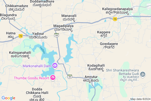
Mantya Map
EDIT Map
Add Your House
 ..
..
Current Corona Virus Infected Patients Count in Tumkur District
| City Name | District Name | Total Covid cases |
|---|---|---|
| Jamalpur | Tumakuru | 1 |
| Tumakuru District | Tumakuru | 1 |
| Tumkur | Tumakuru | 1 |
Locality Name :
Mantya
( ಮಂತ್ಯ )
Taluk Name : Kunigal
District : Tumkur
State : Karnataka
Division : Bangalore
Language : Kannada
Current Time 12:42 PM
Date: Thursday , Apr 24,2025 (IST)
Time zone: IST (UTC+5:30)
Elevation / Altitude: 780 meters. Above Seal level
Telephone Code / Std Code: 08132
Assembly constituency : Kunigal assembly constituency
Assembly MLA : Dr|| H D Ranganath
Lok Sabha constituency : Bangalore Rural parliamentary constituency
Parliament MP : D.K. SURESH
Serpanch Name :
Pin Code : 572142
Post Office Name : Yediyur (Tumkur)
Main Village Name : Mantya
Alternate Village Name : Mantya JHC
Commodities Prices : Nagamangala Market / Mandi
Mantya Live Weather
Temperature: 34.2 °C
scattered clouds
Humidity: 26%
Wind : 2.45 mt/sec towards NE
StationName : "Kunigal"
observed on 1 Hours Back
Temperature: 34.2 °C
scattered clouds
Humidity: 26%
Wind : 2.45 mt/sec towards NE
StationName : "Kunigal"
observed on 1 Hours Back
Mantya Weather Forecast for Next 5 days
25-04-2025
24.6°C to 37.5°C
scattered clouds, broken clouds, clear sky
24.6°C to 37.5°C
scattered clouds, broken clouds, clear sky
26-04-2025
23.6°C to 37.0°C
clear sky, scattered clouds, overcast clouds, light rain
23.6°C to 37.0°C
clear sky, scattered clouds, overcast clouds, light rain
27-04-2025
25.7°C to 35.4°C
broken clouds, overcast clouds, light rain
25.7°C to 35.4°C
broken clouds, overcast clouds, light rain
28-04-2025
24.6°C to 35.5°C
broken clouds, scattered clouds, overcast clouds, light rain
24.6°C to 35.5°C
broken clouds, scattered clouds, overcast clouds, light rain
29-04-2025
23.9°C to 34.8°C
overcast clouds, broken clouds, light rain
23.9°C to 34.8°C
overcast clouds, broken clouds, light rain
Edit below overview about Mantya
Edit below overview about Mantya
OverView of Mantya
Mantya grama was Purchased by Kudure Govinde Gowda by paying 50paise towards tax to British government , who hails from Indies Kere tiptur talluq , There are three temples in the village, Tirumala Temple (Constructed by Govinde Gowda), Lakkama Temple, And Hanumantaraya ( Anjaneya or Maruti) Temple,Edit below overview about Mantya
National Highways Reachable To Mantya
Nationa High Way :NH44
Nationa High Way :NH42
Nationa High Way :NH44
Nationa High Way :NH42
Rivers Near Mantya
Chikkahole :ಚಿಕ್ಕಹೊಳೆ
Chikkahole :ಚಿಕ್ಕಹೊಳೆ
About Mantya
Mantya is a small Village/hamlet in Kunigal Taluk in Tumkur District of Karnataka State, India. It comes under Mantya Panchayath. It belongs to Bangalore Division . It is located 54 KM towards South from District head quarters Tumakuru. 11 KM from Kunigal. 86 KM from State capital Bangalore
Mantya Pin code is 572142 and postal head office is Yediyur (Tumkur).
Amruthur ( 6 KM ) , Nademavinapura ( 7 KM ) , Nagasandra ( 9 KM ) , Bilidevalaya ( 12 KM ) , Herur ( 14 KM ) are the nearby Villages to Mantya. Mantya is surrounded by Nagamangala Taluk towards west , Turuvekere Taluk towards west , Magadi Taluk towards East , Mandya Taluk towards South .
Magadi , Maddur , Ramanagaram , Mandya are the near by Cities to Mantya.
Mantya 2011 Census Details
Mantya Local Language is Kannada. Mantya Village Total population is 381 and number of houses are 110. Female Population is 51.2%. Village literacy rate is 49.3% and the Female Literacy rate is 19.4%.
Population
| Census Parameter | Census Data |
| Total Population | 381 |
| Total No of Houses | 110 |
| Female Population % | 51.2 % ( 195) |
| Total Literacy rate % | 49.3 % ( 188) |
| Female Literacy rate | 19.4 % ( 74) |
| Scheduled Tribes Population % | 0.0 % ( 0) |
| Scheduled Caste Population % | 10.0 % ( 38) |
| Working Population % | 57.2 % |
| Child(0 -6) Population by 2011 | 22 |
| Girl Child(0 -6) Population % by 2011 | 45.5 % ( 10) |
Mantya Census More Deatils.
Politics in Mantya
Indian National Congress , JD(S) , BJP , Indian National Congress (INC) , INC are the major political parties in this area.Polling Stations /Booths near Mantya
1)Govt.higher Primary School Mantya2)Govt.higher Primary School Mangala
3)Govt.lower Primary School Heggadathihalli.
4)Government Girlu0027s Junior College Kunigal
5)Government Higher Primary School Thippanayakana Halli
HOW TO REACH Mantya
By Rail
There is no railway station near to Mantya in less than 10 km. Maddur Rail Way Station (near to Maddur) , Settihalli Rail Way Station (near to Channapatna) , Channapatna Rail Way Station (near to Channapatna) , Nidaghatta Rail Way Station (near to Maddur) are the Rail way stations reachable from near by towns.By Road
Kunigal , Magadi , Nagamangala , Channapatna , Maddur are the nearby by towns to Mantya having road connectivity to MantyaColleges near Mantya
Chanukya Academy Of Management
Address : B.m. Road, Kunigal, Tumkur.
Govt. First Grade Arts, Science And Commerce College
Address : Science And Commerce College, Kunigal, Tumkur
Sri. Siddartha Institute Of Management Studies
Address : Sri. Siddartha Institute Of Management Studies (mb
Supha Institute Of Management Studies
Address : Supha Institute Of Management Studies, Gulur, Kuni
Schools in Mantya
Glps Mantya
Address : mantya , kunigal , tumkur , Karnataka . PIN- 572111 , Post - Amruthur
Govt Health Centers near Mantya
1) KAMBALAPALYA , , Sirivara Road , Kambala Palya2) Chalya , JUNIOR HEALTH ASSISTANT FEMALE , ,
3) HOSAKERE , , Sub Center Hosakere, PHC Besagarahalli Koppa Hobli, ,
Sub Villages in Mantya
Petrol Bunks in Mantya,Kunigal
Petrol Pump
572111; Indira Apartment; Thimma Reddy Colony; 2nd Main Rd; New Tippasandra; J C Nagar; Karnataka 560075; India
4.4 KM distance Detail
more ..
Electronic Shops in Mantya,Kunigal
Choice Solutions Ltd.
874; 1st Floor; Raineo House; Modi Hospital Road; Basaveshwaranagar; Bangalore; Karnataka 560079; India
8.2 KM distance Detail
Sree Rangamaruthi Temple; Dasanapura; Kunigal Dist
kunigal taluk;tumkur district;karnataka state;india; Rangaswamy Bettada Kaval; Karnataka 572130; India
12.4 KM distance Detail
Super Markets in Mantya,Kunigal
Vinayaka Enterprises
Kunigal Town Rd; Gottikere; Anchepalya; Karnataka 572130; India
17.2 KM distance Detail
Local Parks in Mantya,Kunigal
Adichunchanagiri Peacock Sanctuary
College Rd; Adichunchanagiri; Karnataka 571811; India
22.2 KM distance Detail
Governement Offices near Mantya,Kunigal
Sericulture Department Kunigal
Sarakari Krishnaraja; Karnataka 572130; India
14.1 KM distance Detail
DHFL Housing Finance
Maddur Railway Station Rd; K.Kodihalli; Karnataka 571429; India
14.8 KM distance Detail
About Mantya &
History
How to reach Mantya
Tourist Places Near By Mantya
Schools in Mantya
Colleges in Mantya
Temperature & weather of Mantya
places in Mantya
Mantya photos
More Information
How to reach Mantya
Tourist Places Near By Mantya
Schools in Mantya
Colleges in Mantya
Temperature & weather of Mantya
places in Mantya
Mantya photos
More Information
Village Talk
Post News or Events about this Village
Near Cities
Magadi 39 KM near
Maddur 49 KM near
Ramanagaram 53 KM near
Mandya 53 KM near
Magadi 39 KM near
Maddur 49 KM near
Ramanagaram 53 KM near
Mandya 53 KM near
Near By Taluks
Kunigal 11 KM near
Nagamangala 25 KM near
Turuvekere 32 KM near
Magadi 36 KM near
Kunigal 11 KM near
Nagamangala 25 KM near
Turuvekere 32 KM near
Magadi 36 KM near
Near By Air Ports
Mysore Airport 88 KM near
Bengaluru International Airport 100 KM near
Salem Airport 223 KM near
Peelamedu Airport 240 KM near
Mysore Airport 88 KM near
Bengaluru International Airport 100 KM near
Salem Airport 223 KM near
Peelamedu Airport 240 KM near
Near By Tourist Places
Shivagange 47 KM near
Savandurga 48 KM near
Sravanabelagola 53 KM near
Srirangapatna 73 KM near
Bangalore 83 KM near
Shivagange 47 KM near
Savandurga 48 KM near
Sravanabelagola 53 KM near
Srirangapatna 73 KM near
Bangalore 83 KM near
Near By Districts
Tumkur 52 KM near
Mandya 53 KM near
Ramanagara 53 KM near
Bangalore 84 KM near
Tumkur 52 KM near
Mandya 53 KM near
Ramanagara 53 KM near
Bangalore 84 KM near
Near By RailWay Station
Maddur Rail Way Station 47 KM near
Channapatna Rail Way Station 51 KM near
Maddur Rail Way Station 47 KM near
Channapatna Rail Way Station 51 KM near