| Home | City Bus | Maps | Villages | Cities | Rail | Tourist Places | School | College | Pin Codes | Corona Cases Count |
| Distance Calculator Bus Services IFSC Codes Trace Mobile Number Weather Search Place Trace IP Available Cash ATM/Banks Locate Polling Booth Report an Error contact People |
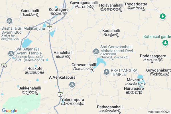
Madavara
Madavara Map
EDIT Map
Add Your House
 ..
..
Current Corona Virus Infected Patients Count in Tumkur District
| City Name | District Name | Total Covid cases |
|---|---|---|
| Tumakuru District | Tumakuru | 1 |
| Tumkur | Tumakuru | 1 |
| Jamalpur | Tumakuru | 1 |
Locality Name :
Madavara
( ಮದವರ )
Taluk Name : Koratagere
District : Tumkur
State : Karnataka
Division : Bangalore
Language : Kannada
Current Time 09:26 AM
Date: Wednesday , Apr 30,2025 (IST)
Time zone: IST (UTC+5:30)
Elevation / Altitude: 841 meters. Above Seal level
Telephone Code / Std Code: 08138
Assembly constituency : Koratagere assembly constituency
Assembly MLA : Dr. G. Parameshwara
Lok Sabha constituency : Tumkur parliamentary constituency
Parliament MP : G. S. BASAVARAJ
Serpanch Name :
Pin Code : 572129
Post Office Name : Koratagere
Main Village Name : Madavara
Commodities Prices : Tumkur Market / Mandi
National Highways Reachable To Madavara
Nationa High Way :NH44;NH648
Nationa High Way :NH44
Nationa High Way :NH44;NH648
Nationa High Way :NH44
Rivers Near Madavara
Uttara Pinakini :ಉತ್ತರ ಪಿನಾಕಿನಿ
Uttara Pinakini :ಉತ್ತರ ಪಿನಾಕಿನಿ
Uttara Pinakini :ಉತ್ತರ ಪಿನಾಕಿನಿ
Uttara Pinakini :ಉತ್ತರ ಪಿನಾಕಿನಿ
About Madavara
Correct below Info and add more info about MadavaraMadavara is a small Village/hamlet in Koratagere Taluk in Tumkur District of Karnataka State, India. It comes under Madavara Panchayath. It belongs to Bangalore Division . It is located 27 KM towards East from District head quarters Tumakuru. 2 KM from Koratagere. 76 KM from State capital Bangalore
Madavara Pin code is 572129 and postal head office is Koratagere .
Vajjanakurike ( 6 KM ) , Yelerampura ( 6 KM ) , Koratagere ( 8 KM ) , Sibi Agrahara ( 8 KM ) , Mavathuru ( 8 KM ) are the nearby Villages to Madavara. Madavara is surrounded by Tumkur Taluk towards west , Madhugiri Taluk towards North , Dodballapur Taluk towards East , Gauribidanur Taluk towards East .
Nelamangala , Tumkur , Madhugiri , Hindupur are the near by Cities to Madavara.
Madavara 2011 Census Details
Madavara Local Language is Kannada. Madavara Village Total population is 834 and number of houses are 198. Female Population is 47.7%. Village literacy rate is 62.6% and the Female Literacy rate is 27.9%.
Population
| Census Parameter | Census Data |
| Total Population | 834 |
| Total No of Houses | 198 |
| Female Population % | 47.7 % ( 398) |
| Total Literacy rate % | 62.6 % ( 522) |
| Female Literacy rate | 27.9 % ( 233) |
| Scheduled Tribes Population % | 0.0 % ( 0) |
| Scheduled Caste Population % | 49.5 % ( 413) |
| Working Population % | 67.7 % |
| Child(0 -6) Population by 2011 | 86 |
| Girl Child(0 -6) Population % by 2011 | 47.7 % ( 41) |
Madavara Census More Deatils.
Politics in Madavara
Bharatiya Janata Party , JD(S) , BJP , Indian National Congress (INC) , INC are the major political parties in this area.Polling Stations /Booths near Madavara
1)Govt.lower Primary School Bajjanahalli2)Govt.lower Primary School
3)Government Lower Primary School Maragondanaguni
4)Govt.kote Higher Primary School Koratagere Town (rcc Building)
5)Government Higher Primary School Duddanahalli
HOW TO REACH Madavara
By Rail
There is no railway station near to Madavara in less than 10 km. Someshwara Rail Way Station (near to Gauribidanur) , Tumakuru Rail Way Station (near to Tumkur) , Gauribidanur Rail Way Station (near to Gauribidanur) , Heggere Halt Rail Way Station (near to Tumkur) are the Rail way stations reachable from near by towns.By Road
Koratagere , Tumkur , Gauribidanur , Kunigal are the nearby by towns to Madavara having road connectivity to MadavaraColleges near Madavara
Channamma First Grade College
Address : Near Atal Ji Janasnehi Kendra , Kolala , Doddaballapura Road
Government First Grade College,koratagere
Address :
Govt Independent
Address :
Sree Basaweshwara Central Composit P U College , Kolala
Address : Near K G B Bank
kolala
Priyadarshini College Of Pharmacy,koratagere
Address : Koratagere,near Hanmanthapura 1st Grade Degree Col
Schools in Madavara
Glps - Madavara
Address : madavara , koratagere , madhugiri , Karnataka . PIN- 572129 , Post - Koratagere
Glps (urdu) - Madavara
Address : madavara , koratagere , madhugiri , Karnataka . PIN- 572129 , Post - Koratagere
Govt Health Centers near Madavara
1) HIREGUNDAGALLU , , Naer Anganawadi ,2) BELAGUMBA , , Urdigere Main Road , Belagumba
3) Madhugiri GH , Madhugiri GH , Madhugiri GH , Madhugiri GH
Sub Villages in Madavara
Hospitals in Madavara,Koratagere
Primary Health Center
Koratagere; Tumkur; SH-3; Magadi Solur Sompura Koratagere Madugiri Road; Tumkur; Tumkur; Karnataka 572129; India
7.8 KM distance Detail
more ..
Petrol Bunks in Madavara,Koratagere
HP PETROL PUMP - SRI DODDEGOWDA PETROL PUMP
Hpcl Dealer Sy.no.18/1a; Jampenahalli Village C.n.durga Hobli; Korategere Taluk; Bengaluru; Karnataka 572129; India
7.6 KM distance Detail
Bharat Petroleum
Koratagere; Tumkur; SH-3; Magadi Solur Sompura Koratagere Madugiri Road; Tumkur; Tumkur; Karnataka 572129; India
7.8 KM distance Detail
more ..
Colleges in Madavara,Koratagere
Maruti ITI College
Koratagere; Tumkur; SH-3; Magadi Solur Sompura Koratagere Madugiri Road; Tumkur; Tumkur; Karnataka 572129; India
6.5 KM distance Detail
CR College of Pharmacy
Koratagere; Tumkur; SH-3; Magadi Solur Sompura Koratagere Madugiri Road; Tumkur; Tumkur; Karnataka 572129; India
7.4 KM distance Detail
C.R.College of Pharmacy
Bangalore Main Road; Koratagere; Tumkur; Karnataka 572129; India
7.4 KM distance Detail
A.Ramadhyani Institute of Community College
Main Road; Infront of Airtel Office; Kotratagere; Karnataka 572129; India
7.8 KM distance Detail
more ..
Schools in Madavara,Koratagere
GHPS Hanumanthayanapalya
GHPS Hanumanthayanapalya;; Maragonahalli; Karnataka 572129; India
5.0 KM distance Detail
Govt Lower Primary School Gantiganahalli Colony
hulikunte post; Koratagere; Karnataka 572129; India
5.8 KM distance Detail
Electronic Shops in Madavara,Koratagere
SRi Maruthi Enterprises
Ik colony; Koratagere Main Rd; rode; Karnataka 572129; India
6.9 KM distance Detail
Abhiman Electricals
Tumkur-Koratagere Hwy; Koratagere; Karnataka 572129; India
7.8 KM distance Detail
Police Stations near Madavara,Koratagere
Governement Offices near Madavara,Koratagere
Office of The Executive Engineer Office Karnataka Electricity Board
Koratagere; Tumkur; SH-3; Magadi Solur Sompura Koratagere Madugiri Road; Tumkur; Tumkur; Karnataka 572129; India
7.8 KM distance Detail
Assistant Forest Officer Office
Koratagere; Tumkur; SH-3; Magadi Solur Sompura Koratagere Madugiri Road; Tumkur; Tumkur; Karnataka 572129; India
8.3 KM distance Detail
About Madavara &
History
How to reach Madavara
Tourist Places Near By Madavara
Schools in Madavara
Colleges in Madavara
Temperature & weather of Madavara
places in Madavara
Madavara photos
More Information
How to reach Madavara
Tourist Places Near By Madavara
Schools in Madavara
Colleges in Madavara
Temperature & weather of Madavara
places in Madavara
Madavara photos
More Information
Village Talk
Post News or Events about this Village
Near Cities
Nelamangala 6 KM near
Tumkur 23 KM near
Madhugiri 24 KM near
Hindupur 52 KM near
Nelamangala 6 KM near
Tumkur 23 KM near
Madhugiri 24 KM near
Hindupur 52 KM near
Near By Taluks
Koratagere 2 KM near
Madhugiri 28 KM near
Tumkur 28 KM near
Dodballapur 29 KM near
Koratagere 2 KM near
Madhugiri 28 KM near
Tumkur 28 KM near
Dodballapur 29 KM near
Near By Air Ports
Bengaluru International Airport 62 KM near
Mysore Airport 163 KM near
Salem Airport 251 KM near
Tirupati Airport 275 KM near
Bengaluru International Airport 62 KM near
Mysore Airport 163 KM near
Salem Airport 251 KM near
Tirupati Airport 275 KM near
Near By Tourist Places
Shivagange 36 KM near
Nandi Hills 50 KM near
Lepakshi 58 KM near
Savandurga 70 KM near
Bangalore 73 KM near
Shivagange 36 KM near
Nandi Hills 50 KM near
Lepakshi 58 KM near
Savandurga 70 KM near
Bangalore 73 KM near
Near By Districts
Tumkur 26 KM near
Chikballapur 55 KM near
Bangalore Rural 60 KM near
Bangalore 74 KM near
Tumkur 26 KM near
Chikballapur 55 KM near
Bangalore Rural 60 KM near
Bangalore 74 KM near
Near By RailWay Station
Tumakuru Rail Way Station 26 KM near
Gauribidanur Rail Way Station 34 KM near
Tumakuru Rail Way Station 26 KM near
Gauribidanur Rail Way Station 34 KM near