| Home | City Bus | Maps | Villages | Cities | Rail | Tourist Places | School | College | Pin Codes | Corona Cases Count |
| Distance Calculator Bus Services IFSC Codes Trace Mobile Number Weather Search Place Trace IP Available Cash ATM/Banks Locate Polling Booth Report an Error contact People |
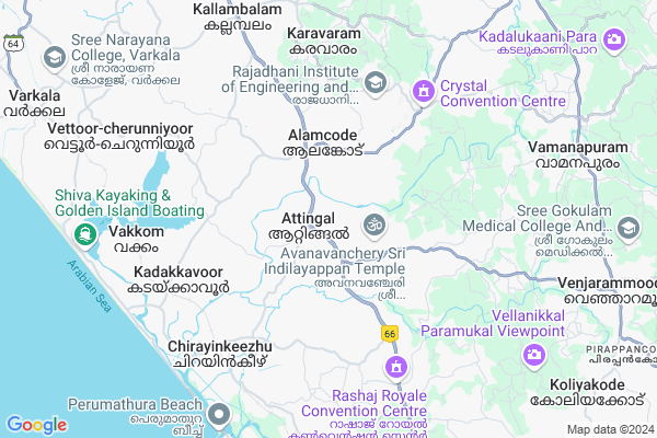
Attingal
Attingal Map
EDIT Map
Add Your House
 ..
..
Current Corona Virus Infected Patients Count in Thiruvananthapuram District
| City Name | District Name | Total Covid cases |
|---|---|---|
| Thiruvananthapuram District | Thiruvananthapuram | 11 |
| Thiruvananthapuram | Thiruvananthapuram | 2 |
| Varkala | Thiruvananthapuram | 1 |
| Nedumangad | Thiruvananthapuram | 1 |
Locality Name :
Attingal
( ആറ്റിങ്ങൽ )
Block Name : Varkala
District : Thiruvananthapuram
State : Kerala
Division : South Kerala
Language : Malayalam and English, Tamil, Hindi, Tulu, Konkani
Current Time 10:44 AM
Date: Tuesday , Apr 29,2025 (IST)
Time zone: IST (UTC+5:30)
Elevation / Altitude: 52 meters. Above Seal level
Telephone Code / Std Code: 0474
Assembly constituency : Attingal assembly constituency
Assembly MLA : O S Ambika
Lok Sabha constituency : Attingal parliamentary constituency
Parliament MP : Adv. ADOOR PRAKASH
Serpanch Name :
Main Village Name : Attingal
Commodities Prices : Attingal Market / Mandi
Attingal Live Weather
Temperature: 28.9 °C
overcast clouds
Humidity: 87%
Wind : 1 mt/sec towards NE
StationName : "Attingal"
observed on 2 Hours Back
Temperature: 28.9 °C
overcast clouds
Humidity: 87%
Wind : 1 mt/sec towards NE
StationName : "Attingal"
observed on 2 Hours Back
Attingal Weather Forecast for Next 5 days
30-04-2025
27.6°C to 29.4°C
light rain, broken clouds
27.6°C to 29.4°C
light rain, broken clouds
01-05-2025
27.0°C to 29.4°C
light rain, overcast clouds
27.0°C to 29.4°C
light rain, overcast clouds
02-05-2025
26.4°C to 29.7°C
overcast clouds, broken clouds, light rain
26.4°C to 29.7°C
overcast clouds, broken clouds, light rain
03-05-2025
27.3°C to 29.8°C
overcast clouds, light rain
27.3°C to 29.8°C
overcast clouds, light rain
04-05-2025
26.7°C to 29.4°C
light rain, broken clouds, scattered clouds
26.7°C to 29.4°C
light rain, broken clouds, scattered clouds
National Highways Reachable To Attingal
Nationa High Way :NH744
Nationa High Way :NH66
Nationa High Way :NH744
Nationa High Way :NH66
Rivers Near Attingal
Parvathy Puthanar
Kallada
Parvathy Puthanar
Kallada
About Attingal
Correct below Info and add more info about AttingalAttingal is a small Village/hamlet in Varkala Block in Thiruvananthapuram District of Kerala State, India. It comes under Attingal Panchayath. It belongs to South Kerala Division . It is located 31 KM towards North from District head quarters Thiruvananthapuram. 10 KM from Varkala. 31 KM from State capital Thiruvananthapuram
Kadakkavoor ( 6 KM ) , Nagaroor ( 6 KM ) , Chirayinkeezhu ( 6 KM ) , Azhoor ( 7 KM ) , Vakkom ( 7 KM ) are the nearby Villages to Attingal. Attingal is surrounded by Varkala Block towards west , Kilimanoor Block towards North , Kazhakuttam Block towards South , Vamanapuram Block towards East .
Attingal , Varkala , Paravoor , Nedumangad are the near by Cities to Attingal.
This Place is in the border of the Thiruvananthapuram District and Kollam District. Kollam District Ithikkara is North towards this place . It is near to arabian sea. There is a chance of humidity in the weather.
Demographics of Attingal
Malayalam is the Local Language here.Politics in Attingal
CPM , Indian National Congress , CPI(M) , INC are the major political parties in this area.Polling Stations /Booths near Attingal
1)Govt Lps Parakulam (south Side)2)Govt. Vijnjanadayini Lps Main Building (south)
3)Town Ups Oomanpallikkara East Building (south)
4)Govt Lps Pedikulam (d P E P Block)
5)U P S Thalikkuzhy
HOW TO REACH Attingal
By Rail
Chirayinkeezhu Rail Way Station , Kadakavur Rail Way Station are the very nearby railway stations to Attingal.Pincodes near Attingal
695101 ( Attingal ) , 695307 ( Nedunganda ) , 695102 ( Alamcode )Colleges near Attingal
Sivagiri Sree Narayana College , Varkala
Address :
Sivagiri Sreenarayana Medical Mission College Of Nursing Sreeneevasapuram Varkala
Address : Sivagiri Sreenarayana Medical Mission College Of N
Schools near Attingal
Gemknow Model School Vettoor
Address : vettoor -cherunniyoor , varkala , thiruvananthapuram , Kerala . PIN- 695312 , Post - Vettoor
Sn Central Emhss Sivagiri
Address : varkala , varkala , thiruvananthapuram , Kerala . PIN- 695145 , Post - Sreenivasapuram
Jawahar Public School Edava
Address : edava , varkala , thiruvananthapuram , Kerala . PIN- 695311 , Post - Edava
Little Flower Emhss Edava
Address : edava , varkala , thiruvananthapuram , Kerala . PIN- 695311 , Post - Edava
Govt Health Centers near Attingal
1) PHC CHITTAR , Chittar Community health centre , Chittar Maniyar road , police stationSub Villages in Attingal
Hospitals in Attingal,Varkala
Govt Homeo Dispensary Vanchiyoor
SH 46; Vanchiyoor; Alamcode; Kerala 695102; India
3.2 KM distance Detail
Sree Nandanam Ayurveda Hospital
Shalimar; Kadavila; Vanchiyoor P. O.; via Alamkode; Thiruvananthapuram; 695102; India
3.9 KM distance Detail
more ..
Petrol Bunks in Attingal,Varkala
Hindustan Petroleum Vishnu Fuel Center
HPC Dealers Kochuvica Alancode PO; Cochin; Kerala 695102; India
3.9 KM distance Detail
Bharat Petroleum
Alamcode Kadakkavoor Anchuthengu Road; Vakkom; Kerala 695306; India
5.0 KM distance Detail
KANNANVILOKAM FUELS CENTRE
Alamcode Kadakkavoor Anchuthengu Road; Vakkom; Kerala 695102; India
5.0 KM distance Detail
more ..
Colleges in Attingal,Varkala
Al Burhan Arabic College & Hiflul Qur-an College
Keezhattingal; Kerala 695102; India
4.1 KM distance Detail
Vedamrutham Ayurveda Pharmacy
Thottikkallu - Manamboor Rd; Chathampara; Attingal; Kerala 695605; India
4.5 KM distance Detail
more ..
Schools in Attingal,Varkala
Mother India International Residential Public School
Keezhattingal; Kerala 695307; India
3.6 KM distance Detail
Al Fitrah Islamic Pre School
Near Palamkonam Salafi Center; Alamcode;; Attingal; Kerala; India
3.8 KM distance Detail
Electronic Shops in Attingal,Varkala
Master Mind Electronics Putiyatadam
Puthiya Thadam Rd; Alamcode; Kerala 695102; India
3.0 KM distance Detail
ELECTRO-TECH DTH&CCTV
Vanchuyoor;alamcodu; Vanchiyoor; Alamcode; Kerala 695102; India
3.2 KM distance Detail
Super Markets in Attingal,Varkala
Sivakrishna Store
Mudapuram; Siva Krishnapuram Road; Chirayinkeezhu; Kerala 695304; India
5.5 KM distance Detail
Local Parks in Attingal,Varkala
JASMIN NURSERY
JASMIN NIVAS; NEAR PALAMKONAM JUMA MASJID; PALAMKONAM; PERUMKULAM P O;; ATTINGAL; THIRUVANATHAPURAM; Kerala 695102; India
3.9 KM distance Detail
Police Stations near Attingal,Varkala
Kadakkavoor Police Station .
Alamcode Kadakkavoor Anchuthengu Road; Anchuthengu; Kerala 695306; India
6.7 KM distance Detail
Kallambalam Police Station
Salem-Kanyakumari Highway; Manambur; Kerala 695611; India
7.4 KM distance Detail
Governement Offices near Attingal,Varkala
Vanchiyoor Milk Marketing Societie
SH 46; Vanchiyoor; Alamcode; Kerala 695102; India
3.4 KM distance Detail
About Attingal &
History
How to reach Attingal
Tourist Places Near By Attingal
Schools in Attingal
Colleges in Attingal
Temperature & weather of Attingal
places in Attingal
Attingal photos
More Information
How to reach Attingal
Tourist Places Near By Attingal
Schools in Attingal
Colleges in Attingal
Temperature & weather of Attingal
places in Attingal
Attingal photos
More Information
Village Talk
Post News or Events about this Village
Near Cities
Attingal 2 KM near
Varkala 13 KM near
Paravoor 17 KM near
Nedumangad 24 KM near
Attingal 2 KM near
Varkala 13 KM near
Paravoor 17 KM near
Nedumangad 24 KM near
Near By Taluks
Chirayinkeezhu 5 KM near
Varkala 9 KM near
Kilimanoor 9 KM near
Kazhakuttam 15 KM near
Chirayinkeezhu 5 KM near
Varkala 9 KM near
Kilimanoor 9 KM near
Kazhakuttam 15 KM near
Near By Air Ports
Trivandrum International Airport 30 KM near
Tuticorin Airport 149 KM near
Kochi Airport 188 KM near
Madurai Airport 210 KM near
Trivandrum International Airport 30 KM near
Tuticorin Airport 149 KM near
Kochi Airport 188 KM near
Madurai Airport 210 KM near
Near By Tourist Places
Varkala 14 KM near
Trivandrum 30 KM near
Ponmudi 36 KM near
Kovalam 42 KM near
Thenmala 43 KM near
Varkala 14 KM near
Trivandrum 30 KM near
Ponmudi 36 KM near
Kovalam 42 KM near
Thenmala 43 KM near
Near By Districts
Thiruvananthapuram 30 KM near
Kollam 39 KM near
Pathanamthitta 71 KM near
Kanniyakumari 100 KM near
Thiruvananthapuram 30 KM near
Kollam 39 KM near
Pathanamthitta 71 KM near
Kanniyakumari 100 KM near
Near By RailWay Station
Chirayinkeezhu Rail Way Station 6.9 KM near
Kadakavur Rail Way Station 7.3 KM near
Akathumuri Rail Way Station 7.8 KM near
Chirayinkeezhu Rail Way Station 6.9 KM near
Kadakavur Rail Way Station 7.3 KM near
Akathumuri Rail Way Station 7.8 KM near