| Home | City Bus | Maps | Villages | Cities | Rail | Tourist Places | School | College | Pin Codes | Corona Cases Count |
| Distance Calculator Bus Services IFSC Codes Trace Mobile Number Weather Search Place Trace IP Available Cash ATM/Banks Locate Polling Booth Report an Error contact People |
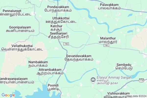
Mylapore
Mylapore Map
EDIT Map
Add Your House
 ..
..
Current Corona Virus Infected Patients Count in Thiruvallur District
| City Name | District Name | Total Covid cases |
|---|---|---|
| Thiruvallur District | Thiruvallur | 54 |
Locality Name :
Mylapore
( மயிலாப்பூர் )
Block Name : Poondi
District : Thiruvallur
State : Tamil Nadu
Language : Tamil
Current Time 10:57 AM
Date: Wednesday , Apr 30,2025 (IST)
Time zone: IST (UTC+5:30)
Elevation / Altitude: 50 meters. Above Seal level
Telephone Code / Std Code: 044
Assembly constituency : Gummidipoondi assembly constituency
Assembly MLA : Govindarajan T.J
Lok Sabha constituency : Tiruvallur parliamentary constituency
Parliament MP : Dr.K.Jayakumar
Serpanch Name :
Pin Code : 602023
Post Office Name : Poondi
Main Village Name : Mylapore
Alternate Village Name : Mylapore Colony
Commodities Prices : Puttur Market / Mandi
Mylapore Live Weather
Temperature: 35.8 °C
broken clouds
Humidity: 37%
Wind : 3.64 mt/sec towards S
StationName : "Tiruvallur"
observed on Now
Temperature: 35.8 °C
broken clouds
Humidity: 37%
Wind : 3.64 mt/sec towards S
StationName : "Tiruvallur"
observed on Now
Mylapore Weather Forecast for Next 5 days
01-05-2025
27.8°C to 39.7°C
broken clouds, scattered clouds, overcast clouds
27.8°C to 39.7°C
broken clouds, scattered clouds, overcast clouds
02-05-2025
27.6°C to 41.0°C
overcast clouds, broken clouds, scattered clouds
27.6°C to 41.0°C
overcast clouds, broken clouds, scattered clouds
03-05-2025
28.1°C to 42.1°C
overcast clouds, broken clouds, scattered clouds, few clouds, light rain
28.1°C to 42.1°C
overcast clouds, broken clouds, scattered clouds, few clouds, light rain
04-05-2025
28.1°C to 41.7°C
overcast clouds, broken clouds, clear sky, light rain
28.1°C to 41.7°C
overcast clouds, broken clouds, clear sky, light rain
05-05-2025
28.7°C to 40.1°C
overcast clouds, broken clouds, light rain
28.7°C to 40.1°C
overcast clouds, broken clouds, light rain
National Highways Reachable To Mylapore
Nationa High Way :NH45
Nationa High Way :NH45
About Mylapore
Correct below Info and add more info about MylaporeMylapore is a small Village/hamlet in Poondi Block in Thiruvallur District of Tamil Nadu State, India. It comes under Mylapore Panchayath. It is located 14 KM towards North from District head quarters Tiruvallur. 4 KM from Poondi. 50 KM from State capital Chennai
Mylapore Pin code is 602023 and postal head office is Poondi .
Attarambakkam ( 3 KM ) , Ammambakkam ( 4 KM ) , Nelvoy ( 4 KM ) , Velagapuram ( 4 KM ) , Meyyur ( 5 KM ) are the nearby Villages to Mylapore. Mylapore is surrounded by Thiruvallur Block towards South , Tiruvallur Block towards South , Ellapuram Block towards East , Nagalapuram Block towards North .
Thiruvallur , Thirunindravur , Ponneri , Arakkonam are the near by Cities to Mylapore.
Mylapore 2011 Census Details
Mylapore Local Language is Tamil. Mylapore Village Total population is 442 and number of houses are 112. Female Population is 48.2%. Village literacy rate is 61.5% and the Female Literacy rate is 24.2%.
Population
| Census Parameter | Census Data |
| Total Population | 442 |
| Total No of Houses | 112 |
| Female Population % | 48.2 % ( 213) |
| Total Literacy rate % | 61.5 % ( 272) |
| Female Literacy rate | 24.2 % ( 107) |
| Scheduled Tribes Population % | 0.0 % ( 0) |
| Scheduled Caste Population % | 38.7 % ( 171) |
| Working Population % | 48.6 % |
| Child(0 -6) Population by 2011 | 48 |
| Girl Child(0 -6) Population % by 2011 | 45.8 % ( 22) |
Mylapore Census More Deatils.
Politics in Mylapore
DMDK , DMK , AIADMK , AIADMK , DMK , PMK , ADMK are the major political parties in this area.HOW TO REACH Mylapore
By Rail
There is no railway station near to Mylapore in less than 10 km.Colleges near Mylapore
Indira Institute Of Engineering And Technology
Address : Pandur – 631 203, Tiruvallur Taluk & District Of
Indira College Of Nursing
Address : Indira College Of Nursing, No.1, Vgr Nagar, Vgr Ga
Schools in Mylapore
Pups, Mylapore
Address : mylapore , poondi , thiruvallur , Tamil Nadu . PIN- 602023 , Post - Poondi
Govt Health Centers near Mylapore
1) Katchur , Primary Health Centre , Uthukotai-Thiruvallur main road , Near by bus stop2) LACHIVAKKAM , PHC , Latchivakkam Street , Near by Bus Stop
3) Pullarambakkam , Health Sub centre , Main Raod, , Pullarambakkam
Sub Villages in Mylapore
Hospitals in Mylapore,Poondi
NuLife Hospital
Kharar - Landran Rd; Sante Majra; Sector 115; Kharar; Punjab 602026; India
3.1 KM distance Detail
Government Upgraded Primary Health Centre
Katchur; Uthukottai; Thiruvallur; SH-50; Thirumazhisai Uthukottai Road; Thiruvallur; Thiruvallur; 602026; India
5.0 KM distance Detail
more ..
Petrol Bunks in Mylapore,Poondi
MARUTHI FILLING STATION
SEETHANCHERI VILLAGE; TIRUVALLUR; Tamil Nadu 602026; India
3.6 KM distance Detail
HP Petroleum
Perinjeri; Thiruvallur; SH-50; Tiruvallur Uthukottai Road; Thiruvallur; Thiruvallur; 602023; India
6.1 KM distance Detail
Indian Oil Petrol Pump
Poondi; Thiruvallur; SH-50; Tiruvallur Uthukottai Road; Thiruvallur; Thiruvallur; 602023; India
6.4 KM distance Detail
more ..
Colleges in Mylapore,Poondi
Govt Higher Secondary School Ground Uthukottai
Tiruvallur-Uthukottai Rd; Uthukkottai; Andhra Pradesh 602026; India
9.7 KM distance Detail
Film Institute Factory
3/331; mariyamman kovil steer; sernthanur; Villupuram; Tamil Nadu 601103; India
11.1 KM distance Detail
IGSM( India Graduate School Of Missiology)
ikkadu; 167; Ambattur Red Hills Rd; Kandigai; Ambattur; Chennai; Tamil Nadu 600053; India
11.9 KM distance Detail
more ..
Schools in Mylapore,Poondi
Panchayat Union primary School
Seethancheri; Uthukottai; Thiruvallur; SH-50; Thirumazhisai Uthukottai Road; Thiruvallur; Thiruvallur; 602026; India
3.7 KM distance Detail
Government School; Ramanathapuram Village
Ammambakkam; Tamil Nadu 602023; India
4.3 KM distance Detail
Police Stations near Mylapore,Poondi
Thiruvallur Town Police Station
53; Gandhi Road; MGM Nagar; Tiruvallur; Tamil Nadu 602001; India
15.0 KM distance Detail
Governement Offices near Mylapore,Poondi
Forest Range Office
Seethanjeri; Thiruvallur; SH-50; Thirumazhisai Uthukottai Road; Thiruvallur; Thiruvallur; 602026; India
2.7 KM distance Detail
About Mylapore &
History
How to reach Mylapore
Tourist Places Near By Mylapore
Schools in Mylapore
Colleges in Mylapore
Temperature & weather of Mylapore
places in Mylapore
Mylapore photos
More Information
How to reach Mylapore
Tourist Places Near By Mylapore
Schools in Mylapore
Colleges in Mylapore
Temperature & weather of Mylapore
places in Mylapore
Mylapore photos
More Information
Village Talk
Post News or Events about this Village
Near Cities
Thiruvallur 14 KM near
Thirunindravur 22 KM near
Ponneri 35 KM near
Arakkonam 36 KM near
Thiruvallur 14 KM near
Thirunindravur 22 KM near
Ponneri 35 KM near
Arakkonam 36 KM near
Near By Taluks
Poondi 4 KM near
Thiruvallur 15 KM near
Ellapuram 15 KM near
Tiruvallur 16 KM near
Poondi 4 KM near
Thiruvallur 15 KM near
Ellapuram 15 KM near
Tiruvallur 16 KM near
Near By Air Ports
Chennai Airport 46 KM near
Tirupati Airport 64 KM near
Bengaluru International Airport 267 KM near
Salem Airport 291 KM near
Chennai Airport 46 KM near
Tirupati Airport 64 KM near
Bengaluru International Airport 267 KM near
Salem Airport 291 KM near
Near By Tourist Places
Sriperumbudur 36 KM near
Thiruthani 37 KM near
Chennai 48 KM near
Pulicat 53 KM near
Kanchipuram 58 KM near
Sriperumbudur 36 KM near
Thiruthani 37 KM near
Chennai 48 KM near
Pulicat 53 KM near
Kanchipuram 58 KM near
Near By Districts
Thiruvallur 14 KM near
Chennai 47 KM near
Kanchipuram 57 KM near
Chittoor 99 KM near
Thiruvallur 14 KM near
Chennai 47 KM near
Kanchipuram 57 KM near
Chittoor 99 KM near
Near By RailWay Station
Tiruvallur Rail Way Station 17 KM near
Arakkonam Junction Rail Way Station 36 KM near
Tiruvallur Rail Way Station 17 KM near
Arakkonam Junction Rail Way Station 36 KM near