| Home | City Bus | Maps | Villages | Cities | Rail | Tourist Places | School | College | Pin Codes | Corona Cases Count |
| Distance Calculator Bus Services IFSC Codes Trace Mobile Number Weather Search Place Trace IP Available Cash ATM/Banks Locate Polling Booth Report an Error contact People |
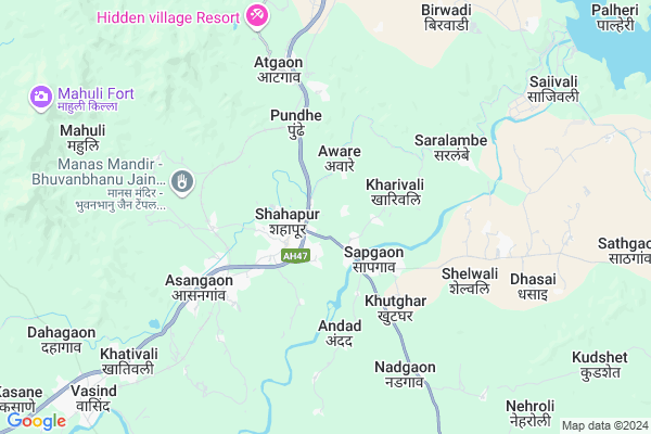
Kambare
Kambare Map
EDIT Map
Add Your House
 ..
..
Current Corona Virus Infected Patients Count in Thane District
| City Name | District Name | Total Covid cases |
|---|---|---|
| Thane | Thane | 108 |
| Navi Mumbai | Thane | 70 |
| Thane District | Thane | 67 |
| Mira-Bhayandar | Thane | 53 |
| Kalyan-Dombivali | Thane | 50 |
| Thane Rural | Thane | 29 |
| MBMC | Thane | 11 |
| Thane Corp | Thane | 6 |
| KDMC | Thane | 5 |
| Bhiwandi | Thane | 4 |
| Ulhasnagar | Thane | 1 |
| Thane - Vashi | Thane | 1 |
Locality Name :
Kambare
( कंबरे )
Taluka Name : Shahapur
District : Thane
State : Maharashtra
Region : Konkan
Division : Konkan
Language : Marathi and Sindhi, Gujarati And Hindi
Current Time 05:45 AM
Date: Monday , Apr 28,2025 (IST)
Time zone: IST (UTC+5:30)
Elevation / Altitude: 77 meters. Above Seal level
Telephone Code / Std Code: 02527
Assembly constituency : Shahapur assembly constituency
Assembly MLA : Daulat Bhika Daroda
Lok Sabha constituency : Bhiwandi parliamentary constituency
Parliament MP : KAPIL MORESHWAR PATIL
Serpanch Name :
Pin Code : 421601
Post Office Name : Shahapur (Thane)
Main Village Name : Kambare
Commodities Prices : Shahapur Market / Mandi
Kambare Live Weather
Temperature: 25.3 °C
clear sky
Humidity: 62%
Wind : 0.3 mt/sec towards NE
StationName : "ShÄ\u0081hÄ\u0081pur"
observed on 1 Hours Back
Temperature: 25.3 °C
clear sky
Humidity: 62%
Wind : 0.3 mt/sec towards NE
StationName : "ShÄ\u0081hÄ\u0081pur"
observed on 1 Hours Back
Kambare Weather Forecast for Next 5 days
29-04-2025
25.9°C to 42.5°C
clear sky
25.9°C to 42.5°C
clear sky
30-04-2025
26.6°C to 42.4°C
clear sky
26.6°C to 42.4°C
clear sky
01-05-2025
26.1°C to 39.9°C
few clouds, clear sky
26.1°C to 39.9°C
few clouds, clear sky
02-05-2025
25.6°C to 41.3°C
clear sky
25.6°C to 41.3°C
clear sky
National Highways Reachable To Kambare
Nationa High Way :NH61
Nationa High Way :NH160
Nationa High Way :NH61
Nationa High Way :NH160
Rivers Near Kambare
Bhairangi
Kalu
Bhairangi
Kalu
About Kambare
Correct below Info and add more info about KambareKambare is a small Village/hamlet in Shahapur Taluka in Thane District of Maharashtra State, India. It comes under Kambare Panchayath. It belongs to Konkan region . It belongs to Konkan Division . It is located 59 KM towards East from District head quarters Thane. 5 KM from Shahapur. 83 KM from State capital Mumbai
Kambare Pin code is 421601 and postal head office is Shahapur (Thane).
Sapgaon ( 2 KM ) , Vafe ( 2 KM ) , Aware ( 2 KM ) , Gavlipada ( 2 KM ) , Cherpoli ( 2 KM ) are the nearby Villages to Kambare. Kambare is surrounded by Murbad Taluka towards South , Wada Taluka towards west , Kalyan Taluka towards South , Ulhasnagar Taluka towards South .
Kalyan , Ulhasnagar , Ambernath , Bhiwandi are the near by Cities to Kambare.
Kambare 2011 Census Details
Kambare Local Language is Marathi. Kambare Village Total population is 1094 and number of houses are 217. Female Population is 48.9%. Village literacy rate is 75.1% and the Female Literacy rate is 33.1%.
Population
| Census Parameter | Census Data |
| Total Population | 1094 |
| Total No of Houses | 217 |
| Female Population % | 48.9 % ( 535) |
| Total Literacy rate % | 75.1 % ( 822) |
| Female Literacy rate | 33.1 % ( 362) |
| Scheduled Tribes Population % | 7.5 % ( 82) |
| Scheduled Caste Population % | 7.0 % ( 77) |
| Working Population % | 54.8 % |
| Child(0 -6) Population by 2011 | 119 |
| Girl Child(0 -6) Population % by 2011 | 40.3 % ( 48) |
Kambare Census More Deatils.
Politics in Kambare
Bharatiya Janata Party , BJP , NCP , INC , SHS are the major political parties in this area.Polling Stations /Booths near Kambare
1)Gopalpada2)Gotheghar
3)Kasghar
4)Katkariwadi (gotheghar)
5)Savroli Khu.
HOW TO REACH Kambare
By Rail
Asangaon Rail Way Station , Atgaon Rail Way Station are the very nearby railway stations to Kambare. Igatpuri Rail Way Station (near to Igatpuri) , Bhiwandi Road Rail Way Station (near to Bhiwandi) , Thakurli Rail Way Station (near to Bhiwandi) , Ghoti Rail Way Station (near to Igatpuri) are the Rail way stations reachable from near by towns.By Road
Igatpuri , Bhiwandi , Jawhar are the nearby by towns to Kambare having road connectivity to KambareColleges near Kambare
Juniar College Dolkhamb
Address :
Schools in Kambare
Z.p. School, Kambare
Address : kambare , shahapur , thane , Maharashtra . PIN- 421601 , Post - Shahapur (Thane)
Govt Health Centers near Kambare
1) Kambhare , Kambhare , shahapur Kasara Highway , NA no billding2) Shahapur 3 , Shahapur 3 , Old Agra Road , Near Grampanchyat / SDH
3) Karole , At Post Karole , Karole Village , Near Grampanchayat
Sub Villages in Kambare
Hospitals in Kambare,Shahapur
neha paper box
dhumal residency Shahapur;; Gotheghar; Maharashtra 421601; India
0.8 KM distance Detail
Sai Baba Multispeciality Hospital
Sharadha Apartment; Near Swad Hotel; Saibaba Hospital; Goteghar Naka; Mumbai - Nashik Expy; Shahapur; Maharashtra 421601; India
1.0 KM distance Detail
more ..
Petrol Bunks in Kambare,Shahapur
HP PETROL PUMP - SUVIDHA AUTO
HPC Dealers Mumbai Agra Road Shahapur; Vashi; 421601; India
1.7 KM distance Detail
HP PETROL PUMP - SHIVRATAN FILLING STATION
Sapgaon Taluka Shahapur; Vashi; Maharashtra 421601; India
2.3 KM distance Detail
more ..
Colleges in Kambare,Shahapur
Disha Institute of Paramedical Science
Pandit naka;old Agra road; Shahapur;Thane; Maharashtra 421601; India
1.6 KM distance Detail
Jeevandeep Shaishnik Sansthas Pois College Of Arts Commerce & Science
dalkand; shahapur; Thane; Maharashtra 400006; India
1.8 KM distance Detail
more ..
Super Markets in Kambare,Shahapur
Sangemarmar ceramics And Granite Company.
Mumbai - Nashik Expy; Shahapur; Maharashtra 421601; India
1.2 KM distance Detail
Local Parks in Kambare,Shahapur
Rutu Park
Rutu Park;Shopping complex;gotheghar ;; NH 3; Shahapur; Maharashtra 421601; India
0.9 KM distance Detail
Police Stations near Kambare,Shahapur
Shahapur Traffic Police Station; Cherpolighat; Asangaon.
Cherpoli; Maharashtra 421601; India
0.8 KM distance Detail
Governement Offices near Kambare,Shahapur
Gotheghar-Local Self-Government Organisation (Grampanchayat Office)
4; Road Number 2; EPIP Zone; Whitefield; Bengaluru; India
1.4 KM distance Detail
Shahapur wedding aap
At post Shenve; Tal - Shahapur; Shahapur; Maharashtra 421601; India
1.4 KM distance Detail
About Kambare &
History
How to reach Kambare
Tourist Places Near By Kambare
Schools in Kambare
Colleges in Kambare
Temperature & weather of Kambare
places in Kambare
Kambare photos
More Information
How to reach Kambare
Tourist Places Near By Kambare
Schools in Kambare
Colleges in Kambare
Temperature & weather of Kambare
places in Kambare
Kambare photos
More Information
Village Talk
Post News or Events about this Village
Near Cities
Kalyan 36 KM near
Ulhasnagar 37 KM near
Ambernath 38 KM near
Bhiwandi 38 KM near
Kalyan 36 KM near
Ulhasnagar 37 KM near
Ambernath 38 KM near
Bhiwandi 38 KM near
Near By Taluks
Shahapur 5 KM near
Murbad 29 KM near
Wada 33 KM near
Kalyan 34 KM near
Shahapur 5 KM near
Murbad 29 KM near
Wada 33 KM near
Kalyan 34 KM near
Near By Air Ports
Chhatrapati Shivaji International Airport 71 KM near
Gandhinagar Airport 83 KM near
Lohegaon Airport 129 KM near
Chikkalthana Airport 246 KM near
Chhatrapati Shivaji International Airport 71 KM near
Gandhinagar Airport 83 KM near
Lohegaon Airport 129 KM near
Chikkalthana Airport 246 KM near
Near By Tourist Places
Mahuli Fort 11 KM near
Igatpuri 39 KM near
Khodala 41 KM near
Ratanwadi 42 KM near
Malshej Ghat 51 KM near
Mahuli Fort 11 KM near
Igatpuri 39 KM near
Khodala 41 KM near
Ratanwadi 42 KM near
Malshej Ghat 51 KM near
Near By Districts
Thane 56 KM near
Nashik 84 KM near
Mumbai 86 KM near
Dadra And Nagar Haveli 108 KM near
Thane 56 KM near
Nashik 84 KM near
Mumbai 86 KM near
Dadra And Nagar Haveli 108 KM near
Near By RailWay Station
Asangaon Rail Way Station 4.8 KM near
Atgaon Rail Way Station 5.9 KM near
Kasara Rail Way Station 28 KM near
Kalyan Junction Rail Way Station 37 KM near
Asangaon Rail Way Station 4.8 KM near
Atgaon Rail Way Station 5.9 KM near
Kasara Rail Way Station 28 KM near
Kalyan Junction Rail Way Station 37 KM near