| Home | City Bus | Maps | Villages | Cities | Rail | Tourist Places | School | College | Pin Codes | Corona Cases Count |
| Distance Calculator Bus Services IFSC Codes Trace Mobile Number Weather Search Place Trace IP Available Cash ATM/Banks Locate Polling Booth Report an Error contact People |
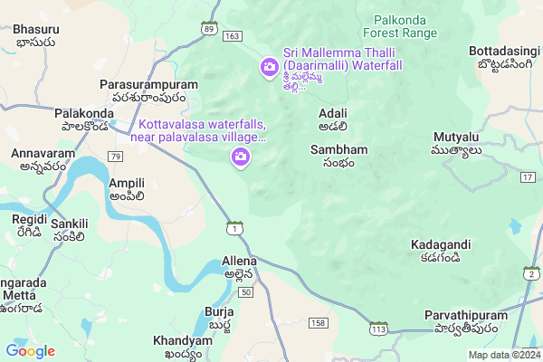
Kotham
Kotham Map
EDIT Map
Add Your House
 ..
..
Current Corona Virus Infected Patients Count in Srikakulam District
| City Name | District Name | Total Covid cases |
|---|---|---|
| Srikakulam District | Srikakulam | 3 |
Locality Name :
Kotham
( కొత్త )
Mandal Name : Seethampeta
District : Srikakulam
State : Andhra Pradesh
Region : Andhra
Language : Telugu
Current Time 10:26 AM
Date: Friday , Apr 25,2025 (IST)
Time zone: IST (UTC+5:30)
Elevation / Altitude: 69 meters. Above Seal level
Telephone Code / Std Code: 08941
Assembly constituency : Pulivendla assembly constituency
Assembly MLA : YEDUGURI SANDINTI JAGAN MOHAN REDDY
Lok Sabha constituency : Kurnool parliamentary constituency
Parliament MP : AYUSHMAN DOCTOR SANJEEV KUMAR
Serpanch Name :
Pin Code : 532443
Post Office Name : Seethampeta
Main Village Name : Kotham
Commodities Prices : Kasinagar Market / Mandi
Kotham Live Weather
Temperature: 38.0 °C
clear sky
Humidity: 31%
Wind : 3.28 mt/sec towards SW
StationName : "PÄ\u0081lkonda"
observed on 10 Mins Back
Temperature: 38.0 °C
clear sky
Humidity: 31%
Wind : 3.28 mt/sec towards SW
StationName : "PÄ\u0081lkonda"
observed on 10 Mins Back
Kotham Weather Forecast for Next 5 days
26-04-2025
24.5°C to 36.4°C
clear sky, few clouds, scattered clouds
24.5°C to 36.4°C
clear sky, few clouds, scattered clouds
27-04-2025
24.0°C to 35.8°C
broken clouds, few clouds, clear sky, scattered clouds
24.0°C to 35.8°C
broken clouds, few clouds, clear sky, scattered clouds
28-04-2025
22.8°C to 35.4°C
clear sky, few clouds, light rain, moderate rain, overcast clouds
22.8°C to 35.4°C
clear sky, few clouds, light rain, moderate rain, overcast clouds
29-04-2025
23.3°C to 34.3°C
overcast clouds, broken clouds, clear sky, few clouds, scattered clouds
23.3°C to 34.3°C
overcast clouds, broken clouds, clear sky, few clouds, scattered clouds
30-04-2025
22.4°C to 34.5°C
scattered clouds, clear sky, light rain, moderate rain, broken clouds
22.4°C to 34.5°C
scattered clouds, clear sky, light rain, moderate rain, broken clouds
Rivers Near Kotham
Garibula Gedda
Bendi Gedda
Garibula Gedda
Bendi Gedda
About Kotham
Correct below Info and add more info about KothamKotham is a small Village/hamlet in Seethampeta Mandal in Srikakulam District of Andhra Pradesh State, India. It comes under Kotham Panchayath. It belongs to Andhra region . It is located 38 KM towards North from District head quarters Srikakulam. 17 KM from Seethampeta. 677 KM from State capital Hyderabad
Kotham Pin code is 532443 and postal head office is Seethampeta .
Allena ( 3 KM ) , Kodisa ( 4 KM ) , Lakkupuram ( 4 KM ) , Donkalapartha ( 5 KM ) , Singannavalasa ( 5 KM ) are the nearby Villages to Kotham. Kotham is surrounded by Palakonda Mandal towards west , Regidi Amadalavalasa Mandal towards west , L.N Peta Mandal towards East , Santhakavati Mandal towards South .
Amadalavalasa , Rajam , Srikakulam , Parvathipuram are the near by Cities to Kotham.
This Place is in the border of the Srikakulam District and Gajapati District. Gajapati District Kasinagar is North towards this place . It is near to the Odisha State Border.
Kotham 2011 Census Details
Kotham Local Language is Telugu. Kotham Village Total population is 243 and number of houses are 56. Female Population is 49.8%. Village literacy rate is 43.2% and the Female Literacy rate is 16.0%.
Population
| Census Parameter | Census Data |
| Total Population | 243 |
| Total No of Houses | 56 |
| Female Population % | 49.8 % ( 121) |
| Total Literacy rate % | 43.2 % ( 105) |
| Female Literacy rate | 16.0 % ( 39) |
| Scheduled Tribes Population % | 100.0 % ( 243) |
| Scheduled Caste Population % | 0.0 % ( 0) |
| Working Population % | 70.8 % |
| Child(0 -6) Population by 2011 | 22 |
| Girl Child(0 -6) Population % by 2011 | 36.4 % ( 8) |
Kotham Census More Deatils.
Politics in Kotham
TDP , YSRC , Yuvajana Sramika Rythu Congress Party , YSRCP , INC are the major political parties in this area.Polling Stations /Booths near Kotham
1)Inagaluru2)Teliki
3)Vempalli
4)Ramireddypalle
5)Musalreddi Gari Palle
HOW TO REACH Kotham
By Road
Amadalavalasa is the Nearest Town to Kotham. Road connectivity is there from Amadalavalasa to Kotham.By Rail
There is no railway station near to Kotham in less than 10 km. How ever there are railway Stations from Near By town Amadalavalasa. are the railway Stations near to Amadalavalasa. You can reach from Amadalavalasa to Kotham by road after .By Bus
Palakonda APSRTC Bus Station , Seethampeta APSRTC Bus Station , Rajam APSRTC Bus Station are the nearby by Bus Stations to Kotham .APSRTC runs Number of busses from major cities to here.Colleges near Kotham
Govt Junior College? Mandasa
Address : Govt Junior College? Mandasa
Apswr Jr College For Girls, Mandasa
Address : Mandasa
A P T W R Jr College (girls), Seethampeta
Address : Seethampeta
Sri Manjusha Jr College, Mandasa
Address : Mandasa
Aptwr Jr College(st)boys Seethampeta
Address : Aptwr Jr College(st)boys Seethampeta
Schools in Kotham
Gpstw Kotham
Address : kotham , seethampeta , srikakulam , Andhra Pradesh . PIN- 532455 , Post - Kotturu
Govt Health Centers near Kotham
1) Kusimi , , Main Road , Near SanthaMalli2) Kusimi , , Kusimi 1st Line , Indian Bank,Kusimi
3) Kodisa , , Main Road Kodisa , Kodisa Panchyathi Building
Sub Villages in Kotham
Hospitals in Kotham,Seethampeta
Sri kotadurga hospital
Palakonda - Kothuru Rd; Palakonda; Andhra Pradesh 532440; India
7.1 KM distance Detail
more ..
Petrol Bunks in Kotham,Seethampeta
Maniratnam Filling Station Indian Oil Petrol Pump
Srikakulam; SH-37; Palkonda Road; Palakonda; Palakonda; Andhra Pradesh 532440; India
7.3 KM distance Detail
HP PETROL PUMP - ANJANEYA AGENCIES
Hpcl Dealers-petrol Bunki; Rajam - Palakonda Rd; Visakhapatnam; Andhra Pradesh 532440; India
8.9 KM distance Detail
more ..
Colleges in Kotham,Seethampeta
GOVERNMENT JUNIOR COLLEGE BURJA
Unnamed Rd;; Neelapuram; Andhra Pradesh 532445; India
5.9 KM distance Detail
Lord Venkateswara Govt. Jr. College (Boys)
Gayatri Nagar; Palakonda; Andhra Pradesh 532440; India
6.7 KM distance Detail
Dr. C.L. Naidu College of Education
Naidu Nagar; Seethampeta Road; Palakonda; Andhra Pradesh 532440; India
7.1 KM distance Detail
more ..
Electronic Shops in Kotham,Seethampeta
Sri Wave Technologies
Near SBI Bank; Main road; Palakonda; Palakonda; Andhra Pradesh 532440; India
8.2 KM distance Detail
Local Parks in Kotham,Seethampeta
NTR Adventure Park
Near State bank; Seethampeta; Andhra Pradesh 532443; India
15.4 KM distance Detail
Governement Offices near Kotham,Seethampeta
MEO Office
Srikakulam; SH-37; Palkonda Road; Palakonda; Palakonda; Andhra Pradesh 532440; India
7.0 KM distance Detail
About Kotham &
History
How to reach Kotham
Tourist Places Near By Kotham
Schools in Kotham
Colleges in Kotham
Temperature & weather of Kotham
places in Kotham
Kotham photos
More Information
How to reach Kotham
Tourist Places Near By Kotham
Schools in Kotham
Colleges in Kotham
Temperature & weather of Kotham
places in Kotham
Kotham photos
More Information
Village Talk
Post News or Events about this Village
Near Cities
Amadalavalasa 24 KM near
Rajam 25 KM near
Srikakulam 37 KM near
Parvathipuram 52 KM near
Amadalavalasa 24 KM near
Rajam 25 KM near
Srikakulam 37 KM near
Parvathipuram 52 KM near
Near By Taluks
Burja 8 KM near
Palakonda 12 KM near
Regidi Amadalavalasa 14 KM near
L.N Peta 14 KM near
Burja 8 KM near
Palakonda 12 KM near
Regidi Amadalavalasa 14 KM near
L.N Peta 14 KM near
Near By Air Ports
Vishakhapatnam Airport 127 KM near
Rajahmundry Airport 299 KM near
Bhubaneswar Airport 313 KM near
Raipur Airport 405 KM near
Vishakhapatnam Airport 127 KM near
Rajahmundry Airport 299 KM near
Bhubaneswar Airport 313 KM near
Raipur Airport 405 KM near
Near By Tourist Places
Vizayanagaram 77 KM near
Araku Valley 116 KM near
Ananthagiri 116 KM near
Simhachalam 124 KM near
Visakhapatnam 132 KM near
Vizayanagaram 77 KM near
Araku Valley 116 KM near
Ananthagiri 116 KM near
Simhachalam 124 KM near
Visakhapatnam 132 KM near
Near By Districts
Srikakulam 36 KM near
Vizianagaram 74 KM near
Gajapati 85 KM near
Rayagada 87 KM near
Srikakulam 36 KM near
Vizianagaram 74 KM near
Gajapati 85 KM near
Rayagada 87 KM near
Near By RailWay Station
Srikakulam Road Rail Way Station 23 KM near
Chipurupalle Rail Way Station 44 KM near
Srikakulam Road Rail Way Station 23 KM near
Chipurupalle Rail Way Station 44 KM near