| Home | City Bus | Maps | Villages | Cities | Rail | Tourist Places | School | College | Pin Codes | Corona Cases Count |
| Distance Calculator Bus Services IFSC Codes Trace Mobile Number Weather Search Place Trace IP Available Cash ATM/Banks Locate Polling Booth Report an Error contact People |
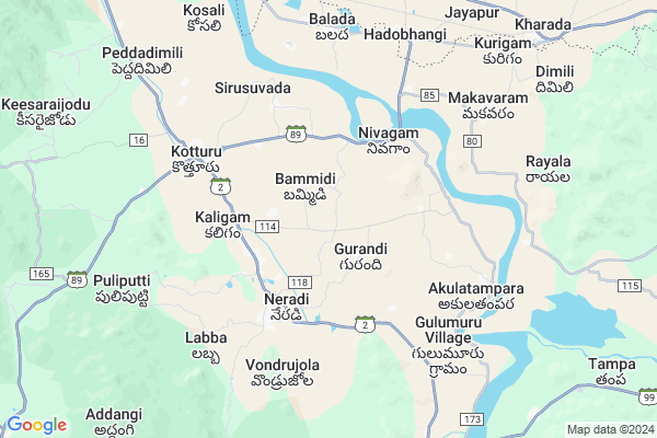
Pathapadu
Pathapadu Map
EDIT Map
Add Your House
 ..
..
Current Corona Virus Infected Patients Count in Srikakulam District
| City Name | District Name | Total Covid cases |
|---|---|---|
| Srikakulam District | Srikakulam | 3 |
Locality Name :
Pathapadu
( పాతపాడు )
Mandal Name : Kotturu
District : Srikakulam
State : Andhra Pradesh
Region : Andhra
Language : Telugu
Current Time 01:37 PM
Date: Monday , Apr 28,2025 (IST)
Time zone: IST (UTC+5:30)
Elevation / Altitude: 69 meters. Above Seal level
Telephone Code / Std Code: 08946
Assembly constituency : Udayagiri assembly constituency
Assembly MLA : REDDY SHANTHI
Lok Sabha constituency : Anantapur parliamentary constituency
Parliament MP : KINJARAPU RAM MOHAN NAIDU
Serpanch Name :
Pin Code : 532457
Post Office Name : Nivagam
Main Village Name : Pathapadu
Commodities Prices : Kasinagar Market / Mandi
Rivers Near Pathapadu
Bendi Gedda
Mahendra Tanaya River :महेंद्र तनया नदी :ମହେନ୍ଦ୍ର ତନୟା ନଦୀ :ఎకువూరు
Bendi Gedda
Mahendra Tanaya River :महेंद्र तनया नदी :ମହେନ୍ଦ୍ର ତନୟା ନଦୀ :ఎకువూరు
About Pathapadu
Correct below Info and add more info about PathapaduPathapadu is a small Village/hamlet in Kotturu Mandal in Srikakulam District of Andhra Pradesh State, India. It comes under Pathapadu Panchayath. It belongs to Andhra region . It is located 60 KM towards North from District head quarters Srikakulam. 0 KM from Kotturu. 695 KM from State capital Hyderabad
Pathapadu Pin code is 532457 and postal head office is Nivagam .
Neradi ( 3 KM ) , Madanapuram ( 3 KM ) , Nivagam ( 3 KM ) , Vasapa ( 3 KM ) , Gunabadhra ( 3 KM ) are the nearby Villages to Pathapadu. Pathapadu is surrounded by Kasinagar Mandal towards North , Hiramandalam Mandal towards South , Pathapatnam Mandal towards East , L.N Peta Mandal towards South .
Parlakhemundi , Gunupur , Amadalavalasa , Rajam are the near by Cities to Pathapadu.
This Place is in the border of the Srikakulam District and Gajapati District. Gajapati District Kasinagar is North towards this place . It is near to the Odisha State Border.
Pathapadu 2011 Census Details
Pathapadu Local Language is Telugu. Pathapadu Village Total population is 461 and number of houses are 132. Female Population is 50.3%. Village literacy rate is 53.1% and the Female Literacy rate is 21.7%.
Population
| Census Parameter | Census Data |
| Total Population | 461 |
| Total No of Houses | 132 |
| Female Population % | 50.3 % ( 232) |
| Total Literacy rate % | 53.1 % ( 245) |
| Female Literacy rate | 21.7 % ( 100) |
| Scheduled Tribes Population % | 0.0 % ( 0) |
| Scheduled Caste Population % | 31.9 % ( 147) |
| Working Population % | 52.3 % |
| Child(0 -6) Population by 2011 | 67 |
| Girl Child(0 -6) Population % by 2011 | 59.7 % ( 40) |
Pathapadu Census More Deatils.
Politics in Pathapadu
TD , TDP , YSRC , Yuvajana Sramika Rythu Congress Party , YSRCP , INC are the major political parties in this area.Polling Stations /Booths near Pathapadu
1)Jaladanki2)Jammalapalem
3)Kummara Kondur
4)L.r.agraharam
5)Veligandla
HOW TO REACH Pathapadu
By Road
Palasa Kasibugga is the Nearest Town to Pathapadu. Palasa Kasibugga is 82 km from Pathapadu. Road connectivity is there from Palasa Kasibugga to Pathapadu.By Rail
Hadobhangi Halt Rail Way Station , Sitapuram Halt Rail Way Station are the very nearby railway stations to Pathapadu. Also you can consider railway Stations from Near By town Palasa Kasibugga. Kotabommali Rail Way Station , Dindu Gopala Puram Halt Rail Way Station are the railway Stations near to Palasa Kasibugga. You can reach from Palasa Kasibugga to Pathapadu by road after .By Bus
Kotturu APSRTC Bus Station , Seethampeta APSRTC Bus Station , Patapatnam(Boarder) APSRTC Bus Station are the nearby by Bus Stations to Pathapadu .APSRTC runs Number of busses from major cities to here.Colleges near Pathapadu
Sri Venkatasai Jr College? Kotturu
Address : Sri Venkatasai Jr College? Kotturu
Sri Venkata Sai Degree College
Address : Karlemma (v), Kottur (m), Srikakulam Dist. - 5324
Schools in Pathapadu
M.p.primary School
Address : pathapadu , kotturu , srikakulam , Andhra Pradesh . PIN- 532457 , Post - Nivagam
Govt Health Centers near Pathapadu
1) Bammidi , , Gudivedhi , Near AWC2) Battilli , , Main Road , Devangula Veedhi
3) Battilli , , Main Road , Near Police Station
Sub Villages in Pathapadu
Hospitals in Pathapadu,Kotturu
PRIMARY HEALTH CENTER HIRAMANDALAM
SUBHLAY HOSPITAL; Bommika; Andhra Pradesh 532459; India
10.1 KM distance Detail
more ..
Petrol Bunks in Pathapadu,Kotturu
SRI SEETHARAMA FILLING STATION BPCL KOTTURU
Alikam – Battili Rd; Kotturu; Andhra Pradesh 532455; India
5.0 KM distance Detail
SRI DAMAYANTHI SANTHAYYA FILLING STATION
Srikakulam; Andhra Pradesh 532459; India
13.6 KM distance Detail
more ..
Colleges in Pathapadu,Kotturu
Sri Rameswari Degree; Sri Rama Junior Colleges
D.No.12-140; Korada Colony; Hiramandalam; Srikakulam; Andhra Pradesh 532459; India
11.8 KM distance Detail
more ..
Electronic Shops in Pathapadu,Kotturu
mobile Repairing And Welding Point
Haddubhangi - Nivagam Rd; Nivagam; Andhra Pradesh 532457; India
4.5 KM distance Detail
Super Markets in Pathapadu,Kotturu
Sri Krishna General Stores And Padmalatha Nilayam
Neradi; Andhra Pradesh 532455; India
3.6 KM distance Detail
Sri Sai Manikanta General Store
Alikam – Battili Rd; Peddaveedhi; Parapuram; Andhra Pradesh 532455; India
4.3 KM distance Detail
Local Parks in Pathapadu,Kotturu
NTR Adventure Park
Near State bank; Seethampeta; Andhra Pradesh 532443; India
14.9 KM distance Detail
Governement Offices near Pathapadu,Kotturu
గొట్టాబెరేజి డివిజన్ కార్యాలయం;Gotta barriage Office
Vamsadhara River; Hiramandalam- Nautala Rd; Subhalai Colony; Gotta; Andhra Pradesh 532459; India
10.9 KM distance Detail
Registrar Office
Alikam – Battili Rd; Hiramandalam; Andhra Pradesh 532459; India
12.2 KM distance Detail
About Pathapadu &
History
How to reach Pathapadu
Tourist Places Near By Pathapadu
Schools in Pathapadu
Colleges in Pathapadu
Temperature & weather of Pathapadu
places in Pathapadu
Pathapadu photos
More Information
How to reach Pathapadu
Tourist Places Near By Pathapadu
Schools in Pathapadu
Colleges in Pathapadu
Temperature & weather of Pathapadu
places in Pathapadu
Pathapadu photos
More Information
Village Talk
Post News or Events about this Village
Near Cities
Parlakhemundi 33 KM near
Gunupur 42 KM near
Amadalavalasa 45 KM near
Rajam 49 KM near
Parlakhemundi 33 KM near
Gunupur 42 KM near
Amadalavalasa 45 KM near
Rajam 49 KM near
Near By Taluks
Kotturu 0 KM near
Kasinagar 9 KM near
Hiramandalam 12 KM near
Pathapatnam 18 KM near
Kotturu 0 KM near
Kasinagar 9 KM near
Hiramandalam 12 KM near
Pathapatnam 18 KM near
Near By Air Ports
Vishakhapatnam Airport 152 KM near
Bhubaneswar Airport 290 KM near
Rajahmundry Airport 322 KM near
Raipur Airport 395 KM near
Vishakhapatnam Airport 152 KM near
Bhubaneswar Airport 290 KM near
Rajahmundry Airport 322 KM near
Raipur Airport 395 KM near
Near By Tourist Places
Vizayanagaram 102 KM near
Berhampur 123 KM near
Gopalpur 131 KM near
Araku Valley 135 KM near
Ananthagiri 135 KM near
Vizayanagaram 102 KM near
Berhampur 123 KM near
Gopalpur 131 KM near
Araku Valley 135 KM near
Ananthagiri 135 KM near
Near By Districts
Srikakulam 58 KM near
Gajapati 59 KM near
Rayagada 78 KM near
Vizianagaram 99 KM near
Srikakulam 58 KM near
Gajapati 59 KM near
Rayagada 78 KM near
Vizianagaram 99 KM near
Near By RailWay Station
Hadobhangi Halt Rail Way Station 8.5 KM near
Srikakulam Road Rail Way Station 43 KM near
Naupada Junction Rail Way Station 48 KM near
Hadobhangi Halt Rail Way Station 8.5 KM near
Srikakulam Road Rail Way Station 43 KM near
Naupada Junction Rail Way Station 48 KM near