| Home | City Bus | Maps | Villages | Cities | Rail | Tourist Places | School | College | Pin Codes | Corona Cases Count |
| Distance Calculator Bus Services IFSC Codes Trace Mobile Number Weather Search Place Trace IP Available Cash ATM/Banks Locate Polling Booth Report an Error contact People |
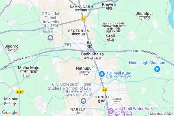
Sector 3 Map
EDIT Map
Add Your House
 ..
..
Current Corona Virus Infected Patients Count in Sonipat District
| City Name | District Name | Total Covid cases |
|---|---|---|
| Sonipat District | Sonipat | 19 |
| Sonepat | Sonipat | 1 |
Village Name :
Sector 3
( सेक्टर ३ )
City Name : Rai
District : Sonipat
State : Haryana
Division : Rohtak
Language : Hindi and Punjabi,urdu
Current Time 05:27 PM
Date: Tuesday , Apr 29,2025 (IST)
Time zone: IST (UTC+5:30)
Elevation / Altitude: 223 meters. Above Seal level
Telephone Code / Std Code: 0180
Ward : Ward
Assembly constituency : Rai assembly constituency
Assembly MLA : Mohan Lal Badoli
Lok Sabha constituency : Sonipat parliamentary constituency
Parliament MP : RAMESH CHANDER KAUSHIK
Pin Code : 131001
Post Office Name : Sonipat
Commodities Prices : Sonepat Market / Mandi
Sector 3 Live Weather
Temperature: 38.8 °C
clear sky
Humidity: 17%
Wind : 2.25 mt/sec towards SW
StationName : "Alīpur"
observed on 8 Mins Back
Temperature: 38.8 °C
clear sky
Humidity: 17%
Wind : 2.25 mt/sec towards SW
StationName : "Alīpur"
observed on 8 Mins Back
Sector 3 Weather Forecast for Next 5 days
30-04-2025
31.3°C to 38.8°C
clear sky
31.3°C to 38.8°C
clear sky
01-05-2025
29.9°C to 41.4°C
clear sky, few clouds, scattered clouds, overcast clouds
29.9°C to 41.4°C
clear sky, few clouds, scattered clouds, overcast clouds
02-05-2025
29.5°C to 42.3°C
overcast clouds, scattered clouds, few clouds, clear sky
29.5°C to 42.3°C
overcast clouds, scattered clouds, few clouds, clear sky
03-05-2025
27.7°C to 41.1°C
broken clouds, clear sky, light rain, overcast clouds
27.7°C to 41.1°C
broken clouds, clear sky, light rain, overcast clouds
04-05-2025
26.6°C to 40.9°C
overcast clouds, light rain, broken clouds
26.6°C to 40.9°C
overcast clouds, light rain, broken clouds
National Highways Reachable To Sector 3
Nationa High Way :NH248BB
Nationa High Way :NH44
Nationa High Way :NH248BB
Nationa High Way :NH44
About Sector 3
Correct below Info and add more info about Sector 3Sector 3 is a Locality in Rai City in Haryana State, India. It is belongs to Rohtak Division .
Sector 3 Pin code is 131001 and postal head office is Sonipat .
Sonipat , Loni , Ganaur , Bahadurgarh are the nearby Cities to Rai.
Demographics of Sector 3
Hindi is the Local Language here.Politics in Sector 3
Bharatiya Janata Party , BJP , INC , INLD are the major political parties in this area.Polling Stations /Booths near Sector 3
1)Govt. Primary School2)Govt High School South Wing
3)Govt. High School West Wing
4)Govt. Primary School South Wing
5)Govt. Primary School North Wing
HOW TO REACH Sector 3
By Rail
Rathdhana Rail Way Station , Narela Rail Way Station are the very nearby railway station to Sector 3.Govt Health Centers near Sector 3
1) Tara Nagar , , ,2) PHC Badh khalsa , , ,
3) Badh khalsa , , ,
Sub Localities in Sector 3
Petrol Bunks in Sector 3,Rai
Indian Oil Petrol Pump
National Highway 1; Rajiv Gandhi Education City; Rai; Haryana 131029; India
1.7 KM distance Detail
GARV AUTO CARE
33 KM STONE; G.T.ROAD; (Opp. TDI MALL); Kundli-131028; Sonipat; Haryana 131028; India
3.1 KM distance Detail
more ..
Colleges in Sector 3,Rai
District Institute Of Education And Technology;BEeswanmeel
GT Road (NH-1); Sector 37; Sonipat; Haryana 131029; India
2.0 KM distance Detail
Bharath Institute of Technology
Sonepat-Gohana National Highway; Near Mohana Police Station; Sonipat; Haryana 131025; India
2.6 KM distance Detail
more ..
Schools in Sector 3,Rai
Brahmi Janta Senior Secondry School
Sector 46; Sonipat; Haryana 131029; India
0.7 KM distance Detail
Electronic Shops in Sector 3,Rai
GN Fabrication
Main Road pithopura vill.opp- NH1 Ansal Highway plaza; Rai; Haryana 131029; India
0.3 KM distance Detail
Jangra Electrical;Mechanical & Electronic Workshop
Nathupur Road; Sector 46; Sonipat; Haryana 131028; India
1.8 KM distance Detail
Super Markets in Sector 3,Rai
Rackly Craft Private Limited
Plot No. 2167; Phase -2; HSIIDC Rai Industrial Estate; Sonipat; Haryana 131029; India
2.8 KM distance Detail
Police Stations near Sector 3,Rai
Rai Police Station Sonipat
Grand Trunk Road; NH-1; Sector 37; Sonipat; Haryana 131029; India
3.9 KM distance Detail
Governement Offices near Sector 3,Rai
Nilesh Carrying Corporation
Flat No.-EWS-B-305 & 307;3rd Floor;Near C Block;; Kingsbury;HUDA Road;TDI City;; Kundli; Sonipat; Haryana 131028; India
2.6 KM distance Detail
About Sector 3 &
History
How to reach Sector 3
Tourist Places Near By Sector 3
Schools in Sector 3
Colleges in Sector 3
Temperature & weather of Sector 3
places in Sector 3
Sector 3 photos
More Information
How to reach Sector 3
Tourist Places Near By Sector 3
Schools in Sector 3
Colleges in Sector 3
Temperature & weather of Sector 3
places in Sector 3
Sector 3 photos
More Information
Locality Talk
Post News or Events about this Locality
Near Cities
Sonipat 12 KM near
Loni 27 KM near
Ganaur 28 KM near
Bahadurgarh 34 KM near
Sonipat 12 KM near
Loni 27 KM near
Ganaur 28 KM near
Bahadurgarh 34 KM near
Near By Taluks
Rai 0 KM near
Sonipat 13 KM near
Kharkhoda 22 KM near
Baghpat 22 KM near
Rai 0 KM near
Sonipat 13 KM near
Kharkhoda 22 KM near
Baghpat 22 KM near
Near By Air Ports
Indira Gandhi International Airport 44 KM near
Muzaffarnagar Airport 89 KM near
Dehra Dun Airport 202 KM near
Chandigarh Airport 222 KM near
Indira Gandhi International Airport 44 KM near
Muzaffarnagar Airport 89 KM near
Dehra Dun Airport 202 KM near
Chandigarh Airport 222 KM near
Near By Tourist Places
Delhi 36 KM near
Noida 48 KM near
Gurgaon 55 KM near
Surajkund 58 KM near
panipat 61 KM near
Delhi 36 KM near
Noida 48 KM near
Gurgaon 55 KM near
Surajkund 58 KM near
panipat 61 KM near
Near By Districts
Sonipat 13 KM near
Baghpat 14 KM near
North West Delhi 16 KM near
North Delhi 24 KM near
Sonipat 13 KM near
Baghpat 14 KM near
North West Delhi 16 KM near
North Delhi 24 KM near
Near By RailWay Station
Rathdhana Rail Way Station 4.7 KM near
Narela Rail Way Station 8.1 KM near
Harsana Kalan Rail Way Station 8.3 KM near
Sonipat Junction Rail Way Station 13 KM near
Rathdhana Rail Way Station 4.7 KM near
Narela Rail Way Station 8.1 KM near
Harsana Kalan Rail Way Station 8.3 KM near
Sonipat Junction Rail Way Station 13 KM near