| Home | City Bus | Maps | Villages | Cities | Rail | Tourist Places | School | College | Pin Codes | Corona Cases Count |
| Distance Calculator Bus Services IFSC Codes Trace Mobile Number Weather Search Place Trace IP Available Cash ATM/Banks Locate Polling Booth Report an Error contact People |
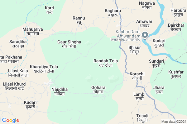
Barah Pan
Barah Pan Map
EDIT Map
Add Your House
 ..
..
Current Corona Virus Infected Patients Count in Sonbhadra District
| City Name | District Name | Total Covid cases |
|---|
Locality Name :
Barah Pan
( बारह पैन )
Block Name : Myorpur
District : Sonbhadra
State : Uttar Pradesh
Division : Mirzapur
Language : Hindi and Urdu
Current Time 07:27 PM
Date: Tuesday , Apr 29,2025 (IST)
Time zone: IST (UTC+5:30)
Elevation / Altitude: 287 meters. Above Seal level
Telephone Code / Std Code: 05447
Assembly constituency : Duddhi assembly constituency
Assembly MLA : Ramdular
Lok Sabha constituency : Robertsganj parliamentary constituency
Parliament MP : PAKAURI LAL KOL
Serpanch Name :
Pin Code : 231212
Post Office Name : Amwar
Main Village Name : Barah Pan
Commodities Prices : Dudhi Market / Mandi
Barah Pan Live Weather
Temperature: 28.1 °C
broken clouds
Humidity: 35%
Wind : 7.88 mt/sec towards SW
StationName : "DÅ«dhi"
observed on 2 Mins Back
Temperature: 28.1 °C
broken clouds
Humidity: 35%
Wind : 7.88 mt/sec towards SW
StationName : "DÅ«dhi"
observed on 2 Mins Back
Barah Pan Weather Forecast for Next 5 days
30-04-2025
24.0°C to 27.5°C
light rain, broken clouds, few clouds
24.0°C to 27.5°C
light rain, broken clouds, few clouds
01-05-2025
23.0°C to 39.8°C
clear sky, light rain, scattered clouds, few clouds
23.0°C to 39.8°C
clear sky, light rain, scattered clouds, few clouds
02-05-2025
24.7°C to 40.4°C
clear sky, scattered clouds, few clouds
24.7°C to 40.4°C
clear sky, scattered clouds, few clouds
03-05-2025
23.4°C to 41.0°C
clear sky, broken clouds, light rain, overcast clouds, scattered clouds
23.4°C to 41.0°C
clear sky, broken clouds, light rain, overcast clouds, scattered clouds
04-05-2025
24.5°C to 40.5°C
scattered clouds, clear sky, few clouds, light rain, broken clouds
24.5°C to 40.5°C
scattered clouds, clear sky, few clouds, light rain, broken clouds
Rivers Near Barah Pan
Rihand
Durbul Nala
Rihand
Durbul Nala
About Barah Pan
Correct below Info and add more info about Barah PanBarah Pan is a small Village/hamlet in Myorpur Block in Sonbhadra District of Uttar Pradesh State, India. It comes under Barah Pan Panchayath. It belongs to Mirzapur Division . It is located 77 KM towards South from District head quarters Robertsganj. 25 KM from Myorpur. 446 KM from State capital Lucknow
Barah Pan Pin code is 231212 and postal head office is Amwar .
Rannu ( 5 KM ) , Bhisur ( 5 KM ) , Korachi ( 6 KM ) , Bagharu ( 6 KM ) , Amawar ( 8 KM ) are the nearby Villages to Barah Pan. Barah Pan is surrounded by Babhani Block towards South , Myorpur Block towards west , Dhurki Block towards East , Ramchandrapur Block towards South .
Renukoot , Kota , Obra , Garhwa are the near by Cities to Barah Pan.
Barah Pan 2011 Census Details
Barah Pan Local Language is Hindi. Barah Pan Village Total population is 640 and number of houses are 136. Female Population is 46.1%. Village literacy rate is 32.0% and the Female Literacy rate is 8.3%.
Population
| Census Parameter | Census Data |
| Total Population | 640 |
| Total No of Houses | 136 |
| Female Population % | 46.1 % ( 295) |
| Total Literacy rate % | 32.0 % ( 205) |
| Female Literacy rate | 8.3 % ( 53) |
| Scheduled Tribes Population % | 66.1 % ( 423) |
| Scheduled Caste Population % | 30.8 % ( 197) |
| Working Population % | 39.8 % |
| Child(0 -6) Population by 2011 | 149 |
| Girl Child(0 -6) Population % by 2011 | 46.3 % ( 69) |
Barah Pan Census More Deatils.
Politics in Barah Pan
BJP , SP , BSP are the major political parties in this area.Polling Stations /Booths near Barah Pan
1)Primary School Ghivhi (north Part)2)Primary School Salaiyadih (west Part)
3)Primary School Bhawar First
4)Primary School Harnakchhar (south Part)
5)Primary School Konga Room No -2
HOW TO REACH Barah Pan
By Rail
There is no railway station near to Barah Pan in less than 10 km.Colleges near Barah Pan
Awadhut Bhagwan Ram Mahavidyalaya
Address :
Sonebarsha Intermediet College
Address :
Schools near Barah Pan
Bhavans K D Kanoriya V Mandir
Address : runukoot , myorpur , sonbhadra , Uttar Pradesh . PIN- 231217 , Post - Renukoot
G I C Shaktinagar
Address : shakti nagar , myorpur , sonbhadra , Uttar Pradesh . PIN- 231222 , Post - Shaktinagar Thermal Power Stat
R.i.c.anpra
Address : anpra , myorpur , sonbhadra , Uttar Pradesh . PIN- 232225
St.fransis S.anpra
Address : anpra , myorpur , sonbhadra , Uttar Pradesh . PIN- 231225 , Post - Anpara Tps
Govt Health Centers near Barah Pan
1) New PHC Amwar , , ,2) Dhurpa , , ,
3) Harpura , , ,
Sub Villages in Barah Pan
Schools in Barah Pan,Myorpur
Electronic Shops in Barah Pan,Myorpur
Super Markets in Barah Pan,Myorpur
Local Parks in Barah Pan,Myorpur
Police Stations near Barah Pan,Myorpur
Governement Offices near Barah Pan,Myorpur
About Barah Pan &
History
How to reach Barah Pan
Tourist Places Near By Barah Pan
Schools in Barah Pan
Colleges in Barah Pan
Temperature & weather of Barah Pan
places in Barah Pan
Barah Pan photos
More Information
How to reach Barah Pan
Tourist Places Near By Barah Pan
Schools in Barah Pan
Colleges in Barah Pan
Temperature & weather of Barah Pan
places in Barah Pan
Barah Pan photos
More Information
Village Talk
Post News or Events about this Village
Near Cities
Renukoot 26 KM near
Kota 45 KM near
Obra 49 KM near
Garhwa 64 KM near
Renukoot 26 KM near
Kota 45 KM near
Obra 49 KM near
Garhwa 64 KM near
Near By Taluks
Dudhi 15 KM near
Babhani 21 KM near
Myorpur 25 KM near
Dhurki 25 KM near
Dudhi 15 KM near
Babhani 21 KM near
Myorpur 25 KM near
Dhurki 25 KM near
Near By Air Ports
Varanasi Airport 173 KM near
Gaya Airport 209 KM near
Bamrauli Airport 238 KM near
Ranchi Airport 256 KM near
Varanasi Airport 173 KM near
Gaya Airport 209 KM near
Bamrauli Airport 238 KM near
Ranchi Airport 256 KM near
Near By Tourist Places
Sarguja 94 KM near
Rohtasgarh Fort 100 KM near
Betla National Park 114 KM near
Palamu 121 KM near
Ambikapur 122 KM near
Sarguja 94 KM near
Rohtasgarh Fort 100 KM near
Betla National Park 114 KM near
Palamu 121 KM near
Ambikapur 122 KM near
Near By Districts
Singrauli 64 KM near
Garhwa 65 KM near
Sonbhadra 75 KM near
Palamu 94 KM near
Singrauli 64 KM near
Garhwa 65 KM near
Sonbhadra 75 KM near
Palamu 94 KM near
Near By RailWay Station
Duddhinagar Rail Way Station 13 KM near
Renukut Rail Way Station 26 KM near
Duddhinagar Rail Way Station 13 KM near
Renukut Rail Way Station 26 KM near