| Home | City Bus | Maps | Villages | Cities | Rail | Tourist Places | School | College | Pin Codes | Corona Cases Count |
| Distance Calculator Bus Services IFSC Codes Trace Mobile Number Weather Search Place Trace IP Available Cash ATM/Banks Locate Polling Booth Report an Error contact People |
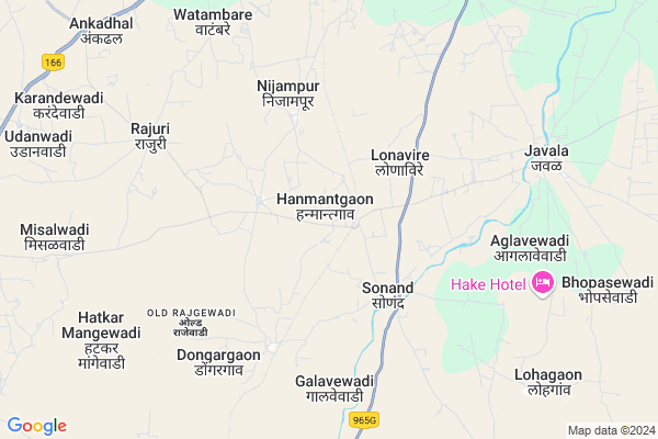
Hanmantgaon
Hanmantgaon Map
EDIT Map
Add Your House
 ..
..
Current Corona Virus Infected Patients Count in Solapur District
| City Name | District Name | Total Covid cases |
|---|---|---|
| Solapur District | Solapur | 26 |
Locality Name :
Hanmantgaon
( हनुमंतगांव )
Taluka Name : Sangola
District : Solapur
State : Maharashtra
Region : Desh or Paschim Maharashtra
Division : Pune
Language : Marathi and Kannada, Telugu, Urdu
Current Time 03:03 PM
Date: Tuesday , Apr 29,2025 (IST)
Time zone: IST (UTC+5:30)
Elevation / Altitude: 505 meters. Above Seal level
Telephone Code / Std Code: 02187
Assembly constituency : Sangole assembly constituency
Assembly MLA : Adv. Shahajibapu Rajaram Patil
Lok Sabha constituency : Madha parliamentary constituency
Parliament MP : Ranjeetsinha Hindurao Naik- Nimbalkar
Serpanch Name :
Pin Code : 413309
Post Office Name : Jawala (Solapur)
Main Village Name : Hanmantgaon
Commodities Prices : Sangola Market / Mandi
Hanmantgaon Live Weather
Temperature: 38.3 °C
clear sky
Humidity: 15%
Wind : 3.06 mt/sec towards N
StationName : "SÄ\u0081ngola"
observed on 1 Hours Back
Temperature: 38.3 °C
clear sky
Humidity: 15%
Wind : 3.06 mt/sec towards N
StationName : "SÄ\u0081ngola"
observed on 1 Hours Back
Hanmantgaon Weather Forecast for Next 5 days
30-04-2025
31.0°C to 38.7°C
clear sky
31.0°C to 38.7°C
clear sky
01-05-2025
28.5°C to 40.3°C
clear sky, few clouds, broken clouds, scattered clouds
28.5°C to 40.3°C
clear sky, few clouds, broken clouds, scattered clouds
02-05-2025
26.4°C to 40.3°C
few clouds, clear sky, broken clouds
26.4°C to 40.3°C
few clouds, clear sky, broken clouds
03-05-2025
28.4°C to 40.0°C
clear sky, scattered clouds
28.4°C to 40.0°C
clear sky, scattered clouds
04-05-2025
28.1°C to 39.3°C
few clouds, broken clouds, scattered clouds, clear sky
28.1°C to 39.3°C
few clouds, broken clouds, scattered clouds, clear sky
National Highways Reachable To Hanmantgaon
Nationa High Way :NH160
Nationa High Way :NH160
Rivers Near Hanmantgaon
Bhima :भीमा :ಭೀಮಾ :भीमा
Bhima :भीमा :ಭೀಮಾ :भीमा
Bhima :भीमा :ಭೀಮಾ :भीमा
Bhima :भीमा :ಭೀಮಾ :भीमा
About Hanmantgaon
Correct below Info and add more info about HanmantgaonHanmantgaon is a small Village/hamlet in Sangola Taluka in Solapur District of Maharashtra State, India. It comes under Hanmantgaon Panchayath. It belongs to Desh or Paschim Maharashtra region . It belongs to Pune Division . It is located 105 KM towards west from District head quarters Solapur. 8 KM from Sangola. 360 KM from State capital Mumbai
Hanmantgaon Pin code is 413309 and postal head office is Jawala (Solapur).
Nijampur ( 4 KM ) , Dongargaon ( 6 KM ) , Rajuri ( 7 KM ) , Burangewadi ( 7 KM ) , Aglavewadi ( 8 KM ) are the nearby Villages to Hanmantgaon. Hanmantgaon is surrounded by Jath Taluka towards South , Atpadi Taluka towards west , Mangalvedhe Taluka towards East , Kavathemahankal Taluka towards South .
Sangole , Mangalvedhe , Pandharpur , Mhaswad are the near by Cities to Hanmantgaon.
Hanmantgaon 2011 Census Details
Hanmantgaon Local Language is Marathi. Hanmantgaon Village Total population is 1187 and number of houses are 252. Female Population is 49.7%. Village literacy rate is 51.6% and the Female Literacy rate is 19.1%.
Population
| Census Parameter | Census Data |
| Total Population | 1187 |
| Total No of Houses | 252 |
| Female Population % | 49.7 % ( 590) |
| Total Literacy rate % | 51.6 % ( 612) |
| Female Literacy rate | 19.1 % ( 227) |
| Scheduled Tribes Population % | 0.0 % ( 0) |
| Scheduled Caste Population % | 4.7 % ( 56) |
| Working Population % | 60.6 % |
| Child(0 -6) Population by 2011 | 170 |
| Girl Child(0 -6) Population % by 2011 | 50.0 % ( 85) |
Hanmantgaon Census More Deatils.
Politics in Hanmantgaon
Bharatiya Janata Party , PWPI , BJP , NCP , SWP , SHS , INC are the major political parties in this area.Polling Stations /Booths near Hanmantgaon
1)Zillha Parishad Primary School H.mangewadi East Side Room No 12)Zillha Parishad Primary School Mahud Bk (dhalewadi) Room No1
3)Vidyamandir Prashala Nazara Middle Room No-01
4)Zillha Parishad Primary School Wasud Room No 1
5)Zillha Parishad Primary School Watambare New Bilding South Side Room No 02
HOW TO REACH Hanmantgaon
By Rail
Javla Rail Way Station , Mhasoba Dongargaon Rail Way Station are the very nearby railway stations to Hanmantgaon. Mhasoba Dongargaon Rail Way Station (near to Sangole) , Jath Road Rail Way Station (near to Sangole) are the Rail way stations reachable from near by towns.By Road
Sangole are the nearby by towns to Hanmantgaon having road connectivity to HanmantgaonColleges near Hanmantgaon
Imperial Institute Of Hotel Management,sangola
Address :
Sonand High School Sonand&jr.college ,sonand,
Address :
Late Pandurang Aaba Bhambure Junior College Alegaon
Address :
Karmveer Bhaurao Patil College Of Art's Mahud.bk
Address :
Manegaon Vidyalay Manegaon
Address :
Schools in Hanmantgaon
Zpps Hanmantgaon
Address : hanmantgaon , sangola , solapur , Maharashtra . PIN- 413309 , Post - Jawala (Solapur)
Govt Health Centers near Hanmantgaon
1) Manegaon , SubCentre Manegaon , ,2) Sonand , SubCentre Sonand , ,
3) Dongargaon , SubCentre Dongargaon , ,
Sub Villages in Hanmantgaon
Hospitals in Hanmantgaon,Sangola
Shashikala Hospital Sonand
Jath-Sangola Rd; Sonand; Maharashtra 413309; India
3.8 KM distance Detail
more ..
Petrol Bunks in Hanmantgaon,Sangola
Baliraja IOCL Petrol Pump ( Mhamane)
Kadlas Jawle road; Sangola; Maharashtra; India
9.9 KM distance Detail
Mhamane (Baliraja KSK) Indian Oil Petrol Pump
kadlas Jawla road; Sangola; Maharashtra; India
10.1 KM distance Detail
more ..
Colleges in Hanmantgaon,Sangola
Gurudiksha Computers & Maha E Seva Kendra
Sangli - Javla - Nandeshwar Rd; Javala; Maharashtra 413309; India
8.6 KM distance Detail
Sinhgad Institute of Business Management
Godasewadi; Maharashtra 413307; India
13.8 KM distance Detail
more ..
Local Parks in Hanmantgaon,Sangola
Matoshri Ramabai Ambedkar Udyan
SH71; Bhim Nagar; Kole; Sangola; Maharashtra 413307; India
19.2 KM distance Detail
About Hanmantgaon &
History
How to reach Hanmantgaon
Tourist Places Near By Hanmantgaon
Schools in Hanmantgaon
Colleges in Hanmantgaon
Temperature & weather of Hanmantgaon
places in Hanmantgaon
Hanmantgaon photos
More Information
How to reach Hanmantgaon
Tourist Places Near By Hanmantgaon
Schools in Hanmantgaon
Colleges in Hanmantgaon
Temperature & weather of Hanmantgaon
places in Hanmantgaon
Hanmantgaon photos
More Information
Village Talk
Post News or Events about this Village
Near Cities
Sangole 7 KM near
Mangalvedhe 44 KM near
Pandharpur 51 KM near
Mhaswad 59 KM near
Sangole 7 KM near
Mangalvedhe 44 KM near
Pandharpur 51 KM near
Mhaswad 59 KM near
Near By Taluks
Sangola 8 KM near
Jath 30 KM near
Atpadi 35 KM near
Mangalvedhe 40 KM near
Sangola 8 KM near
Jath 30 KM near
Atpadi 35 KM near
Mangalvedhe 40 KM near
Near By Air Ports
Sholapur Airport 101 KM near
Kolhapur Airport 125 KM near
Sambre Airport 190 KM near
Latur Airport 208 KM near
Sholapur Airport 101 KM near
Kolhapur Airport 125 KM near
Sambre Airport 190 KM near
Latur Airport 208 KM near
Near By Tourist Places
Pandharpur 51 KM near
Bijapur 89 KM near
Solapur 102 KM near
Kolhapur 131 KM near
Panhala 136 KM near
Pandharpur 51 KM near
Bijapur 89 KM near
Solapur 102 KM near
Kolhapur 131 KM near
Panhala 136 KM near
Near By Districts
Sangli 87 KM near
Bijapur District 90 KM near
Solapur 101 KM near
Kolhapur 130 KM near
Sangli 87 KM near
Bijapur District 90 KM near
Solapur 101 KM near
Kolhapur 130 KM near
Near By RailWay Station
Javla Rail Way Station 1.9 KM near
Mhasoba Dongargaon Rail Way Station 3.1 KM near
Sangola Rail Way Station 17 KM near
Pandharpur Rail Way Station 50 KM near
Javla Rail Way Station 1.9 KM near
Mhasoba Dongargaon Rail Way Station 3.1 KM near
Sangola Rail Way Station 17 KM near
Pandharpur Rail Way Station 50 KM near