| Home | City Bus | Maps | Villages | Cities | Rail | Tourist Places | School | College | Pin Codes | Corona Cases Count |
| Distance Calculator Bus Services IFSC Codes Trace Mobile Number Weather Search Place Trace IP Available Cash ATM/Banks Locate Polling Booth Report an Error contact People |
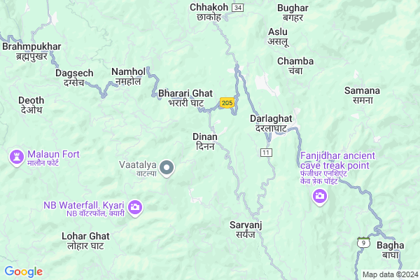
Kund
Kund Map
EDIT Map
Add Your House
 ..
..
Current Corona Virus Infected Patients Count in Solan District
| City Name | District Name | Total Covid cases |
|---|---|---|
| Solan District | Solan | 9 |
Locality Name :
Kund
( कुंड )
Tehsil Name : Kunihar
District : Solan
State : Himachal Pradesh
Language : Hindi
Current Time 01:52 PM
Date: Tuesday , Apr 29,2025 (IST)
Time zone: IST (UTC+5:30)
Elevation / Altitude: 1978 meters. Above Seal level
Telephone Code / Std Code: 01796
Assembly constituency : Arki assembly constituency
Assembly MLA : Sanjay
Lok Sabha constituency : Shimla parliamentary constituency
Parliament MP : SURESH KUMAR KASHYAP
Serpanch Name :
Pin Code : 171102
Post Office Name : Darla
Main Village Name : Kund
Commodities Prices : Bilaspur Market / Mandi
Kund Live Weather
Temperature: 26.7 °C
clear sky
Humidity: 17%
Wind : 3.25 mt/sec towards W
StationName : "Arki"
observed on 1 Hours Back
Temperature: 26.7 °C
clear sky
Humidity: 17%
Wind : 3.25 mt/sec towards W
StationName : "Arki"
observed on 1 Hours Back
Kund Weather Forecast for Next 5 days
30-04-2025
16.2°C to 29.0°C
clear sky, few clouds
16.2°C to 29.0°C
clear sky, few clouds
01-05-2025
15.5°C to 31.4°C
broken clouds, overcast clouds, clear sky
15.5°C to 31.4°C
broken clouds, overcast clouds, clear sky
02-05-2025
13.3°C to 31.5°C
broken clouds, scattered clouds, few clouds, light rain, overcast clouds
13.3°C to 31.5°C
broken clouds, scattered clouds, few clouds, light rain, overcast clouds
03-05-2025
13.7°C to 31.0°C
broken clouds, light rain, overcast clouds, moderate rain
13.7°C to 31.0°C
broken clouds, light rain, overcast clouds, moderate rain
04-05-2025
14.6°C to 28.9°C
overcast clouds, light rain, broken clouds
14.6°C to 28.9°C
overcast clouds, light rain, broken clouds
National Highways Reachable To Kund
Nationa High Way :NH3
Nationa High Way :NH5
Nationa High Way :NH3
Nationa High Way :NH5
Rivers Near Kund
Chandrabhaga :Chenab River :चनाब :ਚਨਾਬ :چناب
Chandrabhaga :Chenab River :चनाब :ਚਨਾਬ :چناب
About Kund
Correct below Info and add more info about KundKund is a small Village/hamlet in Kunihar Tehsil in Solan District of Himachal Pradesh State, India. It comes under Kund Panchayath. It is located 47 KM towards North from District head quarters Solan. 9 KM from Kunihar. 34 KM from State capital Shimla
Kund Pin code is 171102 and postal head office is Darla .
Darla ( 4 KM ) , Saryanj ( 4 KM ) , Materni ( 5 KM ) , Ghanagughat ( 6 KM ) , Kiar Kanaitan ( 7 KM ) are the nearby Villages to Kund. Kund is surrounded by Bilaspur Tehsil towards west , Nalagarh Tehsil towards South , Sundarnagar Tehsil towards North , Basantpur Tehsil towards East .
Shimla , Sundarnagar , Baddi , Solan are the near by Cities to Kund.
Kund 2011 Census Details
Kund Local Language is Hindi. Kund Village Total population is 210 and number of houses are 41. Female Population is 49.0%. Village literacy rate is 73.3% and the Female Literacy rate is 33.3%.
Population
| Census Parameter | Census Data |
| Total Population | 210 |
| Total No of Houses | 41 |
| Female Population % | 49.0 % ( 103) |
| Total Literacy rate % | 73.3 % ( 154) |
| Female Literacy rate | 33.3 % ( 70) |
| Scheduled Tribes Population % | 0.0 % ( 0) |
| Scheduled Caste Population % | 20.0 % ( 42) |
| Working Population % | 62.4 % |
| Child(0 -6) Population by 2011 | 29 |
| Girl Child(0 -6) Population % by 2011 | 37.9 % ( 11) |
Kund Census More Deatils.
Politics in Kund
BJP , INC are the major political parties in this area.Polling Stations /Booths near Kund
1)G.s.s.s. Chandi2)G.p.s. Surajpur
3)G.p.s. Koon
4)G.h.s. Badhokhari (primary Section)
5)G.p.s. Bughar
HOW TO REACH Kund
By Rail
There is no railway station near to Kund in less than 10 km.Colleges near Kund
Solan Homoeopathic Medical College And Hospital
Address : Barog Bye Pass, Kumarhatti Distt Solan (h.p) Solan
Ramanujam Royal College Of Education
Address : Ramanujam Royal College Of Educationvill Mangal, T
Schools near Kund
Lakshay P. S. Arki
Address : arki (4) , arki , solan , Himachal Pradesh . PIN- 173208 , Post - Arki
Gms Pakoti
Address : pakoti , arki , solan , Himachal Pradesh . PIN- 171102 , Post - Darla
B.l.c.p.s Kunihar
Address : hatkot , arki , solan , Himachal Pradesh . PIN- 173207 , Post - Kunihar
Dav Ambuja Vidyanketan Darla
Address : darlaghat , dhundan , solan , Himachal Pradesh . PIN- 171102 , Post - Darla
Govt Health Centers near Kund
1) Battal PHC , NA , NA , Near GDC2) Sharda PHC , Sharda , Sharda , Sharda
3) Badehri SC , Totu , ,
Sub Villages in Kund
Hospitals in Kund,Kunihar
Hari Om Clinic
first Floor Near HP Petrol Pump Bansal Building Syar Darlaghat; Solan; Himachal Pradesh 171102; India
3.4 KM distance Detail
more ..
Petrol Bunks in Kund,Kunihar
Indian Oil Petrol Pump
Shimla-Kangra Rd; Dhundhan; Himachal Pradesh 171102; India
1.8 KM distance Detail
Hindustan Petroleum Petrol Pump
Chamakri Pul; Chamakari; Himachal Pradesh 171102; India
2.1 KM distance Detail
Satyam Service Station Bharat Petroleum
Chamakari; Solan; NH-88; Shimla Kangra Road; Namhol; Namhol; Himachal Pradesh 171102; India
2.1 KM distance Detail
more ..
Colleges in Kund,Kunihar
L.R. Institute of Legal Studies
Sultanpur Road; Post Oachghat; Himachal Pradesh 173223; India
12.7 KM distance Detail
more ..
Schools in Kund,Kunihar
Rajkiya Prathmik Pathshala
Daseharan; Solan; NH-88; Shimla Kangra Road; Namhol; Namhol; Himachal Pradesh 171102; India
2.0 KM distance Detail
Government Primary School
Daseharan; Solan; NH-88; Shimla Kangra Road; Namhol; Namhol; Himachal Pradesh 173235; India
2.0 KM distance Detail
Super Markets in Kund,Kunihar
Brother General Store
Chamakri Pul; Chamakari; Himachal Pradesh 171102; India
1.9 KM distance Detail
All Type Of Imported Wood & All Type Of Fancy Furniture
Chamakari; Himachal Pradesh 171102; India
2.3 KM distance Detail
Police Stations near Kund,Kunihar
Police Station Darlaghat
Shimla-Kangra Rd; Darlaghat; Himachal Pradesh 171102; India
4.3 KM distance Detail
Governement Offices near Kund,Kunihar
Sub-divisional Magistrate Office Darlaghat
Darlaghat; Himachal Pradesh 171102; India
3.3 KM distance Detail
About Kund &
History
How to reach Kund
Tourist Places Near By Kund
Schools in Kund
Colleges in Kund
Temperature & weather of Kund
places in Kund
Kund photos
More Information
How to reach Kund
Tourist Places Near By Kund
Schools in Kund
Colleges in Kund
Temperature & weather of Kund
places in Kund
Kund photos
More Information
Village Talk
Post News or Events about this Village
Near Cities
Shimla 32 KM near
Sundarnagar 36 KM near
Baddi 38 KM near
Solan 43 KM near
Shimla 32 KM near
Sundarnagar 36 KM near
Baddi 38 KM near
Solan 43 KM near
Near By Taluks
Kunihar 9 KM near
Bilaspur 15 KM near
Nalagarh 21 KM near
Sundarnagar 28 KM near
Kunihar 9 KM near
Bilaspur 15 KM near
Nalagarh 21 KM near
Sundarnagar 28 KM near
Near By Air Ports
Simla Airport 30 KM near
Chandigarh Airport 69 KM near
Bhuntar Airport 96 KM near
Ludhiana Airport 119 KM near
Simla Airport 30 KM near
Chandigarh Airport 69 KM near
Bhuntar Airport 96 KM near
Ludhiana Airport 119 KM near
Near By Tourist Places
Naldehra 31 KM near
Chindi 34 KM near
Shimla 34 KM near
Kiarighat 35 KM near
Mashobra 38 KM near
Naldehra 31 KM near
Chindi 34 KM near
Shimla 34 KM near
Kiarighat 35 KM near
Mashobra 38 KM near
Near By Districts
Bilaspur District 20 KM near
Shimla 32 KM near
Solan 45 KM near
Rupnagar 51 KM near
Bilaspur District 20 KM near
Shimla 32 KM near
Solan 45 KM near
Rupnagar 51 KM near
Near By RailWay Station
Anandpur Sahib Rail Way Station 42 KM near
Kalka Rail Way Station 48 KM near
Anandpur Sahib Rail Way Station 42 KM near
Kalka Rail Way Station 48 KM near