| Home | City Bus | Maps | Villages | Cities | Rail | Tourist Places | School | College | Pin Codes | Corona Cases Count |
| Distance Calculator Bus Services IFSC Codes Trace Mobile Number Weather Search Place Trace IP Available Cash ATM/Banks Locate Polling Booth Report an Error contact People |
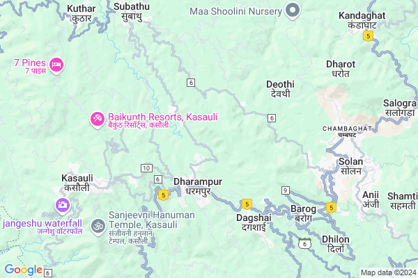
Chhatera
Chhatera Map
EDIT Map
Add Your House
 ..
..
Current Corona Virus Infected Patients Count in Solan District
| City Name | District Name | Total Covid cases |
|---|---|---|
| Solan District | Solan | 9 |
Locality Name :
Chhatera
( छतरा )
Tehsil Name : Dharampur
District : Solan
State : Himachal Pradesh
Language : Hindi
Current Time 11:01 AM
Date: Monday , Apr 28,2025 (IST)
Time zone: IST (UTC+5:30)
Elevation / Altitude: 1483 meters. Above Seal level
Telephone Code / Std Code: 01792
Assembly constituency : Kasauli assembly constituency
Assembly MLA : Vinod Sultanpuri
Lok Sabha constituency : Shimla parliamentary constituency
Parliament MP : SURESH KUMAR KASHYAP
Serpanch Name :
Pin Code : 173211
Post Office Name : Saproon
Main Village Name : Chhatera
Commodities Prices : Solan Market / Mandi
Chhatera Live Weather
Temperature: 30.7 °C
clear sky
Humidity: 11%
Wind : 2.7 mt/sec towards SW
StationName : "Kasauli"
observed on 55 Mins Back
Temperature: 30.7 °C
clear sky
Humidity: 11%
Wind : 2.7 mt/sec towards SW
StationName : "Kasauli"
observed on 55 Mins Back
Chhatera Weather Forecast for Next 5 days
29-04-2025
21.1°C to 32.9°C
clear sky, few clouds
21.1°C to 32.9°C
clear sky, few clouds
30-04-2025
20.2°C to 33.3°C
scattered clouds, few clouds, clear sky
20.2°C to 33.3°C
scattered clouds, few clouds, clear sky
01-05-2025
20.7°C to 33.4°C
scattered clouds, few clouds, clear sky, overcast clouds
20.7°C to 33.4°C
scattered clouds, few clouds, clear sky, overcast clouds
02-05-2025
17.5°C to 32.3°C
overcast clouds, few clouds, broken clouds, light rain
17.5°C to 32.3°C
overcast clouds, few clouds, broken clouds, light rain
03-05-2025
18.5°C to 28.7°C
light rain, overcast clouds, scattered clouds, clear sky
18.5°C to 28.7°C
light rain, overcast clouds, scattered clouds, clear sky
National Highways Reachable To Chhatera
Nationa High Way :NH46
Nationa High Way :NH152D
Nationa High Way :NH46
Nationa High Way :NH152D
Rivers Near Chhatera
Chakan
Singladev Nadi
Chakan
Singladev Nadi
About Chhatera
Correct below Info and add more info about ChhateraChhatera is a small Village/hamlet in Dharampur Tehsil in Solan District of Himachal Pradesh State, India. It comes under Chhatera Panchayath. It is located 9 KM towards west from District head quarters Solan. 7 KM from Dharampur. 28 KM from State capital Shimla
Chhatera Pin code is 173211 and postal head office is Saproon .
Dharampur ( 2 KM ) , Narayani ( 3 KM ) , Chamian ( 4 KM ) , Top-ki-berh ( 4 KM ) , Garkhal Sanawar ( 5 KM ) are the nearby Villages to Chhatera. Chhatera is surrounded by Solan Tehsil towards East , Kandaghat Tehsil towards North , Kalka Tehsil towards South , Pinjore Tehsil towards South .
Solan , Kalka , Pinjore , Karoran are the near by Cities to Chhatera.
This Place is in the border of the Solan District and Panchkula District. Panchkula District Kalka is South towards this place . It is near to the Haryana State Border.
Chhatera 2011 Census Details
Chhatera Local Language is Hindi. Chhatera Village Total population is 308 and number of houses are 59. Female Population is 47.4%. Village literacy rate is 77.3% and the Female Literacy rate is 33.1%.
Population
| Census Parameter | Census Data |
| Total Population | 308 |
| Total No of Houses | 59 |
| Female Population % | 47.4 % ( 146) |
| Total Literacy rate % | 77.3 % ( 238) |
| Female Literacy rate | 33.1 % ( 102) |
| Scheduled Tribes Population % | 0.0 % ( 0) |
| Scheduled Caste Population % | 50.6 % ( 156) |
| Working Population % | 29.5 % |
| Child(0 -6) Population by 2011 | 40 |
| Girl Child(0 -6) Population % by 2011 | 55.0 % ( 22) |
Chhatera Census More Deatils.
Politics in Chhatera
HVC , BJP , INC are the major political parties in this area.Polling Stations /Booths near Chhatera
1)G.p.s. Gulhari (shangli Khurd)2)G.p.s. Gonai
3)O/o Municipal Council Parwanoo
4)O/o Cantt Board Kasauli
5)G.p.s. Kado
HOW TO REACH Chhatera
By Rail
Dharampur Himachal Rail Way Station , Sonwara Rail Way Station are the very nearby railway stations to Chhatera.Colleges near Chhatera
Lr Institute Of Pharmacy
Address : Lr Institute Of Pharmacyvillage Jabli, P.o. Ochgha
Schools near Chhatera
Gsss Kanda
Address : kanda , dharampur , solan , Himachal Pradesh . PIN- 173209 , Post - Dharampur (Solan)
Durga Public School
Address : anji , dharampur , solan , Himachal Pradesh . PIN- 173211 , Post - Saproon
Gsss Pratha
Address : pratha , dharampur , solan , Himachal Pradesh . PIN- 173220 , Post - Sector-2 Parwanoo
Pinegrove School Subathu
Address : krishan garh , kuthar , solan , Himachal Pradesh . PIN- 173206 , Post - Subathu
Govt Health Centers near Chhatera
1) Badehri SC , Totu , ,2) Deen Dayal Upadhyaya Zonal Hospital , Ram Bazaar, Shimla , Shimla ,
3) Khalini SC , Khalini , Khalini , New Temple
Sub Villages in Chhatera
Hospitals in Chhatera,Dharampur
Sub Health Center
Kamthan Kalan; Solan; SH-9; Shalaghat Arki Brotiwala Road; Subathu; Subathu; Himachal Pradesh 173209; India
2.5 KM distance Detail
Tuberculosis Sanitarium
National Highway 22; Dharampur; Himachal Pradesh 173209; India
2.7 KM distance Detail
more ..
Petrol Bunks in Chhatera,Dharampur
Indian Oil Petrol Pump
National Highway 22; Dharampur; Himachal Pradesh 173209; India
2.7 KM distance Detail
MAA JALPA FILLING STATION
Shimla Rd; Dharampur; Himachal Pradesh 173209; India
2.7 KM distance Detail
SHOOLINI FILLING STATION
KUMARHATTI;KALKA SHIMLA RO; SOLON; Himachal Pradesh 173229; India
3.0 KM distance Detail
Jai Hind Filling Station
Near Sanwara; Kalka-Shimla Highway; National Highway 22; Dharampur; Himachal Pradesh 173209; India
3.5 KM distance Detail
more ..
Colleges in Chhatera,Dharampur
Dr. B. R Ambedkar Computer Saksharta mission
96/2;Haridwar Road;Infront of LIC Office;Dharampur; Dharampur; Himachal Pradesh 173209; India
2.9 KM distance Detail
Solan Homoeopathic Medical College & Hospital
Barog Bypass; Distt. Solan; Kumarhatti; Himachal Pradesh 173229; India
5.3 KM distance Detail
Delta Information Services Ltd.; Solan (HP)
NH22; Bhanat; Solan; Himachal Pradesh 173212; India
7.1 KM distance Detail
more ..
Schools in Chhatera,Dharampur
GL Public School
Shawar; Solan; SH-9; Shalaghat Arki Brotiwala Road; Dharampur; Dharampur; Himachal Pradesh 173209; India
1.7 KM distance Detail
goverment shool
Dharampur - Basholu Rd; Dharampur; Himachal Pradesh 173209; India
2.1 KM distance Detail
Divine Public School
Dharampur; Himachal Pradesh; Dharampur; Himachal Pradesh; India
2.2 KM distance Detail
Divine Public School Dharampur
Subathu Rd; Dharampur; Himachal Pradesh 173211; India
2.2 KM distance Detail
Electronic Shops in Chhatera,Dharampur
Girn Electronics
Main Bazar; Dharampur; Solan; Himachal Pradesh 173209; India
2.7 KM distance Detail
Mayaur Electronics
Main Bazar; Dharampur; Shimla; Himachal Pradesh 173209; India
2.7 KM distance Detail
Super Markets in Chhatera,Dharampur
Navjot Juice Bar & Daily Needs
Kasauli Chowk; Dharampur; Himachal Pradesh; India
3.2 KM distance Detail
Police Stations near Chhatera,Dharampur
Police Station
National Highway 22; Dharampur; Himachal Pradesh 173209; India
3.4 KM distance Detail
Police Station Dharampur
Chhahar; Solan; NH-22; Ambala Shimla Kaurik Road; Dharampur; Dharampur; Himachal Pradesh 173209; India
3.4 KM distance Detail
Saproon Police Station
Power House Rd; Lawi Khurd; Solan; Himachal Pradesh 173211; India
6.7 KM distance Detail
Governement Offices near Chhatera,Dharampur
Gram Panchayat; Dharmpur
Kalka - Shimla Rd; Dharampur; Himachal Pradesh 173209; India
2.7 KM distance Detail
Dagshai Jail Museum
National Highway 22; Dagshai; Himachal Pradesh 173210; India
5.0 KM distance Detail
About Chhatera &
History
How to reach Chhatera
Tourist Places Near By Chhatera
Schools in Chhatera
Colleges in Chhatera
Temperature & weather of Chhatera
places in Chhatera
Chhatera photos
More Information
How to reach Chhatera
Tourist Places Near By Chhatera
Schools in Chhatera
Colleges in Chhatera
Temperature & weather of Chhatera
places in Chhatera
Chhatera photos
More Information
Village Talk
Post News or Events about this Village
Near Cities
Solan 5 KM near
Kalka 14 KM near
Pinjore 19 KM near
Karoran 26 KM near
Solan 5 KM near
Kalka 14 KM near
Pinjore 19 KM near
Karoran 26 KM near
Near By Taluks
Solan 7 KM near
Dharampur 7 KM near
Kandaghat 11 KM near
Kalka 14 KM near
Solan 7 KM near
Dharampur 7 KM near
Kandaghat 11 KM near
Kalka 14 KM near
Near By Air Ports
Simla Airport 27 KM near
Chandigarh Airport 39 KM near
Ludhiana Airport 126 KM near
Dehra Dun Airport 131 KM near
Simla Airport 27 KM near
Chandigarh Airport 39 KM near
Ludhiana Airport 126 KM near
Dehra Dun Airport 131 KM near
Near By Tourist Places
Solan 7 KM near
Kasauli 7 KM near
Kiarighat 11 KM near
Parwanoo 12 KM near
Chail 18 KM near
Solan 7 KM near
Kasauli 7 KM near
Kiarighat 11 KM near
Parwanoo 12 KM near
Chail 18 KM near
Near By Districts
Solan 8 KM near
Shimla 27 KM near
Panchkula 33 KM near
Chandigarh 35 KM near
Solan 8 KM near
Shimla 27 KM near
Panchkula 33 KM near
Chandigarh 35 KM near
Near By RailWay Station
Dharampur Himachal Rail Way Station 2.7 KM near
Sonwara Rail Way Station 4.3 KM near
Kumarhatti Dagshai Rail Way Station 5.0 KM near
Kalka Rail Way Station 14 KM near
Chandi Mandir Rail Way Station 28 KM near
Dharampur Himachal Rail Way Station 2.7 KM near
Sonwara Rail Way Station 4.3 KM near
Kumarhatti Dagshai Rail Way Station 5.0 KM near
Kalka Rail Way Station 14 KM near
Chandi Mandir Rail Way Station 28 KM near