| Home | City Bus | Maps | Villages | Cities | Rail | Tourist Places | School | College | Pin Codes | Corona Cases Count |
| Distance Calculator Bus Services IFSC Codes Trace Mobile Number Weather Search Place Trace IP Available Cash ATM/Banks Locate Polling Booth Report an Error contact People |
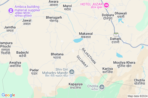
Goreli Map
EDIT Map
Add Your House
 ..
..
Current Corona Virus Infected Patients Count in Sirohi District
| City Name | District Name | Total Covid cases |
|---|
Locality Name :
Goreli
( गोरेली )
Tehsil Name : Reodar
District : Sirohi
State : Rajasthan
Division : Jodhpur
Language : Hindi and Rajasthani
Current Time 05:48 PM
Date: Monday , Apr 28,2025 (IST)
Time zone: IST (UTC+5:30)
Elevation / Altitude: 227 meters. Above Seal level
Telephone Code / Std Code: 02975
Assembly constituency : Reodar assembly constituency
Assembly MLA : Motiram
Lok Sabha constituency : Jalore parliamentary constituency
Parliament MP : Devaji Patel
Serpanch Name :
Pin Code : 307511
Post Office Name : Anadra
Main Village Name : Goreli
Commodities Prices : Amirgadh Market / Mandi
National Highways Reachable To Goreli
Nationa High Way :NH27
Nationa High Way :NH27
Rivers Near Goreli
Sipu
Sili
Sipu
Sili
About Goreli
Correct below Info and add more info about GoreliGoreli is a small Village/hamlet in Reodar Tehsil in Sirohi District of Rajasthan State, India. It comes under Goreli Panchayath. It belongs to Jodhpur Division . It is located 61 KM towards South from District head quarters Sirohi. 11 KM from Reodar. 495 KM from State capital Jaipur
Goreli Pin code is 307511 and postal head office is Anadra .
Bherugarh ( 6 KM ) , Dattani ( 7 KM ) , Marol ( 7 KM ) , Dolpura ( 8 KM ) , Bahadur Pura ( 9 KM ) are the nearby Villages to Goreli. Goreli is surrounded by Amirgadh Tehsil towards South , Mount Abu Tehsil towards East , Dantivada Tehsil towards west , Abu Road Tehsil towards East .
Mount Abu , Palanpur , Deesa , Sirohi are the near by Cities to Goreli.
Goreli 2011 Census Details
Goreli Local Language is Hindi. Goreli Village Total population is 1035 and number of houses are 183. Female Population is 45.7%. Village literacy rate is 17.8% and the Female Literacy rate is 3.7%.
Population
| Census Parameter | Census Data |
| Total Population | 1035 |
| Total No of Houses | 183 |
| Female Population % | 45.7 % ( 473) |
| Total Literacy rate % | 17.8 % ( 184) |
| Female Literacy rate | 3.7 % ( 38) |
| Scheduled Tribes Population % | 0.1 % ( 1) |
| Scheduled Caste Population % | 96.1 % ( 995) |
| Working Population % | 52.9 % |
| Child(0 -6) Population by 2011 | 195 |
| Girl Child(0 -6) Population % by 2011 | 46.7 % ( 91) |
Goreli Census More Deatils.
Politics in Goreli
Bharatiya Janata Party , BJP , INC are the major political parties in this area.Polling Stations /Booths near Goreli
1)Govt Upper Primary School Ganka2)Govt Higher Secondary School (pachshimi Bhag) Dattani
3)Govt Girls Secondary School (east Part) Anadara
4)Govt Higher Secondary School (pachshimi Bhag) Anadara
5)Govt Girls Upper Primary School (center Part ) Hall Bhatana
HOW TO REACH Goreli
By Rail
There is no railway station near to Goreli in less than 10 km.Colleges near Goreli
Mkp
Address :
Narendra Prajapati College Of Science
Address : ...
Schools near Goreli
Govt Senior Secondary School, Magariwara
Address : Near Bus Stand, National Highway No.27 , Magariwara
Govt Upper Primry School(mukesh Prajapat)
Address : Chetak circal karoti
New Pink Modal Upper Primary School Nimatalai
Address : Nimatalai
Jay Shree Rajaram Publick School Dhan
Address : KALBI VAAS
Govt Health Centers near Goreli
1) BUTADI , BUTADI , BUTADI , BUTADI2) MAKAWAL , MAKAWAL , MAKAWAL , MAKAWAL
3) Rampura , RAMPURA , RAMPURA , RAMPURA
Sub Villages in Goreli
Colleges in Goreli,Reodar
Shrimati Chandrawal Gupta College; Basan-Reodar
Reodar; Reodar - Jaswantpura Rd; Revdar; Rajasthan 307514; India
11.0 KM distance Detail
more ..
Governement Offices near Goreli,Reodar
Water Resources Sub Division; Reodar
Reodar - Jaswantpura Rd; Revdar; Rajasthan 307514; India
12.7 KM distance Detail
About Goreli &
History
How to reach Goreli
Tourist Places Near By Goreli
Schools in Goreli
Colleges in Goreli
Temperature & weather of Goreli
places in Goreli
Goreli photos
More Information
How to reach Goreli
Tourist Places Near By Goreli
Schools in Goreli
Colleges in Goreli
Temperature & weather of Goreli
places in Goreli
Goreli photos
More Information
Village Talk
Post News or Events about this Village
Near Cities
Mount Abu 22 KM near
Palanpur 43 KM near
Deesa 49 KM near
Sirohi 58 KM near
Mount Abu 22 KM near
Palanpur 43 KM near
Deesa 49 KM near
Sirohi 58 KM near
Near By Taluks
Reodar 10 KM near
Mount Abu 22 KM near
Amirgadh 22 KM near
Dantivada 26 KM near
Reodar 10 KM near
Mount Abu 22 KM near
Amirgadh 22 KM near
Dantivada 26 KM near
Near By Air Ports
Dabok Airport 154 KM near
Ahmedabad Airport 181 KM near
Jodhpur Airport 224 KM near
Vadodara Airport 283 KM near
Dabok Airport 154 KM near
Ahmedabad Airport 181 KM near
Jodhpur Airport 224 KM near
Vadodara Airport 283 KM near
Near By Tourist Places
Mount Abu 22 KM near
Ambaji 43 KM near
Banaskantha 44 KM near
Danta Ambaji 48 KM near
Sirohi 73 KM near
Mount Abu 22 KM near
Ambaji 43 KM near
Banaskantha 44 KM near
Danta Ambaji 48 KM near
Sirohi 73 KM near
Near By Districts
Banas Kantha 44 KM near
Sirohi 58 KM near
Patan 95 KM near
Jalore 103 KM near
Banas Kantha 44 KM near
Sirohi 58 KM near
Patan 95 KM near
Jalore 103 KM near
Near By RailWay Station
Abu Road Rail Way Station 29 KM near
Palanpur Junction Rail Way Station 44 KM near
Abu Road Rail Way Station 29 KM near
Palanpur Junction Rail Way Station 44 KM near