| Home | City Bus | Maps | Villages | Cities | Rail | Tourist Places | School | College | Pin Codes | Corona Cases Count |
| Distance Calculator Bus Services IFSC Codes Trace Mobile Number Weather Search Place Trace IP Available Cash ATM/Banks Locate Polling Booth Report an Error contact People |
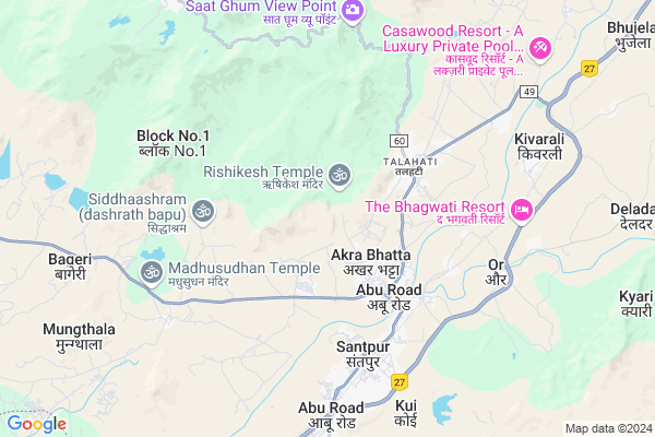
Umarni Map
EDIT Map
Add Your House
 ..
..
Current Corona Virus Infected Patients Count in Sirohi District
| City Name | District Name | Total Covid cases |
|---|
Locality Name :
Umarni
( उमरनी )
Tehsil Name : Abu Road
District : Sirohi
State : Rajasthan
Division : Jodhpur
Language : Hindi and Rajasthani
Current Time 05:22 PM
Date: Friday , Apr 25,2025 (IST)
Time zone: IST (UTC+5:30)
Elevation / Altitude: 260 meters. Above Seal level
Telephone Code / Std Code: 02974
Assembly constituency : Reodar assembly constituency
Assembly MLA : Motiram
Lok Sabha constituency : Jalore parliamentary constituency
Parliament MP : Devaji Patel
Serpanch Name :
Pin Code : 307510
Post Office Name : Shantivan
Main Village Name : Umarni
Commodities Prices : Abu Road Market / Mandi
Umarni Live Weather
Temperature: 40.2 °C
clear sky
Humidity: 10%
Wind : 4.8 mt/sec towards W
StationName : "Ä\u0080bu Road"
observed on 2 Hours Back
Temperature: 40.2 °C
clear sky
Humidity: 10%
Wind : 4.8 mt/sec towards W
StationName : "Ä\u0080bu Road"
observed on 2 Hours Back
Umarni Weather Forecast for Next 5 days
26-04-2025
27.0°C to 39.9°C
clear sky
27.0°C to 39.9°C
clear sky
27-04-2025
24.9°C to 41.1°C
clear sky
24.9°C to 41.1°C
clear sky
28-04-2025
24.7°C to 42.4°C
clear sky
24.7°C to 42.4°C
clear sky
29-04-2025
25.1°C to 43.5°C
clear sky
25.1°C to 43.5°C
clear sky
30-04-2025
24.6°C to 43.3°C
clear sky
24.6°C to 43.3°C
clear sky
National Highways Reachable To Umarni
Nationa High Way :NH27
Nationa High Way :NH27
Rivers Near Umarni
Sai
West Banas
Sai
West Banas
About Umarni
Correct below Info and add more info about UmarniUmarni is a small Village/hamlet in Abu Road Tehsil in Sirohi District of Rajasthan State, India. It comes under Umarni Panchayath. It belongs to Jodhpur Division . It is located 49 KM towards South from District head quarters Sirohi. 4 KM from Abu Road. 474 KM from State capital Jaipur
Umarni Pin code is 307510 and postal head office is Shantivan .
Morthala ( 4 KM ) , Sadar Bazar ( 4 KM ) , Kyariya ( 4 KM ) , Amthala ( 5 KM ) , Santpur ( 5 KM ) are the nearby Villages to Umarni. Umarni is surrounded by Mount Abu Tehsil towards North , Amirgadh Tehsil towards South , Reodar Tehsil towards west , Pindwara Tehsil towards North .
Mount Abu , Sirohi , Pindwara , Palanpur are the near by Cities to Umarni.
This Place is in the border of the Sirohi District and Banas Kantha District. Banas Kantha District Amirgadh is South towards this place . It is near to the Gujarat State Border.
Umarni 2011 Census Details
Umarni Local Language is Hindi. Umarni Village Total population is 1078 and number of houses are 206. Female Population is 52.1%. Village literacy rate is 32.0% and the Female Literacy rate is 10.6%.
Population
| Census Parameter | Census Data |
| Total Population | 1078 |
| Total No of Houses | 206 |
| Female Population % | 52.1 % ( 562) |
| Total Literacy rate % | 32.0 % ( 345) |
| Female Literacy rate | 10.6 % ( 114) |
| Scheduled Tribes Population % | 73.1 % ( 788) |
| Scheduled Caste Population % | 6.4 % ( 69) |
| Working Population % | 45.1 % |
| Child(0 -6) Population by 2011 | 222 |
| Girl Child(0 -6) Population % by 2011 | 54.1 % ( 120) |
Umarni Census More Deatils.
Politics in Umarni
Bharatiya Janata Party , BJP , INC are the major political parties in this area.Polling Stations /Booths near Umarni
1)Govt Higher Secondary School (uttari Bhag) Santpur2)Govt Upper Primary School Dhanpura
3)Govt Upper Primary School Malawa
4)Govt Secondary School (daya Bhag) Vasan
5)Govt Secondary School (purvi Bhag) Maval
HOW TO REACH Umarni
By Rail
Abu Road Rail Way Station , Morthala Rail Way Station are the very nearby railway stations to Umarni.Colleges near Umarni
Seth Mangalchan Choudhary Govt.college Aburoad
Address :
Shri Usb College Of Pharmacy
Address : Shri Usb College Of Pharmacy G-192, Ambaji Industr
Srinath Ji College Of Physiotherapy
Address : Srinath Ji Collegeof Physiotherapy, Amthala, Abu R
Ummed Singh Bhati Shiksha Samiti Nurse / Compounder College
Address : Ummed Singh Bhati Shiksha Samiti Nurse / Compounde
Schools near Umarni
Saraswati Vidya Mandir Upper Primary School Oriya Abu
Address : oriya mount abu
Saraswati Vidya Mandir Upper Primary School Oriya Mount Abu
Address : village - oriya
Govt Health Centers near Umarni
1) Manpur gramin , , Manpur gramin ,2) Morthala , , Morthala ,
3) Abu Road , Village & Post Abu Road , Railway Station Road , Opp. Temple
Sub Villages in Umarni
Hospitals in Umarni,Abu Road
govt.Community Hospital Center ( Civil Hospital )
Abu Road - Mount Abu Road; Abu Road; Rajasthan 307510; India
2.8 KM distance Detail
COMMUNITY HEALTH CENTER ( Civil Hospital ) Aburoad
Akrabhatta; Rajasthan 307510; India
3.0 KM distance Detail
Govt Sec School
Govt. Sec. School; Akra Bhatta; MDR49; Abu Road; Rajasthan 307510; India
3.0 KM distance Detail
more ..
Petrol Bunks in Umarni,Abu Road
B S Petrolum Abu Road
MDR60; Sadar Bazar; Sani Gaon; Abu Road; Rajasthan 307510; India
3.7 KM distance Detail
more ..
Colleges in Umarni,Abu Road
Stp BSTC College
Aaburoad; Sirohi; SH-11; Sirohi Road; Abu Road; Abu Road; Rajasthan 307028; India
2.9 KM distance Detail
shree Tejendra prasadji teachers training college
Swaminarayan ashram;; Pandoori; Rajasthan 307510; India
2.9 KM distance Detail
Chartered Institute of Technology
Danvav Village; Mount Abu Road; Aburoad; MDR 49; Rajasthan; India
2.9 KM distance Detail
Brahma Kumaris Multimedia Activities
Talahati; Abu Road; Rajasthan 307510; India
3.4 KM distance Detail
more ..
Schools in Umarni,Abu Road
Govt. Praveshika Sanskrit School Umarani
Akra Bhatta; Rajasthan 307026; India
1.7 KM distance Detail
ROYAL RAJASTHAN PUBLIC SCHOOL ABUROAD
Khasra no. 318;Rishikesh Road; Umarni; Rajasthan 307026; India
2.1 KM distance Detail
Electronic Shops in Umarni,Abu Road
Apani Tector Company
NR.HOUSING BOARD COLONY MANPUR ROAD; ABUROAD; Rajasthan 307510; India
3.3 KM distance Detail
Local Parks in Umarni,Abu Road
Prakashmani Garden
Opp Diamond Hall; Diamond Hall Road; Talahati; Taleheti; Rajasthan 307510; India
3.2 KM distance Detail
Police Stations near Umarni,Abu Road
Police Thana Sadar; Aburoad
MDR 49; Talahati; Pandoori; Rajasthan 307510; India
3.1 KM distance Detail
Governement Offices near Umarni,Abu Road
Karyalaya Up Panjiyak
Sirohi; SH-11; Sirohi Road; Abu Road; Abu Road; Rajasthan 307028; India
2.8 KM distance Detail
DCF ( Project ) Office & Residence Colony; Forest Department; Goverment of Rajasthan; Abu Road.
Abu Road - Mount Abu Road; Manpur; Rajasthan 307510; India
3.5 KM distance Detail
Taleti Rangers Office; Wild life Sanctuary; Mt Abu.
Abu Road - Mount Abu Road; Talahati; Pandoori; Rajasthan 307510; India
3.7 KM distance Detail
About Umarni &
History
How to reach Umarni
Tourist Places Near By Umarni
Schools in Umarni
Colleges in Umarni
Temperature & weather of Umarni
places in Umarni
Umarni photos
More Information
How to reach Umarni
Tourist Places Near By Umarni
Schools in Umarni
Colleges in Umarni
Temperature & weather of Umarni
places in Umarni
Umarni photos
More Information
Village Talk
Post News or Events about this Village
Near Cities
Mount Abu 11 KM near
Sirohi 47 KM near
Pindwara 47 KM near
Palanpur 55 KM near
Mount Abu 11 KM near
Sirohi 47 KM near
Pindwara 47 KM near
Palanpur 55 KM near
Near By Taluks
Abu Road 4 KM near
Mount Abu 11 KM near
Amirgadh 29 KM near
Reodar 30 KM near
Abu Road 4 KM near
Mount Abu 11 KM near
Amirgadh 29 KM near
Reodar 30 KM near
Near By Air Ports
Dabok Airport 127 KM near
Ahmedabad Airport 181 KM near
Jodhpur Airport 219 KM near
Vadodara Airport 277 KM near
Dabok Airport 127 KM near
Ahmedabad Airport 181 KM near
Jodhpur Airport 219 KM near
Vadodara Airport 277 KM near
Near By Tourist Places
Mount Abu 11 KM near
Ambaji 25 KM near
Danta Ambaji 43 KM near
Sirohi 53 KM near
Banaskantha 57 KM near
Mount Abu 11 KM near
Ambaji 25 KM near
Danta Ambaji 43 KM near
Sirohi 53 KM near
Banaskantha 57 KM near
Near By Districts
Sirohi 46 KM near
Banas Kantha 57 KM near
Jalore 104 KM near
Udaipur 105 KM near
Sirohi 46 KM near
Banas Kantha 57 KM near
Jalore 104 KM near
Udaipur 105 KM near
Near By RailWay Station
Abu Road Rail Way Station 5.5 KM near
Morthala Rail Way Station 6.1 KM near
Kivarli Rail Way Station 9.1 KM near
Sirohi Road Rail Way Station 45 KM near
Abu Road Rail Way Station 5.5 KM near
Morthala Rail Way Station 6.1 KM near
Kivarli Rail Way Station 9.1 KM near
Sirohi Road Rail Way Station 45 KM near