| Home | City Bus | Maps | Villages | Cities | Rail | Tourist Places | School | College | Pin Codes | Corona Cases Count |
| Distance Calculator Bus Services IFSC Codes Trace Mobile Number Weather Search Place Trace IP Available Cash ATM/Banks Locate Polling Booth Report an Error contact People |
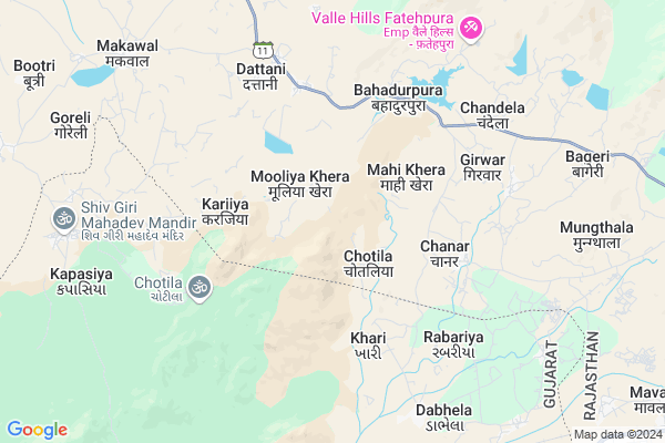
Forest Chotila Map
EDIT Map
Add Your House
 ..
..
Current Corona Virus Infected Patients Count in Sirohi District
| City Name | District Name | Total Covid cases |
|---|
Locality Name :
Forest Chotila
( फारेस्ट चोटिला )
Tehsil Name : Abu Road
District : Sirohi
State : Rajasthan
Division : Jodhpur
Language : Hindi and Rajasthani
Current Time 05:30 PM
Date: Friday , Apr 25,2025 (IST)
Time zone: IST (UTC+5:30)
Elevation / Altitude: 260 meters. Above Seal level
Telephone Code / Std Code: 02974
Assembly constituency : Reodar assembly constituency
Assembly MLA : Motiram
Lok Sabha constituency : Jalore parliamentary constituency
Parliament MP : Devaji Patel
Serpanch Name :
Pin Code : 307026
Post Office Name : Aburoad
Main Village Name : Forest Chotila
Commodities Prices : Amirgadh Market / Mandi
Forest Chotila Live Weather
Temperature: 38.6 °C
clear sky
Humidity: 8%
Wind : 4.93 mt/sec towards SW
StationName : "Mount Abu"
observed on 7 Mins Back
Temperature: 38.6 °C
clear sky
Humidity: 8%
Wind : 4.93 mt/sec towards SW
StationName : "Mount Abu"
observed on 7 Mins Back
Forest Chotila Weather Forecast for Next 5 days
26-04-2025
25.0°C to 37.4°C
clear sky
25.0°C to 37.4°C
clear sky
27-04-2025
23.4°C to 39.3°C
clear sky
23.4°C to 39.3°C
clear sky
28-04-2025
22.5°C to 40.9°C
clear sky
22.5°C to 40.9°C
clear sky
29-04-2025
22.8°C to 41.7°C
clear sky
22.8°C to 41.7°C
clear sky
30-04-2025
22.8°C to 41.6°C
clear sky
22.8°C to 41.6°C
clear sky
National Highways Reachable To Forest Chotila
Nationa High Way :NH27
Nationa High Way :NH27
Rivers Near Forest Chotila
Sai
West Banas
Sai
West Banas
About Forest Chotila
Correct below Info and add more info about Forest ChotilaForest Chotila is a small Village/hamlet in Abu Road Tehsil in Sirohi District of Rajasthan State, India. It comes under Forest Chotila Panchayath. It belongs to Jodhpur Division . It is located 59 KM towards South from District head quarters Sirohi. 19 KM from Abu Road. 491 KM from State capital Jaipur
Forest Chotila Pin code is 307026 and postal head office is Aburoad .
Dattani ( 5 KM ) , Girwar ( 6 KM ) , Chandela ( 7 KM ) , Makawal ( 9 KM ) , Dhawali ( 9 KM ) are the nearby Villages to Forest Chotila. Forest Chotila is surrounded by Reodar Tehsil towards North , Amirgadh Tehsil towards South , Abu Road Tehsil towards East , Dantivada Tehsil towards west .
Mount Abu , Palanpur , Deesa , Sirohi are the near by Cities to Forest Chotila.
This Place is in the border of the Sirohi District and Banas Kantha District. Banas Kantha District Amirgadh is South towards this place . It is near to the Gujarat State Border.
Forest Chotila 2011 Census Details
Forest Chotila Local Language is Hindi. Forest Chotila Village Total population is 221 and number of houses are 43. Female Population is 45.7%. Village literacy rate is 31.2% and the Female Literacy rate is 8.6%.
Population
| Census Parameter | Census Data |
| Total Population | 221 |
| Total No of Houses | 43 |
| Female Population % | 45.7 % ( 101) |
| Total Literacy rate % | 31.2 % ( 69) |
| Female Literacy rate | 8.6 % ( 19) |
| Scheduled Tribes Population % | 99.5 % ( 220) |
| Scheduled Caste Population % | 0.5 % ( 1) |
| Working Population % | 47.5 % |
| Child(0 -6) Population by 2011 | 66 |
| Girl Child(0 -6) Population % by 2011 | 37.9 % ( 25) |
Forest Chotila Census More Deatils.
Politics in Forest Chotila
Bharatiya Janata Party , BJP , INC are the major political parties in this area.Polling Stations /Booths near Forest Chotila
1)Ex.en. Office J.v.v.n.l. Gandhinagar Aburoad2)Govt Upper Primary School Luniyapura (right Part) Aburoad
3)Govt Secondary School Bherugarh
4)Nagarpalika Bal Mandir (daya Bhag) Aburoad
5)Govt Secondary School (uttri Bhag) Sanwara
HOW TO REACH Forest Chotila
By Rail
There is no railway station near to Forest Chotila in less than 10 km.Colleges near Forest Chotila
Seth Mangalchan Choudhary Govt.college Aburoad
Address :
Shri Usb College Of Pharmacy
Address : Shri Usb College Of Pharmacy G-192, Ambaji Industr
Srinath Ji College Of Physiotherapy
Address : Srinath Ji Collegeof Physiotherapy, Amthala, Abu R
Ummed Singh Bhati Shiksha Samiti Nurse / Compounder College
Address : Ummed Singh Bhati Shiksha Samiti Nurse / Compounde
Schools near Forest Chotila
Saraswati Vidya Mandir Upper Primary School Oriya Abu
Address : oriya mount abu
Saraswati Vidya Mandir Upper Primary School Oriya Mount Abu
Address : village - oriya
Govt Health Centers near Forest Chotila
1) Mahikheda , , Mahikheda ,2) BAHADURPURA , BAHADURPURA , BAHADURPURA , BAHADURPURA
3) DATANI , DATANI , DATANI , DATANI
Sub Villages in Forest Chotila
Hospitals in Forest Chotila,Abu Road
Up Swasthya Kendra
Sirohi; SH-11; Sirohi Road; Abu Road; Abu Road; Rajasthan 307026; India
8.4 KM distance Detail
more ..
Petrol Bunks in Forest Chotila,Abu Road
HP PETROL PUMP - HINDUSTAN AUTOMOBILES
Post Shriameergadh Taluka Palanpur Dist BK N GUJ; Ahmedabad; Gujarat 385130; India
12.3 KM distance Detail
more ..
Colleges in Forest Chotila,Abu Road
USB Group Of College
Abu-Ambaji Road; National Highway 14; Khara; Rajasthan 307026; India
12.8 KM distance Detail
more ..
Schools in Forest Chotila,Abu Road
Government Secondary School
Sirohi; SH-11; Sirohi Road; Abu Road; Abu Road; Rajasthan 307026; India
5.2 KM distance Detail
Government Upper Girls Primary School
Revdar; Sirohi; SH-11; Sirohi Road; Abu Road; Abu Road; Rajasthan 307514; India
6.4 KM distance Detail
Electronic Shops in Forest Chotila,Abu Road
Say Mobail Ripering Bhojabhai Sivgiri Maharaj Mandir Road
Kapasiya; Gujarat 385505; India
9.8 KM distance Detail
Say Mobail Ripering Bhojabhai Sivgiri Maharaj Mandir Kapasiya 385135 Gujarat
Kapasiya; Gujarat 385505; India
9.8 KM distance Detail
Super Markets in Forest Chotila,Abu Road
श्री राधा कृष्णा मार्बल &गर्नाइट P.V.T
चन्द्रवती; आबु रोड; राजस्थान 307026; India
15.8 KM distance Detail
Local Parks in Forest Chotila,Abu Road
Camp Climbing World
Gangaram's Farm; Gaumukh Road; Mount Abu; Rajasthan 307501; India
17.0 KM distance Detail
Mount Abu Trekking Camp
ramesh alika; near hotel couples paradise; akshay colony; Mount Abu; Rajasthan 307501; India
17.5 KM distance Detail
Police Stations near Forest Chotila,Abu Road
Adhikshat Police Station; Abu Parbat
MDR60; Machgoan; Mount Abu; Rajasthan 307501; India
17.8 KM distance Detail
Governement Offices near Forest Chotila,Abu Road
Atal Seva Center
Sirohi; SH-11; Sirohi Road; Abu Road; Abu Road; Rajasthan 307026; India
8.5 KM distance Detail
Karyalaya Gram Sachivalya
Sirohi; SH-11; Sirohi Road; Abu Road; Abu Road; Rajasthan 307026; India
8.5 KM distance Detail
About Forest Chotila &
History
How to reach Forest Chotila
Tourist Places Near By Forest Chotila
Schools in Forest Chotila
Colleges in Forest Chotila
Temperature & weather of Forest Chotila
places in Forest Chotila
Forest Chotila photos
More Information
How to reach Forest Chotila
Tourist Places Near By Forest Chotila
Schools in Forest Chotila
Colleges in Forest Chotila
Temperature & weather of Forest Chotila
places in Forest Chotila
Forest Chotila photos
More Information
Village Talk
Post News or Events about this Village
Near Cities
Mount Abu 16 KM near
Palanpur 42 KM near
Deesa 54 KM near
Sirohi 56 KM near
Mount Abu 16 KM near
Palanpur 42 KM near
Deesa 54 KM near
Sirohi 56 KM near
Near By Taluks
Mount Abu 17 KM near
Reodar 17 KM near
Amirgadh 18 KM near
Abu Road 18 KM near
Mount Abu 17 KM near
Reodar 17 KM near
Amirgadh 18 KM near
Abu Road 18 KM near
Near By Air Ports
Dabok Airport 146 KM near
Ahmedabad Airport 177 KM near
Jodhpur Airport 226 KM near
Vadodara Airport 277 KM near
Dabok Airport 146 KM near
Ahmedabad Airport 177 KM near
Jodhpur Airport 226 KM near
Vadodara Airport 277 KM near
Near By Tourist Places
Mount Abu 17 KM near
Ambaji 33 KM near
Danta Ambaji 41 KM near
Banaskantha 44 KM near
Sirohi 69 KM near
Mount Abu 17 KM near
Ambaji 33 KM near
Danta Ambaji 41 KM near
Banaskantha 44 KM near
Sirohi 69 KM near
Near By Districts
Banas Kantha 44 KM near
Sirohi 56 KM near
Patan 97 KM near
Jalore 106 KM near
Banas Kantha 44 KM near
Sirohi 56 KM near
Patan 97 KM near
Jalore 106 KM near
Near By RailWay Station
Abu Road Rail Way Station 19 KM near
Palanpur Junction Rail Way Station 44 KM near
Abu Road Rail Way Station 19 KM near
Palanpur Junction Rail Way Station 44 KM near