| Home | City Bus | Maps | Villages | Cities | Rail | Tourist Places | School | College | Pin Codes | Corona Cases Count |
| Distance Calculator Bus Services IFSC Codes Trace Mobile Number Weather Search Place Trace IP Available Cash ATM/Banks Locate Polling Booth Report an Error contact People |
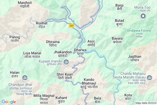
Dharwa
Dharwa Map
EDIT Map
Add Your House
 ..
..
Current Corona Virus Infected Patients Count in Sirmaur District
| City Name | District Name | Total Covid cases |
|---|---|---|
| Sirmaur District | Sirmaur | 1 |
Locality Name :
Dharwa
( धरवा )
Tehsil Name : Shillai
District : Sirmaur
State : Himachal Pradesh
Language : Hindi and Pahari, Punjabi
Current Time 08:52 AM
Date: Wednesday , Apr 30,2025 (IST)
Time zone: IST (UTC+5:30)
Elevation / Altitude: 1520 meters. Above Seal level
Telephone Code / Std Code: 01704
Assembly constituency : Shillai assembly constituency
Assembly MLA : Harshwardhan Chauhan
Lok Sabha constituency : Shimla parliamentary constituency
Parliament MP : SURESH KUMAR KASHYAP
Serpanch Name :
Pin Code : 173027
Post Office Name : Shillai
Main Village Name : Dharwa
Commodities Prices : Vikasnagar Market / Mandi
Dharwa Live Weather
Temperature: 23.6 °C
clear sky
Humidity: 42%
Wind : 1.56 mt/sec towards S
StationName : "ChakrÄ\u0081ta"
observed on Now
Temperature: 23.6 °C
clear sky
Humidity: 42%
Wind : 1.56 mt/sec towards S
StationName : "ChakrÄ\u0081ta"
observed on Now
Dharwa Weather Forecast for Next 5 days
01-05-2025
19.6°C to 30.9°C
clear sky, light rain, overcast clouds
19.6°C to 30.9°C
clear sky, light rain, overcast clouds
02-05-2025
17.0°C to 29.4°C
overcast clouds, moderate rain, heavy intensity rain, light rain
17.0°C to 29.4°C
overcast clouds, moderate rain, heavy intensity rain, light rain
03-05-2025
17.5°C to 29.7°C
light rain, overcast clouds
17.5°C to 29.7°C
light rain, overcast clouds
04-05-2025
18.0°C to 29.2°C
light rain, overcast clouds
18.0°C to 29.2°C
light rain, overcast clouds
05-05-2025
17.7°C to 30.6°C
overcast clouds, broken clouds, scattered clouds, light rain
17.7°C to 30.6°C
overcast clouds, broken clouds, scattered clouds, light rain
National Highways Reachable To Dharwa
Nationa High Way :NH707A
Nationa High Way :NH707A
Rivers Near Dharwa
khatwa Gad
Khutno Gad
khatwa Gad
Khutno Gad
About Dharwa
Correct below Info and add more info about DharwaDharwa is a small Village/hamlet in Shillai Tehsil in Sirmaur District of Himachal Pradesh State, India. It comes under Dharwa Panchayath. It is located 51 KM towards East from District head quarters Nahan. 7 KM from Shillai. 75 KM from State capital Shimla
Dharwa Pin code is 173027 and postal head office is Shillai .
Kando Bhatnol ( 4 KM ) , Naini Dhar ( 4 KM ) , Rast ( 5 KM ) , Bandli ( 5 KM ) , Loja Manal ( 7 KM ) are the nearby Villages to Dharwa. Dharwa is surrounded by Chakrata Tehsil towards East , Chaupal Tehsil towards North , Sangrah Tehsil towards west , Kalsi Tehsil towards East .
Nahan , Mussoorie , Dehradun , Solan are the near by Cities to Dharwa.
This Place is in the border of the Sirmaur District and Dehradun District. Dehradun District Chakrata is East towards this place . It is near to the Uttarakhand State Border.
Dharwa 2011 Census Details
Dharwa Local Language is Hindi. Dharwa Village Total population is 1008 and number of houses are 140. Female Population is 46.2%. Village literacy rate is 58.1% and the Female Literacy rate is 22.7%.
Population
| Census Parameter | Census Data |
| Total Population | 1008 |
| Total No of Houses | 140 |
| Female Population % | 46.2 % ( 466) |
| Total Literacy rate % | 58.1 % ( 586) |
| Female Literacy rate | 22.7 % ( 229) |
| Scheduled Tribes Population % | 0.0 % ( 0) |
| Scheduled Caste Population % | 22.8 % ( 230) |
| Working Population % | 71.9 % |
| Child(0 -6) Population by 2011 | 183 |
| Girl Child(0 -6) Population % by 2011 | 49.2 % ( 90) |
Dharwa Census More Deatils.
Politics in Dharwa
BJP , INC are the major political parties in this area.Polling Stations /Booths near Dharwa
1)G.s.s.s. Chandni2)G.p.s. Devnal
3)G.p.s. Dahar
4)G.p.s. Jasvi
5)G.p.s. Shimola
HOW TO REACH Dharwa
By Rail
There is no railway station near to Dharwa in less than 10 km.Colleges near Dharwa
The Planet Education Institute
Address :
Goverenment Degree College Haripurdhar
Address :
Government Degree College Haripurdhar
Address :
Government Degree College Sangrah
Address :
Nav Durga Pvt. Industrial Training Institute
Address :
Schools in Dharwa
Dharwa
Address : dharwa , shillai , sirmaur , Himachal Pradesh . PIN- 173027 , Post - Shillai
Govt Health Centers near Dharwa
1) Damyana SC , Damyana , Damyana ,2) Pujarli SC , Private Building , Pujarli , Near Village
3) Khalini SC , Khalini , Khalini , New Temple
Sub Villages in Dharwa
Hospitals in Dharwa,Shillai
Community Health Centre
Shillai - Suinal Road; Uttari; Shillai; Himachal Pradesh 173027; India
8.8 KM distance Detail
more ..
Colleges in Dharwa,Shillai
Government Degree College
Paonta - Hatkoti Rd; Shillai; Himachal Pradesh 173027; India
7.4 KM distance Detail
Govt Degree College Haripurdhar
Haripurdhar District; Himachal Pradesh 173023; India
23.2 KM distance Detail
more ..
Schools in Dharwa,Shillai
Government Primary School
Bhagnari; Jhakandon; Himachal Pradesh 173027; India
2.3 KM distance Detail
Government Primary School
Silli; Sirmour; NH-72B; Paonta Hatkoti Road; Sataun; Sataun; Himachal Pradesh 173029; India
4.5 KM distance Detail
Electronic Shops in Dharwa,Shillai
Surender Comm Airtel Distributor
Paonta - Hatkoti Rd; Shillai; Himachal Pradesh 173027; India
8.2 KM distance Detail
Anil Electricals Hospital Road Shillai
Shillai - Suinal Road; Uttari; Shillai; Himachal Pradesh 173027; India
8.4 KM distance Detail
Police Stations near Dharwa,Shillai
Governement Offices near Dharwa,Shillai
Sub Tehsil Office
Haripurdhar - Ronhat Rd; Ronhat; Himachal Pradesh 173027; India
6.9 KM distance Detail
Naib Tehsildar Office
Ronhat; Sirmour; NH-72B; Paonta Hatkoti Road; Sataun; Sataun; Himachal Pradesh 173029; India
6.9 KM distance Detail
About Dharwa &
History
How to reach Dharwa
Tourist Places Near By Dharwa
Schools in Dharwa
Colleges in Dharwa
Temperature & weather of Dharwa
places in Dharwa
Dharwa photos
More Information
How to reach Dharwa
Tourist Places Near By Dharwa
Schools in Dharwa
Colleges in Dharwa
Temperature & weather of Dharwa
places in Dharwa
Dharwa photos
More Information
Village Talk
Post News or Events about this Village
Near Cities
Nahan 49 KM near
Mussoorie 54 KM near
Dehradun 67 KM near
Solan 69 KM near
Nahan 49 KM near
Mussoorie 54 KM near
Dehradun 67 KM near
Solan 69 KM near
Near By Taluks
Shillai 6 KM near
Chakrata 19 KM near
Chaupal 22 KM near
Sangrah 27 KM near
Shillai 6 KM near
Chakrata 19 KM near
Chaupal 22 KM near
Sangrah 27 KM near
Near By Air Ports
Dehra Dun Airport 63 KM near
Simla Airport 75 KM near
Chandigarh Airport 96 KM near
Muzaffarnagar Airport 162 KM near
Dehra Dun Airport 63 KM near
Simla Airport 75 KM near
Chandigarh Airport 96 KM near
Muzaffarnagar Airport 162 KM near
Near By Tourist Places
Chakrata 18 KM near
Kalsi 31 KM near
Paonta Sahib 38 KM near
Hatkoti 48 KM near
Nahan 49 KM near
Chakrata 18 KM near
Kalsi 31 KM near
Paonta Sahib 38 KM near
Hatkoti 48 KM near
Nahan 49 KM near
Near By Districts
Sirmaur 49 KM near
Dehradun 61 KM near
Solan 66 KM near
Shimla 72 KM near
Sirmaur 49 KM near
Dehradun 61 KM near
Solan 66 KM near
Shimla 72 KM near
Near By RailWay Station
Dehradun Rail Way Station 63 KM near
Kalka Rail Way Station 83 KM near
Dehradun Rail Way Station 63 KM near
Kalka Rail Way Station 83 KM near