| Home | City Bus | Maps | Villages | Cities | Rail | Tourist Places | School | College | Pin Codes | Corona Cases Count |
| Distance Calculator Bus Services IFSC Codes Trace Mobile Number Weather Search Place Trace IP Available Cash ATM/Banks Locate Polling Booth Report an Error contact People |
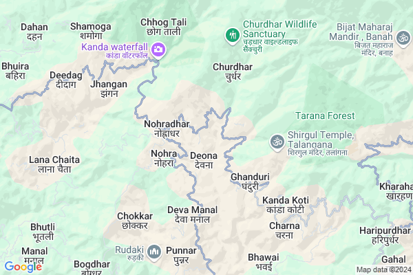
Thanga
Thanga Map
EDIT Map
Add Your House
 ..
..
Current Corona Virus Infected Patients Count in Sirmaur District
| City Name | District Name | Total Covid cases |
|---|---|---|
| Sirmaur District | Sirmaur | 1 |
Locality Name :
Thanga
( ठेंगा )
Tehsil Name : Sangrah
District : Sirmaur
State : Himachal Pradesh
Language : Hindi and Pahari, Punjabi
Current Time 07:15 AM
Date: Saturday , Apr 26,2025 (IST)
Time zone: IST (UTC+5:30)
Elevation / Altitude: 1520 meters. Above Seal level
Telephone Code / Std Code: 01702
Assembly constituency : Sri Renukaji assembly constituency
Assembly MLA : Vinay Kumar
Lok Sabha constituency : Shimla parliamentary constituency
Parliament MP : SURESH KUMAR KASHYAP
Serpanch Name :
Pin Code : 173104
Post Office Name : Nohra
Main Village Name : Thanga
Commodities Prices : Nahan Market / Mandi
Thanga Live Weather
Temperature: 13.2 °C
clear sky
Humidity: 21%
Wind : 3.74 mt/sec towards NE
StationName : "RÄ\u0081jgarh"
observed on 1 Hours Back
Temperature: 13.2 °C
clear sky
Humidity: 21%
Wind : 3.74 mt/sec towards NE
StationName : "RÄ\u0081jgarh"
observed on 1 Hours Back
Thanga Weather Forecast for Next 5 days
27-04-2025
17.4°C to 26.8°C
few clouds, clear sky, scattered clouds, overcast clouds
17.4°C to 26.8°C
few clouds, clear sky, scattered clouds, overcast clouds
28-04-2025
16.3°C to 27.6°C
broken clouds, clear sky, overcast clouds, scattered clouds
16.3°C to 27.6°C
broken clouds, clear sky, overcast clouds, scattered clouds
29-04-2025
16.3°C to 28.6°C
clear sky, scattered clouds, light rain, overcast clouds, broken clouds
16.3°C to 28.6°C
clear sky, scattered clouds, light rain, overcast clouds, broken clouds
30-04-2025
17.2°C to 29.2°C
broken clouds, clear sky, light rain
17.2°C to 29.2°C
broken clouds, clear sky, light rain
01-05-2025
17.3°C to 28.0°C
broken clouds, clear sky
17.3°C to 28.0°C
broken clouds, clear sky
Edit below overview about Thanga
Edit below overview about Thanga
OverView of Thanga
Thanga is small Village situated in District Sirmour under Sub Division Sangrah. Nohradhar is Tehsil of this village. The holly place Churdhar is situated in Devna Thanga Gram Panchayat and nearest Village from Churdhar is Matidaa(Thanga). Solan is nearest market about 70 KM far away from Thanga. Following are the Educational institution1. GHS DEVNA THANGA 2. GSSS CHURAS 3. GSSS NOHRADHAR 4. GDC NOHRADHAR 5. GDC RAJGRAH 6. GDC HARIPURDHAR 7.GDC SANGRAH. By Road Distance of major cities from ThangaNahan-135KmSolan-70KmShimla-110Chandigarh -100km Name of Sub Village of Revenue Village Thanga:-1. Rondi 2. Matidaa 3. Dhaar Baakta.Edit below overview about Thanga
National Highways Reachable To Thanga
Nationa High Way :NH707A
Nationa High Way :NH5
Nationa High Way :NH707A
Nationa High Way :NH5
Rivers Near Thanga
Sainj River
Jalal
Sainj River
Jalal
About Thanga
Thanga is a small Village/hamlet in Sangrah Tehsil in Sirmaur District of Himachal Pradesh State, India. It comes under Thanga Panchayath. It is located 37 KM towards North from District head quarters Nahan. 10 KM from Sangrah. 48 KM from State capital Shimla
Thanga Pin code is 173104 and postal head office is Nohra .
Deva Manal ( 4 KM ) , Chokkar ( 6 KM ) , Charna ( 6 KM ) , Bhawai ( 8 KM ) , Deedag ( 8 KM ) are the nearby Villages to Thanga. Thanga is surrounded by Rajgarh Tehsil towards west , Chaupal Tehsil towards East , Pachhad Tehsil towards west , Shillai Tehsil towards East .
Nahan , Solan , Shimla , Kalka are the near by Cities to Thanga.
Thanga 2011 Census Details
Thanga Local Language is Hindi. Thanga Village Total population is 457 and number of houses are 84. Female Population is 48.6%. Village literacy rate is 76.1% and the Female Literacy rate is 33.3%.
Population
| Census Parameter | Census Data |
| Total Population | 457 |
| Total No of Houses | 84 |
| Female Population % | 48.6 % ( 222) |
| Total Literacy rate % | 76.1 % ( 348) |
| Female Literacy rate | 33.3 % ( 152) |
| Scheduled Tribes Population % | 0.0 % ( 0) |
| Scheduled Caste Population % | 25.8 % ( 118) |
| Working Population % | 58.2 % |
| Child(0 -6) Population by 2011 | 59 |
| Girl Child(0 -6) Population % by 2011 | 50.8 % ( 30) |
Thanga Census More Deatils.
Politics in Thanga
BJP , INC are the major political parties in this area.Polling Stations /Booths near Thanga
1)G.p.s. Chiyan Mamiyana2)G.p.s. Ungar-kando
3)G.s.s.s. Korag
4)G.s.s.s. Nohra (north Part)
5)G.h.s. Deed-panar
HOW TO REACH Thanga
By Rail
There is no railway station near to Thanga in less than 10 km.Colleges near Thanga
Goverenment Degree College Haripurdhar
Address :
Government Degree College Haripurdhar
Address :
Government Degree College Sangrah
Address :
Nav Durga Pvt. Industrial Training Institute
Address :
Government College Sangrah
Address : Himachal Pradesh-173023
Schools in Thanga
Gms Devna Thanga
Address : thanga , nohradhar , sirmaur , Himachal Pradesh . PIN- 173104 , Post - Nohra
Govt Health Centers near Thanga
1) Damyana SC , Damyana , Damyana ,2) Khalini SC , Khalini , Khalini , New Temple
3) Deen Dayal Upadhyaya Zonal Hospital , Ram Bazaar, Shimla , Shimla ,
Sub Villages in Thanga
Petrol Bunks in Thanga,Sangrah
SHIRGUL FILLING STATION
NERI JENGLIA; SIRMAUR; Himachal Pradesh 173101; India
16.5 KM distance Detail
RAJGARH FILLING STATION
RAJGARH;MEENUS SOLAN ROAD; SIRMAUR; Himachal Pradesh 173101; India
17.6 KM distance Detail
more ..
Colleges in Thanga,Sangrah
Govt Degree College Haripurdhar
Haripurdhar District; Himachal Pradesh 173023; India
12.7 KM distance Detail
Government College
Sangrah-Chopal Road; Sangrah; Himachal Pradesh 173023; India
15.0 KM distance Detail
Shiv Shakti College of Advanced Study in Education
Kheri Road;Rajgarh; Himachal Pradesh 173101; India
16.5 KM distance Detail
more ..
Electronic Shops in Thanga,Sangrah
Shirgul Tent House
near SBI Bank himachal pardesh; Deedag; Himachal Pradesh 175032; India
8.5 KM distance Detail
Shirgul Tent House Deedag
near SBI bank himachal pardesh; Deedag; Himachal Pradesh 175032; India
8.5 KM distance Detail
Local Parks in Thanga,Sangrah
Kinkri Devi Park Sangrah
Sangrah - Renukaji - Nahan Rd; Mandoli; Himachal Pradesh 173023; India
15.5 KM distance Detail
Fagu Resort and Adventure Camp
Fagu; Rajgarh; Himachal Pradesh 173101; India
15.5 KM distance Detail
Governement Offices near Thanga,Sangrah
Sub Divisional Magistrate Office
Sangrah - Pallar - Rajgarh Rd; Sangrah; Himachal Pradesh 173023; India
14.8 KM distance Detail
HPPWD Office
Sangrah - Pallar - Rajgarh Rd; Lana Palar; Himachal Pradesh 173023; India
14.9 KM distance Detail
About Thanga &
History
How to reach Thanga
Tourist Places Near By Thanga
Schools in Thanga
Colleges in Thanga
Temperature & weather of Thanga
places in Thanga
Thanga photos
More Information
How to reach Thanga
Tourist Places Near By Thanga
Schools in Thanga
Colleges in Thanga
Temperature & weather of Thanga
places in Thanga
Thanga photos
More Information
Village Talk
Post News or Events about this Village
Near Cities
Nahan 35 KM near
Solan 40 KM near
Shimla 46 KM near
Kalka 54 KM near
Nahan 35 KM near
Solan 40 KM near
Shimla 46 KM near
Kalka 54 KM near
Near By Taluks
Sangrah 9 KM near
Rajgarh 15 KM near
Chaupal 24 KM near
Pachhad 26 KM near
Sangrah 9 KM near
Rajgarh 15 KM near
Chaupal 24 KM near
Pachhad 26 KM near
Near By Air Ports
Simla Airport 49 KM near
Chandigarh Airport 70 KM near
Dehra Dun Airport 88 KM near
Bhuntar Airport 150 KM near
Simla Airport 49 KM near
Chandigarh Airport 70 KM near
Dehra Dun Airport 88 KM near
Bhuntar Airport 150 KM near
Near By Tourist Places
Chail 32 KM near
Nahan 35 KM near
Solan 38 KM near
Kufri 40 KM near
Morni Hills 40 KM near
Chail 32 KM near
Nahan 35 KM near
Solan 38 KM near
Kufri 40 KM near
Morni Hills 40 KM near
Near By Districts
Sirmaur 34 KM near
Solan 37 KM near
Shimla 46 KM near
Panchkula 63 KM near
Sirmaur 34 KM near
Solan 37 KM near
Shimla 46 KM near
Panchkula 63 KM near
Near By RailWay Station
Kalka Rail Way Station 54 KM near
Chandi Mandir Rail Way Station 60 KM near
Kalka Rail Way Station 54 KM near
Chandi Mandir Rail Way Station 60 KM near