| Home | City Bus | Maps | Villages | Cities | Rail | Tourist Places | School | College | Pin Codes | Corona Cases Count |
| Distance Calculator Bus Services IFSC Codes Trace Mobile Number Weather Search Place Trace IP Available Cash ATM/Banks Locate Polling Booth Report an Error contact People |
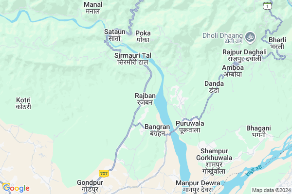
Rajban
Rajban Map
EDIT Map
Add Your House
 ..
..
Current Corona Virus Infected Patients Count in Sirmaur District
| City Name | District Name | Total Covid cases |
|---|---|---|
| Sirmaur District | Sirmaur | 1 |
Locality Name :
Rajban
( रजबन )
Tehsil Name : Paonta Sahib
District : Sirmaur
State : Himachal Pradesh
Language : Hindi and Pahari, Punjabi
Current Time 05:36 AM
Date: Saturday , Apr 26,2025 (IST)
Time zone: IST (UTC+5:30)
Elevation / Altitude: 1552 meters. Above Seal level
Telephone Code / Std Code: 01704
Assembly constituency : Paonta Sahib assembly constituency
Assembly MLA : Sukh Ram
Lok Sabha constituency : Shimla parliamentary constituency
Parliament MP : SURESH KUMAR KASHYAP
Serpanch Name :
Pin Code : 173028
Post Office Name : Rajban
Main Village Name : Rajban
Commodities Prices : Paonta Sahib Market / Mandi
Rajban Live Weather
Temperature: 22.0 °C
scattered clouds
Humidity: 19%
Wind : 4.5 mt/sec towards N
StationName : "Harbatpur"
observed on Now
Temperature: 22.0 °C
scattered clouds
Humidity: 19%
Wind : 4.5 mt/sec towards N
StationName : "Harbatpur"
observed on Now
Rajban Weather Forecast for Next 5 days
27-04-2025
25.3°C to 39.2°C
scattered clouds, few clouds, clear sky, overcast clouds
25.3°C to 39.2°C
scattered clouds, few clouds, clear sky, overcast clouds
28-04-2025
23.4°C to 39.2°C
broken clouds, clear sky, scattered clouds
23.4°C to 39.2°C
broken clouds, clear sky, scattered clouds
29-04-2025
23.7°C to 39.9°C
clear sky, few clouds, overcast clouds
23.7°C to 39.9°C
clear sky, few clouds, overcast clouds
30-04-2025
24.0°C to 39.8°C
clear sky, few clouds, light rain, overcast clouds
24.0°C to 39.8°C
clear sky, few clouds, light rain, overcast clouds
01-05-2025
24.8°C to 38.1°C
clear sky, light rain, overcast clouds, scattered clouds
24.8°C to 38.1°C
clear sky, light rain, overcast clouds, scattered clouds
National Highways Reachable To Rajban
Nationa High Way :NH707A
Nationa High Way :NH707A
Rivers Near Rajban
Bata Nadi
Tons
Bata Nadi
Tons
About Rajban
Correct below Info and add more info about RajbanRajban is a small Village/hamlet in Paonta Sahib Tehsil in Sirmaur District of Himachal Pradesh State, India. It comes under Rajban Panchayath. It is located 41 KM towards East from District head quarters Nahan. 6 KM from Paonta Sahib. 93 KM from State capital Shimla
Rajban Pin code is 173028 and postal head office is Rajban .
Phulpur ( 4 KM ) , Poka ( 4 KM ) , Danda ( 5 KM ) , Satuan ( 5 KM ) , Shivpur ( 6 KM ) are the nearby Villages to Rajban. Rajban is surrounded by Vikasnagar Tehsil towards East , Shillai Tehsil towards North , Kalsi Tehsil towards East , Sahaspur Tehsil towards East .
Nahan , Mussoorie , Dehradun , Jagadhri are the near by Cities to Rajban.
This Place is in the border of the Sirmaur District and Dehradun District. Dehradun District Vikasnagar is East towards this place . It is near to the Uttarakhand State Border.
Rajban 2011 Census Details
Rajban Local Language is Hindi. Rajban Village Total population is 1877 and number of houses are 444. Female Population is 46.8%. Village literacy rate is 71.9% and the Female Literacy rate is 30.5%.
Population
| Census Parameter | Census Data |
| Total Population | 1877 |
| Total No of Houses | 444 |
| Female Population % | 46.8 % ( 878) |
| Total Literacy rate % | 71.9 % ( 1349) |
| Female Literacy rate | 30.5 % ( 572) |
| Scheduled Tribes Population % | 2.3 % ( 43) |
| Scheduled Caste Population % | 15.3 % ( 288) |
| Working Population % | 31.0 % |
| Child(0 -6) Population by 2011 | 207 |
| Girl Child(0 -6) Population % by 2011 | 48.8 % ( 101) |
Rajban Census More Deatils.
Politics in Rajban
BJP , LMHP , INC are the major political parties in this area.Polling Stations /Booths near Rajban
1)G.p.s. Rajban (eastern Part)2)G.p.s. Puruwala
3)G.p.s. Manpur Devra
4)G.p.s. Devinagar
5)G.p.s. Dobri Salwala (western Part)
HOW TO REACH Rajban
By Rail
There is no railway station near to Rajban in less than 10 km.Colleges near Rajban
The Planet Education Institute
Address :
Himachal Institute Of Dental Sciences
Address : Himachal Institute Of Dental Sciencesrampur Road,
Schools in Rajban
Doon Valley Int Sch Cci Rajban
Address : rajban , paonta sahib , sirmaur , Himachal Pradesh . PIN- 173028 , Post - Rajban
Govt Health Centers near Rajban
1) Amboi SC , Private Building , Amboi , Near Village2) Damyana SC , Damyana , Damyana ,
3) Khalini SC , Khalini , Khalini , New Temple
Sub Villages in Rajban
Hospitals in Rajban,Paonta Sahib
E.S.I. Dispensary Industrial Area Gondpur
Nihal Garh; Himachal Pradesh 173025; India
7.6 KM distance Detail
more ..
Petrol Bunks in Rajban,Paonta Sahib
ANAND & CO.
SATAUN; SATAUN RAJBAN ROAD; SIRMAUR; Himachal Pradesh 173025; India
2.1 KM distance Detail
Indian Oil: Shiv Shakti Filling Station
Paonta Sahib; Sirmaur; Gorkhuwala; Himachal Pradesh 173025; India
4.9 KM distance Detail
HP PETROL PUMP - PONTA HP CENTER
Village Ponta Sahib; Taruwala; Shimla; Himachal Pradesh 173025; India
5.1 KM distance Detail
Essar Fuel Station
Bhagani - Sahib Rd; Puruwala; Himachal Pradesh 173025; India
5.5 KM distance Detail
more ..
Colleges in Rajban,Paonta Sahib
Doon International College of Education
C.C.I. Campus; Rajban; Sirmaur District; Paonta Sahib; Himachal Pradesh 173025; India
0.4 KM distance Detail
Himachal Institute of Pharmacy
Rampur Ghat Road; Paonta Sahib; Himachal Pradesh 173025; India
9.6 KM distance Detail
Himachal Institute of Dental Sciences
Himachal Group of Institutions; Rampur Ghat Rd; Paonta Sahib; Himachal Pradesh 173025; India
9.6 KM distance Detail
Himachal Institute of Nursing
Himachal Group of Institutions; Rampur Ghat Rd; Paonta Sahib; Himachal Pradesh 173025; India
9.6 KM distance Detail
more ..
Schools in Rajban,Paonta Sahib
Government Primary School
Paonta Sahib - Purwala - Bharli Rd; Dubri; Himachal Pradesh 173025; India
2.7 KM distance Detail
Govt. High School Bangran
Phulpur Shamshergarh; Himachal Pradesh 173025; India
3.6 KM distance Detail
Electronic Shops in Rajban,Paonta Sahib
Lokmitra Kendra Bangran; FulPur
Bhagani - Sahib Rd; Bangran; Himachal Pradesh 173025; India
3.5 KM distance Detail
Don Welding Work Shop
Paonta Sahib - Purwala - Bharli Rd; Bangran; Himachal Pradesh 173025; India
3.5 KM distance Detail
Super Markets in Rajban,Paonta Sahib
Rajpur Market
Paonta Sahib - Purwala - Bharli Rd; Rajpur Daghali; Himachal Pradesh 173025; India
8.2 KM distance Detail
Local Parks in Rajban,Paonta Sahib
Garibnath Forest (North)
Phulpur Shamshergarh; Himachal Pradesh 173025; India
3.7 KM distance Detail
Guru Govind Singh Park
Main Bazar; Paonta Sahib; Himachal Pradesh 173025; India
11.7 KM distance Detail
Police Stations near Rajban,Paonta Sahib
Police Station Paonta Sahib
Main Bazar; Paonta Sahib; Himachal Pradesh 173025; India
11.8 KM distance Detail
Police Check Post Kulhal
Kulhal; Dehradun; NH-72; Chakrata Road; Dehradun; Dehradun; Uttarakhand 248142; India
12.4 KM distance Detail
Governement Offices near Rajban,Paonta Sahib
The Nihalgarh Multi Purpose Co-operative Office
72; Paonta - Hatkoti Rd; Paonta Sahib; Himachal Pradesh 173025; India
7.0 KM distance Detail
Gram Panchayat Amarkot
Amarkot PO; Nihalgarh Teh - Dist; Paonta Sahib; Himachal Pradesh 173025; India
8.0 KM distance Detail
About Rajban &
History
How to reach Rajban
Tourist Places Near By Rajban
Schools in Rajban
Colleges in Rajban
Temperature & weather of Rajban
places in Rajban
Rajban photos
More Information
How to reach Rajban
Tourist Places Near By Rajban
Schools in Rajban
Colleges in Rajban
Temperature & weather of Rajban
places in Rajban
Rajban photos
More Information
Village Talk
Post News or Events about this Village
Near Cities
Nahan 39 KM near
Mussoorie 45 KM near
Dehradun 51 KM near
Jagadhri 57 KM near
Nahan 39 KM near
Mussoorie 45 KM near
Dehradun 51 KM near
Jagadhri 57 KM near
Near By Taluks
Paonta Sahib 5 KM near
Vikasnagar 16 KM near
Shillai 21 KM near
Kalsi 27 KM near
Paonta Sahib 5 KM near
Vikasnagar 16 KM near
Shillai 21 KM near
Kalsi 27 KM near
Near By Air Ports
Dehra Dun Airport 47 KM near
Simla Airport 92 KM near
Chandigarh Airport 94 KM near
Muzaffarnagar Airport 135 KM near
Dehra Dun Airport 47 KM near
Simla Airport 92 KM near
Chandigarh Airport 94 KM near
Muzaffarnagar Airport 135 KM near
Near By Tourist Places
Paonta Sahib 10 KM near
Kalsi 19 KM near
Chakrata 31 KM near
Nahan 40 KM near
Mussoorie 45 KM near
Paonta Sahib 10 KM near
Kalsi 19 KM near
Chakrata 31 KM near
Nahan 40 KM near
Mussoorie 45 KM near
Near By Districts
Sirmaur 39 KM near
Dehradun 45 KM near
Yamunanagar 62 KM near
Saharanpur 67 KM near
Sirmaur 39 KM near
Dehradun 45 KM near
Yamunanagar 62 KM near
Saharanpur 67 KM near
Near By RailWay Station
Dehradun Rail Way Station 47 KM near
Doiwala Rail Way Station 65 KM near
Dehradun Rail Way Station 47 KM near
Doiwala Rail Way Station 65 KM near