| Home | City Bus | Maps | Villages | Cities | Rail | Tourist Places | School | College | Pin Codes | Corona Cases Count |
| Distance Calculator Bus Services IFSC Codes Trace Mobile Number Weather Search Place Trace IP Available Cash ATM/Banks Locate Polling Booth Report an Error contact People |
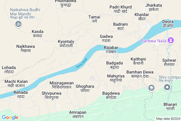
Panwar
Panwar Map
EDIT Map
Add Your House
 ..
..
Current Corona Virus Infected Patients Count in Singrauli District
| City Name | District Name | Total Covid cases |
|---|
Locality Name :
Panwar
( पंवार )
Tehsil Name : Chitrangi
District : Singrauli
State : Madhya Pradesh
Division : Rewa
Language : Hindi and Bagheli, English
Current Time 01:30 PM
Date: Wednesday , Apr 30,2025 (IST)
Time zone: IST (UTC+5:30)
Elevation / Altitude: 336 meters. Above Seal level
Telephone Code / Std Code: 07806
Assembly constituency : Chitrangi assembly constituency
Assembly MLA : Radha Ravindra Singh
Lok Sabha constituency : Sidhi parliamentary constituency
Parliament MP : Riti Pathak
Serpanch Name :
Pin Code : 486882
Post Office Name : Chitrangi
Main Village Name : Panwar
Commodities Prices : Singroli Market / Mandi
Panwar Live Weather
Temperature: 37.8 °C
clear sky
Humidity: 20%
Wind : 2.39 mt/sec towards SE
StationName : "GhorÄ\u0081wal"
observed on Now
Temperature: 37.8 °C
clear sky
Humidity: 20%
Wind : 2.39 mt/sec towards SE
StationName : "GhorÄ\u0081wal"
observed on Now
Panwar Weather Forecast for Next 5 days
01-05-2025
25.7°C to 37.5°C
clear sky, light rain
25.7°C to 37.5°C
clear sky, light rain
02-05-2025
24.5°C to 38.3°C
clear sky, overcast clouds, scattered clouds
24.5°C to 38.3°C
clear sky, overcast clouds, scattered clouds
03-05-2025
24.4°C to 38.9°C
clear sky, scattered clouds, light rain, broken clouds
24.4°C to 38.9°C
clear sky, scattered clouds, light rain, broken clouds
04-05-2025
26.0°C to 41.0°C
scattered clouds, few clouds, clear sky
26.0°C to 41.0°C
scattered clouds, few clouds, clear sky
05-05-2025
28.1°C to 42.4°C
few clouds, clear sky, scattered clouds
28.1°C to 42.4°C
few clouds, clear sky, scattered clouds
National Highways Reachable To Panwar
Nationa High Way :NH39
Nationa High Way :NH39
Rivers Near Panwar
Durbul Nala
Son :Son River :सोन नदी :ಸೋನ್ ನದಿ :സോൻ നദി
Durbul Nala
Son :Son River :सोन नदी :ಸೋನ್ ನದಿ :സോൻ നദി
About Panwar
Correct below Info and add more info about PanwarPanwar is a small Village/hamlet in Chitrangi Tehsil in Singrauli District of Madhya Pradesh State, India. It comes under Panwar Panchayath. It belongs to Rewa Division . It is located 50 KM towards North from District head quarters Singrauli. 17 KM from Chitrangi. 646 KM from State capital Bhopal
Panwar Pin code is 486882 and postal head office is Chitrangi .
Khaidar ( 8 KM ) , Odani ( 11 KM ) , Dar ( 11 KM ) , Lamsarai ( 13 KM ) , Khatai ( 13 KM ) are the nearby Villages to Panwar. Panwar is surrounded by Ghorawal Tehsil towards East , Chopan Tehsil towards East , Obra Tehsil towards East , Patehra Tehsil towards North .
Shahganj , Obra , Singrauli , Robertsganj are the near by Cities to Panwar.
Panwar 2011 Census Details
Panwar Local Language is Hindi. Panwar Village Total population is 417 and number of houses are 97. Female Population is 49.9%. Village literacy rate is 51.6% and the Female Literacy rate is 19.2%.
Population
| Census Parameter | Census Data |
| Total Population | 417 |
| Total No of Houses | 97 |
| Female Population % | 49.9 % ( 208) |
| Total Literacy rate % | 51.6 % ( 215) |
| Female Literacy rate | 19.2 % ( 80) |
| Scheduled Tribes Population % | 0.0 % ( 0) |
| Scheduled Caste Population % | 1.9 % ( 8) |
| Working Population % | 49.4 % |
| Child(0 -6) Population by 2011 | 79 |
| Girl Child(0 -6) Population % by 2011 | 51.9 % ( 41) |
Panwar Census More Deatils.
Politics in Panwar
Bharatiya Janata Party , BJP , INC are the major political parties in this area.Polling Stations /Booths near Panwar
1)Khairapura2)Kulakwar
3)Machi Kala
4)Bagdara
5)Bargavan
HOW TO REACH Panwar
By Rail
There is no railway station near to Panwar in less than 10 km.Colleges near Panwar
Arvind Biotech
Address :
Schools in Panwar
Ps Panwar
Address : panwar , chitarangi , singrauli , Madhya Pradesh . PIN- 486882 , Post - Chitrangi
Govt Health Centers near Panwar
1) SHC Nogai , up swasthay kendra Nougai , Nougai Main , Nougai Main2) SHC Gadhwa , SHC Gadhwa , SHC Gadhwa , SHC Gadhwa
3) SHC Kyuntali , up swasthay kendra Kyontali , Kyonayli , Main Road Kyontali
Sub Villages in Panwar
Schools in Panwar,Chitrangi
Electronic Shops in Panwar,Chitrangi
Super Markets in Panwar,Chitrangi
Local Parks in Panwar,Chitrangi
Police Stations near Panwar,Chitrangi
Governement Offices near Panwar,Chitrangi
About Panwar &
History
How to reach Panwar
Tourist Places Near By Panwar
Schools in Panwar
Colleges in Panwar
Temperature & weather of Panwar
places in Panwar
Panwar photos
More Information
How to reach Panwar
Tourist Places Near By Panwar
Schools in Panwar
Colleges in Panwar
Temperature & weather of Panwar
places in Panwar
Panwar photos
More Information
Village Talk
Post News or Events about this Village
Near Cities
Shahganj 37 KM near
Obra 40 KM near
Singrauli 45 KM near
Robertsganj 47 KM near
Shahganj 37 KM near
Obra 40 KM near
Singrauli 45 KM near
Robertsganj 47 KM near
Near By Taluks
Chitrangi 16 KM near
Ghorawal 30 KM near
Chopan 38 KM near
Obra 40 KM near
Chitrangi 16 KM near
Ghorawal 30 KM near
Chopan 38 KM near
Obra 40 KM near
Near By Air Ports
Varanasi Airport 111 KM near
Bamrauli Airport 150 KM near
Gaya Airport 259 KM near
Gorakhpur Airport 285 KM near
Varanasi Airport 111 KM near
Bamrauli Airport 150 KM near
Gaya Airport 259 KM near
Gorakhpur Airport 285 KM near
Near By Tourist Places
Vindhyachal 75 KM near
Varanasi 99 KM near
Sarnath 108 KM near
Rohtasgarh Fort 142 KM near
Allahabad 143 KM near
Vindhyachal 75 KM near
Varanasi 99 KM near
Sarnath 108 KM near
Rohtasgarh Fort 142 KM near
Allahabad 143 KM near
Near By Districts
Singrauli 47 KM near
Sonbhadra 48 KM near
Mirzapur 71 KM near
Sidhi 90 KM near
Singrauli 47 KM near
Sonbhadra 48 KM near
Mirzapur 71 KM near
Sidhi 90 KM near
Near By RailWay Station
Obra Dam Rail Way Station 39 KM near
Chopan Rail Way Station 42 KM near
Obra Dam Rail Way Station 39 KM near
Chopan Rail Way Station 42 KM near