| Home | City Bus | Maps | Villages | Cities | Rail | Tourist Places | School | College | Pin Codes | Corona Cases Count |
| Distance Calculator Bus Services IFSC Codes Trace Mobile Number Weather Search Place Trace IP Available Cash ATM/Banks Locate Polling Booth Report an Error contact People |
Jamual
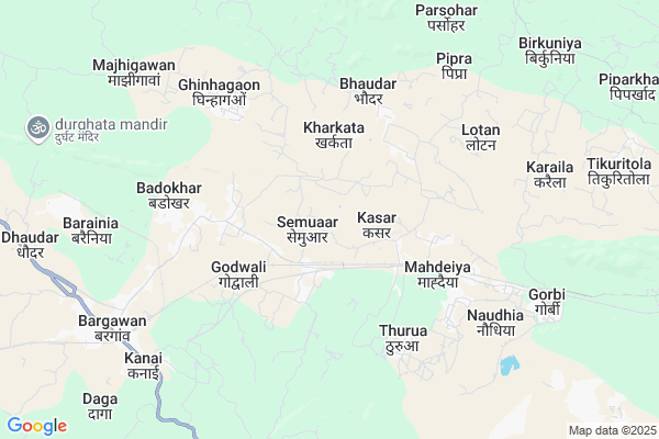
Jamual Map
EDIT Map
Add Your House
 ..
..
Current Corona Virus Infected Patients Count in Singrauli District
| City Name | District Name | Total Covid cases |
|---|
Locality Name :
Jamual
( जमुआल )
Tehsil Name : Chitrangi
District : Singrauli
State : Madhya Pradesh
Division : Rewa
Language : Hindi and Bagheli, English
Current Time 01:32 PM
Date: Wednesday , Apr 30,2025 (IST)
Time zone: IST (UTC+5:30)
Elevation / Altitude: 336 meters. Above Seal level
Telephone Code / Std Code: 07806
Assembly constituency : Chitrangi assembly constituency
Assembly MLA : Radha Ravindra Singh
Lok Sabha constituency : Sidhi parliamentary constituency
Parliament MP : Riti Pathak
Serpanch Name :
Pin Code : 486892
Post Office Name : Gorbi
Main Village Name : Jamual
Commodities Prices : Singroli Market / Mandi
National Highways Reachable To Jamual
Nationa High Way :NH39
Nationa High Way :NH39
Rivers Near Jamual
Durbul Nala
Son :Son River :सोन नदी :ಸೋನ್ ನದಿ :സോൻ നദി
Durbul Nala
Son :Son River :सोन नदी :ಸೋನ್ ನದಿ :സോൻ നദി
About Jamual
Correct below Info and add more info about JamualJamual is a small Village/hamlet in Chitrangi Tehsil in Singrauli District of Madhya Pradesh State, India. It comes under Jamual Panchayath. It belongs to Rewa Division . It is located 19 KM towards west from District head quarters Singrauli. 35 KM from Chitrangi. 621 KM from State capital Bhopal
Jamual Pin code is 486892 and postal head office is Gorbi .
Kharkata ( 3 KM ) , Solang ( 5 KM ) , Sigahi ( 6 KM ) , Pateri ( 6 KM ) , Karaila ( 8 KM ) are the nearby Villages to Jamual. Jamual is surrounded by Waidhan Tehsil towards South , Deosar Tehsil towards west , Chitrangi Tehsil towards North , Sihawal Tehsil towards west .
Singrauli , Obra , Renukoot , Kota are the near by Cities to Jamual.
Jamual 2011 Census Details
Jamual Local Language is Hindi. Jamual Village Total population is 84 and number of houses are 13. Female Population is 52.4%. Village literacy rate is 64.3% and the Female Literacy rate is 27.4%.
Population
| Census Parameter | Census Data |
| Total Population | 84 |
| Total No of Houses | 13 |
| Female Population % | 52.4 % ( 44) |
| Total Literacy rate % | 64.3 % ( 54) |
| Female Literacy rate | 27.4 % ( 23) |
| Scheduled Tribes Population % | 0.0 % ( 0) |
| Scheduled Caste Population % | 0.0 % ( 0) |
| Working Population % | 28.6 % |
| Child(0 -6) Population by 2011 | 8 |
| Girl Child(0 -6) Population % by 2011 | 62.5 % ( 5) |
Jamual Census More Deatils.
Politics in Jamual
Bharatiya Janata Party , BJP , INC are the major political parties in this area.Polling Stations /Booths near Jamual
1)Bachhanar2)Lohada
3)Bagdara
4)Khamhardih
5)Khairapura
HOW TO REACH Jamual
By Rail
Mahdeiya Rail Way Station , Bargawan Rail Way Station are the very nearby railway stations to Jamual.Colleges near Jamual
Arvind Biotech
Address :
Schools in Jamual
Setelite Shala Jamual Kahiri Dand
Address : jamual , chitarangi , singrauli , Madhya Pradesh . PIN- 486882 , Post - Chitrangi
Govt Health Centers near Jamual
1) SHC Ghinahagaon , Ghinahagaon , Ghinahagaon , Ghinahagaon2) SHC Bhalugarh , SHC Bhalugarh , SHC Bhalugarh , Bhalugarh
3) SHC Chingo , Chingo , SHC Chingo , SHC Chingo
Sub Villages in Jamual
Schools in Jamual,Chitrangi
Electronic Shops in Jamual,Chitrangi
Super Markets in Jamual,Chitrangi
Local Parks in Jamual,Chitrangi
Police Stations near Jamual,Chitrangi
Governement Offices near Jamual,Chitrangi
About Jamual &
History
How to reach Jamual
Tourist Places Near By Jamual
Schools in Jamual
Colleges in Jamual
Temperature & weather of Jamual
places in Jamual
Jamual photos
More Information
How to reach Jamual
Tourist Places Near By Jamual
Schools in Jamual
Colleges in Jamual
Temperature & weather of Jamual
places in Jamual
Jamual photos
More Information
Village Talk
Post News or Events about this Village
Near Cities
Singrauli 19 KM near
Obra 57 KM near
Renukoot 58 KM near
Kota 74 KM near
Singrauli 19 KM near
Obra 57 KM near
Renukoot 58 KM near
Kota 74 KM near
Near By Taluks
Singrauli 17 KM near
Waidhan 24 KM near
Deosar 26 KM near
Chitrangi 34 KM near
Singrauli 17 KM near
Waidhan 24 KM near
Deosar 26 KM near
Chitrangi 34 KM near
Near By Air Ports
Varanasi Airport 156 KM near
Bamrauli Airport 174 KM near
Gaya Airport 282 KM near
Khajuraho Airport 303 KM near
Varanasi Airport 156 KM near
Bamrauli Airport 174 KM near
Gaya Airport 282 KM near
Khajuraho Airport 303 KM near
Near By Tourist Places
Vindhyachal 115 KM near
Baikunthpur 122 KM near
Sarguja 134 KM near
Rewa 143 KM near
Varanasi 144 KM near
Vindhyachal 115 KM near
Baikunthpur 122 KM near
Sarguja 134 KM near
Rewa 143 KM near
Varanasi 144 KM near
Near By Districts
Singrauli 18 KM near
Sidhi 75 KM near
Sonbhadra 83 KM near
Mirzapur 113 KM near
Singrauli 18 KM near
Sidhi 75 KM near
Sonbhadra 83 KM near
Mirzapur 113 KM near
Near By RailWay Station
Mahdeiya Rail Way Station 7.1 KM near
Bargawan Rail Way Station 8.7 KM near
Singrauli Rail Way Station 14 KM near
Obra Dam Rail Way Station 58 KM near
Mahdeiya Rail Way Station 7.1 KM near
Bargawan Rail Way Station 8.7 KM near
Singrauli Rail Way Station 14 KM near
Obra Dam Rail Way Station 58 KM near