| Home | City Bus | Maps | Villages | Cities | Rail | Tourist Places | School | College | Pin Codes | Corona Cases Count |
| Distance Calculator Bus Services IFSC Codes Trace Mobile Number Weather Search Place Trace IP Available Cash ATM/Banks Locate Polling Booth Report an Error contact People |
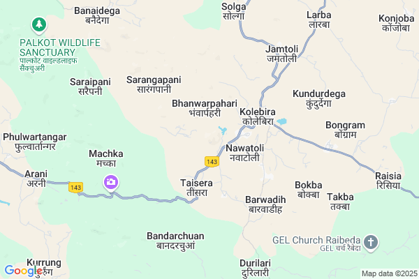
Gobardhasa Map
EDIT Map
Add Your House
 ..
..
Current Corona Virus Infected Patients Count in Simdega District
| City Name | District Name | Total Covid cases |
|---|---|---|
| Simdega District | Simdega | 2 |
Locality Name :
Gobardhasa
( गोबरढासा )
Block Name : Kolebira
District : Simdega
State : Jharkhand
Language : Hindi and Santali
Current Time 11:26 AM
Date: Wednesday , Feb 05,2025 (IST)
Time zone: IST (UTC+5:30)
Elevation / Altitude: 452 meters. Above Seal level
Telephone Code / Std Code: 06527
Assembly constituency : Kolebira assembly constituency
Assembly MLA : NAMAN BIXAL KONGARI
Lok Sabha constituency : Khunti parliamentary constituency
Parliament MP : ARJUN MUNDA
Serpanch Name :
Main Village Name : Gobardhasa
Commodities Prices : Panposh Market / Mandi
Gobardhasa Live Weather
Temperature: 26.5 °C
clear sky
Humidity: 29%
Wind : 1.69 mt/sec towards SW
StationName : "Simdega"
observed on 2 Hours Back
Temperature: 26.5 °C
clear sky
Humidity: 29%
Wind : 1.69 mt/sec towards SW
StationName : "Simdega"
observed on 2 Hours Back
Gobardhasa Weather Forecast for Next 5 days
06-02-2025
19.1°C to 32.7°C
clear sky, few clouds
19.1°C to 32.7°C
clear sky, few clouds
07-02-2025
16.7°C to 32.0°C
clear sky
16.7°C to 32.0°C
clear sky
08-02-2025
14.3°C to 31.8°C
clear sky
14.3°C to 31.8°C
clear sky
09-02-2025
12.9°C to 30.2°C
clear sky
12.9°C to 30.2°C
clear sky
10-02-2025
13.9°C to 32.1°C
clear sky
13.9°C to 32.1°C
clear sky
National Highways Reachable To Gobardhasa
Nationa High Way :NH320G
Nationa High Way :NH320G
Rivers Near Gobardhasa
Chinda
Sankh River :Sankh River
Chinda
Sankh River :Sankh River
About Gobardhasa
Correct below Info and add more info about GobardhasaGobardhasa is a small Village/hamlet in Kolebira Block in Simdega District of Jharkhand State, India. It comes under Gobardhasa Panchayath. It is located 23 KM towards East from District head quarters Simdega. 7 KM from Kolebira. 114 KM from State capital Ranchi
Biru ( 12 KM ) , Tutikel ( 14 KM ) , Jokbahar ( 14 KM ) , Tamra ( 14 KM ) , Agharma ( 15 KM ) are the nearby Villages to Gobardhasa. Gobardhasa is surrounded by Palkot Block towards North , Simdega Block towards west , Pakartanr Block towards west , Basia Block towards North .
Simdega , Biramitrapur , Gumla , Raurkela are the near by Cities to Gobardhasa.
This Place is in the border of the Simdega District and Gumla District. Gumla District Palkot is North towards this place .
Gobardhasa 2011 Census Details
Gobardhasa Local Language is Hindi. Gobardhasa Village Total population is 296 and number of houses are 61. Female Population is 48.3%. Village literacy rate is 62.8% and the Female Literacy rate is 27.7%.
Population
| Census Parameter | Census Data |
| Total Population | 296 |
| Total No of Houses | 61 |
| Female Population % | 48.3 % ( 143) |
| Total Literacy rate % | 62.8 % ( 186) |
| Female Literacy rate | 27.7 % ( 82) |
| Scheduled Tribes Population % | 85.5 % ( 253) |
| Scheduled Caste Population % | 14.5 % ( 43) |
| Working Population % | 58.1 % |
| Child(0 -6) Population by 2011 | 47 |
| Girl Child(0 -6) Population % by 2011 | 44.7 % ( 21) |
Gobardhasa Census More Deatils.
Politics in Gobardhasa
Jharkhand Party , Bharatiya Janata Party , BJP , JKP , INC are the major political parties in this area.Polling Stations /Booths near Gobardhasa
1)R.c.p.s. Sajbahar (kacchhupani)2)High School Rajutoli
3)S.s. High S. Kolebira ( East Part)
4)Anganbari Kendra Pujartoli
5)Govt. Upg Middle. School Techatoli (konmenjra)
HOW TO REACH Gobardhasa
By Rail
There is no railway station near to Gobardhasa in less than 10 km.Pincodes near Gobardhasa
835211 ( Kolebira ) , 835228 ( Biru ) , 835220 ( Palkot )Colleges near Gobardhasa
Ss+2 High School Jaldega
Address :
Schools near Gobardhasa
Saraswati Shishu Mandir
Address :
Govt Health Centers near Gobardhasa
1) HSC SARANGAPANI , HSC SARANGAPANI , SARANGAPANI ,2) HSC Bander Chua , HSC Bander Chua , Bander Chua , Bander Chua
3) HSC JAMTOLI , HSC JAMTOLI , JAMTOLI ,
Sub Villages in Gobardhasa
Petrol Bunks in Gobardhasa,Kolebira
HP PETROL PUMP - SAHU PETROL PUMP
HP Petrol Pump Vill- Kolebira; National Highway 23; 835211; India
1.4 KM distance Detail
more ..
Electronic Shops in Gobardhasa,Kolebira
Sanjeev Ellectronics And Electrics
Kolebira - Hat Gamharia Rd; Kolebira; Jharkhand 835211; India
3.5 KM distance Detail
Super Markets in Gobardhasa,Kolebira
Nik Motors Main Road Kolebira
Rourkela - Gumla - Ranchi Road; Kolebira; Jharkhand 835211; India
3.2 KM distance Detail
About Gobardhasa &
History
How to reach Gobardhasa
Tourist Places Near By Gobardhasa
Schools in Gobardhasa
Colleges in Gobardhasa
Temperature & weather of Gobardhasa
places in Gobardhasa
Gobardhasa photos
More Information
How to reach Gobardhasa
Tourist Places Near By Gobardhasa
Schools in Gobardhasa
Colleges in Gobardhasa
Temperature & weather of Gobardhasa
places in Gobardhasa
Gobardhasa photos
More Information
Village Talk
Post News or Events about this Village
Near Cities
Simdega 22 KM near
Biramitrapur 37 KM near
Gumla 46 KM near
Raurkela 60 KM near
Simdega 22 KM near
Biramitrapur 37 KM near
Gumla 46 KM near
Raurkela 60 KM near
Near By Taluks
Kolebira 6 KM near
Palkot 20 KM near
Simdega 23 KM near
Pakartanr 24 KM near
Kolebira 6 KM near
Palkot 20 KM near
Simdega 23 KM near
Pakartanr 24 KM near
Near By Air Ports
Ranchi Airport 108 KM near
Gaya Airport 258 KM near
Bhubaneswar Airport 331 KM near
Patna Airport 364 KM near
Ranchi Airport 108 KM near
Gaya Airport 258 KM near
Bhubaneswar Airport 331 KM near
Patna Airport 364 KM near
Near By Tourist Places
Simdega 21 KM near
Gumla 46 KM near
Chotanagpur 55 KM near
Rourkela 60 KM near
Jashpur 65 KM near
Simdega 21 KM near
Gumla 46 KM near
Chotanagpur 55 KM near
Rourkela 60 KM near
Jashpur 65 KM near
Near By Districts
Simdega 23 KM near
Gumla 46 KM near
Jashpur 65 KM near
Khunti 84 KM near
Simdega 23 KM near
Gumla 46 KM near
Jashpur 65 KM near
Khunti 84 KM near
Near By RailWay Station
Rourkela Junction Rail Way Station 61 KM near
Rajgangpur Rail Way Station 63 KM near
Rourkela Junction Rail Way Station 61 KM near
Rajgangpur Rail Way Station 63 KM near