| Home | City Bus | Maps | Villages | Cities | Rail | Tourist Places | School | College | Pin Codes | Corona Cases Count |
| Distance Calculator Bus Services IFSC Codes Trace Mobile Number Weather Search Place Trace IP Available Cash ATM/Banks Locate Polling Booth Report an Error contact People |
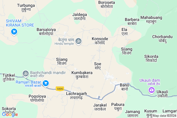
Chhotketunga Map
EDIT Map
Add Your House
 ..
..
Current Corona Virus Infected Patients Count in Simdega District
| City Name | District Name | Total Covid cases |
|---|---|---|
| Simdega District | Simdega | 2 |
Locality Name :
Chhotketunga
( छोटकेतुंगा )
Block Name : Bano
District : Simdega
State : Jharkhand
Language : Hindi and Santali
Current Time 08:32 PM
Date: Friday , Apr 25,2025 (IST)
Time zone: IST (UTC+5:30)
Elevation / Altitude: 452 meters. Above Seal level
Telephone Code / Std Code: 06527
Assembly constituency : Kolebira assembly constituency
Assembly MLA : NAMAN BIXAL KONGARI
Lok Sabha constituency : Khunti parliamentary constituency
Parliament MP : ARJUN MUNDA
Serpanch Name :
Main Village Name : Chhotketunga
Commodities Prices : Panposh Market / Mandi
Chhotketunga Live Weather
Temperature: 32.2 °C
clear sky
Humidity: 7%
Wind : 4.03 mt/sec towards N
StationName : "Birmitrapur"
observed on 26 Mins Back
Temperature: 32.2 °C
clear sky
Humidity: 7%
Wind : 4.03 mt/sec towards N
StationName : "Birmitrapur"
observed on 26 Mins Back
Chhotketunga Weather Forecast for Next 5 days
26-04-2025
27.2°C to 31.7°C
clear sky
27.2°C to 31.7°C
clear sky
27-04-2025
25.4°C to 41.7°C
clear sky, scattered clouds, broken clouds, few clouds
25.4°C to 41.7°C
clear sky, scattered clouds, broken clouds, few clouds
28-04-2025
26.5°C to 39.3°C
scattered clouds, broken clouds, overcast clouds
26.5°C to 39.3°C
scattered clouds, broken clouds, overcast clouds
29-04-2025
23.2°C to 37.7°C
overcast clouds, broken clouds, scattered clouds, light rain
23.2°C to 37.7°C
overcast clouds, broken clouds, scattered clouds, light rain
30-04-2025
21.1°C to 35.1°C
scattered clouds, clear sky, few clouds, light rain, moderate rain, overcast clouds
21.1°C to 35.1°C
scattered clouds, clear sky, few clouds, light rain, moderate rain, overcast clouds
National Highways Reachable To Chhotketunga
Nationa High Way :NH320D
Nationa High Way :NH320G
Nationa High Way :NH320D
Nationa High Way :NH320G
Rivers Near Chhotketunga
Halwal
Karo River
Halwal
Karo River
About Chhotketunga
Correct below Info and add more info about ChhotketungaChhotketunga is a small Village/hamlet in Bano Block in Simdega District of Jharkhand State, India. It comes under Chhotketunga Panchayath. It is located 48 KM towards East from District head quarters Simdega. 11 KM from Bano. 100 KM from State capital Ranchi
Pabura ( 8 KM ) , Tutikel ( 12 KM ) , Tati ( 13 KM ) , Banki ( 13 KM ) , Patiamba ( 14 KM ) are the nearby Villages to Chhotketunga. Chhotketunga is surrounded by Kolebira Block towards west , Jaldega Block towards South , Rania Block towards East , Kamdara Block towards North .
Biramitrapur , Simdega , Raurkela , Gumla are the near by Cities to Chhotketunga.
Chhotketunga 2011 Census Details
Chhotketunga Local Language is Hindi. Chhotketunga Village Total population is 582 and number of houses are 104. Female Population is 50.9%. Village literacy rate is 65.3% and the Female Literacy rate is 29.7%.
Population
| Census Parameter | Census Data |
| Total Population | 582 |
| Total No of Houses | 104 |
| Female Population % | 50.9 % ( 296) |
| Total Literacy rate % | 65.3 % ( 380) |
| Female Literacy rate | 29.7 % ( 173) |
| Scheduled Tribes Population % | 80.4 % ( 468) |
| Scheduled Caste Population % | 0.0 % ( 0) |
| Working Population % | 50.2 % |
| Child(0 -6) Population by 2011 | 91 |
| Girl Child(0 -6) Population % by 2011 | 46.2 % ( 42) |
Chhotketunga Census More Deatils.
Politics in Chhotketunga
Jharkhand Party , Bharatiya Janata Party , BJP , JKP , INC are the major political parties in this area.Polling Stations /Booths near Chhotketunga
1)P.s. Domtoli (north Part)2)R.c. P.s Jamtoli
3)P.s. Ramjari (west Part)
4)Praimary School Bhanwarpahar
5)Panchayat Bhawan Orga
HOW TO REACH Chhotketunga
By Rail
Bano Rail Way Station , Kanaroan Rail Way Station are the very nearby railway stations to Chhotketunga.Pincodes near Chhotketunga
835201 ( Bano ) , 835211 ( Kolebira ) , 835229 ( Basia )Colleges near Chhotketunga
Ss+2 High School Jaldega
Address :
Schools near Chhotketunga
R.c.high School Banki
Address :
Govt Health Centers near Chhotketunga
1) HSC Sizang , HSC Sizang , Sizang , Sizang2) HSC BARASLOYA , HSC BARASLOYA , BARASLOYA ,
3) HSC SIJANG , HSC SIJANG , SIJANG ,
Sub Villages in Chhotketunga
Schools in Chhotketunga,Bano
Kolebira Kasturba Gandhi Balika Awasiya Vidyalaya
Bongram; Jharkhand 835211; India
20.0 KM distance Detail
About Chhotketunga &
History
How to reach Chhotketunga
Tourist Places Near By Chhotketunga
Schools in Chhotketunga
Colleges in Chhotketunga
Temperature & weather of Chhotketunga
places in Chhotketunga
Chhotketunga photos
More Information
How to reach Chhotketunga
Tourist Places Near By Chhotketunga
Schools in Chhotketunga
Colleges in Chhotketunga
Temperature & weather of Chhotketunga
places in Chhotketunga
Chhotketunga photos
More Information
Village Talk
Post News or Events about this Village
Near Cities
Biramitrapur 37 KM near
Simdega 45 KM near
Raurkela 53 KM near
Gumla 59 KM near
Biramitrapur 37 KM near
Simdega 45 KM near
Raurkela 53 KM near
Gumla 59 KM near
Near By Taluks
Bano 10 KM near
Kolebira 18 KM near
Jaldega 24 KM near
Rania 26 KM near
Bano 10 KM near
Kolebira 18 KM near
Jaldega 24 KM near
Rania 26 KM near
Near By Air Ports
Ranchi Airport 94 KM near
Gaya Airport 257 KM near
Bhubaneswar Airport 321 KM near
Patna Airport 363 KM near
Ranchi Airport 94 KM near
Gaya Airport 257 KM near
Bhubaneswar Airport 321 KM near
Patna Airport 363 KM near
Near By Tourist Places
Chotanagpur 43 KM near
Simdega 44 KM near
Rourkela 53 KM near
Gumla 60 KM near
Jashpur 88 KM near
Chotanagpur 43 KM near
Simdega 44 KM near
Rourkela 53 KM near
Gumla 60 KM near
Jashpur 88 KM near
Near By Districts
Simdega 45 KM near
Gumla 59 KM near
Khunti 67 KM near
Jashpur 88 KM near
Simdega 45 KM near
Gumla 59 KM near
Khunti 67 KM near
Jashpur 88 KM near
Near By RailWay Station
Bano Rail Way Station 3.4 KM near
Kanaroan Rail Way Station 7.4 KM near
Manoharpur Rail Way Station 52 KM near
Bondamunda Rail Way Station 55 KM near
Bano Rail Way Station 3.4 KM near
Kanaroan Rail Way Station 7.4 KM near
Manoharpur Rail Way Station 52 KM near
Bondamunda Rail Way Station 55 KM near