| Home | City Bus | Maps | Villages | Cities | Rail | Tourist Places | School | College | Pin Codes | Corona Cases Count |
| Distance Calculator Bus Services IFSC Codes Trace Mobile Number Weather Search Place Trace IP Available Cash ATM/Banks Locate Polling Booth Report an Error contact People |
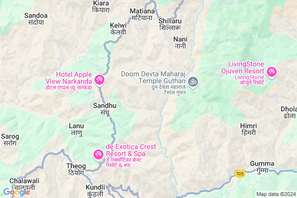
Karani
Karani Map
EDIT Map
Add Your House
 ..
..
Current Corona Virus Infected Patients Count in Shimla District
| City Name | District Name | Total Covid cases |
|---|
Locality Name :
Karani
( करनी )
Tehsil Name : Theog
District : Shimla
State : Himachal Pradesh
Language : Pahari and Hindi, Punjabi
Current Time 07:03 AM
Date: Saturday , Apr 26,2025 (IST)
Time zone: IST (UTC+5:30)
Elevation / Altitude: 2086 meters. Above Seal level
Telephone Code / Std Code: 01783
Assembly constituency : Theog assembly constituency
Assembly MLA : Kuldeep Singh Rathore
Lok Sabha constituency : Shimla parliamentary constituency
Parliament MP : SURESH KUMAR KASHYAP
Serpanch Name :
Pin Code : 171220
Post Office Name : Chhaila
Main Village Name : Karani
Commodities Prices : Shimla and Kinnaur(Rampur) Market / Mandi
Karani Live Weather
Temperature: 5.5 °C
scattered clouds
Humidity: 37%
Wind : 3.15 mt/sec towards E
StationName : "Theog"
observed on 1 Hours Back
Temperature: 5.5 °C
scattered clouds
Humidity: 37%
Wind : 3.15 mt/sec towards E
StationName : "Theog"
observed on 1 Hours Back
Karani Weather Forecast for Next 5 days
27-04-2025
14.6°C to 27.7°C
scattered clouds, few clouds, clear sky
14.6°C to 27.7°C
scattered clouds, few clouds, clear sky
28-04-2025
13.9°C to 29.1°C
clear sky, scattered clouds, broken clouds, few clouds
13.9°C to 29.1°C
clear sky, scattered clouds, broken clouds, few clouds
29-04-2025
14.0°C to 30.4°C
clear sky, few clouds, scattered clouds
14.0°C to 30.4°C
clear sky, few clouds, scattered clouds
30-04-2025
14.9°C to 31.7°C
clear sky, few clouds
14.9°C to 31.7°C
clear sky, few clouds
01-05-2025
16.1°C to 31.7°C
clear sky
16.1°C to 31.7°C
clear sky
National Highways Reachable To Karani
Nationa High Way :NH707A
Nationa High Way :NH5
Nationa High Way :NH707A
Nationa High Way :NH5
Rivers Near Karani
Mansrad Gad
Ashmi River
Mansrad Gad
Ashmi River
About Karani
Correct below Info and add more info about KaraniKarani is a small Village/hamlet in Theog Tehsil in Shimla District of Himachal Pradesh State, India. It comes under Karani Panchayath. It is located 27 KM towards East from District head quarters Shimla. 10 KM from Basa Theog. 27 KM from State capital Shimla
Karani Pin code is 171220 and postal head office is Chhaila .
Sandhu ( 3 KM ) , Kaleend ( 3 KM ) , Chikhar ( 5 KM ) , Bharara ( 6 KM ) , Kyara ( 6 KM ) are the nearby Villages to Karani. Karani is surrounded by Narkanda Tehsil towards North , Jubbal Kotkhai Tehsil towards East , Nankhari Tehsil towards North , Basantpur Tehsil towards west .
Shimla , Solan , Kalka , Pinjore are the near by Cities to Karani.
Karani 2011 Census Details
Karani Local Language is Pahari. Karani Village Total population is 203 and number of houses are 42. Female Population is 51.2%. Village literacy rate is 78.8% and the Female Literacy rate is 38.4%.
Population
| Census Parameter | Census Data |
| Total Population | 203 |
| Total No of Houses | 42 |
| Female Population % | 51.2 % ( 104) |
| Total Literacy rate % | 78.8 % ( 160) |
| Female Literacy rate | 38.4 % ( 78) |
| Scheduled Tribes Population % | 0.0 % ( 0) |
| Scheduled Caste Population % | 51.7 % ( 105) |
| Working Population % | 67.0 % |
| Child(0 -6) Population by 2011 | 16 |
| Girl Child(0 -6) Population % by 2011 | 31.3 % ( 5) |
Karani Census More Deatils.
Politics in Karani
BJP , INC are the major political parties in this area.Polling Stations /Booths near Karani
1)G.p.s Kihri2)G.m.s. Keet
3)G.s.s.s. Kumarsain (western Part)
4)G.p.s. Chamola
5)G.p.s Dakana
HOW TO REACH Karani
By Rail
There is no railway station near to Karani in less than 10 km.Colleges near Karani
Government Degree College, Nerwa.
Address :
Hp.shimla. Suni College
Address :
Govind Ballabh Pant Memorial Post-grauate College Rampur Bushahr
Address :
Govt.degree College Kumarsain
Address :
Govt. College (center Of Excellence), Sanjali
Address :
Schools near Karani
Gsss Ghoond
Address : ghoond , deha , shimla , Himachal Pradesh . PIN- 171220 , Post - Chhaila
Gsss Balag
Address : balag , deha , shimla , Himachal Pradesh . PIN- 171226 , Post - Balag
J K M Montessort High Sch Nani
Address : nani , matiana , shimla , Himachal Pradesh . PIN- 171212 , Post - Matiana
Ishan Public School W.n.3
Address : theog , theog , shimla , Himachal Pradesh . PIN- 171201 , Post - Theog
Govt Health Centers near Karani
1) Damyana SC , Damyana , Damyana ,2) Khalini SC , Khalini , Khalini , New Temple
3) Deen Dayal Upadhyaya Zonal Hospital , Ram Bazaar, Shimla , Shimla ,
Sub Villages in Karani
Petrol Bunks in Karani,Theog
Swarup Service Station Indian Oil Petrol Pump
Kokunala; Shimla; SH-10; Theog Hatkoti Rohru Road; Kotkhai; Kotkhai; Himachal Pradesh 171202; India
13.4 KM distance Detail
Narkanda Filling Station Indian Oil Petrol Pump
Narkanda; Shimla; NH-22; Rampur Road; Kumarsain; Kumarsain; Himachal Pradesh 171203; India
13.8 KM distance Detail
more ..
Colleges in Karani,Theog
IHM Kufri Shimla
Shimla; NH 22; Near Army Canteen; Kufri; Himachal Pradesh 171012; India
18.5 KM distance Detail
more ..
Schools in Karani,Theog
Blue Bells Mahori
Chailla - Mahori Rd; Mahori; Himachal Pradesh 171220; India
1.9 KM distance Detail
Local Parks in Karani,Theog
Camp Himalayan yew
Village Nagrot P.O. Narkanda Teshil Kumarsain Distt. Shimla 171213; Shimla; Himachal Pradesh 171213; India
13.0 KM distance Detail
HIMALAYAN ALPINE
Near Hatu Hotel road; NH05; Narkand; Himachal Pradesh 171213; India
13.6 KM distance Detail
Governement Offices near Karani,Theog
Forest Department Office
Kotkhai Road; Kotkhai; Himachal Pradesh 171202; India
15.6 KM distance Detail
About Karani &
History
How to reach Karani
Tourist Places Near By Karani
Schools in Karani
Colleges in Karani
Temperature & weather of Karani
places in Karani
Karani photos
More Information
How to reach Karani
Tourist Places Near By Karani
Schools in Karani
Colleges in Karani
Temperature & weather of Karani
places in Karani
Karani photos
More Information
Village Talk
Post News or Events about this Village
Near Cities
Shimla 26 KM near
Solan 46 KM near
Kalka 64 KM near
Pinjore 69 KM near
Shimla 26 KM near
Solan 46 KM near
Kalka 64 KM near
Pinjore 69 KM near
Near By Taluks
Theog 9 KM near
Narkanda 17 KM near
Jubbal Kotkhai 22 KM near
Nankhari 24 KM near
Theog 9 KM near
Narkanda 17 KM near
Jubbal Kotkhai 22 KM near
Nankhari 24 KM near
Near By Air Ports
Simla Airport 28 KM near
Chandigarh Airport 89 KM near
Bhuntar Airport 107 KM near
Dehra Dun Airport 124 KM near
Simla Airport 28 KM near
Chandigarh Airport 89 KM near
Bhuntar Airport 107 KM near
Dehra Dun Airport 124 KM near
Near By Tourist Places
Narkanda 13 KM near
Kufri 16 KM near
Mashobra 18 KM near
Naldehra 24 KM near
Shimla 26 KM near
Narkanda 13 KM near
Kufri 16 KM near
Mashobra 18 KM near
Naldehra 24 KM near
Shimla 26 KM near
Near By Districts
Shimla 26 KM near
Solan 45 KM near
Bilaspur District 72 KM near
Sirmaur 75 KM near
Shimla 26 KM near
Solan 45 KM near
Bilaspur District 72 KM near
Sirmaur 75 KM near
Near By RailWay Station
Kalka Rail Way Station 64 KM near
Chandi Mandir Rail Way Station 77 KM near
Kalka Rail Way Station 64 KM near
Chandi Mandir Rail Way Station 77 KM near