| Home | City Bus | Maps | Villages | Cities | Rail | Tourist Places | School | College | Pin Codes | Corona Cases Count |
| Distance Calculator Bus Services IFSC Codes Trace Mobile Number Weather Search Place Trace IP Available Cash ATM/Banks Locate Polling Booth Report an Error contact People |
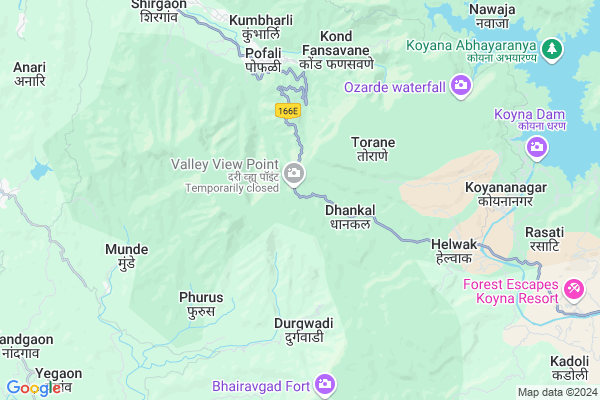
Ghatmatha
Ghatmatha Map
EDIT Map
Add Your House
 ..
..
Current Corona Virus Infected Patients Count in Satara District
| City Name | District Name | Total Covid cases |
|---|---|---|
| Satara District | Satara | 16 |
| Khandala | Satara | 1 |
Locality Name :
Ghatmatha
( घाटमाथा )
Taluka Name : Patan
District : Satara
State : Maharashtra
Region : Desh or Paschim Maharashtra
Division : Pune
Language : Marathi and Satara
Current Time 12:32 PM
Date: Sunday , Apr 27,2025 (IST)
Time zone: IST (UTC+5:30)
Elevation / Altitude: 610 meters. Above Seal level
Telephone Code / Std Code: 02372
Assembly constituency : Patan assembly constituency
Assembly MLA : Desai Shambhuraj Shivajirao
Lok Sabha constituency : Satara parliamentary constituency
Parliament MP : SHRIMANT CHH. UDAYANRAJE PRATAPSINHMAHARAJ BHONSLE
Serpanch Name :
Main Village Name : Ghatmatha
Commodities Prices : Patan Market / Mandi
Ghatmatha Live Weather
Temperature: 37.8 °C
clear sky
Humidity: 14%
Wind : 3.32 mt/sec towards W
StationName : "PÄ\u0081tan"
observed on Now
Temperature: 37.8 °C
clear sky
Humidity: 14%
Wind : 3.32 mt/sec towards W
StationName : "PÄ\u0081tan"
observed on Now
Ghatmatha Weather Forecast for Next 5 days
28-04-2025
21.5°C to 39.2°C
few clouds, scattered clouds, clear sky
21.5°C to 39.2°C
few clouds, scattered clouds, clear sky
29-04-2025
21.1°C to 39.5°C
few clouds, broken clouds, clear sky
21.1°C to 39.5°C
few clouds, broken clouds, clear sky
30-04-2025
21.0°C to 38.4°C
scattered clouds, broken clouds, clear sky
21.0°C to 38.4°C
scattered clouds, broken clouds, clear sky
01-05-2025
20.4°C to 38.1°C
few clouds, clear sky
20.4°C to 38.1°C
few clouds, clear sky
02-05-2025
20.2°C to 39.1°C
few clouds, clear sky
20.2°C to 39.1°C
few clouds, clear sky
National Highways Reachable To Ghatmatha
Nationa High Way :NH166E
Nationa High Way :NH48
Nationa High Way :NH166E
Nationa High Way :NH48
Rivers Near Ghatmatha
Tulsi
Tulsi
About Ghatmatha
Correct below Info and add more info about GhatmathaGhatmatha is a small Village/hamlet in Patan Taluka in Satara District of Maharashtra State, India. It comes under Ghatmatha Panchayath. It belongs to Desh or Paschim Maharashtra region . It belongs to Pune Division . It is located 55 KM towards west from District head quarters Satara. 30 KM from Patan. 234 KM from State capital Mumbai
Shivandeshwar ( 5 KM ) , Helwak ( 6 KM ) , Gokul Tarf Helwak ( 6 KM ) , Humbarli ( 8 KM ) , Kamargaon ( 9 KM ) are the nearby Villages to Ghatmatha. Ghatmatha is surrounded by Patan Taluka towards East , Sangmeshwar Taluka towards South , Khed Taluka towards North , Guhagar Taluka towards west .
Chiplun , Karad , Satara , Mahabaleswar are the near by Cities to Ghatmatha.
Ghatmatha 2011 Census Details
Ghatmatha Local Language is Marathi. Ghatmatha Village Total population is 197 and number of houses are 43. Female Population is 45.2%. Village literacy rate is 66.5% and the Female Literacy rate is 24.9%.
Population
| Census Parameter | Census Data |
| Total Population | 197 |
| Total No of Houses | 43 |
| Female Population % | 45.2 % ( 89) |
| Total Literacy rate % | 66.5 % ( 131) |
| Female Literacy rate | 24.9 % ( 49) |
| Scheduled Tribes Population % | 0.0 % ( 0) |
| Scheduled Caste Population % | 0.0 % ( 0) |
| Working Population % | 57.9 % |
| Child(0 -6) Population by 2011 | 20 |
| Girl Child(0 -6) Population % by 2011 | 35.0 % ( 7) |
Ghatmatha Census More Deatils.
Politics in Ghatmatha
Nationalist Congress Party , NCP , SHS are the major political parties in this area.Polling Stations /Booths near Ghatmatha
1)Z.p.primary School Room No.1 New East Tarale2)Z.p.primary School Room No.1 Kokisare
3)Z.p.primary School Karate Room No.1
4)Z.p.primary School Room No.1 Banpethwadi
5)Z.p.primary School Room No.1 Pimploshi
HOW TO REACH Ghatmatha
By Rail
There is no railway station near to Ghatmatha in less than 10 km. Shirravde Rail Way Station (near to Karad) , Satara Rail Way Station (near to Satara) , Jarandeshwar Rail Way Station (near to Satara) , Masur Rail Way Station (near to Karad) are the Rail way stations reachable from near by towns.By Road
Karad , Satara are the nearby by towns to Ghatmatha having road connectivity to GhatmathaPincodes near Ghatmatha
415601 ( Pophali ) , 415207 ( Koyana ) , 415602 ( Shirgaon (CPN) )Colleges near Ghatmatha
Zhilha Parishad Prathmic Shala,vekhandwadi
Address :
Shri Naikaba Vidyalaya, Galmewadi
Address :
Balasaheb Desai College Patan
Address :
Schools near Ghatmatha
Netagi Subhash Chandra H. Sch.
Address : koynanagar , patan , satara , Maharashtra . PIN- 415207 , Post - Koyana
Shri Kshetrapal Vid. & Jr. Col
Address : adul , patan , satara , Maharashtra . PIN- 415205 , Post - Malharpeth Karad
K.dynanoji Salunkhe Highschool
Address : patan , patan , satara , Maharashtra . PIN- 415206 , Post - Patan (Satara)
M. Gandhi Vid. & Arts College
Address : sanbur , patan , satara , Maharashtra . PIN- 415112 , Post - Dhebewadi
Govt Health Centers near Ghatmatha
1) Pophali , At Post Pophali , ,2) Helwak , , ,
3) Helwak , 5 , ,
Sub Villages in Ghatmatha
Schools in Ghatmatha,Patan
Netaji Subhashchandra High school Koynanagar
Koyananagar; Maharashtra 415207; India
8.7 KM distance Detail
Local Parks in Ghatmatha,Patan
Helwak Range Forest Office (Chandoli National Park)
Koyna-Helwak Rd; Gokul tarf helwak; Maharashtra 415207; India
7.5 KM distance Detail
Governement Offices near Ghatmatha,Patan
Grampanchayat Office Yerad ( Ramacha Vada )
Yerad; Maharashtra 415206; India
23.3 KM distance Detail
About Ghatmatha &
History
How to reach Ghatmatha
Tourist Places Near By Ghatmatha
Schools in Ghatmatha
Colleges in Ghatmatha
Temperature & weather of Ghatmatha
places in Ghatmatha
Ghatmatha photos
More Information
How to reach Ghatmatha
Tourist Places Near By Ghatmatha
Schools in Ghatmatha
Colleges in Ghatmatha
Temperature & weather of Ghatmatha
places in Ghatmatha
Ghatmatha photos
More Information
Village Talk
Post News or Events about this Village
Near Cities
Chiplun 24 KM near
Karad 53 KM near
Satara 55 KM near
Mahabaleswar 66 KM near
Chiplun 24 KM near
Karad 53 KM near
Satara 55 KM near
Mahabaleswar 66 KM near
Near By Taluks
Chipalun 22 KM near
Patan 29 KM near
Sangmeshwar 30 KM near
Guhagar 47 KM near
Chipalun 22 KM near
Patan 29 KM near
Sangmeshwar 30 KM near
Guhagar 47 KM near
Near By Air Ports
Kolhapur Airport 119 KM near
Lohegaon Airport 151 KM near
Sambre Airport 221 KM near
Chhatrapati Shivaji International Airport 232 KM near
Kolhapur Airport 119 KM near
Lohegaon Airport 151 KM near
Sambre Airport 221 KM near
Chhatrapati Shivaji International Airport 232 KM near
Near By Tourist Places
Mandwa 42 KM near
Velneshwar 54 KM near
Satara 56 KM near
Guhagar 57 KM near
Anjanvel 62 KM near
Mandwa 42 KM near
Velneshwar 54 KM near
Satara 56 KM near
Guhagar 57 KM near
Anjanvel 62 KM near
Near By Districts
Satara 53 KM near
Ratnagiri 66 KM near
Kolhapur 109 KM near
Sangli 126 KM near
Satara 53 KM near
Ratnagiri 66 KM near
Kolhapur 109 KM near
Sangli 126 KM near
Near By RailWay Station
Aravali Road Rail Way Station 16 KM near
Savarda Rail Way Station 18 KM near
Aravali Road Rail Way Station 16 KM near
Savarda Rail Way Station 18 KM near