| Home | City Bus | Maps | Villages | Cities | Rail | Tourist Places | School | College | Pin Codes | Corona Cases Count |
| Distance Calculator Bus Services IFSC Codes Trace Mobile Number Weather Search Place Trace IP Available Cash ATM/Banks Locate Polling Booth Report an Error contact People |
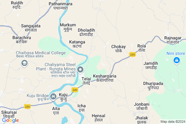
Kamarbasa
Kamarbasa Map
EDIT Map
Add Your House
 ..
..
Current Corona Virus Infected Patients Count in Saraikela Kharsawan District
| City Name | District Name | Total Covid cases |
|---|
Locality Name :
Kamarbasa
( कमरबस्ता )
Block Name : Rajnagar
District : Saraikela Kharsawan
State : Jharkhand
Language : Hindi and Santali
Current Time 02:54 PM
Date: Tuesday , Apr 29,2025 (IST)
Time zone: IST (UTC+5:30)
Elevation / Altitude: 198 meters. Above Seal level
Telephone Code / Std Code: 06597
Assembly constituency : Saraikela assembly constituency
Assembly MLA : CHAMPAI SOREN
Lok Sabha constituency : Singhbhum parliamentary constituency
Parliament MP : GEETA KORA
Serpanch Name :
Pin Code : 831002
Post Office Name : Tatanagar
Main Village Name : Kamarbasa
Commodities Prices : Balarampur Market / Mandi
National Highways Reachable To Kamarbasa
Nationa High Way :NH320D
Nationa High Way :NH118
Nationa High Way :NH320D
Nationa High Way :NH118
Rivers Near Kamarbasa
Swarnarekha :Subarnarekha River
Kharkai River
Swarnarekha :Subarnarekha River
Kharkai River
About Kamarbasa
Correct below Info and add more info about KamarbasaKamarbasa is a small Village/hamlet in Rajnagar Block in Saraikela Kharsawan District of Jharkhand State, India. It comes under Kamarbasa Panchayath. It is located 13 KM towards South from District head quarters Seraikela. 11 KM from Rajnagar. 122 KM from State capital Ranchi
Kamarbasa Pin code is 831002 and postal head office is Tatanagar .
Dhuripada ( 8 KM ) , Jonbani ( 8 KM ) , Pathanmara ( 9 KM ) , Rajnagar ( 10 KM ) , Herma ( 12 KM ) are the nearby Villages to Kamarbasa. Kamarbasa is surrounded by Chaibasa Block towards west , Saraikela Block towards North , Hatgamharia Block towards South , West Singhbhum Block towards west .
Chaibasa , Chakradharpur , Jamshedpur , Barughutu are the near by Cities to Kamarbasa.
This Place is in the border of the Saraikela Kharsawan District and East Singhbum District. East Singhbum District Potka is East towards this place . Also it is in the Border of other district West Singhbhum .
Kamarbasa 2011 Census Details
Kamarbasa Local Language is Hindi. Kamarbasa Village Total population is 607 and number of houses are 92. Female Population is 48.9%. Village literacy rate is 67.7% and the Female Literacy rate is 27.8%.
Population
| Census Parameter | Census Data |
| Total Population | 607 |
| Total No of Houses | 92 |
| Female Population % | 48.9 % ( 297) |
| Total Literacy rate % | 67.7 % ( 411) |
| Female Literacy rate | 27.8 % ( 169) |
| Scheduled Tribes Population % | 77.8 % ( 472) |
| Scheduled Caste Population % | 0.0 % ( 0) |
| Working Population % | 42.0 % |
| Child(0 -6) Population by 2011 | 50 |
| Girl Child(0 -6) Population % by 2011 | 44.0 % ( 22) |
Kamarbasa Census More Deatils.
Politics in Kamarbasa
Indian National Congress , JBSP , BJP , INC are the major political parties in this area.Polling Stations /Booths near Kamarbasa
1)Primary School Rood No-5 Place Raidih(right Wing)2)Ums Bhawan Timuniya
3)Upgrated Middle School Sarangchira
4)Middle School Adityapur North Block From East Room No-3
5)Kalikapur Tisco Samudiyak Kendra Tayo Colony
HOW TO REACH Kamarbasa
By Rail
There is no railway station near to Kamarbasa in less than 10 km.Schools near Kamarbasa
Academic English High School Rajnagar
Address : Near Gamdesai
po+ps -Rajnagar
S S + 2 High School
Address :
Govt Health Centers near Kamarbasa
1) HSC BANDUA , , BANDUA ,2) HSC SINDRI , , ,
3) HSC NAKAHASA , , ,
Sub Villages in Kamarbasa
Petrol Bunks in Kamarbasa,Rajnagar
OM SHANTI FILLING STATION
SARAIKELA; SERAIKALA KARSAWAN; Jharkhand 833219; India
11.4 KM distance Detail
more ..
Schools in Kamarbasa,Rajnagar
Middle School Sarangposi
Saraikela Rajnagar Road; Sarangpos; Jharkhand 831002; India
10.3 KM distance Detail
Abhijeet Workers Intercollege Rajnager
Seraikela Kharsawan; Jharkhand 831002; India
11.6 KM distance Detail
Local Parks in Kamarbasa,Rajnagar
Veer Shahid Shiddhu Kanhu Park
Jharkhand State Highway 5; Jaganathpur; Jharkhand 833219; India
14.9 KM distance Detail
About Kamarbasa &
History
How to reach Kamarbasa
Tourist Places Near By Kamarbasa
Schools in Kamarbasa
Colleges in Kamarbasa
Temperature & weather of Kamarbasa
places in Kamarbasa
Kamarbasa photos
More Information
How to reach Kamarbasa
Tourist Places Near By Kamarbasa
Schools in Kamarbasa
Colleges in Kamarbasa
Temperature & weather of Kamarbasa
places in Kamarbasa
Kamarbasa photos
More Information
Village Talk
Post News or Events about this Village
Near Cities
Chaibasa 14 KM near
Chakradharpur 35 KM near
Jamshedpur 39 KM near
Barughutu 45 KM near
Chaibasa 14 KM near
Chakradharpur 35 KM near
Jamshedpur 39 KM near
Barughutu 45 KM near
Near By Taluks
Rajnagar 11 KM near
Chaibasa 12 KM near
Saraikela 12 KM near
West Singhbhum 14 KM near
Rajnagar 11 KM near
Chaibasa 12 KM near
Saraikela 12 KM near
West Singhbhum 14 KM near
Near By Air Ports
Ranchi Airport 112 KM near
Gaya Airport 289 KM near
Netaji Subhas Chandra Bose Airport 289 KM near
Bhubaneswar Airport 292 KM near
Ranchi Airport 112 KM near
Gaya Airport 289 KM near
Netaji Subhas Chandra Bose Airport 289 KM near
Bhubaneswar Airport 292 KM near
Near By Tourist Places
Seraikela 12 KM near
Jamshedpur 41 KM near
Purulia 81 KM near
Dassam Falls 87 KM near
Chotanagpur 116 KM near
Seraikela 12 KM near
Jamshedpur 41 KM near
Purulia 81 KM near
Dassam Falls 87 KM near
Chotanagpur 116 KM near
Near By Districts
Saraikela Kharsawan 12 KM near
West Singhbhum 14 KM near
East Singhbum 38 KM near
Khunti 94 KM near
Saraikela Kharsawan 12 KM near
West Singhbhum 14 KM near
East Singhbum 38 KM near
Khunti 94 KM near
Near By RailWay Station
Rajkharsawan Junction Rail Way Station 20 KM near
Sini Junction Rail Way Station 23 KM near
Rajkharsawan Junction Rail Way Station 20 KM near
Sini Junction Rail Way Station 23 KM near